Lac d'Oô hike
View Photos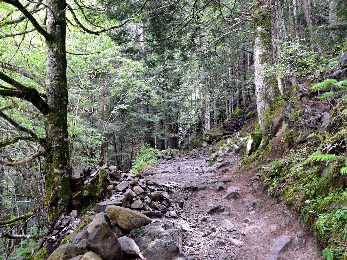
Lac d'Oô hike
Difficulty Rating:
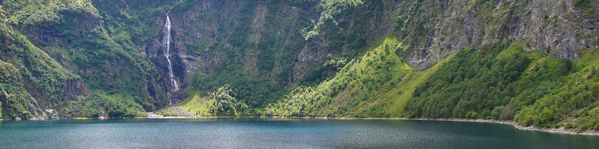
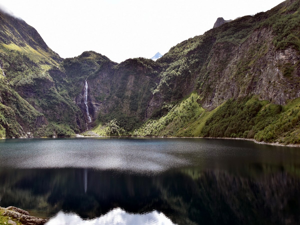
The Lac d'Oô hike is a stunning hike in the Pyrenees. Imagine a lake surrounded by steep slopes, with a beautiful waterfall opposite of it. This is the Lac d'Oô, the second most visited natural site in the Pyrenees! Experienced hikers can also extend this hike to Lac d’Espiningo or the stunning Lac du Portillon.
Getting there
From Luchon (also called Bagnères de Luchon), take the D618 in the direction of the Col de Peyresourde. After the village of Cazeaux-de-Larboust, turn left to take the D76 which will lead you to the village of Oô (pronounce "Oh"). Drive through the village and across the bridge to reach the hamlet of Les Granges d'Astau, where there is plenty of space available for parking.

About
| When to do | May to October |
| Backcountry Campsites | Bivvy is permitted around the lake and higher, further S in the valley. Watch out for cows! |
| Toilets | Oô (4km), Luchon (13km) |
| Family friendly | Yes |
| Route Signage | Average |
| Crowd Levels | High |
| Route Type | Out and back |
Lac d'Oô
Elevation Graph
Weather
Route Description for Lac d'Oô
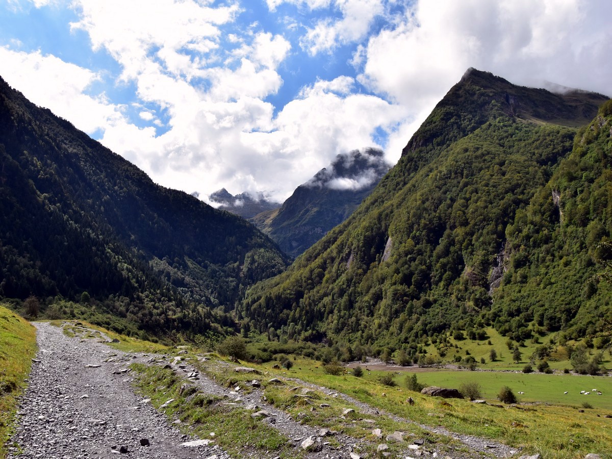
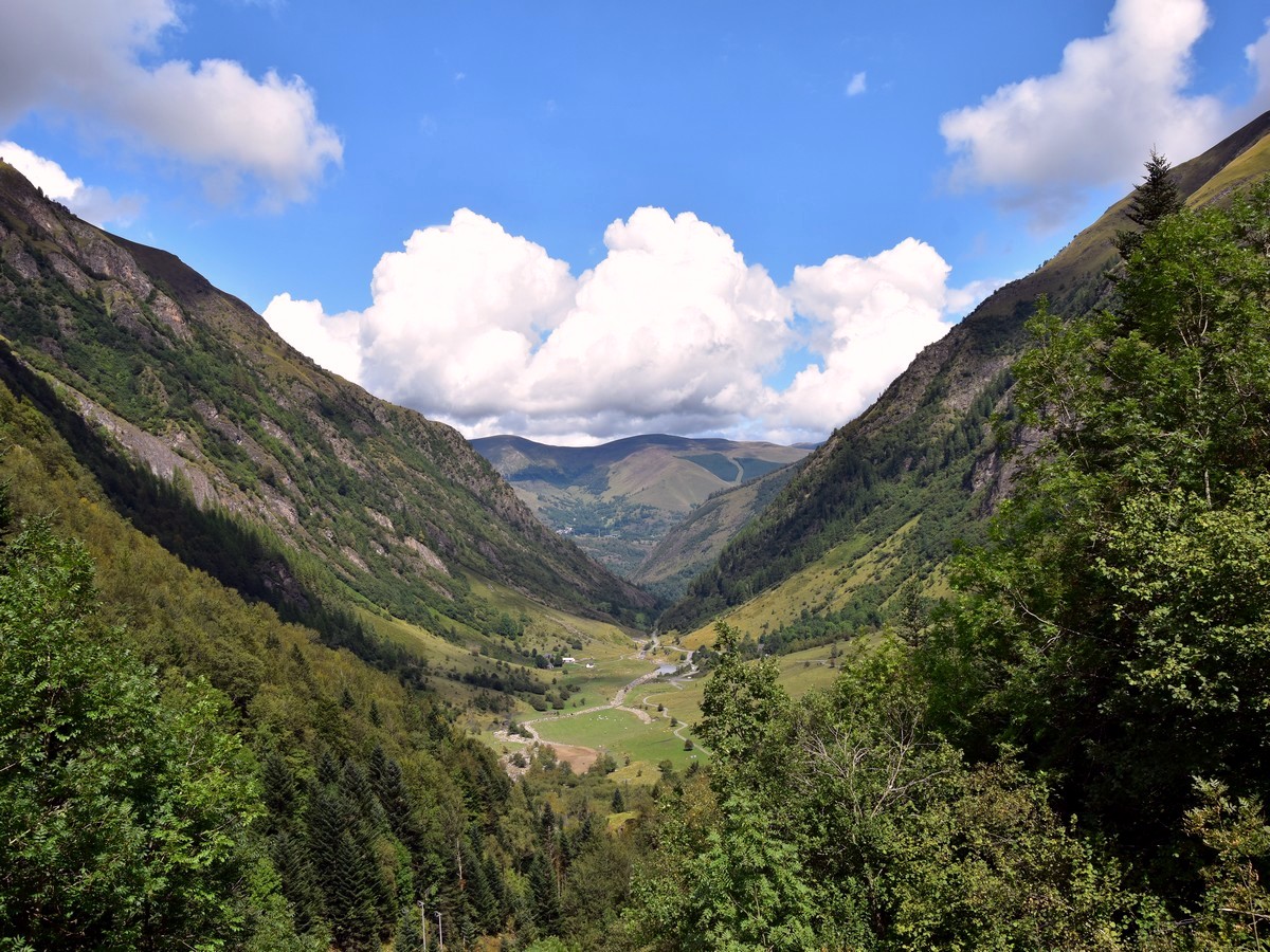
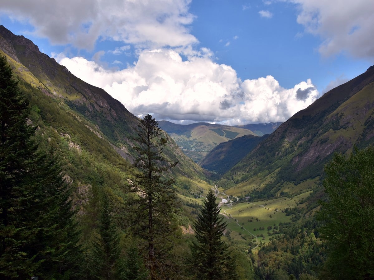
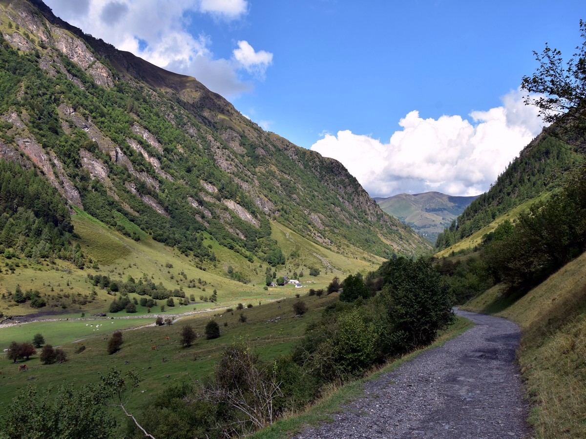
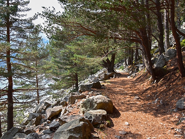
The hike to Lac d’Oô is a stunner. Starting from Les Granges d’Astau (3740ft), head south on a gravel road, along the Val d’Astau. You go first through open, green fields where cows are grazing, then through a forest.
While the path is definitely not designed for strollers, it is rather easy-going, so it may be suitable for young children who are used to do a bit of walking. The ascent is gentle and rather straightforward at the beginning.
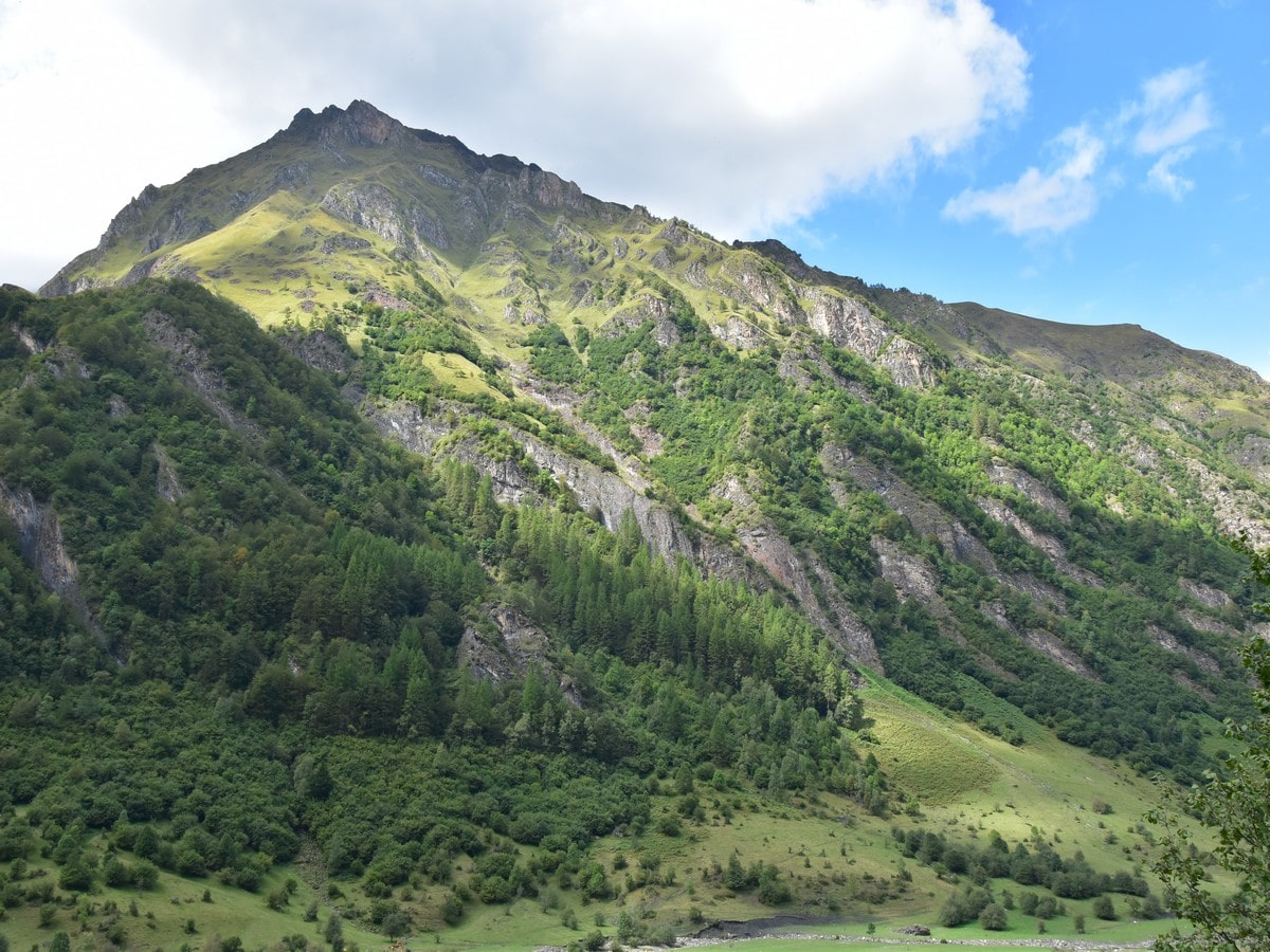
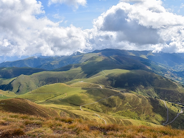
After approximately 1.2mi, the track steepens a bit and starts to zigzag. Make sure you stick to the wide, stony track and take the time for a breather here and there as the views of the valley open from time to time, with the bulky Montagne d’Espiau in the background.
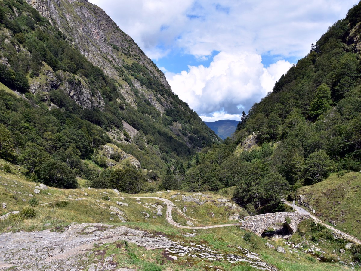
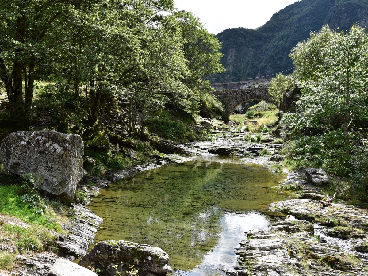
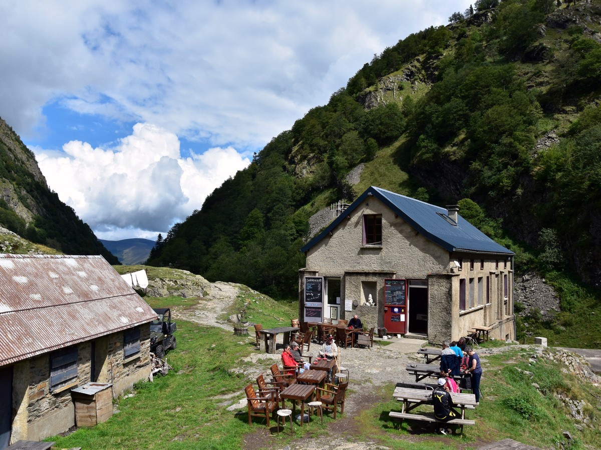
After a while, the track levels and then goes down and up again twice through the forest, with very steep ground to the right, before reaching a beautiful stone bridge at the foot of the dam. Cross the bridge to your right and head up (left) along the track to the Refuge du Lac d’Oô, which overlooks the end of the lake.
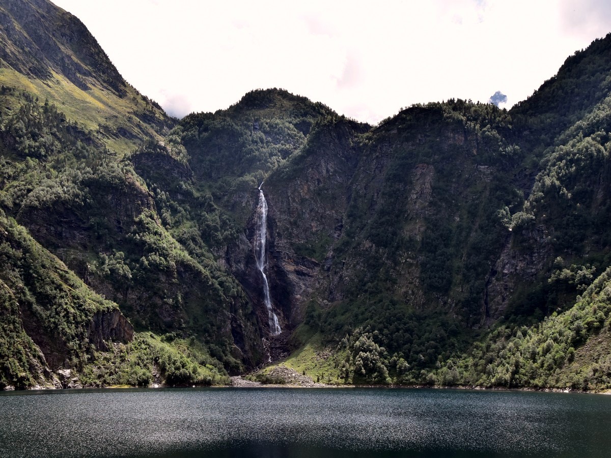
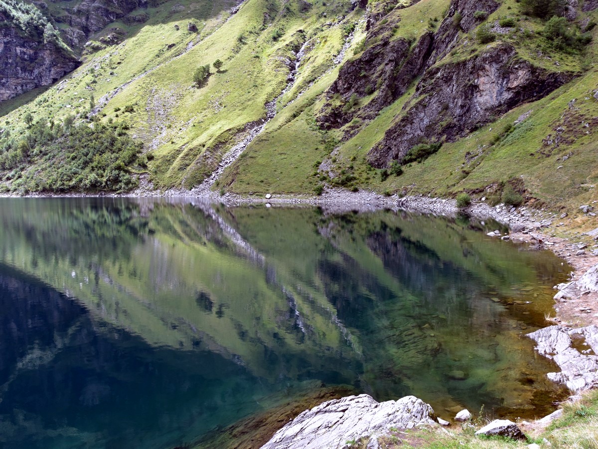
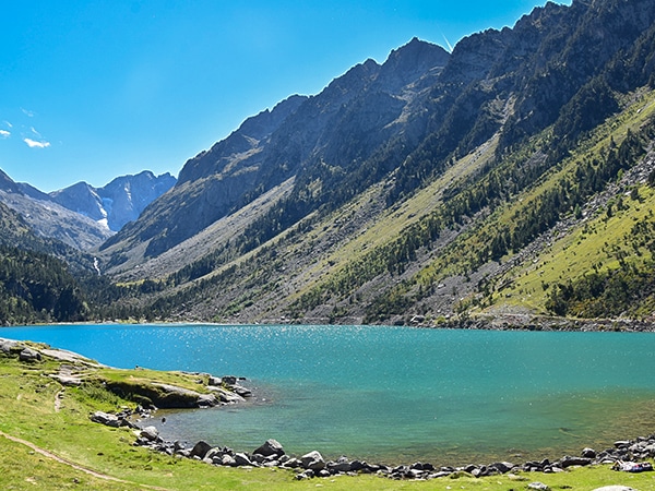
Sit down on the rocks and enjoy the view! The level of water may vary according to the season; when the lake is full, the reflections of the surrounding slopes in the water are incredible. The waterfall is 902ft high and is one of the highest in the Pyrenees.
If you have brought a picnic, this is the ideal place for it, otherwise, the refuge serves food and drinks daily throughout the season. This walk can be highly enjoyable any time of the year. In May (and usually even later), you can still see some snow on the higher tops which are visible behind the waterfall. In October you will be delighted by the amazing autumn colours of the beech trees to the left of the lake.
You may be tempted to take a dip, though note that there is hardly a place to stand in the water as the bottom goes down very steeply.
Return the way you came. You may notice some things you have not seen on the way up, including another high but very thin waterfall along the slopes to your left, as you come out of the forestry.
Insider Hints
If you get hungry or thirsty on the way back, why not stop at one of the two bar-restaurants opposite the car park, le Mailh d'Astau and l'Auberge d'Astau. L’Auberge d’Astau offers some lovely food at reasonable prices, including delicious organic trout filets from the local trout farm at Oô. If the weather turns a bit chilly you will surely enjoy sitting by the fireplace while enjoying your food or drink!
If you have the legs and enough time, take a longer walk to enjoy more of this majestic scenery. From the refuge by the lake, just walk back to cross the bridge and follow the GR10 to your right. It rises steeply through beautiful beech trees, with some amazing views over the lake and the waterfall. Keep following the GR10 until around the 6266ft contour line, where it takes a sharp turn left N up the slopes. Leave it here, staying on the path leading S to the Col d'Espingo (6453ft), where you will enjoy some great views over the Cirque d'Espingo, which is surrounded by a few +9843ft peaks. From there, it is an easy stroll to the Lac d'Espingo and the Refuge d’Espingo, which also serves food in high season, and to the Lac Saussat, a great spot for picnic. This would add some 5.0mi return, with an extra 1640ft ascent, so allow at least 3h return from the Lac d'Oô.
The fittest and most experienced hikers may want to go and explore even further to reach the Lac du Portillon at 8760ft. The Refuge du Portillon provides some basic accommodation for the night (do not forget your duvet!) and normally serves food during the high season. The views over the Lac du Portillon, with the many +9843ft peaks and their glaciers behind is absolutely stunning. The refuge can be the base for tougher expeditions to reach some of the higher peaks, the highest of the area being the Pic de Perdiguère (10571ft), which stands on the Spanish border.

Similar hikes to the Lac d'Oô hike
Oredon - Aubert - Aumar
This hike, starting from the Lac d'Orédon, takes you through the wild, magical landscapes of the Néouvielle. Hike by Les…
Mont Né
The hike to Mont Né is a great first peak for your kids. Hiking on a well-maintained path takes you…
Lac de Gaube
Hiking to the Lac de Gaube is a lovely stroll along well-kept tracks with beautiful waterfalls everywhere. The goal is…
Rolando Acciaio 4 years ago
The perfect place for a wonderful hike and the landscapes are wonderful
Felix Legrand 4 years ago
A beautiful place and a lake with a variety of colors through the day
MountainPaw 4 years ago
it's a good place to spend the day in nature
Villon H. 4 years ago
Easy hike to view the lake. Lakeshore was very crowded, takes a couple of times for us to get a decent family photo. It's very beautiful.
Grendy Noire 4 years ago
Very beautiful, of course. Not very stressful and very easy to do.
Jake Reeli 4 years ago
Superb hike with nice surroundings. The lake looks spectacular. It's quite crowded, but nothing to worry about when you go early.
Rowena D. 4 years ago
This easy hike is a good exercise. There was a mild ascend, but it's not that steep so it's quite easy. I think it would be great for family hikes.
Elizabeth M. 4 years ago
it has some challenges but it was very easy...we started around 10 am and it was pretty crowded already...
Adriadna Y. 4 years ago
Amazing hike. Enjoyed the views of the lake and the waterfalls. They look amazing in the photos!
Kim Pillar 4 years ago
Nice short hike offering incredible views of Lac d'Oô Valley and Lac du Portillon. Make sure you take the time to see both!