
Cirque de Gavarnie hike
View Photos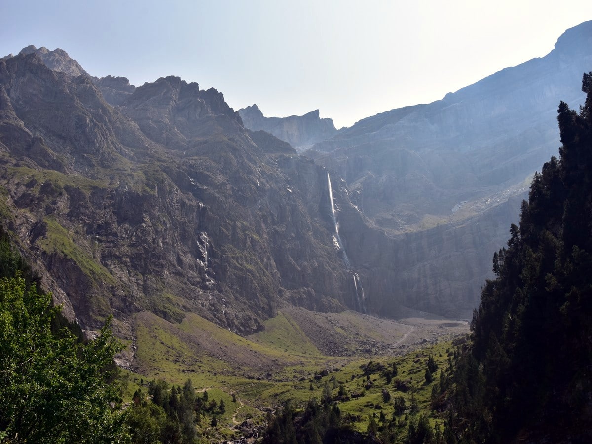
Cirque de Gavarnie hike
Difficulty Rating:
A hike to the Cirque de Gavarnie is the most popular hike in the French Pyrenees. But there’s a reason! You cannot come to the Pyrenees without a walk to the stunning Cirque de Gavarnie! It’s arguably one of the most beautiful sites in France and part of the UNESCO Global Heritage. Plus, we found a "secret" viewpoint.
Getting there
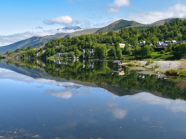
The village of Gavarnie is situated at the end of the deep valley south of Lourdes. There is a mandatory car park (5 euro fee) in the village by the Office de Tourisme, except of course for visitors who are staying at the campsite or in one of the hotels or guest houses. The village is closed to trafffic from 9am-5pm, so to beat the crowds you must arrive early or park in the town.

About
| When to do | May to October |
| Backcountry Campsites | No |
| Toilets | Soon after start, to the left of the main street |
| Family friendly | Yes |
| Route Signage | Average |
| Crowd Levels | Extreme |
| Route Type | Out and back |
Cirque de Gavarnie
Elevation Graph
Weather
Route Description for Cirque de Gavarnie
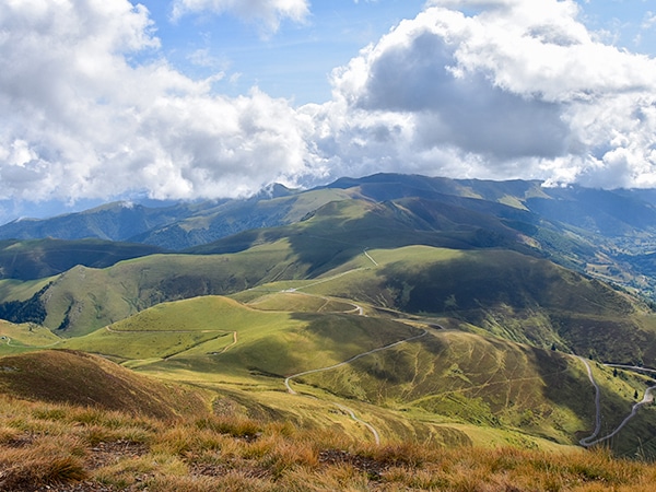
The Cirque de Gavarnie is a highlight for most holiday-makers making the trip to the Pyrenees. This is a pleasant hike that isn’t too hard.
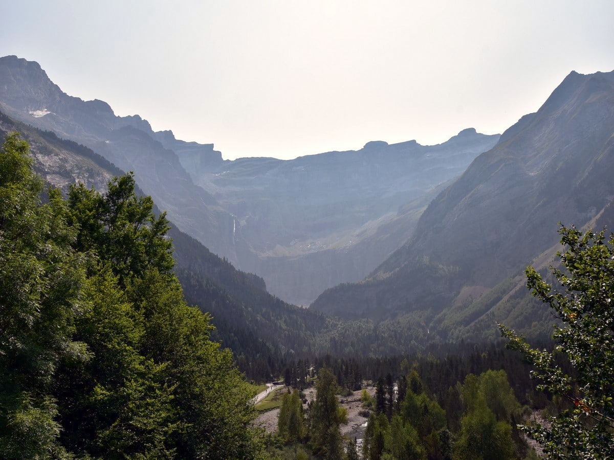
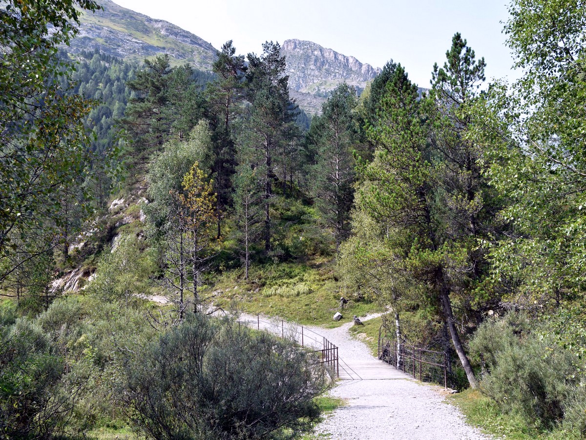
From the car park, head downhill to the main crossroads in the centre of Gavarnie. This is the starting point of the route shown on the map. Follow the main street heading south, passing by numerous shops, bars and restaurants. After coming around a bend, the road splits, with the road to the right going up and the route we want to take going down to the left. From here the Cirque de Gavarnie is visible in the distance and is so huge it looks unreal!
Follow the road as it runs out of the village and along the Gave de Gavarnie (river). You will see two bar-restaurants on the other side of the Gave, and after this, cross the bridge to the other side of the Gave and follow the road until it becomes a gravel track.
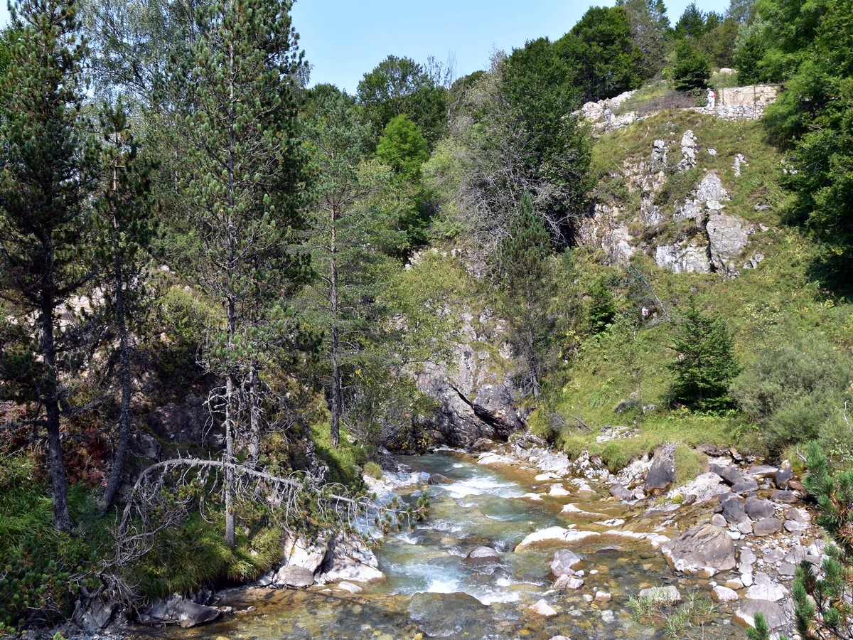
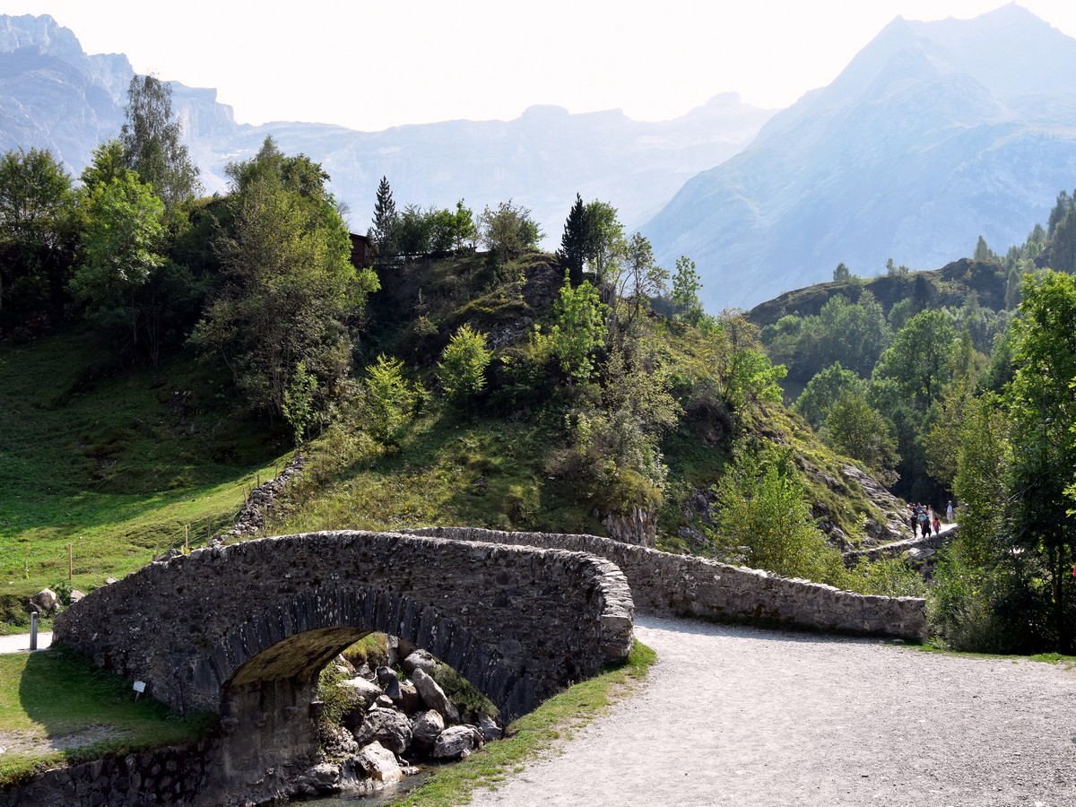
This is a lovely stretch along the shallow river, which can be done with a stroller. You will soon reach the Pont de Nadau, a lovely stone bridge, which is a perfect foreground for a great photo with the amazing Cirque in the background. If you have had enough or have a stroller, you can cross the bridge and come back along the other river bank.
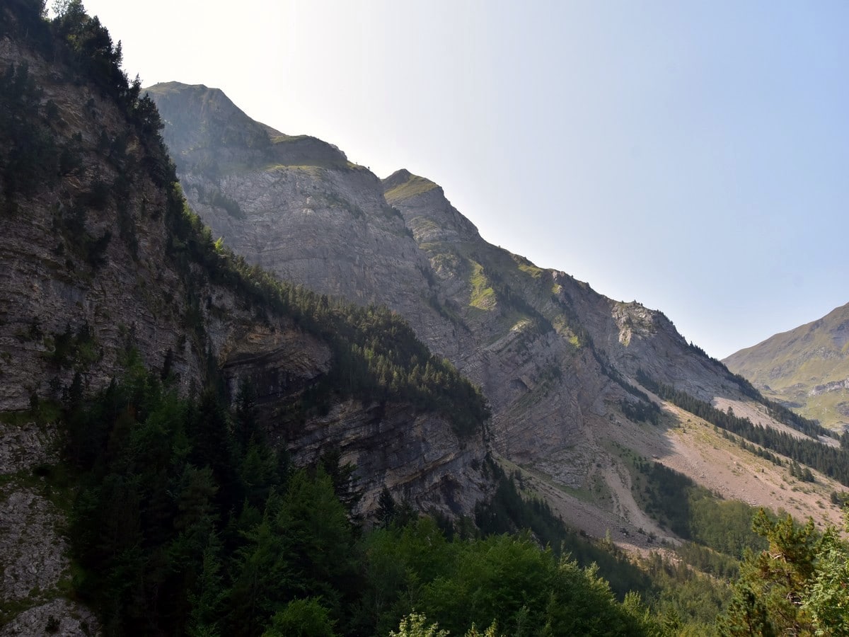
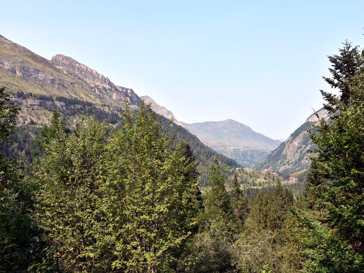
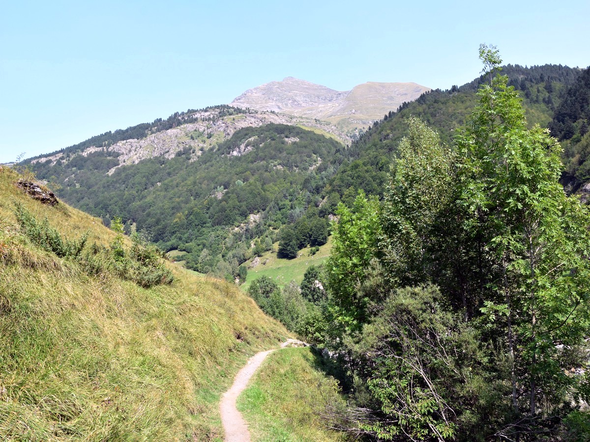
But the best of this walk is still to come, so continue ahead. Do not cross the bridge and keep following the main track. From here it steepens up, crossing a bit of a forest, and you soon pass by a UNESCO World Heritage plaque. Soon afterwards, the views open over a large valley with the Cirque de Gavarnie now entirely dominating the landscape in the background.
The track now goes downhill to reach some open ground. From there, it rises gently up to approximately 4757ft, where it steepens again quite significantly as you lose sight of the Cirque. This is the only “difficult” part of the hike, but it just lasts for a few hundred metres.
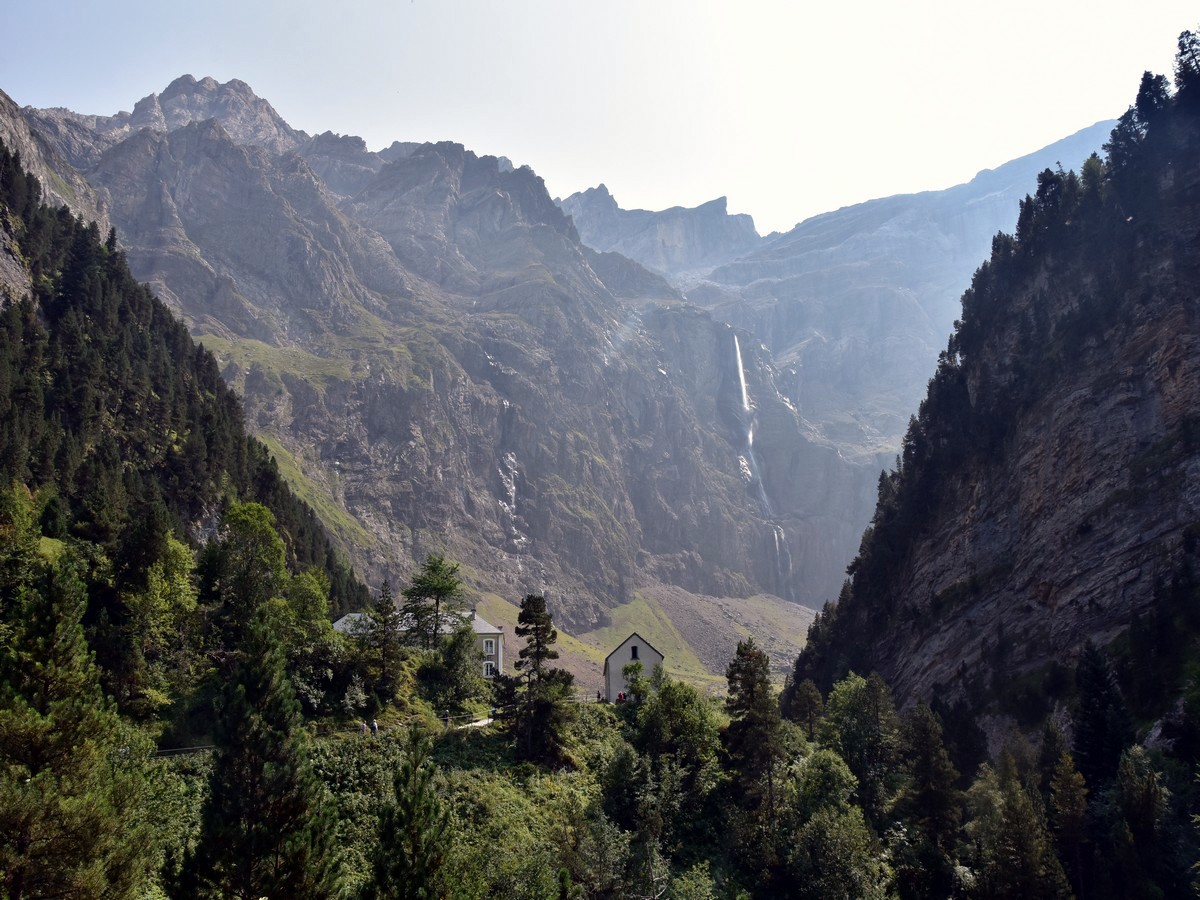
As for the route-finding, the track is so obvious that you have no chance to get lost! Soon the Hôtellerie du Cirque appears in the distance, with the Cirque itself and its 1385ft waterfall behind. Down to the right, the river has dug a deep hollow, giving a real sensation of wilderness.
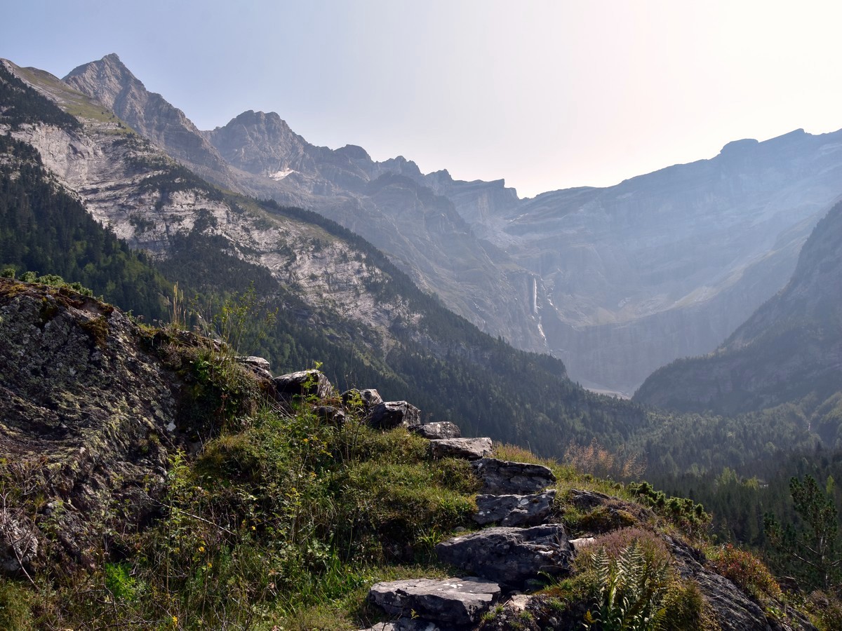
As you reach the Hôtellerie, the view over the Cirque becomes simply incredible! You are now at 5151ft while the highest peaks in front of you exceeding 9843ft! The gorgeous waterfall can be approached continuing the track, adding some 1.9mi distance and 492ft ascent to the walk.
To return, you can simply follow your track and retrace your steps.
Another option is to cross the bridge on the way back (just before the main track runs uphill for a few dozen metres to reach the UNESCO plaque) and follow the left/W river bank.
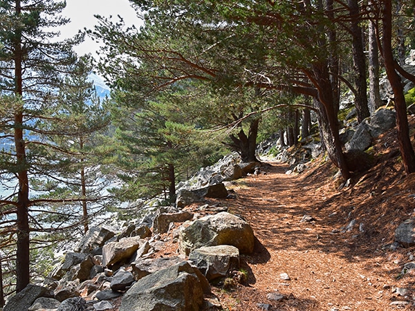
If you want to have one of the best views of the Cirque du Gavarnie, and have it in private, then we have a surprise for you! Right after the bridge, look out for that tiny path through the forest to your right. Walk up this path until you are out of the forest (hardly a minute or two). The main path which runs along the left bank of the Gave is down there in front of you, slightly to your right. But before you head down this way, take a look to your left: a faint path leads you up to a hump and what looks like stairs; carefully climb the first set of stones to enjoy a stupendous – and often private – view of the Cirque du Gavarnie! This is our “secret” viewpoint: this promontory is indeed a bit sideways and therefore not frequented often. You may even climb the last stairs, minding the steep ground to your right to sit on what looks like a minor summit, which could be a great spot for picnic!
Retrace you steps down and veer left to reach the path. Follow it down to your right as it soon gets back along the river. After a few minutes, you will be back at the Pont de Nadau. Stay on the left bank, passing by a bar called “Le Pailha” (see Insider Tips section below) and meet the road at the first bridge you crossed on the way up, just before the entrance of the village. Follow the road back into the village to your starting point.
Insider Hints
Gavarnie village is closed to traffic from the 15th of June to the 30th of September. Parking in and around the village is restricted between the hours from 9 AM to 5 PM. These restrictions do not apply to those who arrive before 9 AM or those who are staying at one of the Hotels/accommodations. The parking at the entrance can get crowded whilst the car parks within the village are less so. Beat the crowds, arrive early or park within one of the hotel car parks. The Hotel Vignemale car park is facing the Cirque with picnic tables and shaded spaces.
The Cirque de Gavarnie is part of the Pyrénées-Mont Perdu area, which was declared a UNESCO World Heritage site in 1997. The area is host to some of the highest peaks of the Pyrenees, including the third highest, the Monte Perdido (Mont Perdu in French, 11007ft).
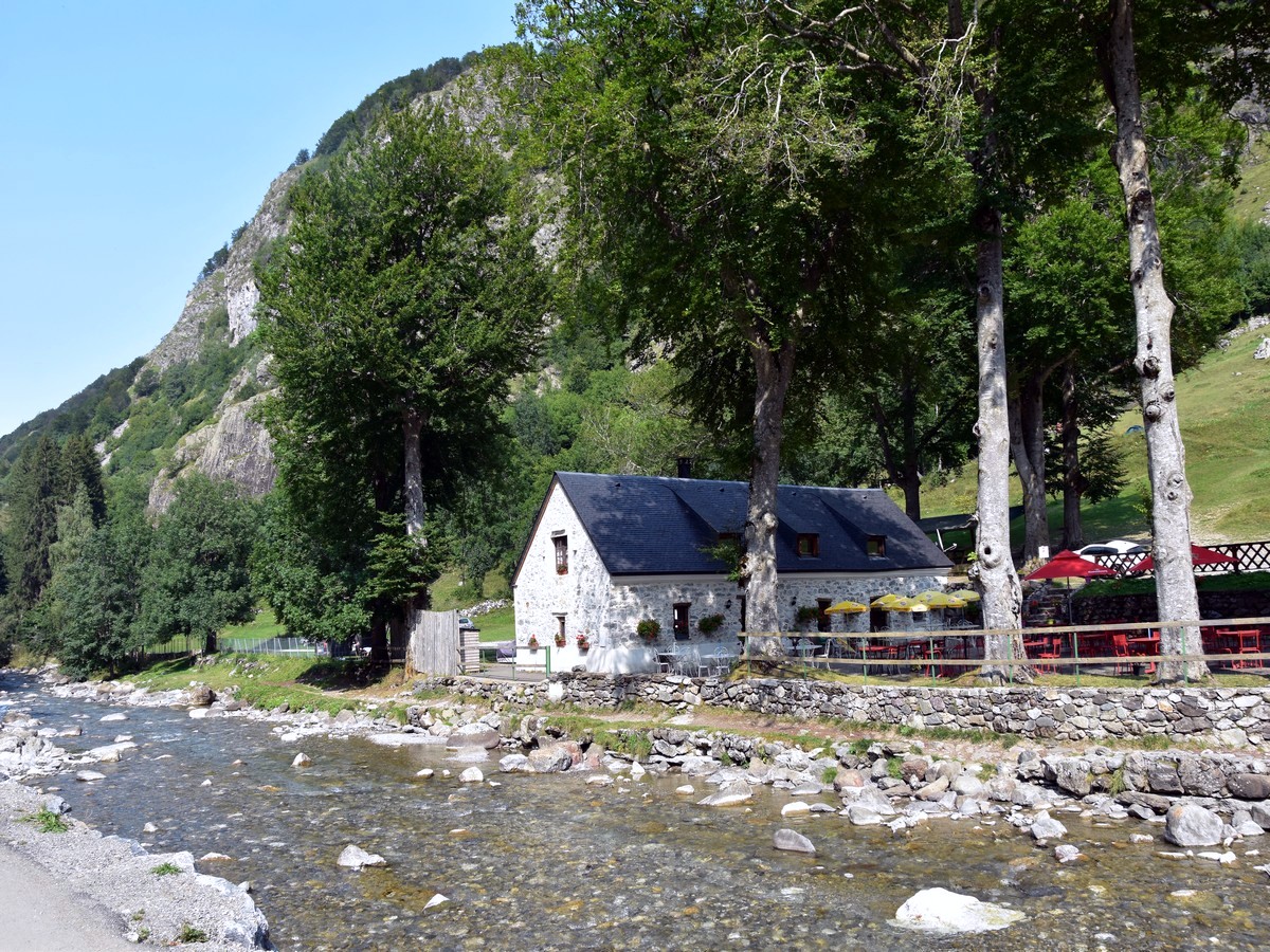
There is a great choice of bars and restaurants along the main street in the village. You can be tempted to ask for a local beer at La Ruade at the start/end of the walk. Further along the way, you will find some lovely places to enjoy a refreshment or proper food, next to the Gave (local name for a river -pronounce "gav", like "cat"). If you want a quiet place to enjoy a drink or a crêpe or ice-cream, try "Le Pailha", a bar which is on the left (W) bank of the Gave – it even has a swing for the kids!
There are plenty of hikes of all levels to be done in the area. The most popular one is La Brèche de Roland (9209ft), starting from the Col des Tentes (7244ft). Despite its reasonable amount of ascent (about 2133ft), this walk is for very experienced hikers only as the second half is on steep ground with scree, and includes a tricky stream crossing and some (relatively easy) scrambling. It is best done in the summer and in the absence of snow or ice. The route crosses what remains of the Glacier de la Brèche, but does not require any special equipment in summer conditions. La Brèche de Roland is a huge gap of about 328ft high and 131ft wide which stands at the Spanish border. From up there, the views over the Spanish side and over the Cirque de Gavarnie are absolutely breathtaking!
The tiny campsite "La Bergerie", situated south of the village, along the route described below, is a perfect spot to explore the Cirque de Gavarnie and allows you to avoid paying the 5-euro car park fee.

Similar hikes to the Cirque de Gavarnie hike
Oredon - Aubert - Aumar
This hike, starting from the Lac d'Orédon, takes you through the wild, magical landscapes of the Néouvielle. Hike by Les…
Mont Né
The hike to Mont Né is a great first peak for your kids. Hiking on a well-maintained path takes you…
Lac de Loudenvielle
The walk to Lac de Loudenvielle is a lovely hike around a beautiful lake, which can easily be done with…
stuartb3502 4 years ago
Did this a week ago with my wife. We're used to doing 10 mile walks in less taxing hills and occasional trips to fells etc. There is no doubt this is a gob-smackingly beautiful place. I feared it would be spoiled by being too popular, but on a mixed weather day in mid-September it was not so busy as to be spoiled (apart from the disgusting typical littering of toilet paper in some places and trampling of the crocuses). We just did the route straight up and back apart from taking the path to the right of the river at the first bridge. This goes to the viewpoint mentioned above and was much quieter also. Well worth it. Truth be told we found this quite strenuous. It was similar to say doing Haystacks in the lakes (a proper walk but not a problem). There were plenty of people doing it in trainers and sandals. The part after the hotel up to the base of the waterfall is described as a half hour addition. It probably is, but the last part is actually very steep (not scrambling, but steep on a loose surface with interspersed footholds). Worth doing for the full experience however as the view back down to the hotel and the valley beyond is fantastic. You can also get a cool shower just by getting closer to the waterfall :-) We then crossed the stream (which I guess would not be safe/possible at other times and came back the other side which makes for a good change). We found it hard to tear ourselves away from this place. Worth noting that it's a longish slow drive on typical gorge roads (usually behind a motorhome) . Absoultely worth it however. Time taken includes stop for lunch at the top , lots of photos and not seeing the point of rushing through somewhere this beautiful.
MountainPaw 4 years ago
The landscape and views are spectacular
TeddyBear 4 years ago
A must-do in the Pyrenees. a very beautiful scene and a comfortable 2 hours walk
Rolando Acciaio 4 years ago
Very impressive and great place for hiking a superb waterfall
Villon H. 4 years ago
Short hike with amazing views!! Definitely crowded! We got there about 1pm and it was hard to get a parking space.
Grendy Noire 4 years ago
Accessible hike. Just go early or stay the night before you plan to hike for a more carefree experience.
Jake Reeli 4 years ago
I don't really wonder why this area is very popular. The scenery was just terrific!
Rowena D. 4 years ago
We stayed at the hotel, so it was very convenient for us to do this hike. It was an amazing experience. The sunrise looks remarkable.
Elizabeth M. 4 years ago
gorgeous area...it's very short and easy..but very crowded even in the morning...
Adriadna Y. 4 years ago
Crowded but a beautiful view. Not a real hike, in my opinion, expect to see lots of people taking pictures here and there.