
Mont Né hike
View Photos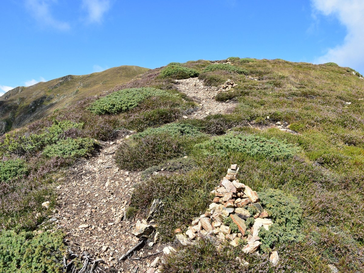
Mont Né hike
Difficulty Rating:
The hike to Mont Né is a great first peak for your kids. Hiking on a well-maintained path takes you up the steep slopes of Mont Né to enjoy some mighty views over the rest of the massif. You will love this hike!
Getting there
From Luchon (also called Bagnères de Luchon), take the D618 which leads to the Col de Peyresourde. After 2.5mi, turn right direction Le Bourg d'Oueil. Follow the D51 along the Vallée d'Oueil until you reach the tiny village of Le Bourg d'Oueil. Turn right up the steep road to reach the Port de Balès at 5758ft where there is parking.

About
| When to do | May to October |
| Backcountry Campsites | Yes |
| Toilets | Bourg d'Oueil (6km), Luchon (20km) |
| Family friendly | No |
| Route Signage | None |
| Crowd Levels | Moderate |
| Route Type | Circuit |
Mont Né
Elevation Graph
Weather
Route Description for Mont Né
Hiking up to Mont Né is a great first peak for new hikers or for older children.
Park at the Port de Balès (5758ft) where you will already be enjoying the views! Cross to the north-west side of the road to pick the path which starts between the two signposts.
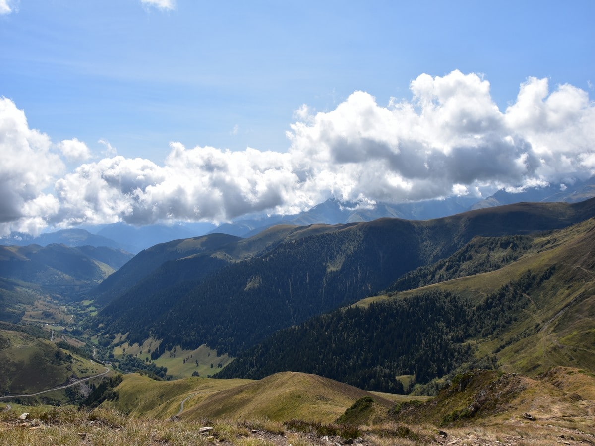
The path climbs gently along a grassy slope to contour a minor top. After about 1969ft, you will reach a kind of flat ridge. Drop down a few metres, aiming at a good track to your right. Follow this track which soon starts winding, rising more steeply, until you reach 6168ft (last hairpin on this track). Leave the track (it continues north to contour the east shoulder of the Mont Né). You veer west along a small path which rises straight up the shoulder. As you gain height, the views get more spectacular.
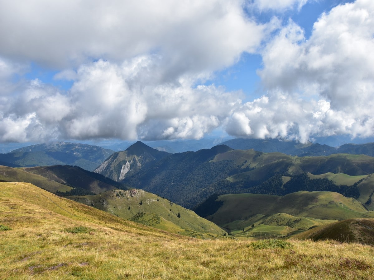
Follow this path up the steep slopes. It eases before getting even steeper as the ground turns from grassy to rocky. This is the last pull to the top of the ridge, which you will reach just above 6955ft. Once on the ridge, turn left to reach the top of the Mont Né at 7044ft.
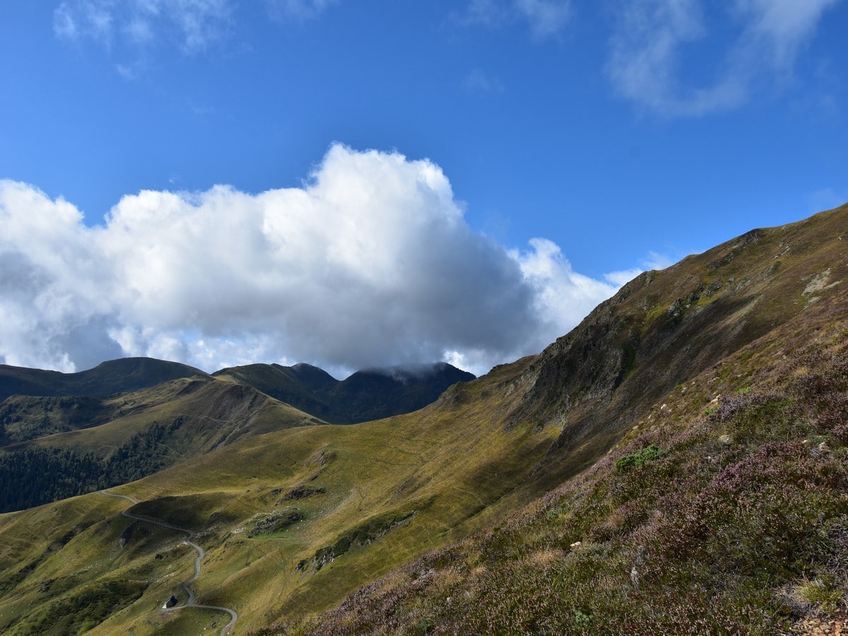
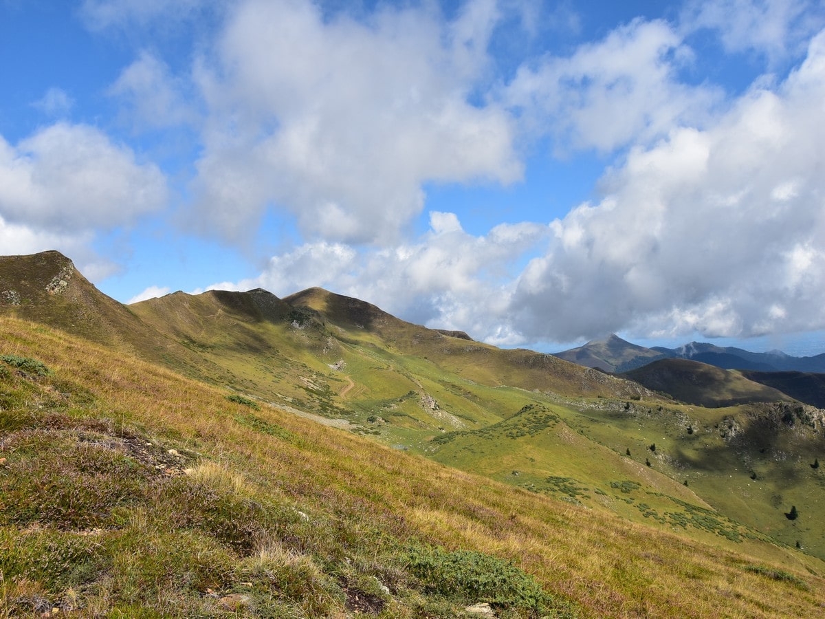
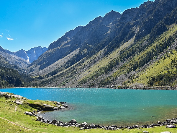
The summit of Mont Né has a substantial cairn and offers a breathtaking vista over the main Pyrenees to the south, with most of the main +9843ft peaks visible. You will also particularly enjoy the views to the south-west, over the beautiful Lac de Bareilles. The Pic du Midi de Bigorre and its observatory can be seen to the west, while to the north the beautiful, grassy ridge stretches for kilometres, looking very inviting. To the east, you can spot the car park at the Port de Balès, where you just came from. Watch for griffon vultures, which are very common in the area.
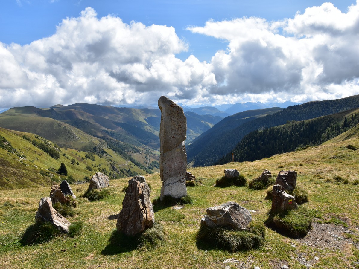
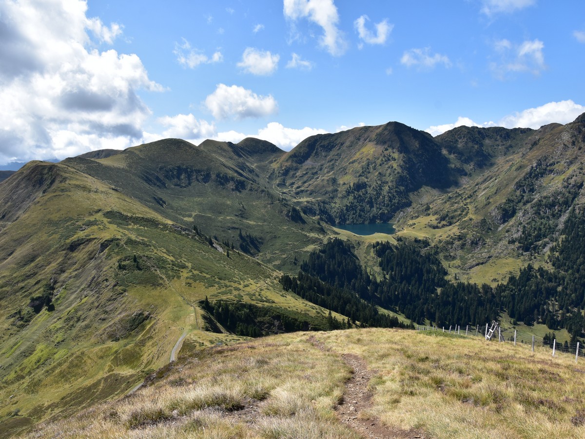
From the summit cairn, continue along the ridge on the obvious trail, climbing up and down a stile. The descent is steep but rather easy-going. The trail will take you down to the Port (col) de Pierrefitte (6086ft), where you will admire a standing stone surrounded with a stone circle, which may date originally from the Bronze Age!
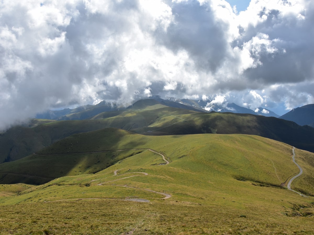
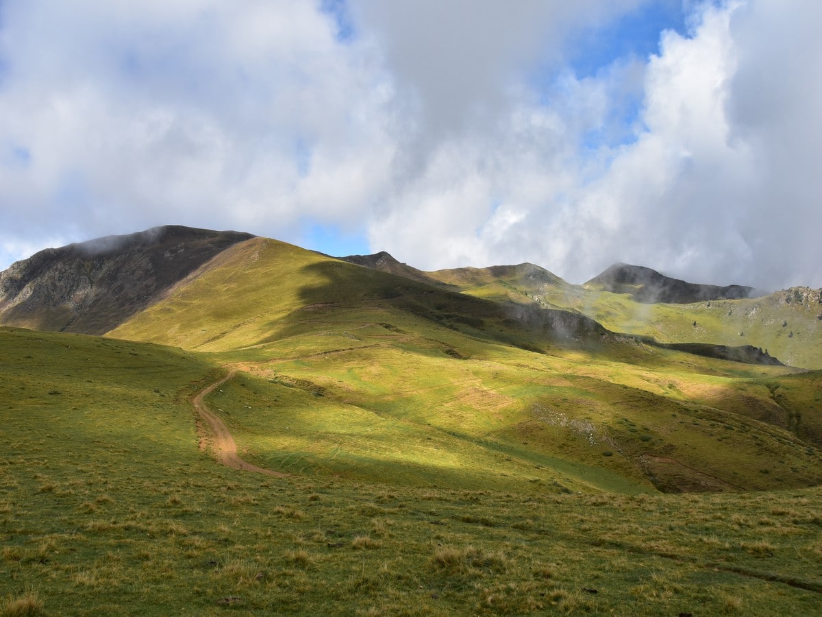
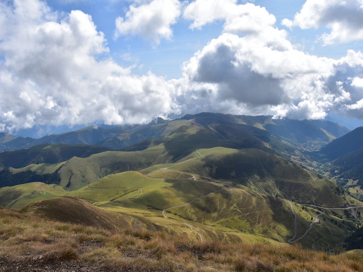
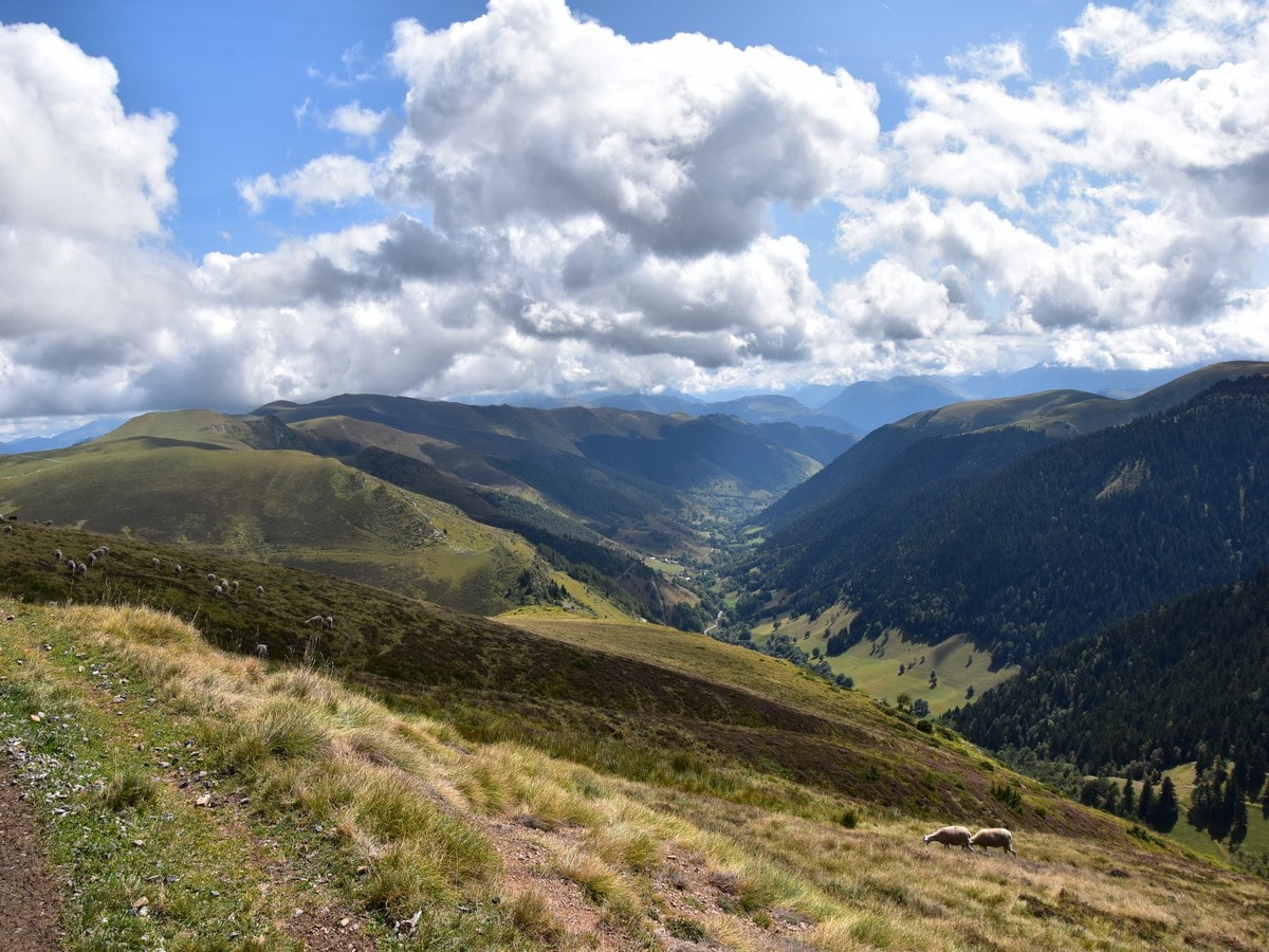
From the Port de Pierrefite there are routes in all directions. To the right (SW) is the path to the Lac de Bareilles and behind the stone circle (SE) is the path which leads down to Le Bourg d’Oueil. You want to take the main track to the left (goes north-east). This was previously a paved road which has deteriorated over the years, and it makes a perfect return route with panoramic views over the beautiful Vallée d’Oueil, which is arguably one of the most beautiful valleys of the French Pyrenees.
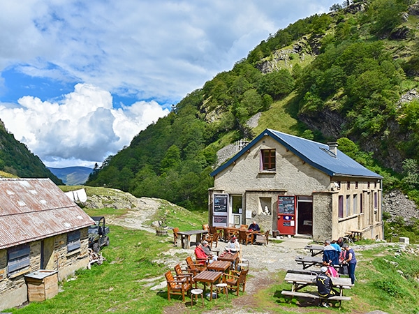
On the way back, you will certainly encounter some sheep and may spot a kestrel or two and more vultures. You will also pass by the Refuge du Mont Né, one of the local huts where a bivvy is possible.
Follow the track until you approach the main road rising from Le Bourg d’Oueil. At the last bend before the junction, pick a path to the left which makes a kind of shortcut and will enable you to avoid walking on tarmac. This path leads you straight to the signposts at the starting point.
Insider Hints
The hotel "Le Sapin Fleuri" in Le Bourg d'Oueil is a nice place for food and drink on the terrace. There is also a small restaurant (La Grange de Cirès) in Cirès, one of the several beautiful tiny villages of the Vallée d'Oueil.
This walk could be completed with kids who are used to walking, as the amount of ascent is not too high. If you have younger kids and/or a stroller, easier options are available. You can either complete part of the return route suggested here, out and back along the track to the Port de Pierrefitte. Alternatively, follow the track out and back SE of the Port de Balès or cross the road and pick the track to the NE. Either options offer nice views for little effort.
Access to the Port de Balès can be done from the north, but this is on a winding, narrow road. Driving from either side, mind the cattle who are running free and therefore often standing in the middle of the road!
The area is host to a large colony of griffon vultures. If you are lucky, you could see them hovering high above your head! A couple of bearded vultures may also be spotted in the wild area near the Montious, W of the Lac de Bareilles.
We recommend hiking to the beautiful Lac de Bareilles from the Port de Pierrefitte. This would add a mere 1.6mi and 328ft climbing. More experienced hikers could also push towards the amazing Pic du Lion (6896ft), and then to the Sommet du Tech (7014ft) and the wild, remote Montious (7123ft). Steep slopes and use of hands are required on a few occasions. This tough hike would add about 6.2mi and some 2625ft climbing to the total. Good navigation skills would also be required, as the Montious ridge has no markings. The ridge to the N of the Mont Né also offers great walking. Note that the Mont Né can also be accessed from Le Bourg d'Oueil (with a total of ca. 6.2mi and 2625ft ascent).

Similar hikes to the Mont Né hike
Oredon - Aubert - Aumar
This hike, starting from the Lac d'Orédon, takes you through the wild, magical landscapes of the Néouvielle. Hike by Les…
Lac de Gaube
Hiking to the Lac de Gaube is a lovely stroll along well-kept tracks with beautiful waterfalls everywhere. The goal is…
Lac d'Oô
The Lac d'Oô hike is a stunning hike in the Pyrenees. Imagine a lake surrounded by steep slopes, with a…
TeddyBear 4 years ago
Absolutely breathtaking! It is an easy hike that took 3 hours
Felix Legrand 4 years ago
Wonderful landscape and Very nice point of view on the valley of d'Oueil
Mustafa P. 4 years ago
One of the most anticipated hike! Finally able to do this hike! After several attempts of planning it with my friends! For some reason, they suddenly get too busy, or had an important thing to do on the day we set. But now, it's actually real! So awesome.
Dayton M. 4 years ago
Stunning all the way. Worth doing! Highly recommended.
Minzy Lee 4 years ago
From the beginning until the end the views were spectacular. By the time I parked the car, I was already welcomed by the magnificent beauty of nature!
SnowdonLover 4 years ago
Incredible views. Well-maintained trail that you can easily follow
Karina M. 5 years ago
It was more open compared to other hikes I've done in the park before. I also had sunburn in some parts of my face, so wear sunscreen if you have sensitive skin.
Abraham W. 5 years ago
I really love this hike!!! It's also an easy hike for the kids.
Lorde P. 5 years ago
A nice hike you can do with kids. There are few bearded vultures in the wild area. Great view all around!
Ramesh Patel 5 years ago
I would have to say it's a must-visit! Stunning scenery the whole way through.