
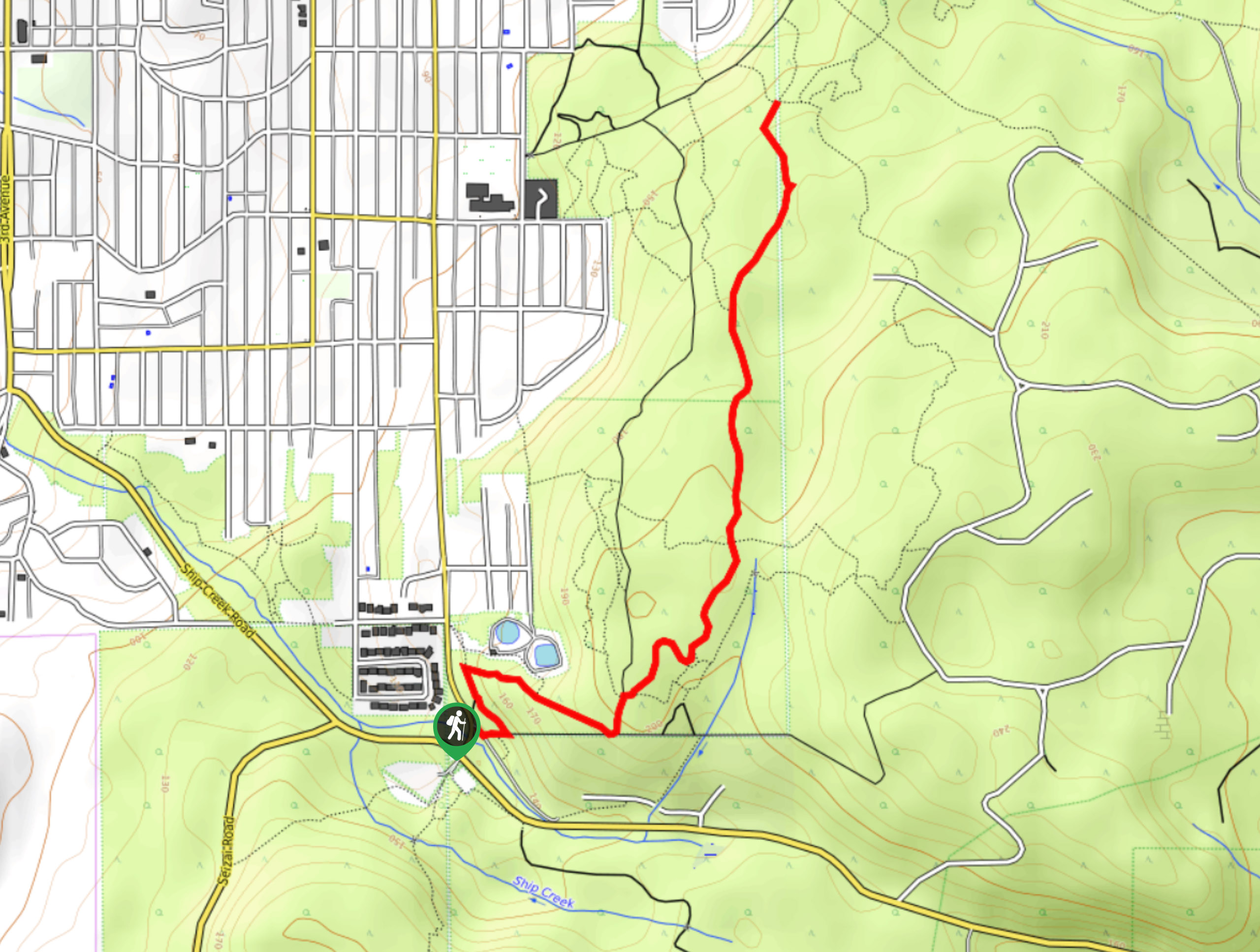
Fir Baby Trail
View Photos
Fir Baby Trail
Difficulty Rating:
The Fir Baby Trail is a great hiking route on the eastern edge of Port Alberni, BC, that will lead you through a scenic stretch of forest with several creek crossings. While the route doesn’t feature much in the way of incredible vistas, the temperate rainforest setting provides an almost magical atmosphere that is tough to beat. Hikers should take note that this is a multi-use trail, so remember to keep an eye out for passing bikers and share the trail.
Getting there
To reach the trailhead for the Fir Baby Trail from Port Alberni, drive south along Anderson Avenue for 1.2mi and turn left.

About
| When to do | Year-Round |
| Backcountry Campsites | No |
| Pets allowed | Yes - On Leash |
| Family friendly | Older Children only |
| Route Signage | Average |
| Crowd Levels | Moderate |
| Route Type | Out and back |
Fir Baby Trail
Elevation Graph
Weather
Fir Baby Trail Description
If you enjoy hiking through near-magical settings packed with dripping, moss-covered trees, vibrant green ferns, and rushing creeks, then the Fir Baby Trail in Port Alberni is the perfect route for you. Although you will have to share the path with mountain bikers, hiking this trail is still an amazing experience that will allow you to feel a bit of solitude in the rainforest. Setting out from the trailhead, the trail initially leads you to the east on an uphill climb under the thick canopy of the forest, before turning to the north. Along this part of the trail, you will pass by mature trees and cross over rushing creeks to eventually arrive at the end of the trail. From here, you can retrace your steps and relive your amazing rainforest walk on the return leg of the journey.
Similar hikes to the Fir Baby Trail hike
Mount Hankin Bluffs Loop Trail
The Mount Hankin Bluffs Loop is a moderate length lollipop hiking route just south of Port Alberni that will expose…
Roger’s Creek Nature Trail
Hiking the Roger’s Creek Nature Trail is an amazing family-friendly adventure just outside of Port Alberni that will expose you…
China Creek Falls Hike
The China Creek Falls Hike is a short 1.7mi out-and-back route that will take you through a charming…
Comments