
China Creek Falls Hike
View Photos
China Creek Falls Hike
Difficulty Rating:
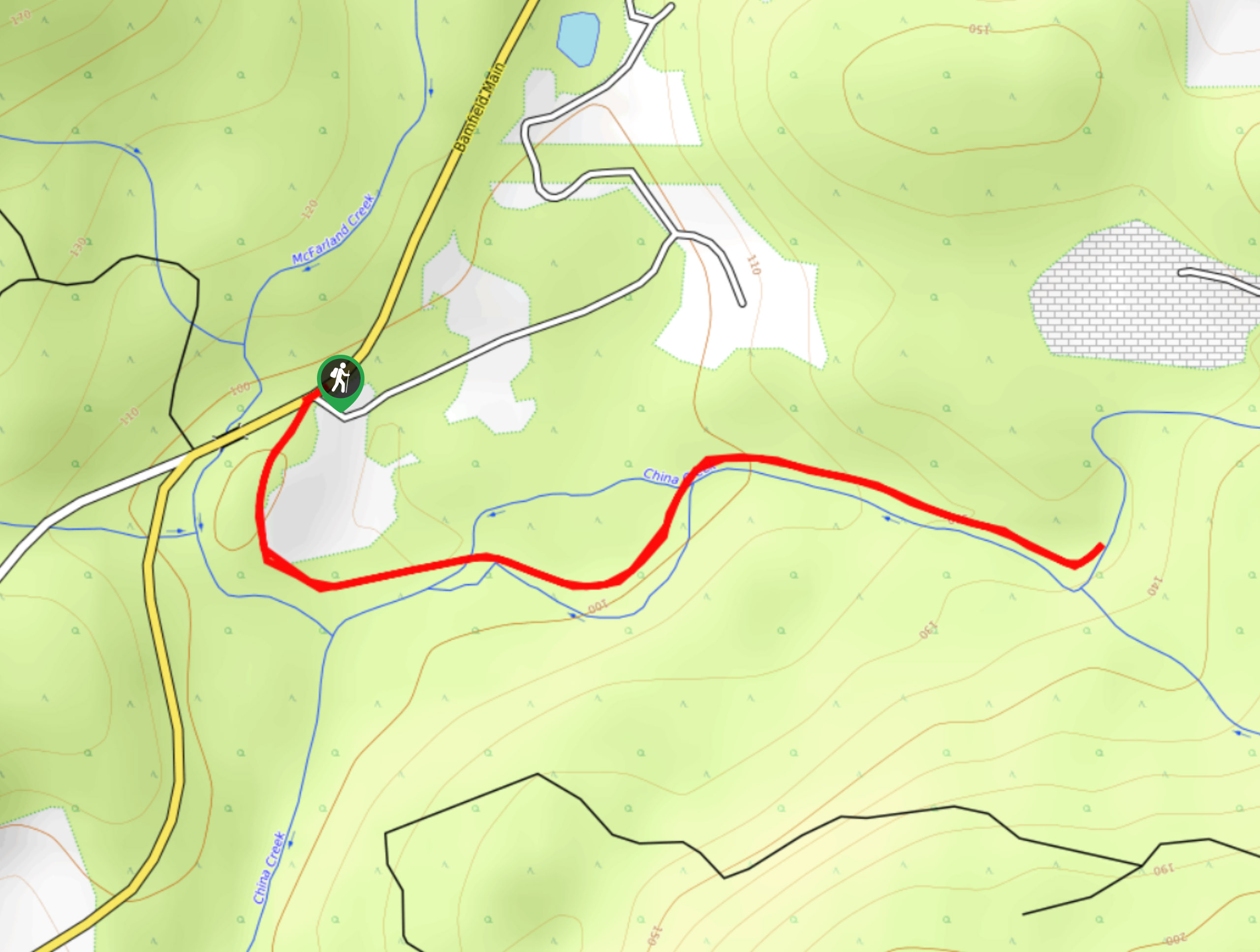
The China Creek Falls Hike is a short 1.7mi out-and-back route that will take you through a charming stretch of forest to reach the site of a gushing waterfall. Although trails here are well-maintained, they can become a bit wet and muddy during the spring/autumn season, requiring good hiking footwear to keep your feet dry on the trail. A great family-friendly route, the serene setting around the falls is a fantastic place to set up for a picnic on the weekend.
Getting there
To reach the parking area for the China Creek Falls Trail from Port Alberni, drive south along 3rd Avenue for 0.7mi and turn left onto Ship Creek Road. Continue on for 0.9mi, and keep straight onto Franklin River Road, following it for the next 3.8mi. You will find the trailhead on the left.

About
| When to do | March-October |
| Backcountry Campsites | No |
| Pets allowed | Yes |
| Family friendly | Yes |
| Route Signage | Average |
| Crowd Levels | Low |
| Route Type | Out and back |
China Creek Falls Hike
Elevation Graph
Weather
China Creek Falls Hike Description
While it may only be a short adventure, the ultimate payoff of reaching the picturesque China Creek Falls is more than enough of a reward to make this a popular hike in the Port Alberni area. Setting out from the trailhead, you will initially follow the trail south through the forest before it bends to the east along the waters of China Creek. After walking along the edge of the water, you will eventually arrive at the scenic location of the falls. Take some time to explore the area around the falls and serene pool below before heading back along the trail to return to your vehicle.
Similar hikes to the China Creek Falls Hike hike
Mount Hankin Bluffs Loop Trail
The Mount Hankin Bluffs Loop is a moderate length lollipop hiking route just south of Port Alberni that will expose…
Loon Lake Loop Hike
The Loon Lake Loop is a very short hiking route to the east of Port Alberni, BC, that will lead…
Fir Baby Trail
The Fir Baby Trail is a great hiking route on the eastern edge of Port Alberni, BC, that will lead…
Comments