Alamere Falls Trail
View Photos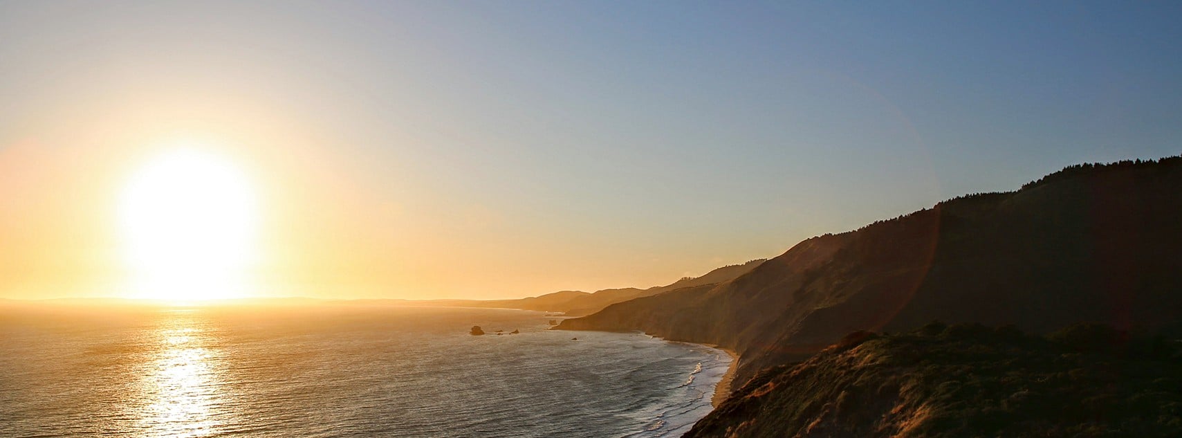
Alamere Falls Trail
Difficulty Rating:
The Alamere Falls Trail travels to one of the world’s rare tidal falls, which surges 40ft over the Point Reyes National Seashore. Located in the Bay Area, this beautiful hike boasts the perfect opportunity to escape the city and rediscover our world’s natural beauty. This spectacular adventure will not disappoint—you have our word!
Getting there
The Alamere Falls Trail departs from the Palomarin Trailhead off Mesa Road.

About
| Backcountry Campground | Wildcat Campground, wilderness permit required. |
| When to do | Year-round |
| Pets allowed | No |
| Family friendly | Older Children only |
| Route Signage | Good |
| Crowd Levels | High |
| Route Type | Out and back |
Alamere Falls Trail
Elevation Graph
Weather
Alamere Falls Trail Description
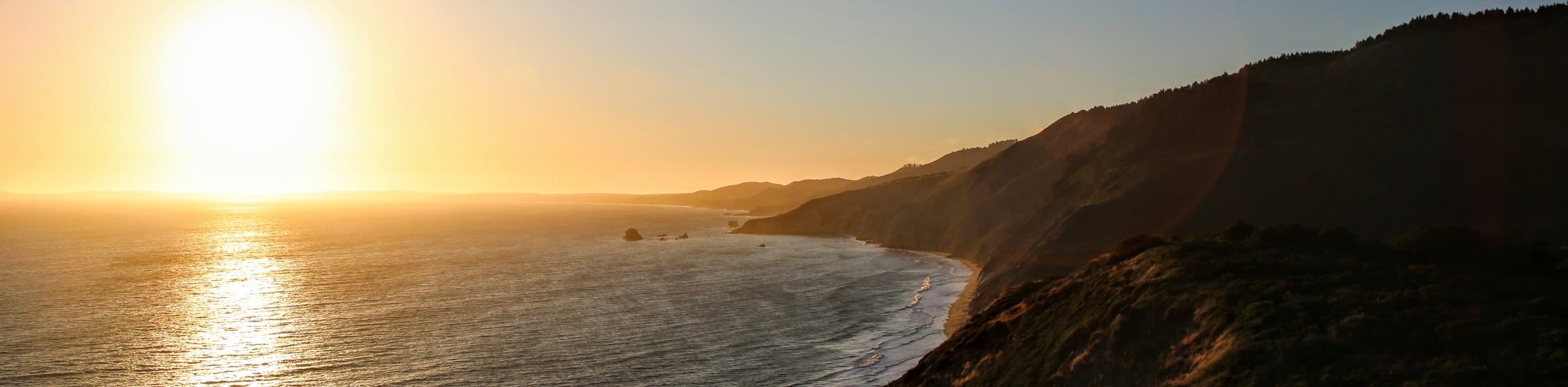
Explore one of the two tidal falls in the state of California along the Alamere Falls Trail. This scenic adventure wanders along the fragile shale cliffside of the Pacific Ocean, before plunging down onto Alamere Creek Beach. As you travel through the varying terrain of forests, tall bush, and exposed dirt trails, it is important to be mindful of the coastal erosion, delicate shale, and poison oak. We encourage you to wear long sleeves and long pants, as well as a sturdy pair of footwear to better navigate the technical route. Additionally, this revered path attracts countless adventurers and the parking lot often fills before noon, so head out in the early morning for a more secluded experience. Do not attempt this trail at high tide, as the rogue waves can sweep you into the surf.
The millions of visitors that have tackled this trek are a testament to its beauty. The Alamere Falls Trail is an incredible day-hike that exposes breathtaking scenery, passing several crystalline lakes before dropping down to the beach. Packed full of wonderment, this hike may be one of the most beautiful hikes in the state. Enjoy the shade of the lush tree canopy, pass dozens of Instagram-able locales—especially the rope swing on Bass Lake—and, on a clear day, you may even see the Farallon Islands! If you hike in the summer months, be sure to cool off in one of the many lakes off the trail on your way back! We love this trek, and we know you will too!
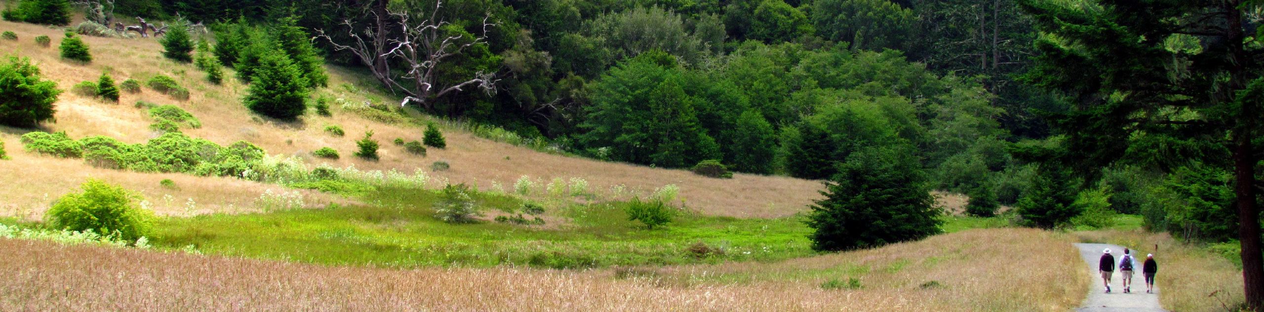
If you arrived early enough to secure a spot in the parking lot, then you can begin your exciting excursion along the Alamere Falls Trail. Setting out from the Palomarin Trailhead, your adventure follows the Coast Trail northwest. The initial segment of the hike will guide you along the coast. Enjoy the commanding views of the Pacific and the Farallon Islands. Eventually, the path will divert inland to ascend into the woodlands. Take advantage of the tree canopy that provides shade from the beating sun, and follow the undulating path that will deliver you to Bass Lake. If you are ready for a swim now, then take a break and cool off! If not, continue along the Coast Trail.
Traveling west, you will be led between Crystal Lake and Pelican Lake. After passing the lakes, you will reach the shortcut down to the beach, but remember to exercise caution, as this route is dangerous and requires scrambling down the slippery shale with the help of a rope. We suggest taking the scenic route, continuing along the Coast Trail over Alamere Creek. Traveling northwest, you will pass Wildcat Lake and track west to make your way down the vertiginous terrain to Wildcat Campground. From here, you will follow the Stewart Trail down to Wildcat Beach. Head left and follow the crowds south along the sandy beach. As you meander along the shoreline, take some time to marvel in the scenes of the rocky sculptures that adorn the ocean.
Following the revered route, you will ultimately reach Alamere Falls. Revel in the beauty and grandeur of the waterfalls that cascade over the shale bluffs. Let the fresh mist of Alamere Creek refresh you, then set up shop on the beach and have a picnic overlooking the postcard perfect scene. If time permits, explore the beach or toss a ball before beginning your return. To get back to the trailhead, simply retrace your footing along the path to make your way past the lakes and back to the car park, which marks the end of your stunning adventure on the west coast.
Trail Highlights
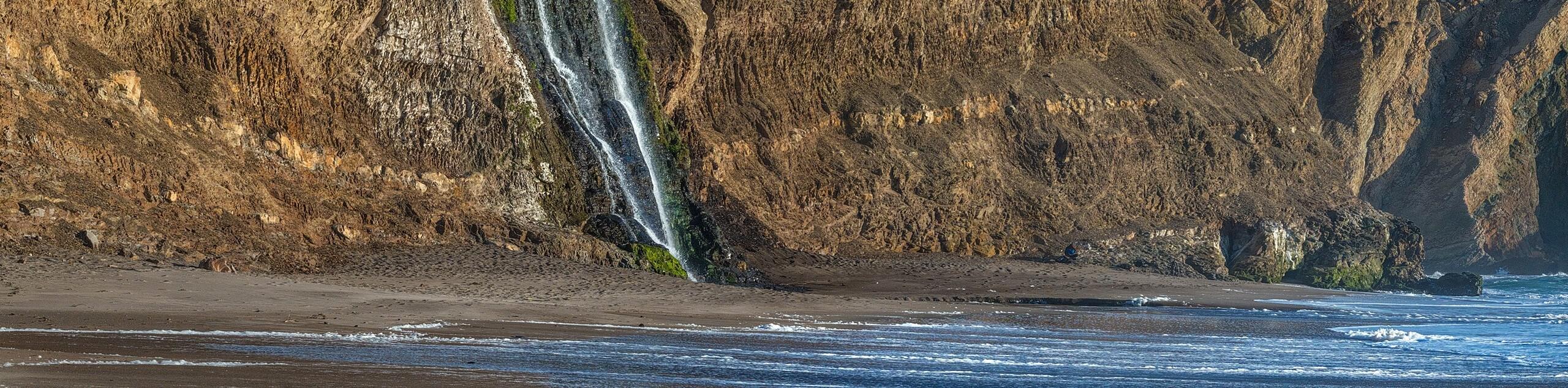
Alamere Falls
The Alamere Falls is a rare tidefall located in the Bay Area of California. Located above the Alamere Creek Beach on the Point Reyes National Seashore, the Alamere Falls is a popular weekend destination—so expect a crowd! A set of three cascades that tumble over the shale cliffside, the collection of waterfalls drops over 40ft into the Pacific. At the top of many adventures to-do lists, the impressive scene, and rarity of the falls are a must-see, and the epic hike down is all part of the fun!
Frequently Asked Questions
How long does it take to hike the Alamere Falls Trail?
Hiking the Alamere Falls Trail can take anywhere between 5-7.5hrs.
Is the Alamere Falls Trail difficult?
The Alamere Falls Trail is a moderately challenging route suitable for intermediate hikers and families with older children.
Insider Hints
Poison Oak grows along the trail, so long pants and long sleeves are recommended
Take your time and mind your footing as the shale rocks are often slippery
DO NOT ATTEMPT this hike at high tide as the rogue waves can drag you into the surf
Head out in the early morning or on weekdays for a more secluded experience
At low tide, take a picnic and have lunch on the beach
Note no drones are allowed
Similar hikes to the Alamere Falls Trail hike
Wildcat Camp Trail to Alamere Falls
The Wildcat Camp Trail to Alamere Falls Hike is an amazing adventure that travels to one of the world’s rare…
Mount Wittenburg and Bear Valley Loop
Immerse yourself in California’s coastal wilderness along the Mount Wittenburg and Bear Valley Loop. This epic day hike travels through…
Old Pine, Sky, and Meadow Loop
The Old Pine, Sky, and Meadow Loop is a relatively unfrequented trail in the Point Reyes National Seashore that offers…
Comments