Blue Mesa Trail
View Photos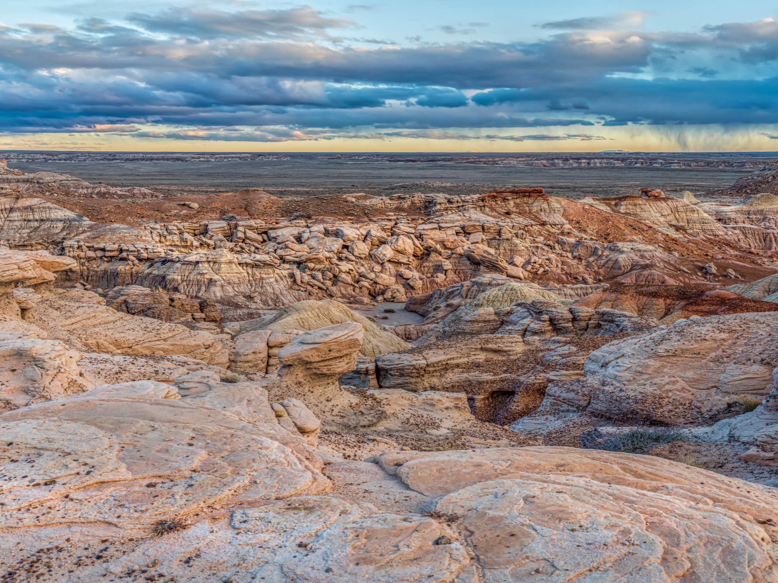
Blue Mesa Trail
Difficulty Rating:
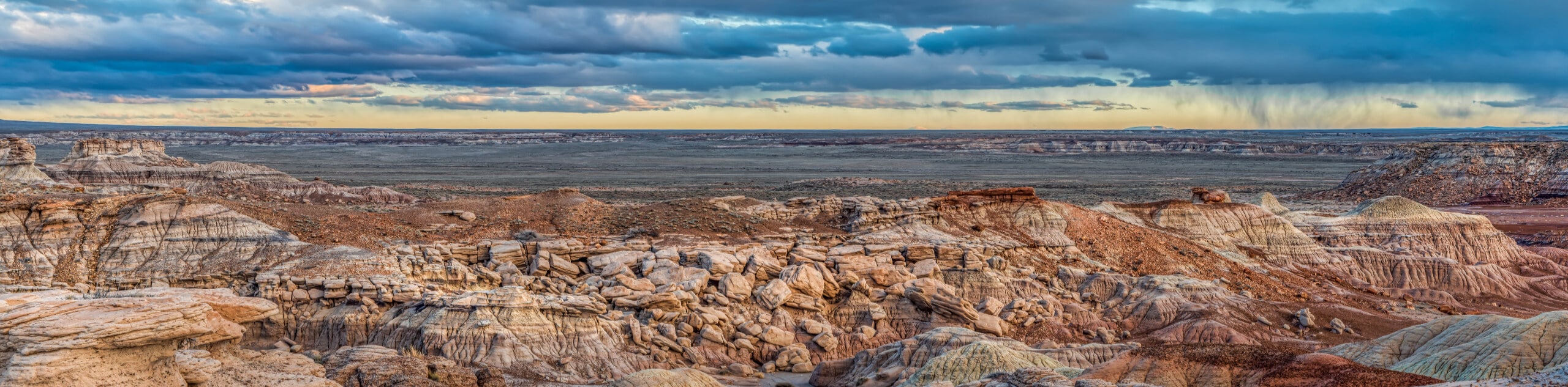
Blue Mesa Trail is one of the most popular hikes in Arizona’s Petrified Forest National Park. With dazzling views of the neatly striped hills and mesas, giant fossils of petrified wood, and a convenient paved trail, this hike is a great pick for hikers of any skill level and age in the park. It’s a short loop, but it definitely packs in the scenery. Use this as a first introduction to the park since it’s right in the middle of the park road, or enjoy it on its own. Expect heavy traffic on this route.
The Blue Mesa Trail is best done in the morning when the sun is at a low slant. This illuminates the colors of the hills and prevents shadowing from the hills on the western side of this loop (which you’d experience in the afternoon). Don’t stress if you can’t do this hike in the morning, though, it’s just a suggestion!
Getting there
The trailhead for the Blue Mesa Trail is off Blue Mesa Scenic Road.

About
| Backcountry Campground | No |
| When to do | February-November |
| Pets allowed | Yes - On Leash |
| Family friendly | Yes |
| Route Signage | Good |
| Crowd Levels | High |
| Route Type | Loop |
Blue Mesa Trail
Elevation Graph
Weather
Blue Mesa Trail Description
Blue Mesa Trail is one of the top trails in Petrified Forest National Park, partly for its amazing views and partly for its easy nature. At only one mile long, it’s accessible for all skill levels. The scenery is quite stunning, with colorful striped badlands hiding big tree fossils from the Late Triassic Epoch, around 225 million years ago.
The Blue Mesa Trail is at its best in the morning light when the low-slanted sun can illuminate the hills around you. Since this hike is right in the middle of the park, it’s a great one to start with to get a sense of the landscape, or to use as your only trail if you’re in the park for less hiking and more scenic driving.
This route is easy, but there is some elevation change that might be too difficult for elderly hikers or those with mobility challenges. Remember to keep your dogs on a leash at all times in the park and stick to the defined pathways.
From the trailhead, follow the asphalt route straight ahead and then as it curves left around the hills. You’ll then take a few zig-zagging turns down to the floor of the valley. This is the steepest part of the hike. Most users report having no issues with it, but no worries if you need to take it slow.
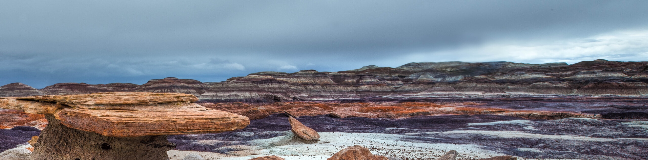
Admire the badlands, a combo of mudstone and claystone that has been extensively eroded. The clay is what gives the hills their wrinkled appearance as it swells with water and then shrinks as it dries. You’ll see gray, blue, purple, and brown in the hillsides, mostly the result of different kinds of clay in the earth.
Once you’re on the valley floor, stay right to loop around. You’re now hiking through the remnants of a huge Triassic river system that left massive sedimentary deposits in the area over 225 million years ago.
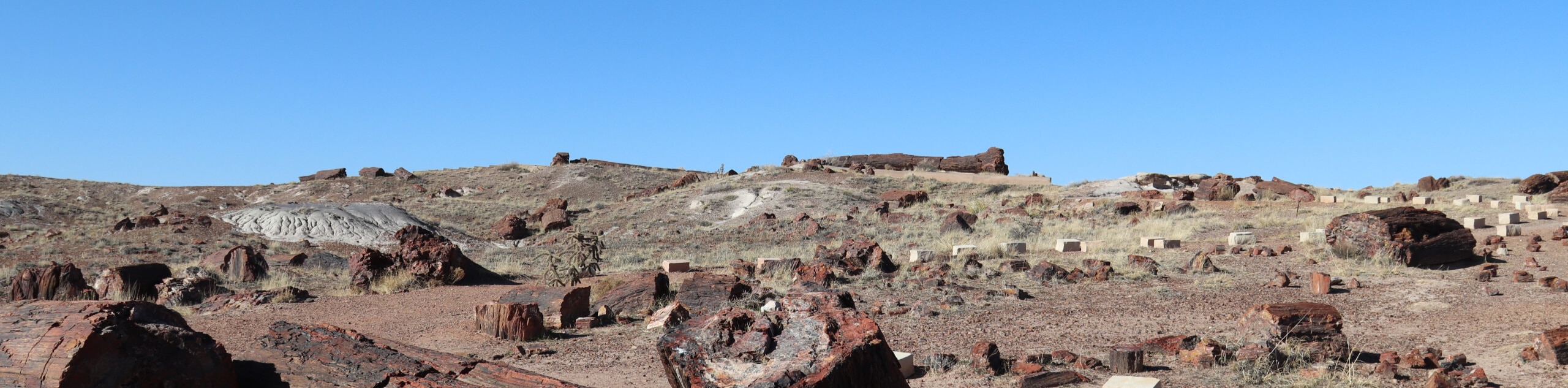
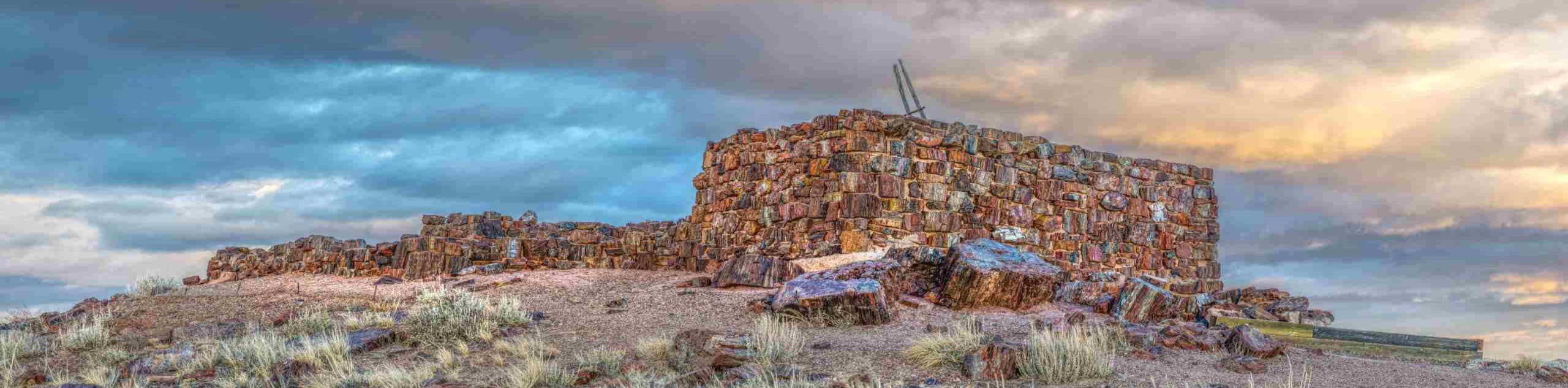
Look for hunks of petrified woods as you hike the loop. These are ancient, and they belong right here in the park: remember that taking any amount of petrified wood or other fossils from the park is considered theft. Leave them be, admire them, snap photos, and then continue on.
The loop turns south and then eventually north again. Approach the grand, striped mesa walls and re-meet the main trail, which you’ll retrace to the trailhead.
Once you make it back, consider taking a moment on the wooden chair here to sit, catch your breath, and take in the views one more time before departing.
Hiking Route Highlights
Petrified Forest Badlands
The unique landscape seen throughout Petrified Forest National Park is the result of changes over millions of years. Over 200 million years ago, a huge river system ran through this area, depositing sediment (the Chinle Formation). After the Colorado Plateau was pushed upwards by tectonic plate movement, erosion began to carve out the badlands you see today. Fossils of petrified wood are left from trees that lived in the Late Triassic Epoch, and over 600 archeological sites are left from the early inhabitants of the park area, who arrived in the area 8,000 years ago and abandoned it by 1400 CE.
Frequently Asked Questions
How long is the Blue Mesa Trail?
This trail is only a mile long in total.
Where is the Blue Mesa Trail in the Petrified Forest?
It’s right in the middle of the park off the main park road.
Is the Petrified Forest worth going to?
It’s definitely worth it. This is an extremely unique landscape.
Insider Hints
Bring lots of water if you’re here in the summer as it can get hot out.
The Petrified Forest tends to be very windy. Consider an extra layer.
There is a fee required to access this park. Learn more with the NPS.
Similar hikes to the Blue Mesa Trail hike
Red Basin-Clam Beds Hike
The Red Basin-Clam Beds hike is a backcountry adventure in Arizona’s fascinating Petrified Forest National Park. This hike is best…
Giant Logs Trail
The Giant Logs Trail is a 0.6mi easy trail near the Rainbow Forest Museum and Visitor Center in…
Long Logs and Agate House Loop Trail
The Long Logs and Agate House Loop Trail is a historical hike in Petrified Forest National Park that shows off…
Comments