Red Basin-Clam Beds Hike
View Photos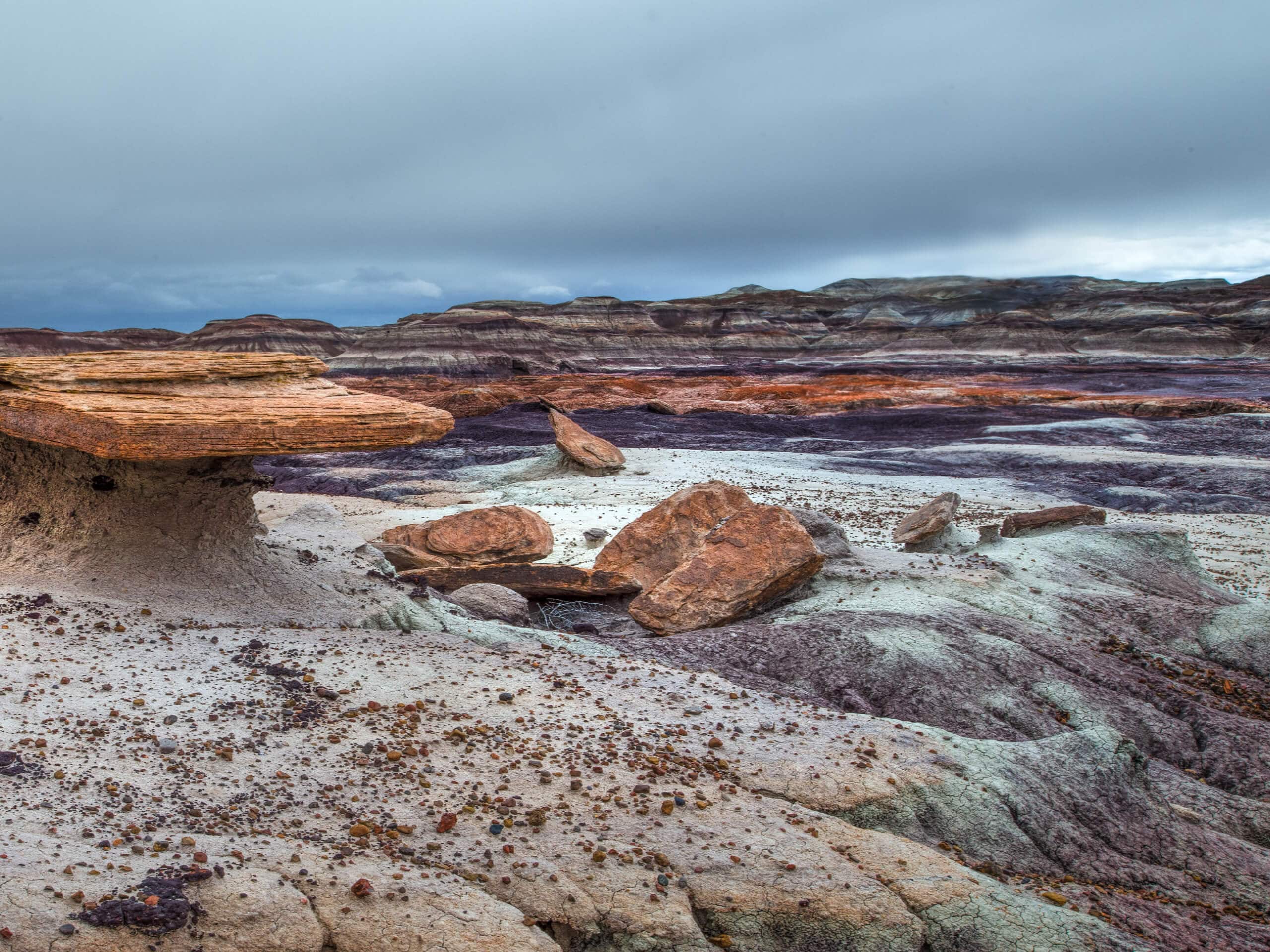
Red Basin-Clam Beds Hike
Difficulty Rating:
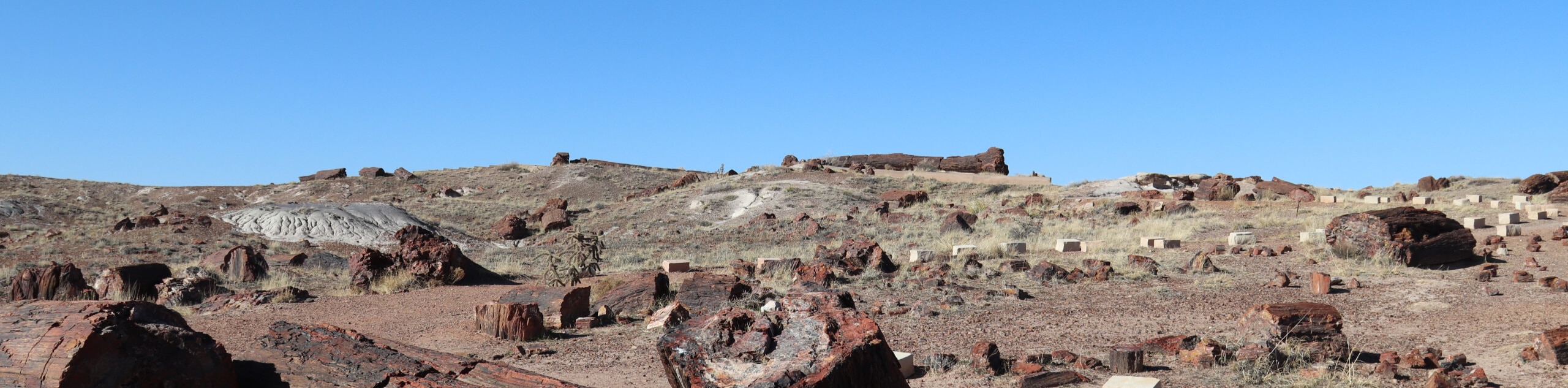
The Red Basin-Clam Beds hike is a backcountry adventure in Arizona’s fascinating Petrified Forest National Park. This hike is best suited for the adventurous ones, as it’s not well-marked, requires some bushwhacking, and has some thorny footing to deal with. Little kids and dogs might not have the best time on this hike, but hikers who enjoy exercising their route-finding and getting away from busy trails will enjoy it. Expect light traffic.
Getting there
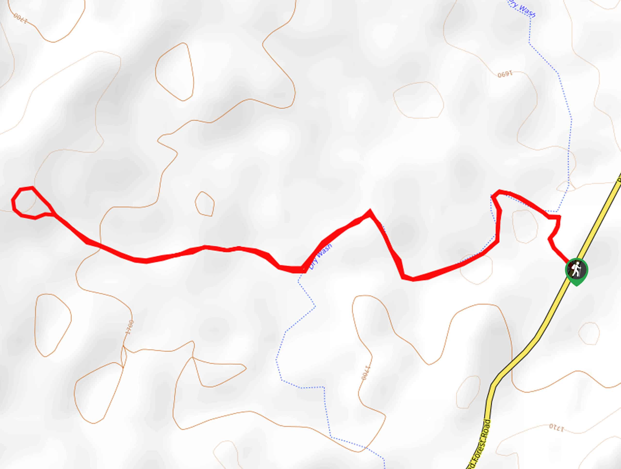
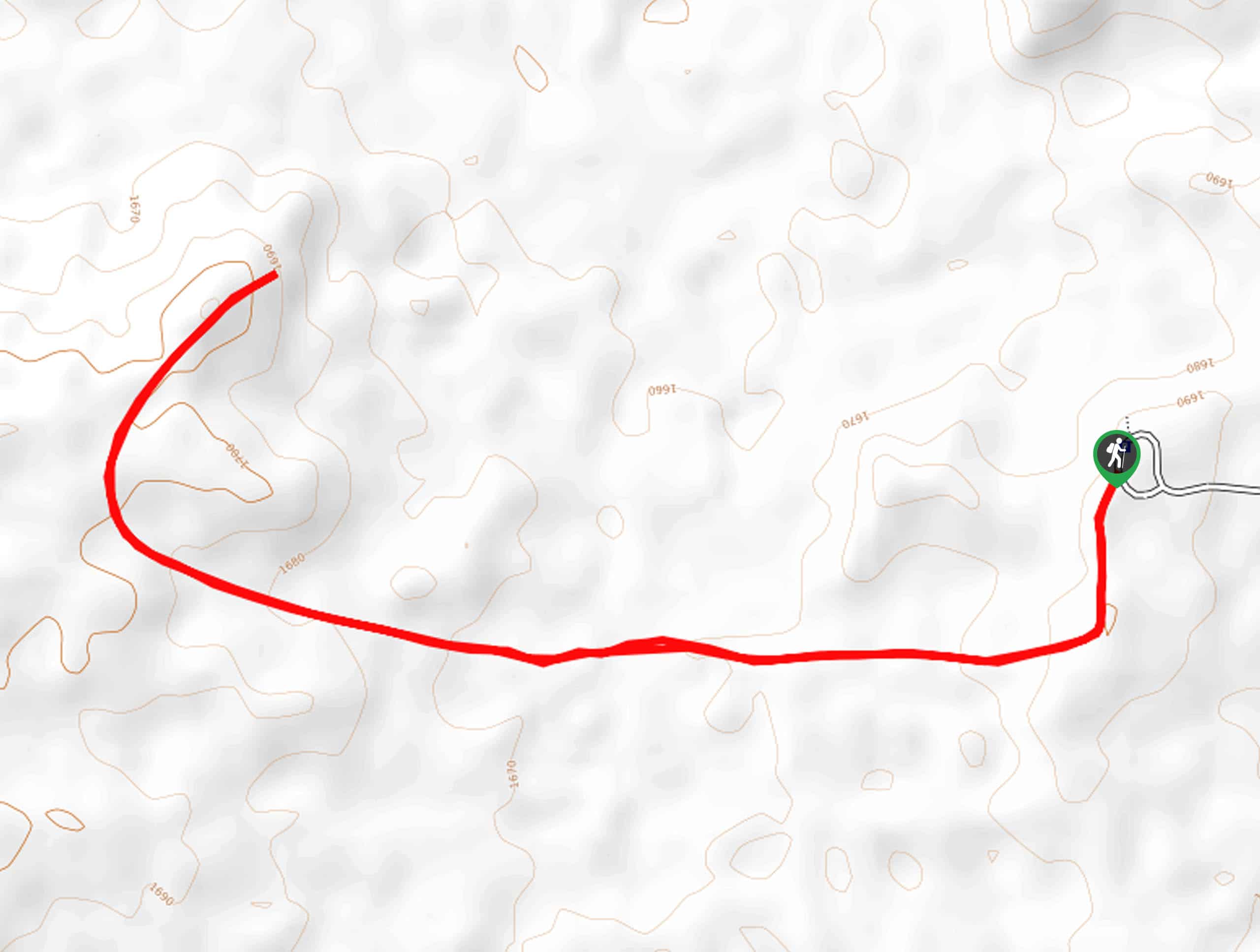
The trailhead for the Red Basin-Clam Beds hike is on Blue Mesa Scenic Road.

About
| Backcountry Campground | No |
| When to do | February-November |
| Pets allowed | Yes - On Leash |
| Family friendly | Older Children only |
| Route Signage | Poor |
| Crowd Levels | Moderate |
| Route Type | Lollipop |
Red Basin-Clam Beds Hike
Elevation Graph
Weather
Red Basin-Clam Beds Hike Description
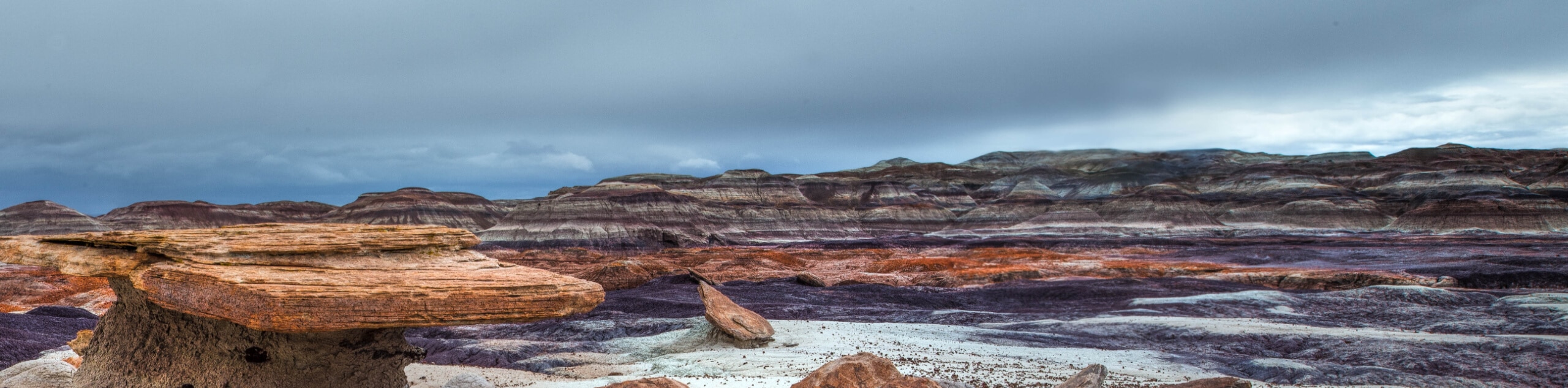
The Red Basin-Clam Beds hike is one of the backcountry hikes in Petrified Forest National Park. This route, true to the name, leads you over an ancient clam bed. Yes, this area used to be completely covered by water if you can believe it! This hike offers interesting views of the badlands and it’s very, very quiet. You’ll probably have the place to yourself.
Gaiters are something to consider if you choose to hike through the grasslands. While leashed dogs are allowed on this hike, we don’t recommend bringing them. The grassland is spiky and thorny and users report needing to do thorn removal on their dogs afterwards. You’ll almost definitely require an offline GPS map to make it through this hike as there’s no defined trail in some spots. You can also grab a trail guide from the visitor center to help.
From the Blue Mesa Scenic Road, hike a few steps south on the road and then look for the trail where it heads off to your left. The loop travels clockwise through Billings Gap and through several washes in Red Basin before returning through the clam beds. Admire the hoodoos and the rock formations as you explore. You’ll eventually meet up with the main trail to return to the trailhead.
Similar hikes to the Red Basin-Clam Beds Hike hike
Martha's Butte Hike
Martha’s Butte is a hike in Arizona’s Petrified Forest National Park that reveals ancient petroglyphs and the moonlike landscape of…
First Forest Point Hike
The First Forest Point hike in Arizona’s Petrified Forest National Park is known for its large collection of petrified wood.…
Giant Logs Trail
The Giant Logs Trail is a 0.6mi easy trail near the Rainbow Forest Museum and Visitor Center in…
Comments