
Martha's Butte Hike
View Photos
Martha's Butte Hike
Difficulty Rating:
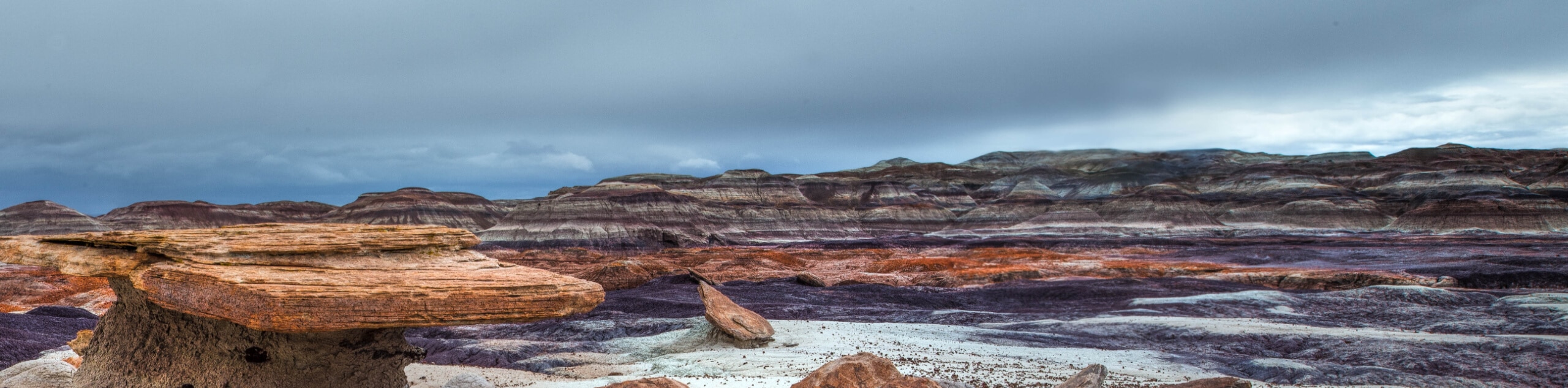
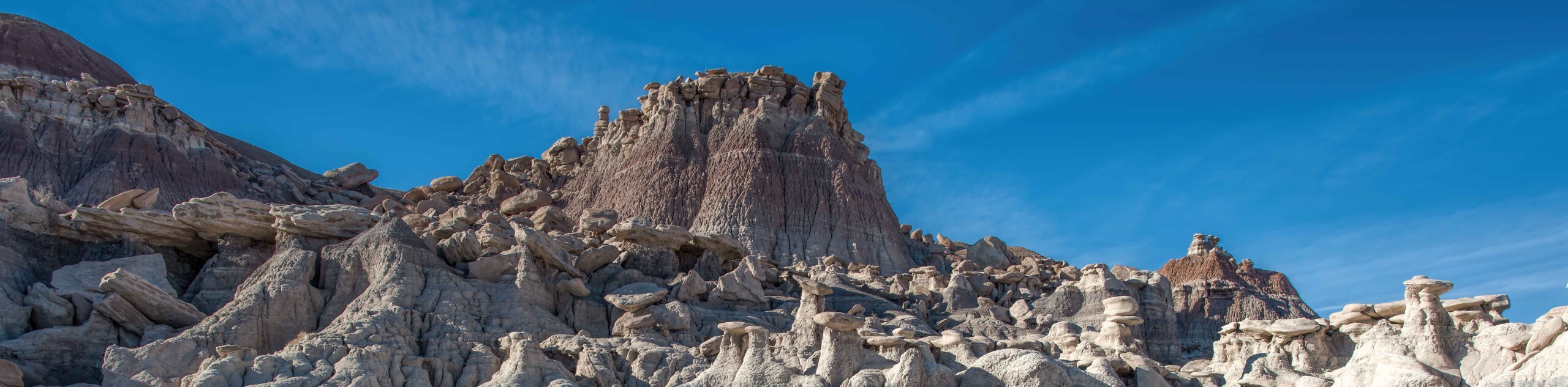
Martha’s Butte is a hike in Arizona’s Petrified Forest National Park that reveals ancient petroglyphs and the moonlike landscape of this unique park. This region was inhabited about 650 years ago, and depictions of animals, people, and shapes are carefully preserved on rocks around Martha's Butte. The origin of the name, or who Martha was, is unknown. Expect light traffic on this route, which will require some route-finding.
This route is currently closed because of damage. Check with the National Park Service for status updates.
Getting there
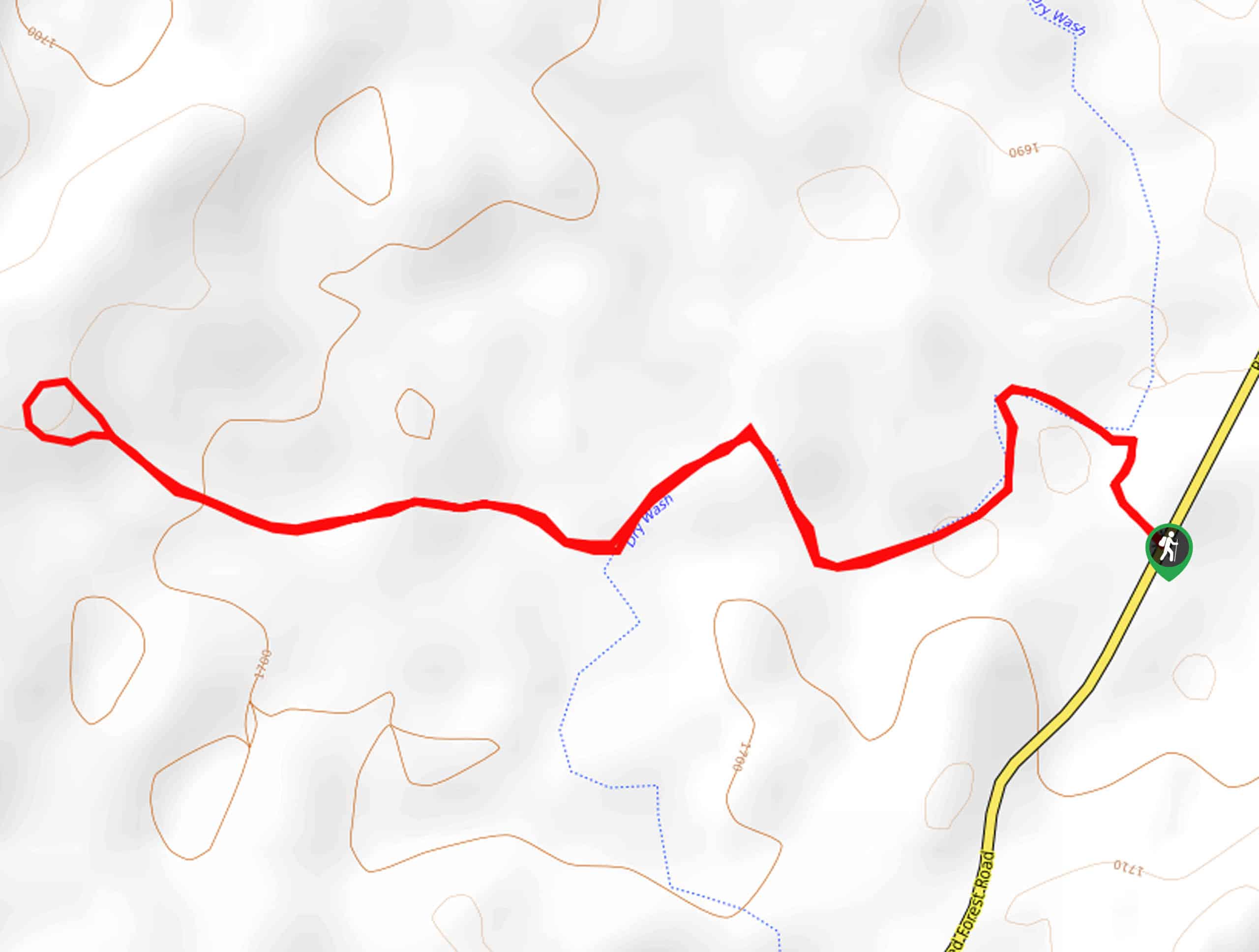
The trailhead for the Martha's Butte Hike is on Petrified Forest Road.

About
| Backcountry Campground | No |
| When to do | February-November |
| Pets allowed | Yes - On Leash |
| Family friendly | Yes |
| Route Signage | Poor |
| Crowd Levels | Low |
| Route Type | Loop |
Martha's Butte Hike
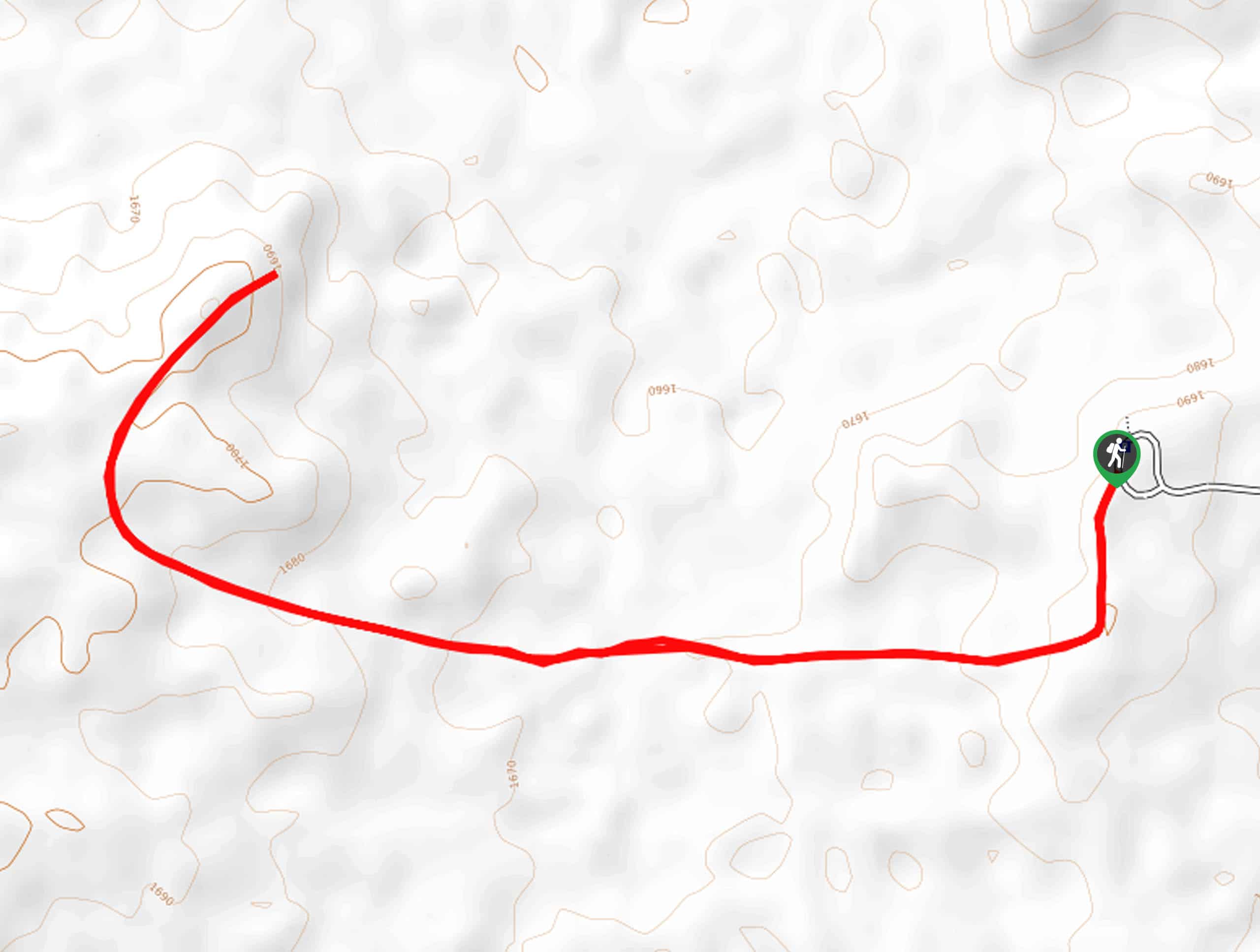
Elevation Graph
Weather
Martha's Butte Hike Description
The Martha’s Butte hike reveals an incredibly well-preserved set of petroglyphs surrounding a butte in the lunar landscape of Arizona’s Petrified Forest National Park. This hike does require some route-finding, so we recommend downloading a GPS track ahead of time to help you find your way. This hike is moderately difficult and suitable for most skill levels.
Please remember not to touch the petroglyphs. The oils from our hands can affect the integrity of the images, and once they’re lost, they’re gone forever. Take as many photos as you like, though!
From the trailhead, hike to Dry Wash and follow the wash and then take a right where the trail pulls out of the wash. Hike west to the butte. The trail loops the butte before heading back. Take your time around the butte, admiring the people, animals, and shapes drawn on the rocks. When you’re ready, retrace your steps to the trailhead.
Similar hikes to the Martha's Butte Hike hike
Red Basin-Clam Beds Hike
The Red Basin-Clam Beds hike is a backcountry adventure in Arizona’s fascinating Petrified Forest National Park. This hike is best…
First Forest Point Hike
The First Forest Point hike in Arizona’s Petrified Forest National Park is known for its large collection of petrified wood.…
Devil's Playground Loop
The Devil’s Playground Loop is a 7.6mi moderate hike in Petrified Forest National Park known for its hoodoos,…
Comments