Blue Forest Trail
View Photos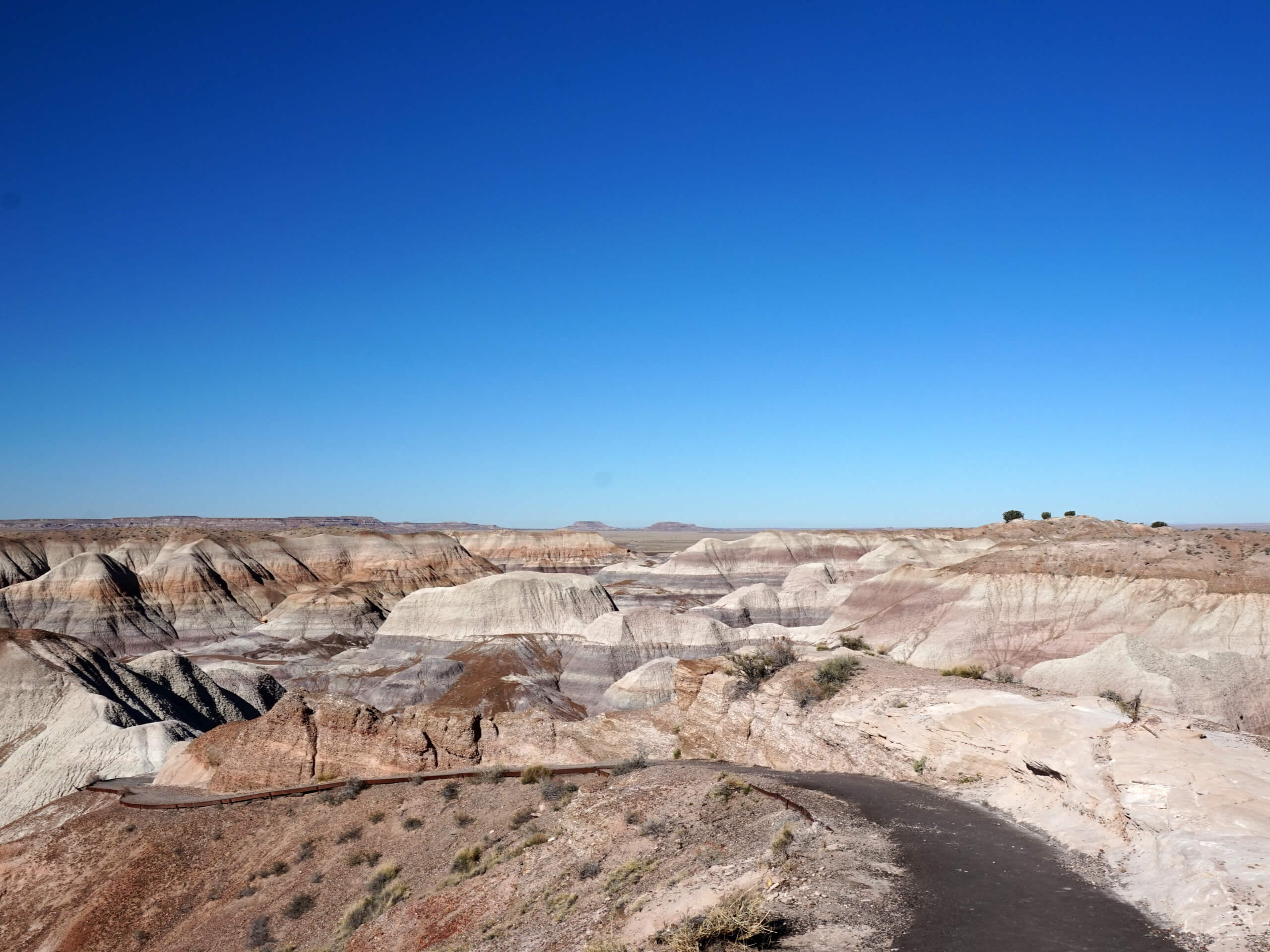
Blue Forest Trail
Difficulty Rating:
Blue Forest Trail is one of the most popular and historic hikes in Arizona’s Petrified Forest National Park. Originally constructed in the 1930s by the Civilian Conservation Corps, the trail connects the main road near the Teepees to the also popular Blue Mesa Trail. The trail shows off the blue and white striped badlands and petrified wood with constantly evolving views. The park’s landscape is one of a kind, and this trail is an ideal one to experience it from.
This hike is moderately difficult and is suitable for most skill levels and ages. If you hike this route in the summer, bring plenty of water. Adventurous hikers can use this trail to connect to the Blue Mesa Loop for a longer hike. Expect moderate traffic.
Getting there
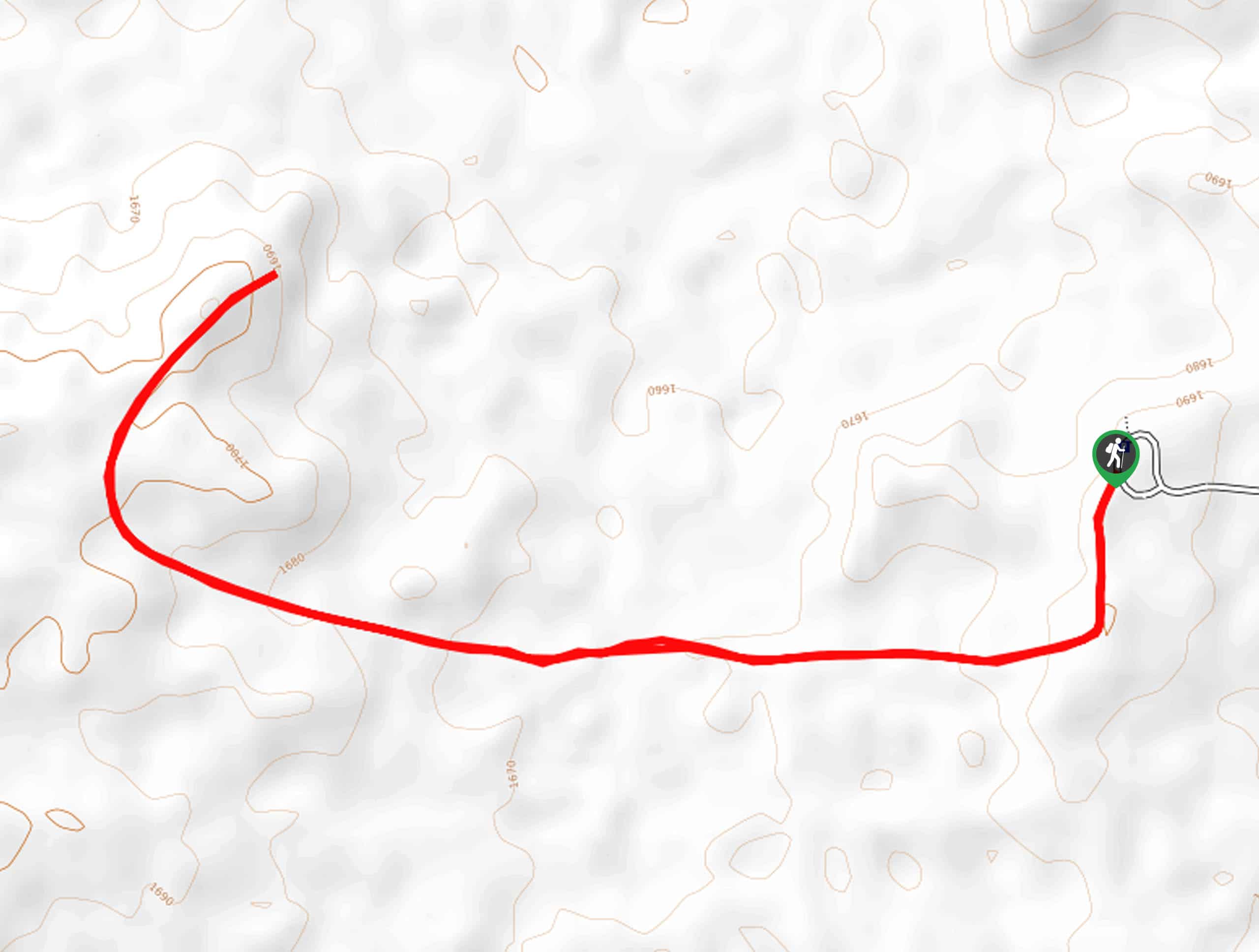
The trailhead for the Blue Forest Trail is on Petrified Forest Road.

About
| Backcountry Campground | No |
| When to do | February-November |
| Pets allowed | Yes - On Leash |
| Family friendly | Yes |
| Route Signage | Good |
| Crowd Levels | Low |
| Route Type | Lollipop |
Blue Forest Trail
Elevation Graph
Weather
Blue Forest Trail Description
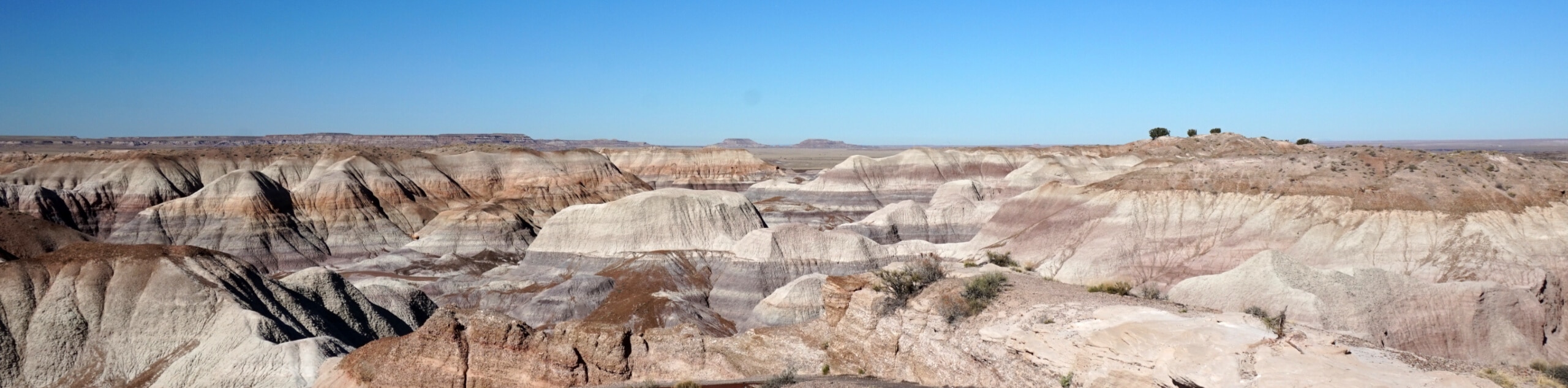
Blue Forest Trail is one of the most popular trails in Petrified Forest National Park, known for its colorful blue-striped badlands and big tree fossils from the Late Triassic Epoch, dating back 225 million years ago.
The trail was originally built between 1934 and 1937 and was improved for hikers in 2013. It provides a close-up look at the petrified wood that this park is known for, in addition to the peculiar badlands, a landscape formed over millions of years by sediment deposits and erosion.
The badlands are made up of mudstone and claystone that have been extensively eroded. The clay is what gives the hills their wrinkled appearance as it swells with water and then shrinks as it dries. You’ll see gray, blue, purple, and brown in the hillsides, mostly the result of different kinds of clay in the earth.
The same huge Triassic river system that left massive sedimentary deposits in the area over 225 million years ago is what helped preserve the trees. As the tectonic plates thrust the Colorado Plateau upwards, the deposits settled over what was a tropical lowland, and the trees were preserved. The wood crystallized in place, and erosion revealed what you see today.
Look for hunks of petrified woods as you hike the loop. These are ancient, and they belong right here in the park: remember that taking any amount of petrified wood or other fossils from the park is considered theft. Admire them, take photos, and then continue on, leaving them in place for future hikers to enjoy.
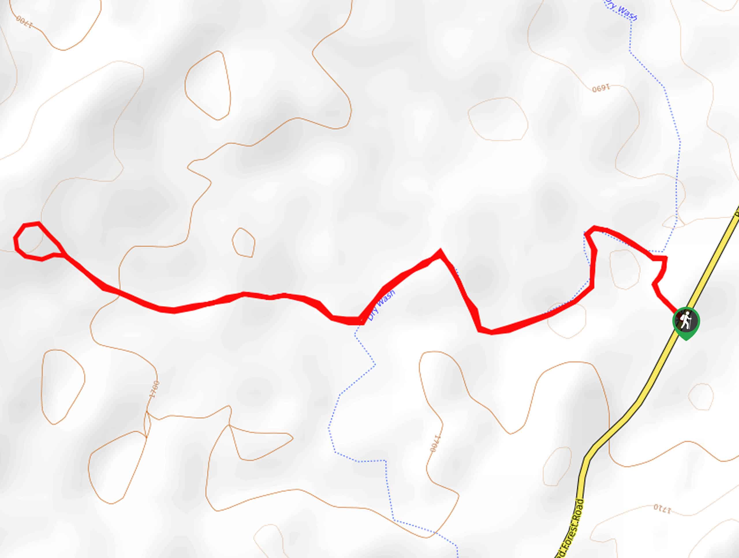
This route is easier to follow if you have some route-finding ability, but novice hikers should either grab a guide from the visitor center, use the online one, or download a GPS route.
This route begins from a roadside pullout near the Teepees, and the trailhead is unmarked. You’ll follow an old road grade for a half-mile, which begins to gently climb up a hill. Look for a wooden post and switchbacks marking the way.
Continue towards the hoodoos. Keep them on your right and hike along a low ridge. You’ll notice remnants of gravel on the path–this tells you which way to go.
Continue along the ridge, climbing gradually until you reach small junipers. The trail veers left and descends towards the Blue Mesa Trail. If you want to also hike the Blue Mesa Trail, keep going. If you don’t this is where you will turn around and retrace your steps from.
Hiking Route Highlights
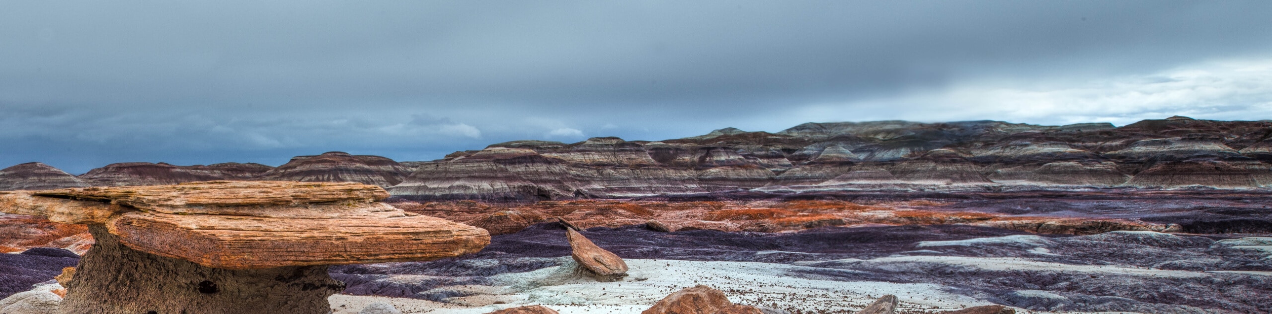
Petrified Forest Badlands
The unique landscape seen throughout Petrified Forest National Park is the result of changes over millions of years. Over 200 million years ago, a huge river system ran through this area, depositing sediment (the Chinle Formation). After the Colorado Plateau was pushed upwards by tectonic plate movement, erosion began to carve out the badlands you see today. Fossils of petrified wood are left from trees that lived in the Late Triassic Epoch, and over 600 archeological sites are left from the early inhabitants of the park area, who arrived in the area 8,000 years ago and abandoned it by 1400 CE.
Frequently Asked Questions
How long does it take to drive through the Petrified Forest?
The drive through the park takes about 45 minutes, but we recommend taking your time, adding in some hikes, and stopping at viewpoints.
Where is the Blue Forest Trail in the Petrified Forest?
This trail is near mile marker 14 on the northbound (east) side of the park road.
Is the Petrified Forest worth going to?
It’s definitely worth it. This is an extremely unique landscape!
Insider Hints
Bring lots of water if you’re here in the summer as it can get hot out.
The Petrified Forest tends to be very windy. Consider an extra layer.
There is a fee required to access this park. Learn more with the NPS.
Similar hikes to the Blue Forest Trail hike
Martha's Butte Hike
Martha’s Butte is a hike in Arizona’s Petrified Forest National Park that reveals ancient petroglyphs and the moonlike landscape of…
Red Basin-Clam Beds Hike
The Red Basin-Clam Beds hike is a backcountry adventure in Arizona’s fascinating Petrified Forest National Park. This hike is best…
First Forest Point Hike
The First Forest Point hike in Arizona’s Petrified Forest National Park is known for its large collection of petrified wood.…
Comments