Torside and Rhodeswood Reservoirs Walk
View Photos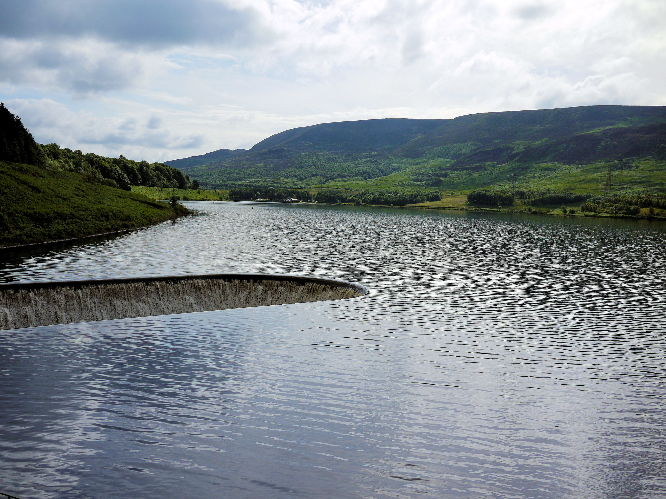
Torside and Rhodeswood Reservoirs Walk
Difficulty Rating:
The Torside and Rhodeswood Reservoirs Walk is a fun - if rugged - adventure near Glossop that will take you uphill across the moor for some beautiful sightlines across the Peak District. While out on this walk, you will pass by several reservoirs and enjoy views across the water, before making the steep uphill climb to the elevated viewpoints. This walk is a bit rough and the route can be hard to follow in places, so keep an eye on the GPS and don’t be afraid to blaze your own trail.
Getting there
To reach the car park for the Torside and Rhodeswood Reservoirs Walk from Glossop, drive north on Norfolk Street/B6105 for 4.0mi and you will find the car park on the right.

About
| When to do | March-November |
| Backcountry Campsites | Crowden Campsite |
| Pets allowed | Yes - On Leash |
| Family friendly | Older Children only |
| Route Signage | Poor |
| Crowd Levels | Moderate |
| Route Type | Lollipop |
Torside and Rhodeswood Reservoirs Walk
Elevation Graph
Weather
Torside and Rhodeswood Reservoirs Walk Description
While the Torside and Rhodeswood Reservoirs Walk is sure to provide you with a fun day out on the trails, it is also a bit hard to navigate in places. Make sure to keep an eye on your GPS in order to stay on the correct path and get the most out of the walk. Additionally, portions of the trail are rather boggy and rugged, requiring a decent pair of walking boots to stay comfortable and have the best footing.
Even though navigation might be a bit tricky, the scenic views from the top of the moor and the sense of adventure along this walk are enough to make it worthwhile effort. The lower portions of the trail are easy enough to traverse and will see you make your way around the reservoirs for some nice views across the water. From there, walkers will need to work their way up along the rugged terrain of the moor to receive some amazing views that sweep across the Peak District, before descending the hillside on the return journey to the carpark. If you really want to take your time exploring the area, try combining this walk with a weekend of camping at the nearby Crowden Campsite.
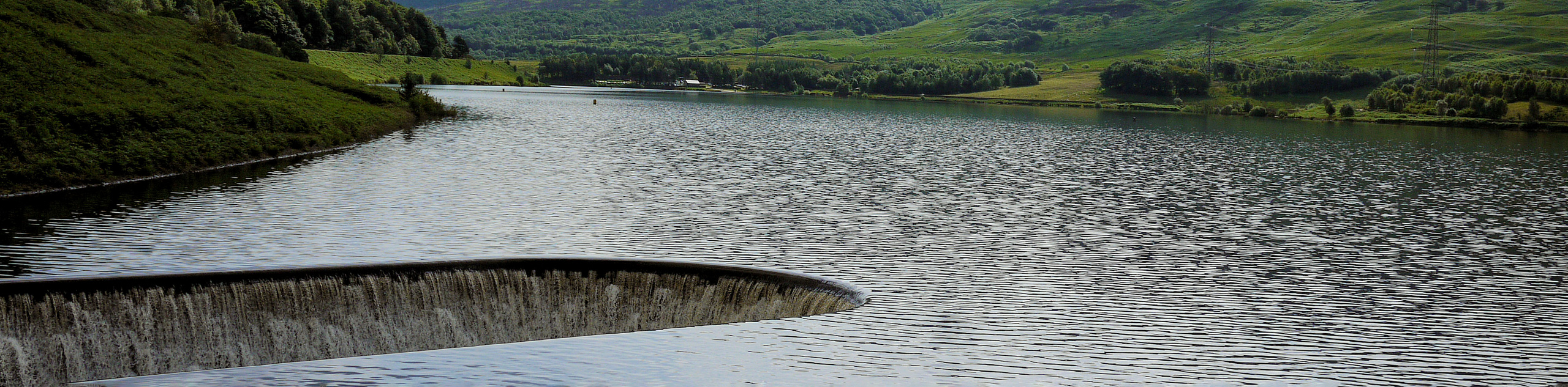
Setting out from the carpark, follow the trail on the left, as it leads around a short loop to arrive at a junction. Turn right here to pass through a gate and continue on for 0.8mi along a tree-lined track that will eventually meet up with the road. Make your way to the other side and pick the trail back up, passing through one junction and turning left at the second to eventually arrive at a fork in the path. Keep right at the fork you make your way across the dam wall, while enjoying some scenic views that stretch across the water.
Upon reaching the other side, follow the footpath branching off to the right and keep right at the fork to pass through a gate and continue along the tree-lined trail. Keep left and pass through the gate to cross over the A628. Continue along the track for 0.6mi, passing through three gates to eventually find a trail branching off to the left. Follow this to begin your climb up the moor, turning left after 0.3mi for a more direct route to the top.
Make your way along the steep route that crosses the rugged moorland terrain for 1.1mi, taking in the amazing scenery of the Peak District including Bleaklow and Peak Naze to the south before arriving at Combes Clough. Go over the stream and continue west along the trail, enjoying views of the towns of Glossop and Hadfield in the valley below as you begin to descend the hillside.
0.4mi after crossing the Combes Clough, you will come to a series of forks in the trail. Keep left at each and cross over the stile to make your way downhill and briefly pass through a stretch of forest. Arriving at a gate, pass through and continue downhill along the trail until you come to the edge of the road. Make your way to the other side and follow the trail through the woods to meet up with the Rhodeswood Dam. Traverse the dam and keep left at the fork to set out on the final leg of the Torside and Rhodeswood Reservoirs Walk.
Keep straight along the trail for the next 0.8mi, enjoying some final views across the water as you pass through a series of three gates and arrive at a junction. Head to the right here and follow the trail over the road to eventually make your way back to the car park, where you began your journey.
Other amazing walks in Peak District National Park
Check out our guides to Kinder Scout, Mam Tor, Stanage Edge, Dovedale, and Padley Gorge. Or see all of our Peak District walks on 10Adventures.
Insider Hints
Keep an eye on your GPS as this route can be a bit hard to follow in certain areas.
Wear sturdy walking boots for this rugged walk.
Combine this walk with a weekend of camping at the nearby Crowden Campsite.
The trail can be wet in certain areas along the moor.
Similar hikes to the Torside and Rhodeswood Reservoirs Walk hike

Valehouse Reservoir Circular
The Valehouse Reservoir Circular is a 3.1mi lollipop trail near Glossop that travels around the edge of the…

Three Edges Walk
The Three Edges Walk is a challenging circuit in Derbyshire that will take you along three escarpments that offer some…

Edale Rocky Ridges Walk
The Edale Rocky Ridges Walk is just that - an adventurous walk along a rugged ridgeline. While out on the…
Comments