Baslow Edge Circular Walk
View Photos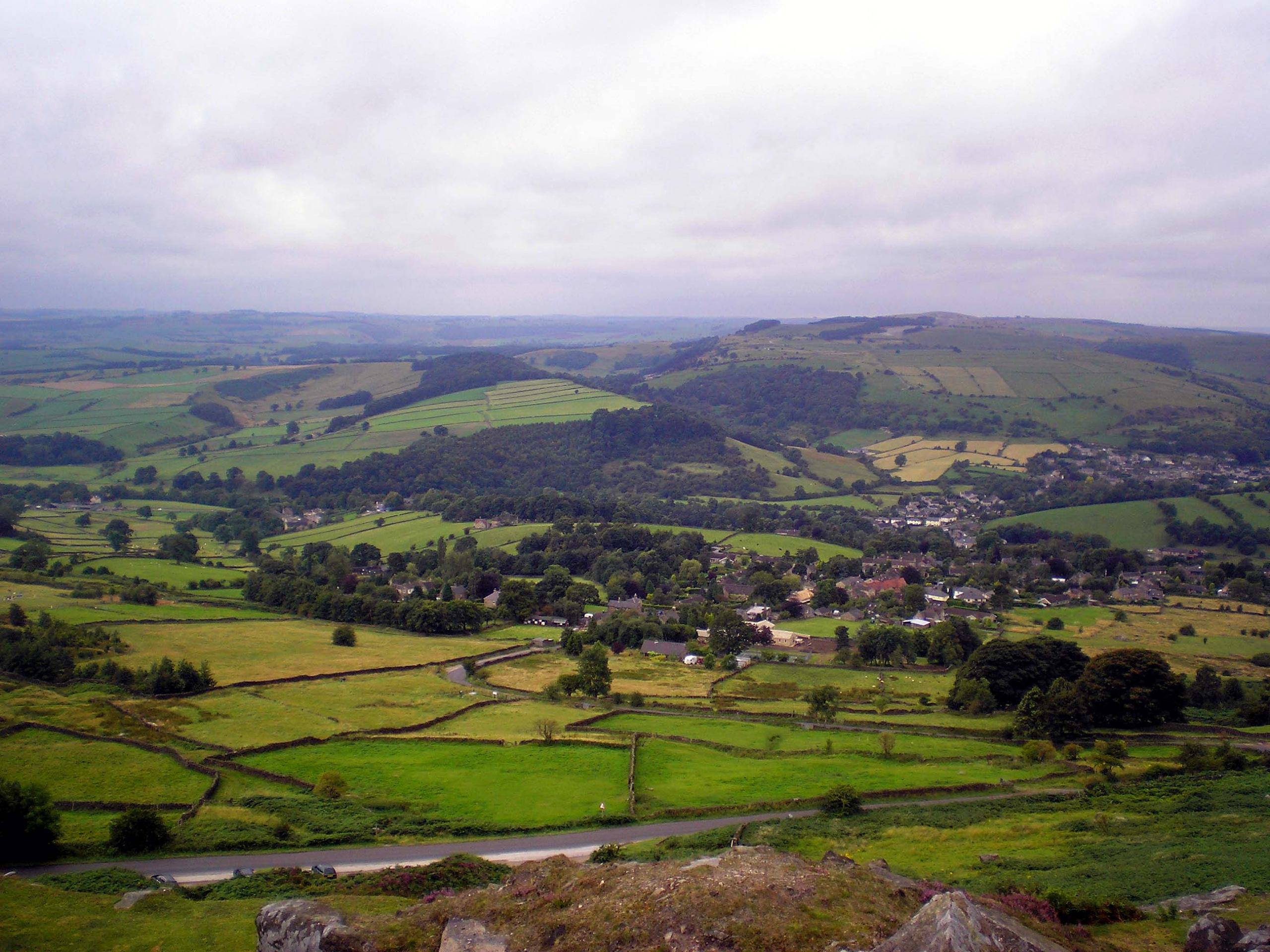
Baslow Edge Circular Walk
Difficulty Rating:
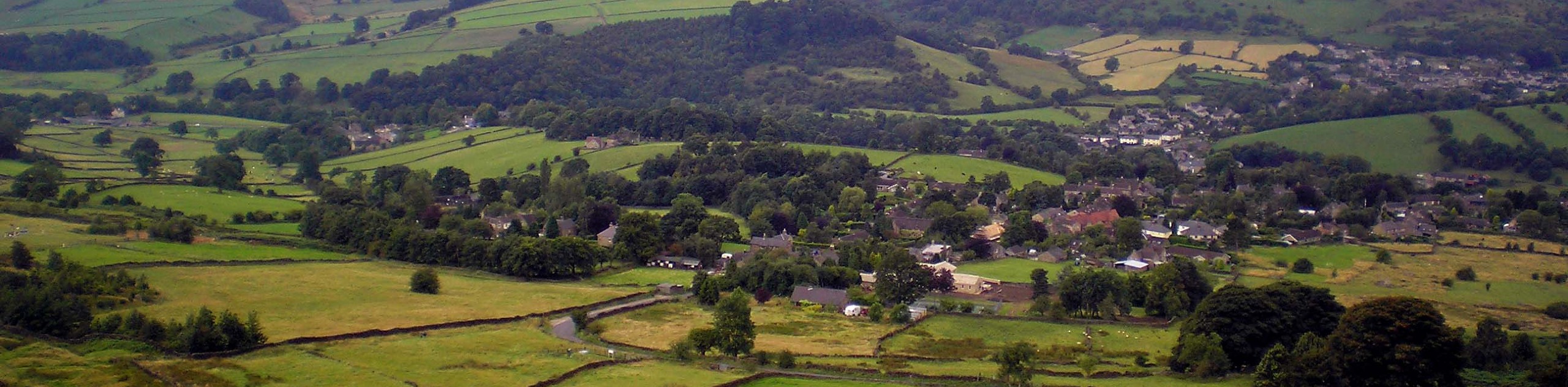
Walking the Baslow Edge Circular is a fun adventure near Bakewell that will take you along the escarpment for views across the Derbyshire countryside. The walk sets out from Baslow and climbs uphill along the escarpment to take walkers through Froggatt Wood, before returning through the charming villages situated along the River Derwent. With a few brief climbs to get your blood flowing and excellent views across the valley, this is a fantastic walk that most walkers will be able to enjoy.
Getting there
To reach the car park for the Baslow Edge Circular Walk from Bakewell, drive northeast on the A619 for 3.8mi and take the second exit at the roundabout onto Church Lane/A619. After 0.4mi, turn right and continue for 200ft before turning right again onto Church Lane. In 100ft, you will find the car park on the left.

About
| When to do | Year-Round |
| Backcountry Campsites | No |
| Pets allowed | Yes - On Leash |
| Family friendly | Older Children only |
| Route Signage | Average |
| Crowd Levels | Moderate |
| Route Type | Lollipop |
Baslow Edge Circular Walk
Elevation Graph
Weather
Baslow Edge Circular Trail Description
The majority of the Baslow Edge Circular Walk is made up of either well-maintained paths or village walkways, although there are a few portions of the trail – notably through Froggatt Wood – that can be a bit wet and muddy at certain times of the year. Make sure to wear decent walking boots to better traverse the variety of terrain that can be found along this trail. Additionally, parking at the suggested trailhead can be limited, so be sure to arrive early to secure a space.
This walk features a perfect mix of natural scenery and urban/village walkways that are sure to be enjoyed by any and all walkers. While there are a few small climbs along the escarpment, these are more than manageable and provide a bit of excitement along the walk. With amazing scenery looking out across the rolling green hills and quaint villages of the valley, there is no reason to put off the baslow Edge Circular Walk.
Setting out from the car park, head north and cross the A619, following Eaton Hill for 0.3mi as you work your way through the village of Baslow. Turn right at the fork and follow the road for another 0.2mi until it transitions into a more narrow track. Head right at the next fork in the trail and keep straight for 0.7mi, as you climb up the escarpment to arrive at the site of a monument dedicated to Wellington’s victory at Waterloo in 1815.
From here, head back to the previous junction and turn right, following the path straight along Baslow Edge for the next 0.7mi, while enjoying the scenic views across the valley. Cross over the stile and make your way to the opposite side of the road, picking the trail back up and keeping straight for the next 1.2mi. Along this portion of the walk, you will make your way along the Curbar Edge, a popular destination for rock climbers due to the craggy rock outcrop of the escarpment.
Arriving at a fork in the trail, keep right to traverse the Froggatt Edge for 0.3mi for some more amazing views of the surrounding landscape. When the trail starts to bend to the right, turn back and retrace your steps to the junction, following it to the right top descend the hillside through Froggatt Wood in the direction of the village. Pass straight through the junctions and make your way over the road, crossing a stile to continue downhill until you arrive in the village at the edge of Froggatt Lane.
Head right along the road and follow it for 0.1mi, turning left to cross the Froggatt Bridge over the River Derwent and pick up a trail on the left. Crossing over the stile, make your way through the forest along the edge of the river for 0.5mi until you cross a bridge over Stoke Brook. Keep left at the fork and continue past the Calver Marshes Wildlife Project to make your way over the road. Follow closely along the edge of the river for 0.6mi, until you arrive in the village of Calver.
There are a few spots in the village to stop in for some mid-walk refreshments such as The Eating House or the Bridge Inn, but if you would rather keep on moving, head left along the road and cross over the river, turning left again to follow the road another 0.3mi into Curbar. Once there, turn right along Cliff Lane and follow it for 0.1mi to pick up a trail on the left. Cross over the stile and make your way through the farmland until you reach another stile. Cross over and turn left, following the trail for another 0.6mi to pass through a series of gates and arrive at the edge of a farm.
Make your way south along the lane for 0.6mi to re-enter the village of Baslow. Turn right here, followed by a left on Eaton Hill to follow it back to the trailhead. After wrapping up the Baslow Edge Circular Walk, you can either pop into one of the nearby restaurants to refuel after your long walk or head back to the car park to make your way home.
Other amazing walks in Peak District National Park
Check out our guides to Kinder Scout, Mam Tor, Stanage Edge, Dovedale, and Padley Gorge. Or see all of our Peak District walks on 10Adventures.
Insider Hints
Parking can be very limited at the trailhead, so make sure to arrive early or on off-peak days.
Pop into the Bridge Inn in Calver for some mid-walk drinks and food.
Wear decent walking boots to combat the variety of terrain that you will experience on the trail.
Similar hikes to the Baslow Edge Circular Walk hike

Valehouse Reservoir Circular
The Valehouse Reservoir Circular is a 3.1mi lollipop trail near Glossop that travels around the edge of the…

Three Edges Walk
The Three Edges Walk is a challenging circuit in Derbyshire that will take you along three escarpments that offer some…

Edale Rocky Ridges Walk
The Edale Rocky Ridges Walk is just that - an adventurous walk along a rugged ridgeline. While out on the…
Comments