
Lady Canning’s Plantation and Burbage Moor Walk
View Photos
Lady Canning’s Plantation and Burbage Moor Walk
Difficulty Rating:
The Lady Canning’s Plantation and Burbage Moor Walk is a beautiful route that traverses the woodlands and rugged moors that can be found west of the city of Sheffield. The trail first passes through the charming forests of Lady Canning’s Plantation via its many mountain bike routes before traversing the moor for some amazing views across the Burbage Valley. Highlights along the trail include the tranquil forests, as well as a sightline from the escarpment toward Higger Tor and Carl Wark.
Getting there
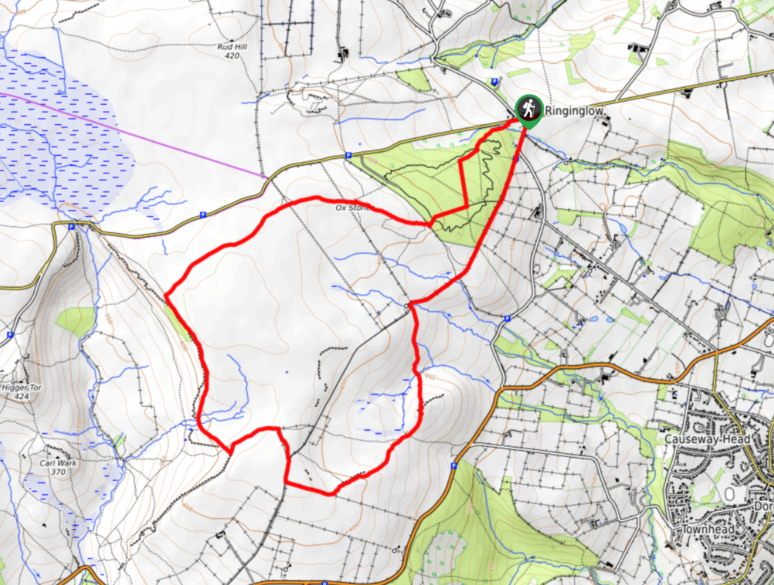
To get to the car park for the Lady Canning’s Plantation and Burbage Moor Walk from Hathersage, head east on Main Road/A6187 for 1.1mi and turn left to continue on for another 1.7mi. Keep right here and continue onto Ringinglow Road for another 2.3mi to find the car park on the left.

About
| When to do | March-November |
| Backcountry Campsites | No |
| Pets allowed | Yes - On Leash |
| Family friendly | Older Children only |
| Route Signage | Average |
| Crowd Levels | Moderate |
| Route Type | Circuit |
Lady Canning’s Plantation and Burbage Moor Walk
Elevation Graph
Weather
Lady Canning’s Plantation and Burbage Moor Walk Description
Most often associated with its mountain bike trails, Lady Canning’s Plantation and Burbage Moor also offer great opportunities to walk the rugged moor and experience spectacular views across the Peak District. Setting out from the village of Ringinglow next to The Norfolk Arms, follow the trail through the forested expanse of the Lady Canning’s Plantation to the southwest, keeping an eye out for any passing bikers as you enjoy the peaceful woodland atmosphere. Eventually, you will exit the cover of the trees and make your way across the moor toward the escarpment known as Burbage Edge. Here, you will have some spectacular views across the valley towards the iconic Higger Tor and the Iron Age fort atop Carl Wark. After walking the length of the escarpment, follow the trail east to once again pass through the wood on the return to The Norfolk Arms for a quick post-walk pint.
Other amazing walks in Peak District National Park
Check out our guides to Kinder Scout, Mam Tor, Stanage Edge, Dovedale, and Padley Gorge. Or see all of our Peak District walks on 10Adventures.
Similar hikes to the Lady Canning’s Plantation and Burbage Moor Walk hike

Valehouse Reservoir Circular
The Valehouse Reservoir Circular is a 3.1mi lollipop trail near Glossop that travels around the edge of the…

Three Edges Walk
The Three Edges Walk is a challenging circuit in Derbyshire that will take you along three escarpments that offer some…

Edale Rocky Ridges Walk
The Edale Rocky Ridges Walk is just that - an adventurous walk along a rugged ridgeline. While out on the…
Comments