Kinder Reservoir Walk
View Photos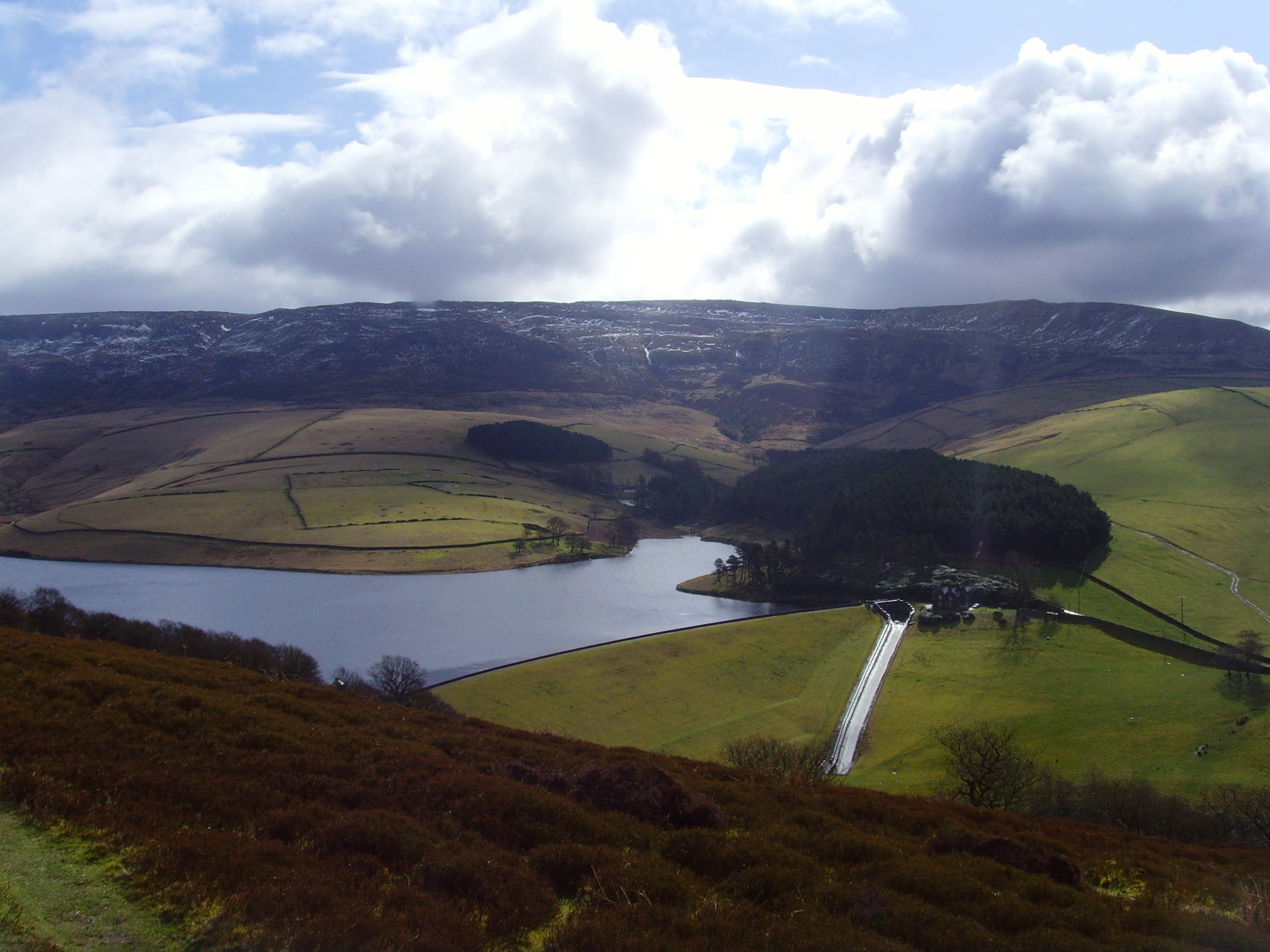
Kinder Reservoir Walk
Difficulty Rating:
The Kinder Reservoir Walk is an intermediate length journey that will take you from the town of Glossop to cross the moor and eventually arrive at the edge of the reservoir. While out on the trail, you will enjoy scenic views across the rugged landscape of the moor and take in some nice sights across the water. Although the trail will likely be a bit boggy in certain areas, the fun uphill climb across the sometimes challenging terrain will make for a memorable experience outdoors in the Peak District.
Getting there
To reach the Kinder Reservoir Walk trailhead from the Glossop railway station, head south on Norfolk Street for 430ft and continue onto Victoria Street. After 0.6mi, you will arrive at the trailhead.

About
| When to do | April-November |
| Backcountry Campsites | No |
| Pets allowed | Yes - On Leash |
| Family friendly | Older Children only |
| Route Signage | Average |
| Crowd Levels | Moderate |
| Route Type | Circuit |
Kinder Reservoir Walk
Elevation Graph
Weather
Kinder Reservoir Walk Description
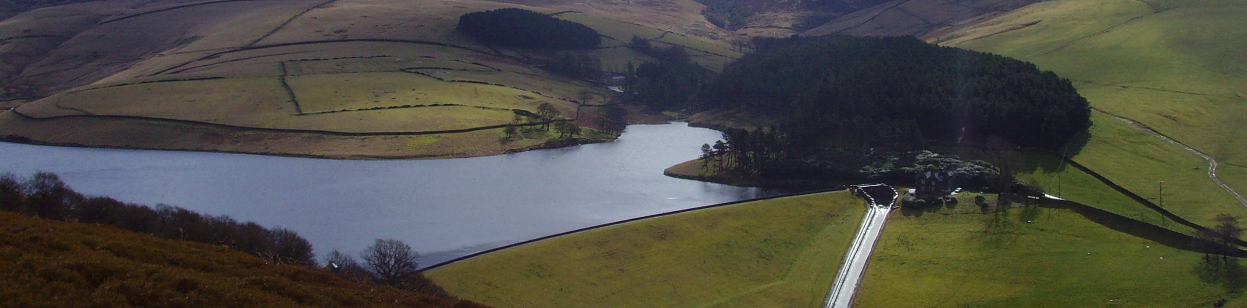
The Kinder Reservoir Walk is a rough and rugged, yet beautiful route that will take you across the moor to visit the edge of the reservoir. While the route does utilize a variety of terrain, including urban walkways, the long stretches of trail that cross the moor can be wet and boggy, especially after a good rainfall. Make sure to wear decent walking footwear for this outing.
Setting out from the trailhead in Glossop, head east along the road and follow it as it narrows into a path and heads through the forest. From here, you will cross a stretch of farmland to meet up with Hague Street. Head right at the road and follow it to cross Derbyshire Level. Once you are on the opposite side of the road, follow the path as it crosses over Bray Clough and climbs uphill along the moor.
Continue uphill through the rugged terrain of the moor and take in the sights of the town behind you. Keep left at the next two junctions and continue to the summit of Mill Hill for some nice views of the surrounding landscape. From here, head through the junction to reach the waters of William Clough, following it to the southwest to eventually arrive at the edge of the Kinder Reservoir. Enjoy the beautiful views overlooking the calm water of the reservoir, before heading west to cut across the moor toward the A624.
After meeting up with the road near Hollingworth Clough, continue following it to the north, before making a right to climb uphill along the moor. When you reach a junction, take the path to the left to descend the hillside and pass through a stretch of forest on the return part of the journey to Glossop.
Other amazing walks in Peak District National Park
Check out our guides to Kinder Scout, Mam Tor, Stanage Edge, Dovedale, and Padley Gorge. Or see all of our Peak District walks on 10Adventures.
Similar hikes to the Kinder Reservoir Walk hike

Valehouse Reservoir Circular
The Valehouse Reservoir Circular is a 3.1mi lollipop trail near Glossop that travels around the edge of the…

Three Edges Walk
The Three Edges Walk is a challenging circuit in Derbyshire that will take you along three escarpments that offer some…

Edale Rocky Ridges Walk
The Edale Rocky Ridges Walk is just that - an adventurous walk along a rugged ridgeline. While out on the…
Comments