Howden Edge and Reservoir Walk
View Photos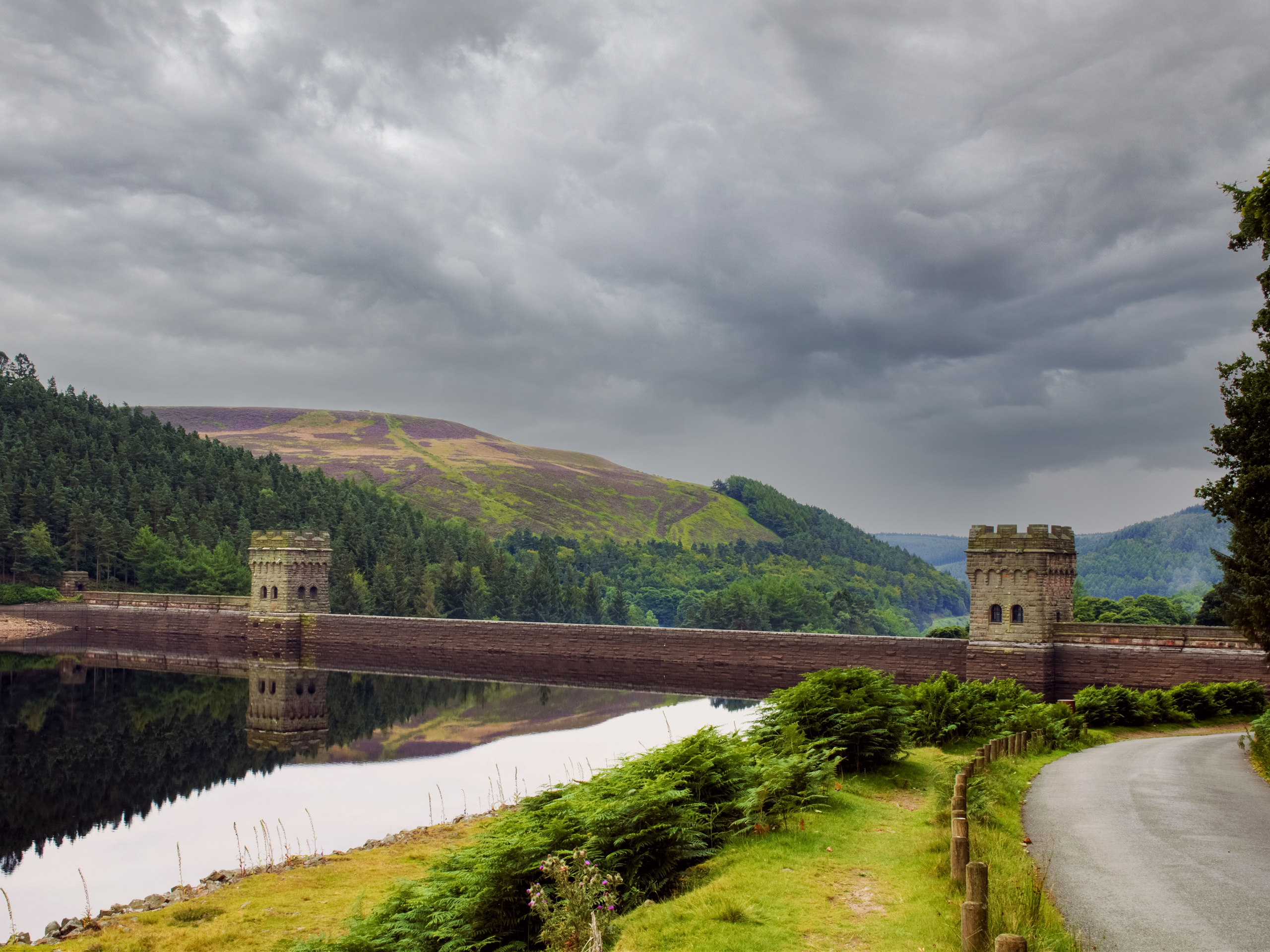
Howden Edge and Reservoir Walk
Difficulty Rating:
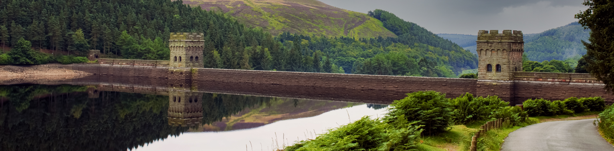
A day out on the Howden Edge and Reservoir trail is almost guaranteed to be one well-spent, as the scenic views across the Howden Moors and surrounding Upper Derwent Valley are truly a beautiful sight to behold. While out on this 9.3mi lollipop route, you will skirt around the edge of the charming Howden Reservoir before climbing up the hillside for some amazing views across the surrounding moorland and calm waters below. Access to the trailhead can be restricted on weekends, so make sure to plan your trip ahead of time as it is one that you won’t want to miss.
Getting there
To reach the trailhead for the Howden Edge and Reservoir Walk from Sheffield, head west on the A57 for 0.7mi and make a slight right onto Manchester Road/A57. Follow this for 9.5mi and turn right. COntinue on for 7.1mi to arrive at the starting point for the walk at King’s Tree.

About
| When to do | March-October |
| Backcountry Campsites | No |
| Pets allowed | Yes - On Leash |
| Family friendly | Older Children only |
| Route Signage | Average |
| Crowd Levels | Moderate |
| Route Type | Lollipop |
Howden Edge and Reservoir Walk
Elevation Graph
Weather
Howden Edge and Reservoir Walk Description
As mentioned, access to the starting point for the Howden Edge and Reservoir Walk at King’s Tree is often blocked to vehicles on weekends in order to provide a more relaxed walking and cycling atmosphere. While this is not always the case, it is best to keep it in mind when planning a trek in the area. Additionally, this trail does climb up a few steep stretches of terrain in order to access the moorland high above the reservoir. Make sure to wear proper walking footwear and appropriate clothing as weather conditions can change rapidly on Howden Edge.
With the somewhat tricky access to the trailhead aside, this is an amazing walk that will allow you to take in the breathtaking scenery surrounding Howden Reservoir and the surrounding moor. From the trailhead at King’s Tree, walkers will make their way around the edge of the reservoir and take in views across the water before climbing uphill through the moorland terrain toward High Stones, a peak that stands as the highpoint within the boundaries of both South Yorkshire and Sheffield. With fun trails and a great sightline overlooking the Upper Derwent Valley, there is no reason to put off this fantastic walking experience.
Setting out from the trailhead, make your way north along the edge of the Howden Reservoir for 0.5mi, passing through a gate and crossing over the Linch Clough before reaching a point where the trail runs parallel to the River Derwent. From here, continue through the forest alongside the winding river, passing through another gate to arrive at a bridge crossing over the river near the Slippery Stones. After crossing the bridge, continue on for 475ft, where you will come to a fork in the trail.
Head left here and make the next left turn along the trail to make your way back over the river, where you will come to another junction. Follow the path to the right and keep right for the next 1.1mi to climb uphill through the steep terrain of the moor alongside Cranberry Clough. After passing by some rock cairns, you will come to a junction in the trail. Pass straight through and continue uphill for another 0.2mi, passing by several more rock cairns to come to another intersection atop Howden Edge.
Turn right here to make your way south along the hilltop and cross over a stile, taking in the stunning views of the surrounding moor with the waters of Howden Reservoir nestled in the valley floor far below. After 1.2mi of walking along Howden Edge, you will come to the highpoint of the ridge known as High Stones. From here, follow the trail as it begins to descend Howden Edge, arriving at a trail fork in 0.9mi. Keep left here and continue downhill towards the Derwent Dam at the southern point of the reservoir.
0.7mi after the fork, you will cross over a stream and continue to head downhill, passing through a beautiful stretch of woodland terrain before arriving at a junction. Head to the right and follow the path past the flowing waters of the dam to make your way through the forest alongside the eastern edge of the reservoir. Keep straight along the trail to cross over the Howden Clough and continue along the edge of the water, gazing out across its calm, blue expanse when the opportunity to see through the tree cover presents itself.
From here, continue along the path for 1.6mi, keeping the dense tree cover and the water on your left and the hillside on your right. After passing through two gates, you will eventually arrive at the junction in the trail near the Slippery Stones that you passed before. Head left and make your way over the bridge crossing to follow the flowing waters of the River Derwent back to the trailhead where you began the Howden Edge and Reservoir Walk.
Other amazing walks in Peak District National Park
Check out our guides to Kinder Scout, Mam Tor, Stanage Edge, Dovedale, and Padley Gorge. Or see all of our Peak District walks on 10Adventures.
Insider Hints
Road access to the trailhead at King’s Tree is often restricted on weekends. Make sure to plan your trip accordingly.
Weather conditions can change rapidly atop Howden Edge. Plan for all conditionals and bring proper clothing/gear.
Wear decent walking footwear, as sections of the trail are steep/uneven.
Similar hikes to the Howden Edge and Reservoir Walk hike

Valehouse Reservoir Circular
The Valehouse Reservoir Circular is a 3.1mi lollipop trail near Glossop that travels around the edge of the…

Three Edges Walk
The Three Edges Walk is a challenging circuit in Derbyshire that will take you along three escarpments that offer some…

Edale Rocky Ridges Walk
The Edale Rocky Ridges Walk is just that - an adventurous walk along a rugged ridgeline. While out on the…
Comments