
Buxton to King Solomon’s Temple Walk
View Photos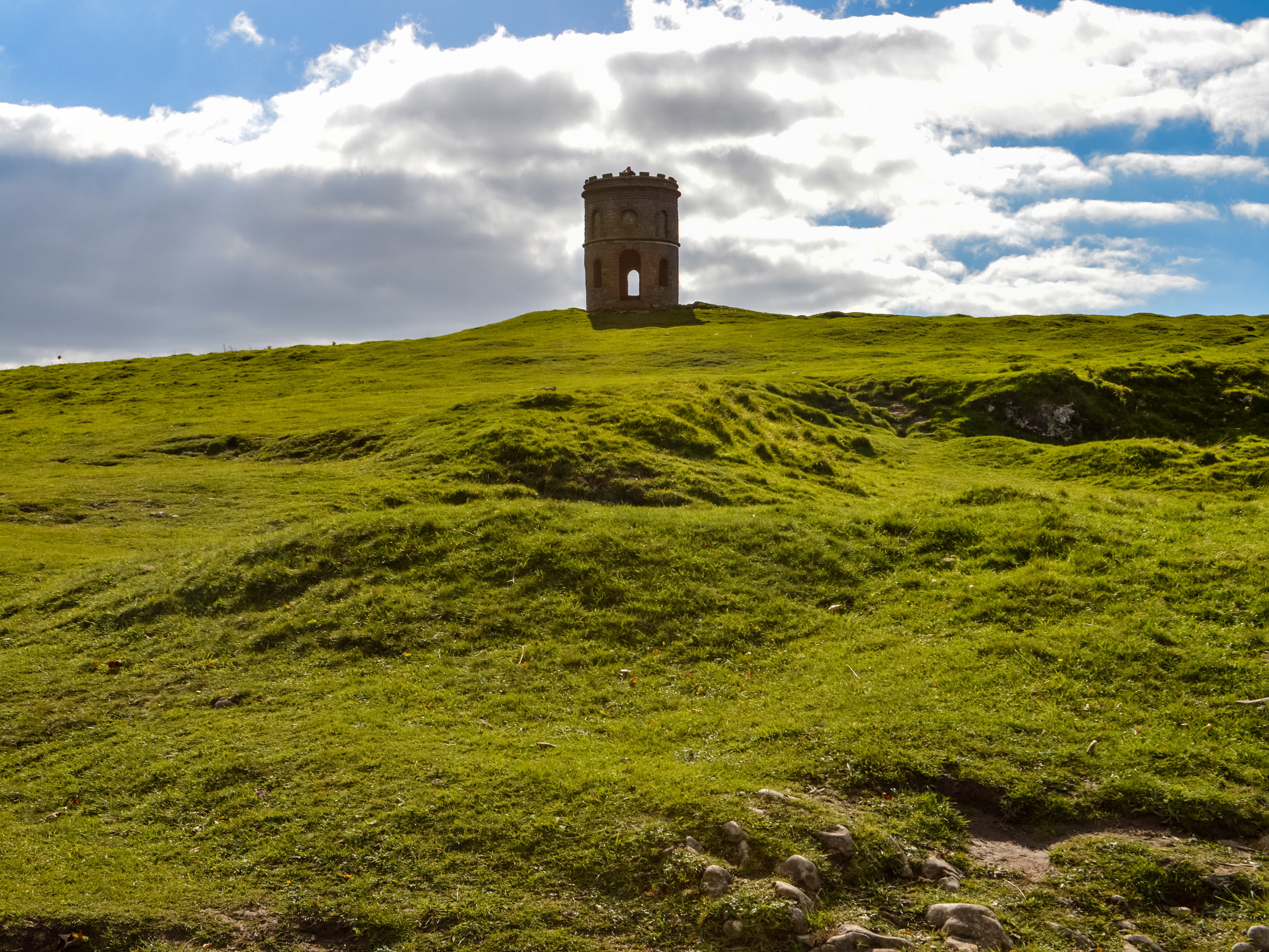
Buxton to King Solomon’s Temple Walk
Difficulty Rating:
The Buxton to King Solomon’s Temple Walk is a 6.5mi circular walking route that will take you from the heart of the city to a scenic viewpoint overlooking the Derbyshire countryside. The trail is a good mix of urban and rural terrain that is easy to navigate and suitable for hikers of most skill levels. Along the walk, you will traverse some open farmland around Harpur Hill before visiting the charming Victorian Era tower known as King Solomon’s Temple for some beautiful views of the surrounding area.
Getting there
To reach the car park for the Buxton to King Solomon’s Temple Walk from Buxton railway station, head west on Station Road for 0.1mi and take the second exit at the roundabout onto St. John’s Road. In 0.3mi, turn left onto Burlington Road and you will find the car park on the left in 275ft.

About
| When to do | Year-Round |
| Backcountry Campsites | No |
| Pets allowed | Yes - On Leash |
| Family friendly | Yes |
| Route Signage | Average |
| Crowd Levels | Moderate |
| Route Type | Circuit |
Buxton to King Solomon’s Temple Walk
Elevation Graph
Weather
Buxton to King Solomon’s Temple Trail Description
Although the walk from Buxton to King Solomon’s Temple features a fair amount of urban walkways, there is a decent portion to the south of the city that traverses open stretches of farmland with some uphill climbs. These areas are a bit more rugged and can sometimes be bogged down with mud, so make sure to wear proper walking boots when out on the trail. Additionally, this area can often see livestock populations roaming free across the countryside. If you are travelling with a dog, be sure to keep it on a lead to avoid any interactions.
With a strong mix of urban and rural landscapes, this walking route is a fun adventure that features easy-to-navigate trails and beautiful scenery. While out on the walk, you will make your way through the city of Buxton and head south to traverse the lush green farmland around the village of Harpur Hill. From there, you will cross the open terrain and make your way up to King Solomon’s Temple, a Victorian folly that was rebuilt in the 1890s, for some amazing views overlooking the surrounding countryside. This is a fun, intermediate length walk that the whole family can enjoy.
Setting out from the car park, make your way east through the Pavillion Gardens along the flowing River Wye until you meet up with The Square Road. Make your way across and turn left on The Crescent, following it as it skirts around the park and meets up with the Spring Gardens Shopping Centre walkway. Make your way between the shops, trying not to get distracted from the task ahead, and turn right along the trail just before the roundabout.
Continue on to the southeast to cross over Bakewell Road, picking up the trail to the left and following it over the River Wye to enter into Ashwood Park. Continue south through the park for 0.3mi and turn right to cross over the bridge and make your way to the other side of Bakewell Road. Once there, turn right at the roundabout and follow along the B5059 for 0.3mi where you will turn left on Heath Park Road. Continue south along the residential street and cross Byron Street to cut across Cote Heath Park to the southwest. When you have reached the skate park, continue west along the road and turn right to follow the A515 south.
After 0.1mi, turn right onto Fern Road keep on for 0.3mi, where you will find a trail branching off to the right. Take this path and follow it for the next 0.6mi, keeping right along the trail as you walk along the edge of the open farmland terrain and pass through a series of gates and stiles to eventually meet up with Grin Low Road.
From here, cross over the road and head left for a short stretch to pick the trail back up and cross over a small bridge. Continue on for 0.3mi, where you will come to a fork in the path right in front of a farm. Head right here to work your way around the buildings and keep right through the next two junctions. Keep straight along the lane for the next 1.0mi as you wind through the open countryside and eventually meet up with the road.
Make your way directly across and follow the road for 480ft to pick up the trail on the right. In 0.2mi, turn right at the junction and follow this trail east through the webs of walking paths that will lead you up Grin Low Hill to King Solomon’s Temple. Explore the area around the unique tower and take in the breathtaking views that stretch out across the farmland and villages of the Derbyshire countryside. After taking in the sights, follow the trail that leads away from the tower to the north to begin your return to the heart of Buxton.
Keep right for the next 0.5mi, as you pass through open stretches of terrain and scenic woodlands to arrive at an intersection in the trail. Take the path to the left, following it until you meet up with Green Lane. Turn right here and continue through the city until you meet up with the A515, following it to the left for 0.1mi until you reach Chapel Street. Turn left, followed by a quick right and another left to follow Fountain Street into the Pavillion Gardens. From here, you can either cut across the park to return to your vehicle or take some time relaxing in the gardens while thinking about the day’s journey from Buxton to King Solomon’s Temple.
Other amazing walks in Peak District National Park
Check out our guides to Kinder Scout, Mam Tor, Stanage Edge, Dovedale, and Padley Gorge. Or see all of our Peak District walks on 10Adventures.
Insider Hints
This trail can be a bit muddy at times, especially during the spring/autumn seasons.
If you are walking with a dog, make sure to keep it on a lead to avoid interactions with livestock.
Similar hikes to the Buxton to King Solomon’s Temple Walk hike

Valehouse Reservoir Circular
The Valehouse Reservoir Circular is a 3.1mi lollipop trail near Glossop that travels around the edge of the…

Three Edges Walk
The Three Edges Walk is a challenging circuit in Derbyshire that will take you along three escarpments that offer some…

Edale Rocky Ridges Walk
The Edale Rocky Ridges Walk is just that - an adventurous walk along a rugged ridgeline. While out on the…
Comments