Bottoms to Woodhead Reservoir Circular Walk
View Photos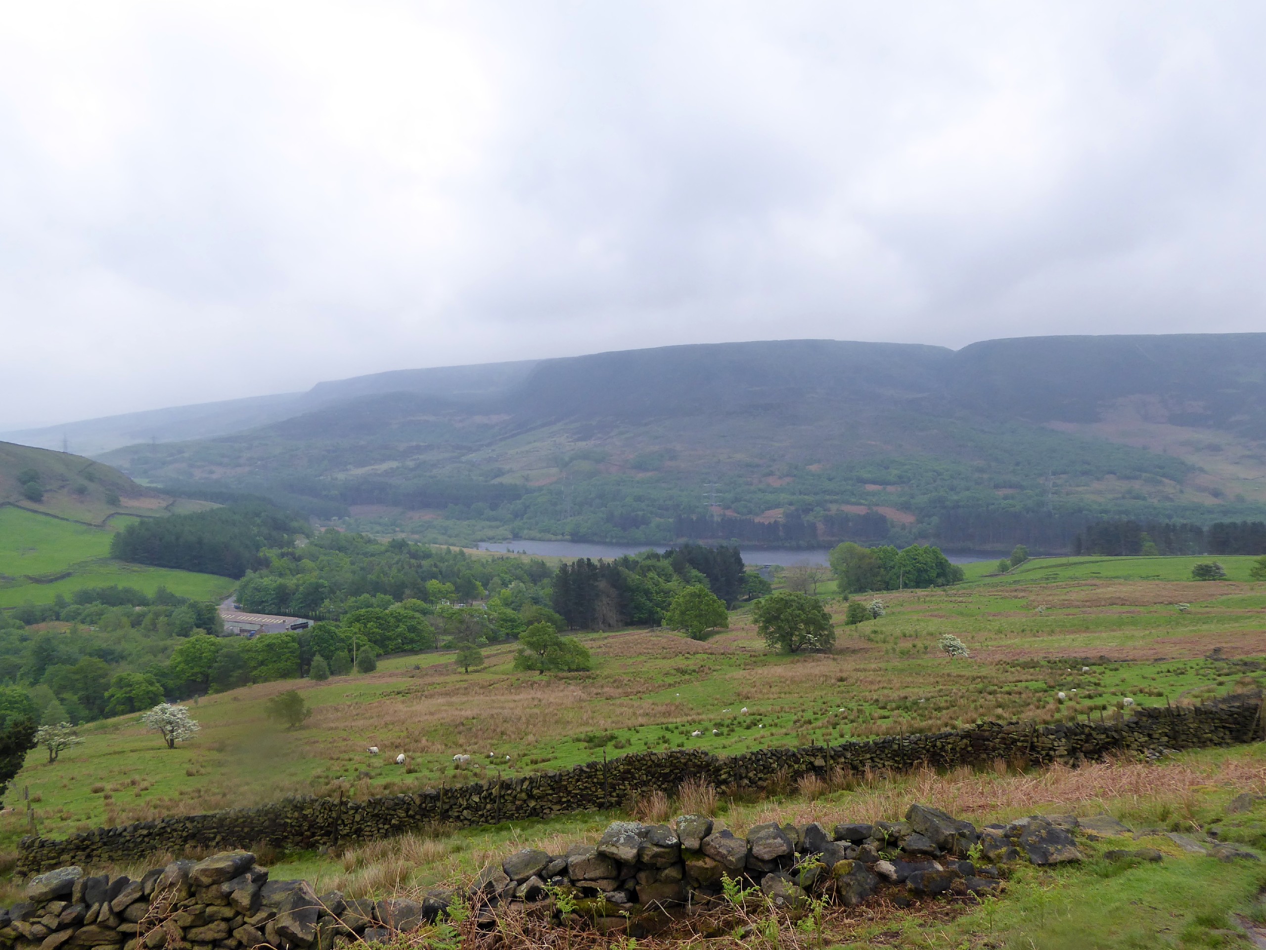
Bottoms to Woodhead Reservoir Circular Walk
Difficulty Rating:
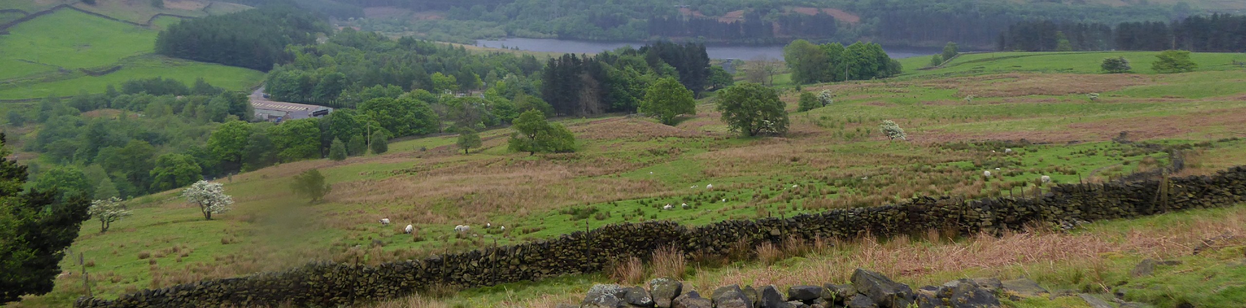
The Bottoms to Woodhead Reservoir Circular Walk is a fantastic long-distance walking route on the edge of the Peak District that will lead you around the edge of five different reservoirs. As you make your way around the Bottoms, Valehouse, Rhodeswood, Torside, and Woodhead reservoirs, you will have some spectacular views across the calm water and the surrounding hills of the Derbyshire countryside. This walk is great for a long-distance weekend stroll or for outdoor enthusiasts looking to build up to longer and more challenging routes.
Getting there
To reach the car park for the Bottoms to Woodhead Reservoir Circular from Crowden, drive southwest on the A628 for 3.4mi and make a sharp left turn. After 0.3mi, continue straight for another 0.2mi, before turning right to cross the dam. After 0.2mi, you will arrive at the car park.

About
| When to do | March-November |
| Backcountry Campsites | Crowden Campsite |
| Pets allowed | Yes - On Leash |
| Family friendly | Older Children only |
| Route Signage | Average |
| Crowd Levels | Moderate |
| Route Type | Circuit |
Bottoms to Woodhead Reservoir Circular Walk
Elevation Graph
Weather
Bottoms to Woodhead Reservoir Trail Description
While there is a moderate amount of elevation gain along the Bottoms to Woodhead Reservoir Circular, the real challenge of the walk is the overall distance. Make sure that you wear comfortable, and if possible waterproof, walking shoes for this 13.2mi journey, as the trail can often be quite muddy. Additionally, parking at the trailhead is limited, so make sure to arrive early in order to secure a space.
Setting out from the car park next to the Valehouse Reservoir, follow the trail along the forest edge of the water, before it climbs slightly uphill to follow along the road. Continue on to the northeast, where you will eventually come to the edge of the Rhodeswood Reservoir. Keep straight along the tree-lined trail, as it passes by the dam wall of the Torside Reservoir follows along the shoreline to provide some nice views across the water. When you come to the Torside car park, there are toilet facilities if you need them.
From here, continue to the northeast to pass through stretches of woodland and open terrain until you begin to walk the edge of the Woodhead Reservoir. Take in the beautiful views of the surrounding hilly landscape, as you round the eastern side of the reservoir and cross the River Etherow. Immediately after the river crossing, you will need to climb uphill for a short distance and head west to walk along the slopes of Pikenaze Hill. As you walk this section, you will have a nice, elevated view that stretches out across the reservoirs.
Upon descending the hill, continue around the edge of the water to cross over Withens Brook and make your way along the northside of the Woodhead Reservoir towards the Crowden Campsite. This area offers a number of trails that branch off to the north to explore the moors and dales that characterize the beautiful Peak District landscape.
Continue along the trail towards the southwest for the final leg of the journey that will lead you along each of the reservoirs that you had previously passed. After making your way through the serene stretch of woodland terrain that makes up the Valehouse Wood, head left to cross over the dam wall and return to the trailhead where you began the walk.
Other amazing walks in Peak District National Park
Check out our guides to Kinder Scout, Mam Tor, Stanage Edge, Dovedale, and Padley Gorge. Or see all of our Peak District walks on 10Adventures.
Similar hikes to the Bottoms to Woodhead Reservoir Circular Walk hike

Valehouse Reservoir Circular
The Valehouse Reservoir Circular is a 3.1mi lollipop trail near Glossop that travels around the edge of the…

Three Edges Walk
The Three Edges Walk is a challenging circuit in Derbyshire that will take you along three escarpments that offer some…

Edale Rocky Ridges Walk
The Edale Rocky Ridges Walk is just that - an adventurous walk along a rugged ridgeline. While out on the…
Comments