
Rothbury Riverside Walk
View Photos
Rothbury Riverside Walk
Difficulty Rating:
The Rothbury Riverside Walk is a laidback adventure in Northumberland that will allow you to explore a charming town and relax in a wonderful riverside setting. While out on the trail, you will walk along the banks of the River Coquet and enjoy the surrounding scenery, before looping through the charming town of Rothbury. This short route is perfectly suited for a relaxing weekend stroll.
Getting there
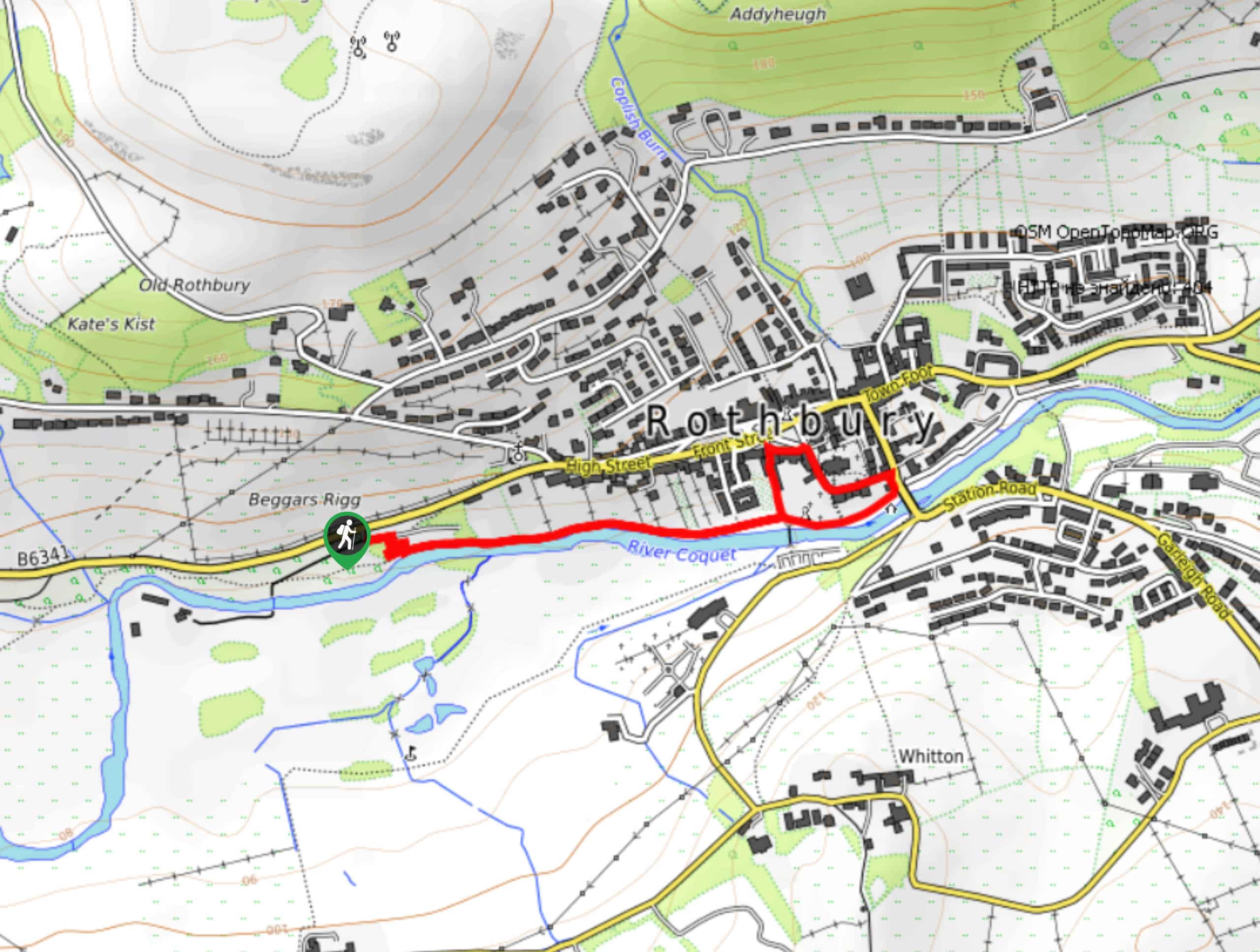
The trailhead for the Rothbury Riverside Walk can be found at the Beggars Rigg Car Park on B6341.

About
| Backcountry Campground | No |
| When to do | Year-Round |
| Pets allowed | Yes - On Leash |
| Family friendly | Yes |
| Route Signage | Average |
| Crowd Levels | Moderate |
| Route Type | Lollipop |
Rothbury Riverside Walk
Elevation Graph
Weather
Rothbury Riverside Walk Description
If you are in the mood for taking a relaxing stroll along the edge of a charming river in Northumberland, then you will certainly want to explore the laidback trails of the Rothbury Riverside Walk. In addition to exploring the scenic river’s edge, you will also complete a short loop through the town of Rothbury, making for a fun afternoon outdoors.
Setting out from the car park, you will follow a short winding path down to the edge of the River Coquet and turn left to follow along its north bank. Take some time here as you stroll along the water’s edge, enjoying the lovely views of the surrounding trees and stone bridges as you make your way into Rothbury.
Turning left at the bridge, you will make your way onto Haw Hill and follow it to the northwest past the Church of All Saints, eventually looping around Market Place on the way back to the river bank. From here, you will head right in order to retrace your steps on the return to the car park where you began.
Similar hikes to the Rothbury Riverside Walk hike

Hadrian’s Wall: Steel Rigg to Lanercost
Walking Hadrian’s Wall: Steel Rigg to lanercost is a fantastic - albeit lengthy - adventure that will lead you across…

Hadrian’s Wall: Wallsend to Heddon on the Wall
Hadrian’s Wall: Wallsend to Heddon on the Wall is the first section of the long distance Hadrian’s Wall Path walking…

Scotch Gill Woods Walk
The Scotch Gill Woods Walk is a short and easy-going adventure in Morpeth, Northumberland that will take you through a…
Comments