
Holburn, North Hazelrigg, and Belford Circular Walk
View Photos
Holburn, North Hazelrigg, and Belford Circular Walk
Difficulty Rating:
The Holburn, North Hazelrigg, and Belford Circular Walk is a wonderful adventure across the Northumberland countryside that features a good variety of terrain along the route. While out walking the trail, you will make your way across the open farmland to reach the village of Belford, before looping around the Swinhoe Lakes and Holburn lake to visit St Cuthbert’s Cave. This is a fantastic outing for those who want a bit of a longer route when exploring Northumberland.
Getting there
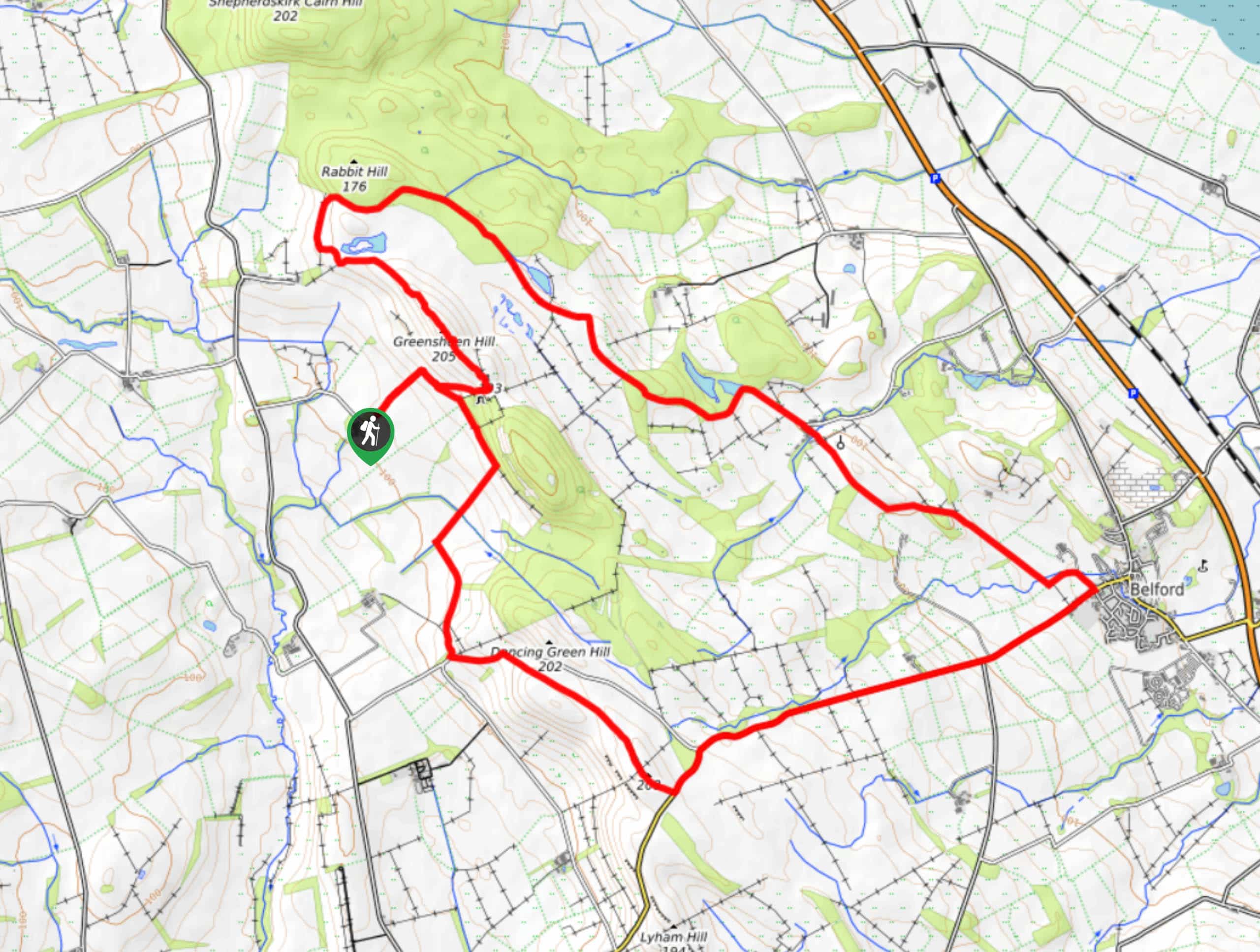
The trailhead for the Holburn, North Hazelrigg, and Belford Circular Walk can be found 1.34mi southeast of Holburn at the National Trust Saint Cuthbert’s car park.

About
| Backcountry Campground | No |
| When to do | March-October |
| Pets allowed | Yes - On Leash |
| Family friendly | Older Children only |
| Route Signage | Average |
| Crowd Levels | Moderate |
| Route Type | Lollipop |
Holburn, North Hazelrigg, and Belford Circular Walk
Elevation Graph
Weather
Holburn, North Hazelrigg, and Belford Circular Walk Description
If you are looking to make sure that you get your steps in while taking in the natural beauty of the Northumberland landscape, then the Holburn, North Hazelrigg, and Belford Circular Walk is a great option to do so.
Setting out from the car park, you will initially make your way uphill towards St Cuthbert’s Cave, turning to the southeast just before it as you will visit the site on the return leg of the walk. From here, you will traverse the open countryside to eventually arrive at the charming village of Belford.
Reaching the Belford War Memorial, you will turn to the left and leave the village behind, once again traversing the countryside as you pass by the scenic shores of the Swinhoe Lakes and Holburn Lake. From here, follow the trail as it turns back to the southwest and climbs uphill across Greensheen Hill, where you will arrive at the site of St Cuthbert’s Cave on the edge of the forest. After visiting the site, you will make your way downhill to the west on the return to the car park.
Similar hikes to the Holburn, North Hazelrigg, and Belford Circular Walk hike

Hadrian’s Wall: Steel Rigg to Lanercost
Walking Hadrian’s Wall: Steel Rigg to lanercost is a fantastic - albeit lengthy - adventure that will lead you across…

Hadrian’s Wall: Wallsend to Heddon on the Wall
Hadrian’s Wall: Wallsend to Heddon on the Wall is the first section of the long distance Hadrian’s Wall Path walking…

Scotch Gill Woods Walk
The Scotch Gill Woods Walk is a short and easy-going adventure in Morpeth, Northumberland that will take you through a…
Comments