
Elsdon Burn Walk
View Photos
Elsdon Burn Walk
Difficulty Rating:
The Elsdon Burn Walk is a great outdoor excursion in Northumberland, UK that will take you through an historic village to roam the nearby countryside. While out on the trail, you will pass through the Medieval settlement of Elsdon, before looping around the picturesque countryside surrounding the winding banks of Elsdon Burn. This fun route is suitable for nearly all ages and skill levels.
Getting there
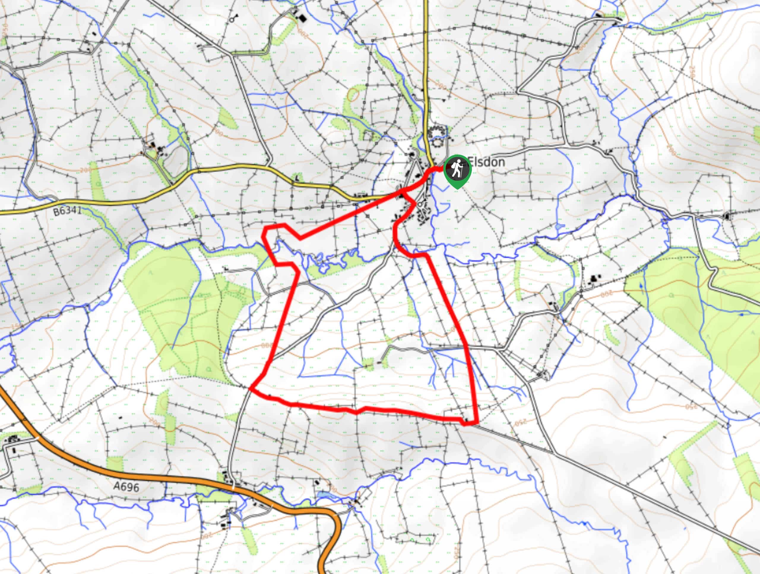
The trailhead for the Elsdon Burn Walk can be found in the village of Elsdon, next to the village hall.

About
| Backcountry Campground | No |
| When to do | Year-Round |
| Pets allowed | Yes - On Leash |
| Family friendly | Yes |
| Route Signage | Average |
| Crowd Levels | Moderate |
| Route Type | Lollipop |
Elsdon Burn Walk
Elevation Graph
Weather
Elsdon Burn Walk Description
For those outdoor enthusiasts that are looking to take in a bit of local history while exploring the rolling hills and green fields of Northumberland, the Elsdon Burn Walk is a fantastic option to get outside for some fresh air.
Setting out from the trailhead near the village hall, you will make your way to the southwest through the village while taking some time to explore the historic buildings that make up one of the best-preserved Medieval settlements in Northumberland National Park.
After passing by the First and Last Brewery, you will continue on to the southwest until you arrive at the banks of Elsdon Burn. Once you have crossed over to the opposite side, you will climb uphill and make a loop around the countryside, enjoying some sweeping views of the surrounding farmland, before making the final descent back into the village where you started the walk.
Similar hikes to the Elsdon Burn Walk hike

Hadrian’s Wall: Steel Rigg to Lanercost
Walking Hadrian’s Wall: Steel Rigg to lanercost is a fantastic - albeit lengthy - adventure that will lead you across…

Hadrian’s Wall: Wallsend to Heddon on the Wall
Hadrian’s Wall: Wallsend to Heddon on the Wall is the first section of the long distance Hadrian’s Wall Path walking…

Scotch Gill Woods Walk
The Scotch Gill Woods Walk is a short and easy-going adventure in Morpeth, Northumberland that will take you through a…
Comments