
Bakethin North Shore Walk
View Photos
Bakethin North Shore Walk
Difficulty Rating:
The Bakethin North Shore Walk is a fantastic excursion in Northumberland that will expose you to a variety of terrain, including a tranquil forest and lakeside setting. While out walking the trail, you will pass through a forest and cross over the River North Tyne, making your way through the woodland landscape before returning along the shores of the Bakethin Reservoir and the impressive Kielder Viaduct. This easy-going trail is packed full of amazing views, making it ideal for a fun family adventure in Northern England.
Getting there
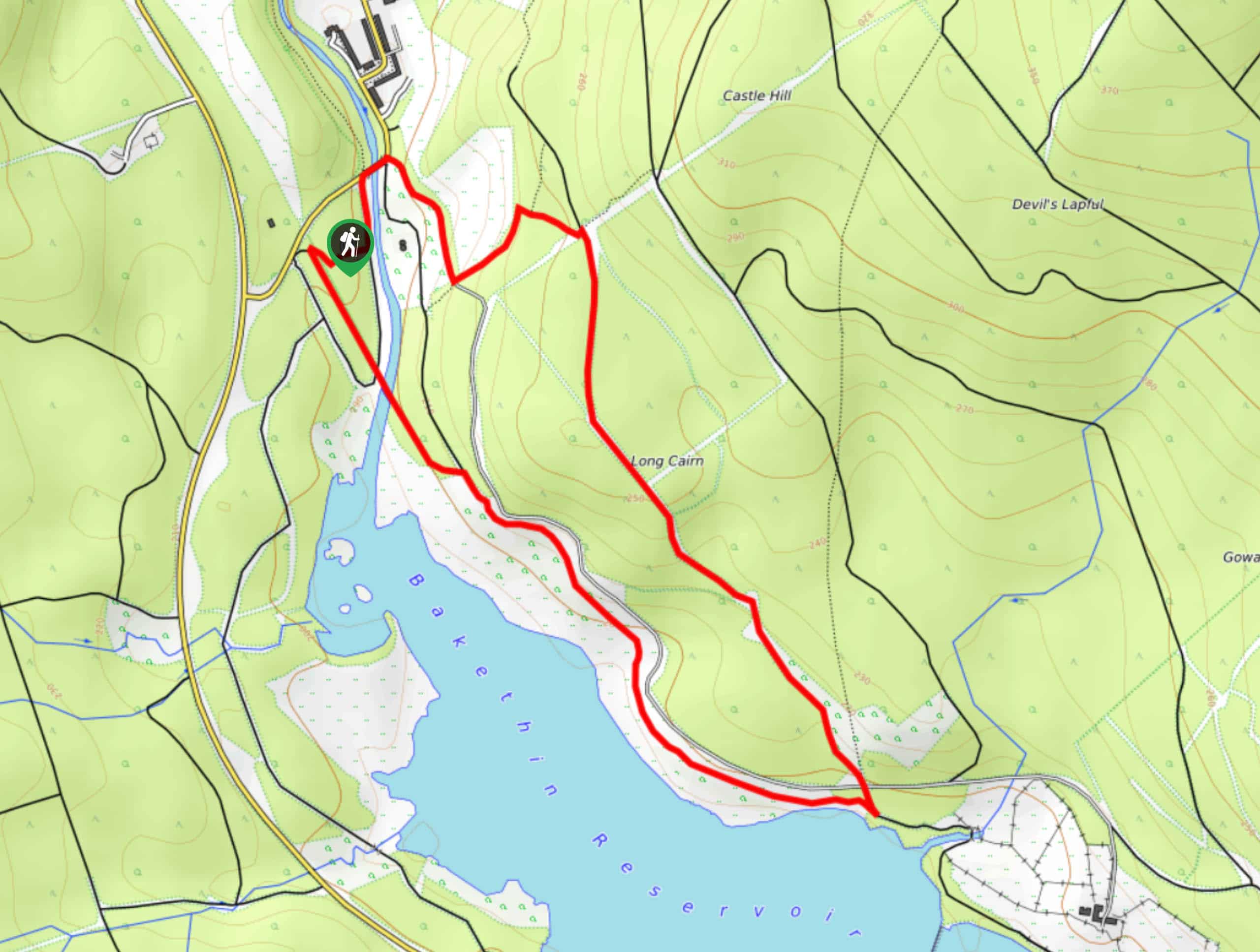
The trailhead for the Bakethin North Shore Walk can be found at the Bakethin car park, just south of Kielder on the way to the Kielder Viaduct.

About
| Backcountry Campground | No |
| When to do | Year-Round |
| Pets allowed | Yes - On Leash |
| Family friendly | Yes, but not for pushchairs |
| Route Signage | Average |
| Crowd Levels | Moderate |
| Route Type | Circuit |
Bakethin North Shore Walk
Elevation Graph
Weather
Bakethin North Shore Walk Description
If you find yourself in the northern reaches of England and have been searching for a walking route with a variety of terrain, beautifully scenic views, and wonderful architecture, then look no further than the Bakethin North Shore Walk.
Setting out from the car park, you will make your way to the northeast through the forest, before crossing over the banks of the River North Tyne. From here, you will head to the southeast to traverse a track that cuts through meadows and woods, eventually reaching the southernmost point of the route.
At this point, you will meet up with the charming shores of the Bakethin Reservoir, turning your direction to the northwest in order to follow closely along the water’s edge while taking in the views. Eventually, you will arrive at the arched expanse of the Kielder Viaduct, which will take you back across the River North Tyne and through the forest to arrive back at the car park where you started your walk.
Similar hikes to the Bakethin North Shore Walk hike

Hadrian’s Wall: Steel Rigg to Lanercost
Walking Hadrian’s Wall: Steel Rigg to lanercost is a fantastic - albeit lengthy - adventure that will lead you across…

Hadrian’s Wall: Wallsend to Heddon on the Wall
Hadrian’s Wall: Wallsend to Heddon on the Wall is the first section of the long distance Hadrian’s Wall Path walking…

Scotch Gill Woods Walk
The Scotch Gill Woods Walk is a short and easy-going adventure in Morpeth, Northumberland that will take you through a…
Comments