
Howe Sound Crest Trail
View Photos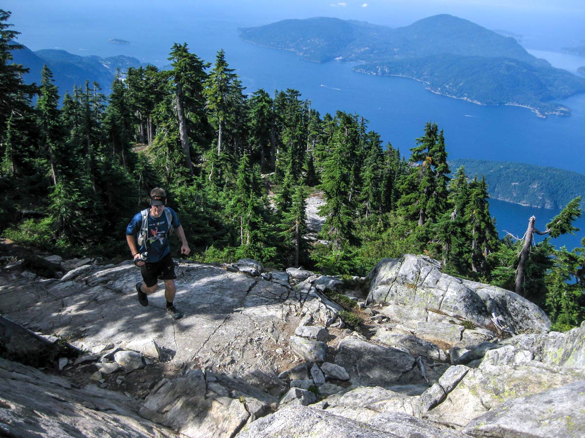
Howe Sound Crest Trail
Difficulty Rating:
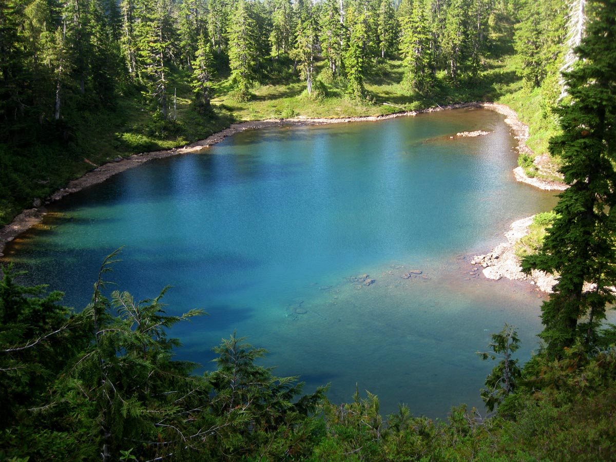
The Howe Sound Crest Trail (HSCT) is arguably one of the best hiking trails near Vancouver for serious hikers, stretching over 18.6mi from Cypress Bowl to Porteau Cove. Keep your hiking boots laced tight as you head over multiple summits, offering spectacular views of Howe Sound, The Lions, and the beautifully turquoise Deeks Lakes, to name a few.
Getting there
From North Vancouver, head to the TC/BC-1 W ramp to West Vancouver/Whistler. Continue for 5.6mi, then take exit 8 to merge onto Cypress Bowl Rd toward Cypress Mountain Ski Area. Park at the farthest parking lot closest to the ski lodge.

About
| When to do | Late July to September |
| Backcountry Campsites | Yes |
| Pets allowed | Yes - On Leash |
| Family friendly | No |
| Route Signage | Average |
| Crowd Levels | Moderate |
| Route Type | One Way |
Howe Sound Crest Trail
Elevation Graph
Weather
Route Description for Howe Sound Crest Trail
Be forewarned, the Howe Sound Crest Trail (HSCT) is not for the faint of heart, and while it can be done in one very long day, it is typically tackled as an overnight trip. We like this as a long day-hike as you can pare down the weight of your pack, and enjoy this incredible route with just a daypack.
Since this is a one-way hike, you’ll need to drop off one car in Porteau Cove, the end point, before making your way to the starting point in a second vehicle. The parking lot is off Porteau Road, a quick 15 minutes north of Lions Bay on the Sea to Sky highway.
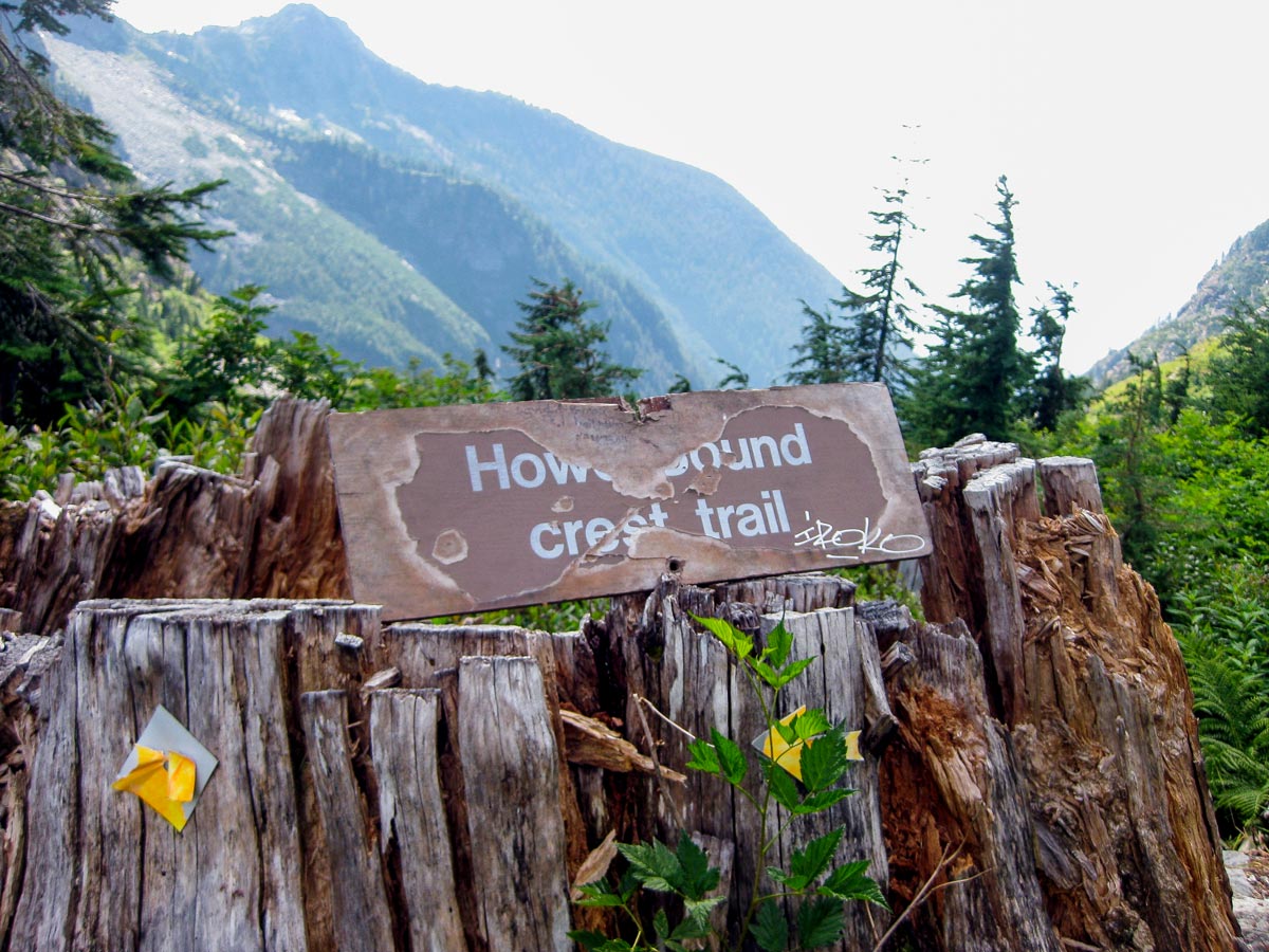
Once back at the Cypress Mountain Ski Area parking lot, you’ll find a BC Parks map at the trailhead. For this hike, you’ll be following the ‘Howe Sound Crest Trail,’ which is well marked and easy to follow.
Start the hike on a high note, as you make your way to St. Mark’s Summit. There is a steady gain in elevation for 3.4mi, but it is a relatively easy trail to follow. Once you arrive at the peak, you will need to take a quick detour off the HSCT to the trails on your left to take in the sight above Howe Sound. From here, you can see Mount Gardner on Bowen Island.
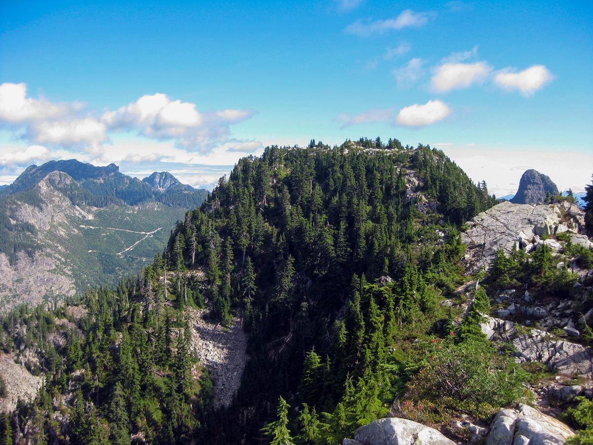
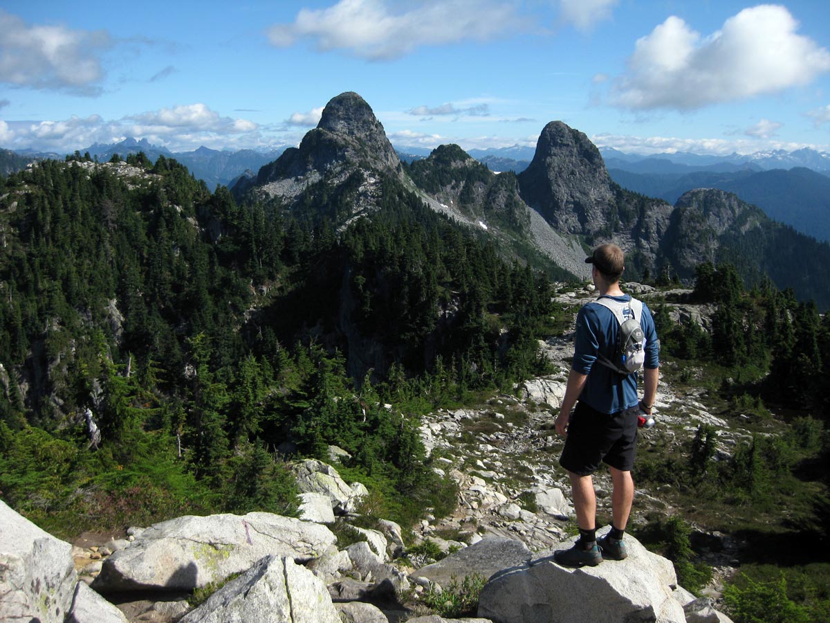
Depart from St. Mark’s Summit and make your way back onto the marked trail for the Howe Sound Crest Trail, then continue north with Mt. Unnecessary South and North peaks standing between you and The Lions. Be wary, the trail becomes far less developed and easy from this point on, but is still well marked. Prepare for your next challenge, a steep climb up to Mt. Unnecessary Ridge.
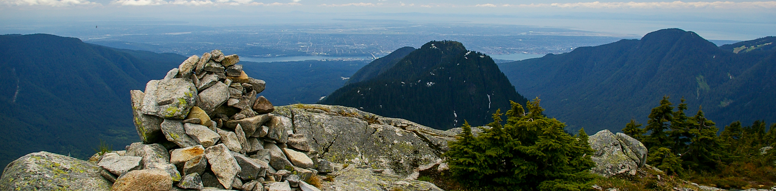
If you choose to avoid scrambling up the West Lion, this will be the highest elevation you’ll reach on this trail at 5059ft. Mt. Unnecessary offers spectacular scenery in all directions (Howe Sound to the west, North Vancouver to the East, and The Lions due north).
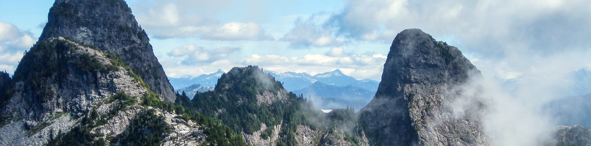
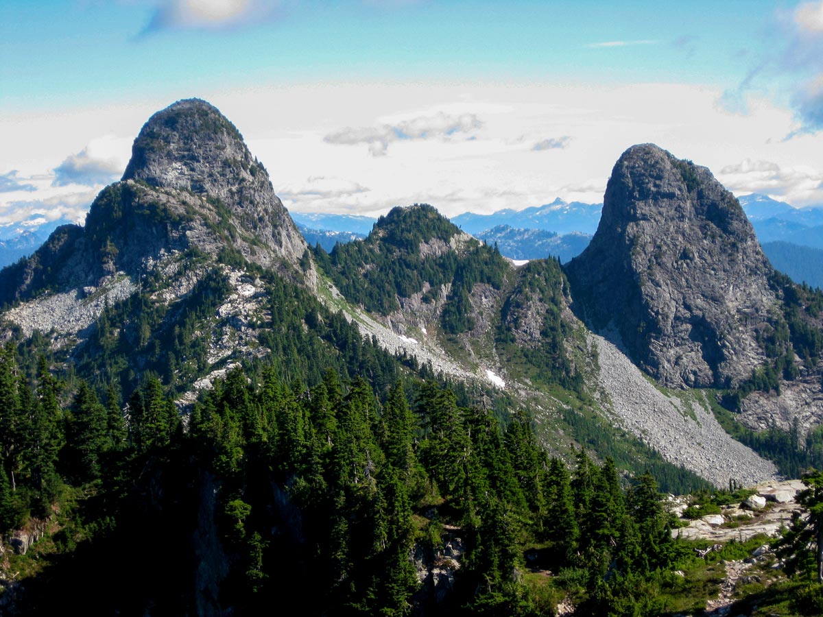
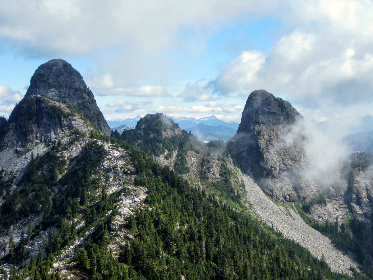
Next up, a hike to the infamous Lions. For those of extreme fitness level, you may choose to scramble up the West Lion (with extreme caution), but this does add more distance, elevation, and time than our guide lists. We suggest you continue on the Howe Sound Crest Trail, and follow the trail that veers down to your right.
This section can be dangerous with falling rocks coming down overhead from those who choose to scale the Lion. Next, you have to scale across the West Lion to the col between the two peaks. If you have a heavy pack, this part may be difficult
After a short rest, you’ll make your way to James Peak. The trail drops from the col and carries on around Thomas peak, as you scramble over some boulders, and then climb to Enchantment Pass.
Finally, you’ve arrived at James Peak, where you should grab your camera and snap a few photos of the sunning vistas in every direction. The next park of the trail is a steep drop off the other side of James Peak, so proceed with caution as you make your way towards David Peak.
Follow the path snaking around David Peak for about 2.5mi, here the trail will open up again and you will soon be in Magnesia Meadows. Beyond David Peak, there is a trail junction that connects to Mount Harvey to the west – you do not want to go this way, it can be a very dangerous trail, where hikers can become lost and require rescue. Ensure you stay due-north on the HSCT towards Brunswick Mountain.
At Magnesia Meadow, you’ll pass an emergency shelter, then continue onwards through a thick forest, before coming to the junction for Brunswick Mountain. You have three options here: firstly, you can take the trail up (to your right) hiking up Brunswick. The second option is to head down (to your left) into Lions Bay, which is a useful option is there is bad weather.
We recommend the third option, crossing the trail and following the Howe Sound Crest Trail northwest along Hat Pass. From here, start the decent towards Brunswick Lake Hut, overlooking mountaintops and lush forests on your walk down.
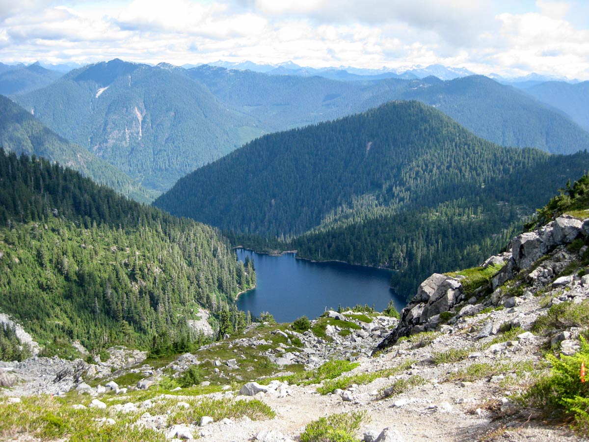
Up ahead, you’ll notice a creek connecting Brunswick Lake to Deeks Lake. From here, follow the path as it runs parallel to Deeks Lake, passing a roaring waterfall, and a lookout point over both Deeks Lake and Middle Lake.
From here, you’re finally in the home stretch. Keep a steady pace as you head downhill towards the Porteau Cove parking lot.
Once you come out from the trail, you’ll find yourself on a well-maintained logging road, which carries you all the way to the parking lot. Congratulations, you’ve just completed the Howe Sound Crest Trail!
Insider Hints
The Howe Sound Crest Trail is one of the most challenging hikes in SW BC. Do not attempt this trail unless you are experienced, and comfortable with challenging trail conditions.
While we show this as a 1-day hike, many people do it over two days. This is even more popular for trail running, and it doesn’t get any better than Howe Sound. Doing a car-drop and travelling light means you can traverse the whole trail in a day.
There are plenty of options for backcountry camping options: Plateau above Enchantment Lake (6.8mi from Cypress Mountain Resort); Magnesia Meadows (9.0mi from Cypress Mountain Resort); Brunswick Lake (11.8mi from Cypress Mountain Resort); Deeks Lake (13.7mi from Cypress Mountain Resort).
Please be aware Campfires are NOT permitted anywhere on this trail.
Backcountry travelers are encouraged to use extreme caution in avalanche terrain, look for the marked signs on the trail.

Similar hikes to the Howe Sound Crest Trail hike
Hike to South Needle
The Hike to South Needle follows along an extension of the trail to Lynn Peak, passing by the viewpoint and…

Lynn Lake Trail
The Lynn Lake Trail is a lengthy hike through the Lynn Headwaters backcountry that is sure to get you off…
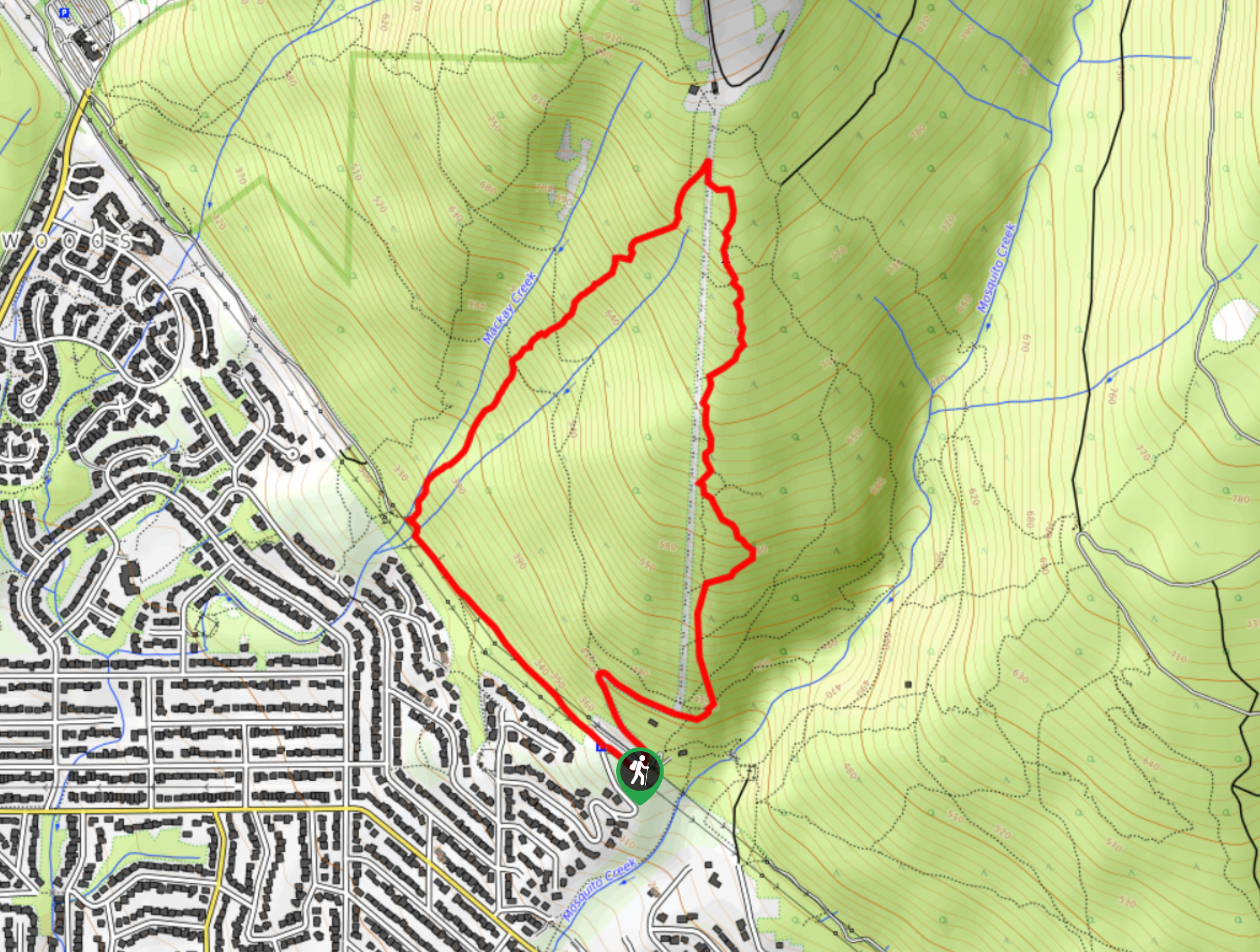
Mackay Creek Trail Loop
The Mackay Creek Loop Trail is an intense workout for hikers that love a steep incline along a short route.…
Nadeem Medulla 4 years ago
Very difficult hike, it's also possible to get lost while hiking here and there have been casualties associated with this area.
Noah Copper 4 years ago
Amazing hike. Been here before a few years back and the views still remain as beautiful as I remember! It never ceases to amaze me.
Eric Parats 5 years ago
A lovely hike. If you like a good hike or nature walk, check this trail out and you won't be disappointed. Bring the dogs or go with a group of friends.
Glori S. 5 years ago
Bring a walking stick, dress in layers, and waterproof hiking boots. Steep and snowy still. Will definitely come back again.
Nathan R. 5 years ago
Arduous and quite dangerous. Wear proper footwear, bring water, and make sure to stay on the trail. If you're not sure where the trail stops and go back the way you came.
Jude L. 5 years ago
One of the hardest hike I've ever done. Bring lots of water on this hike as it will really take a lot of your stamina. I'm just glad I've conquered this trail.
Suzane L. 5 years ago
There are some bears sighting so bring a bear spray with you. An amazing and challenging trail even for seasoned hikers. Bring some trekking poles as it will help you along the way.
Kenneth D. 5 years ago
A difficult hike with a lot of steep ascents. The hike will reward you with amazing views of the surroundings. It shouldn't be underestimated.
EthelB. 5 years ago
Beautiful scenery awaits at the top. The hike was brutal, and it got me sweating a lot. Bring enough water to avoid dehydration.
loneranger 5 years ago
This hike requires a certain type of fitness. Not great for people with knee problems and oldies.