Cates Park Loop
View Photos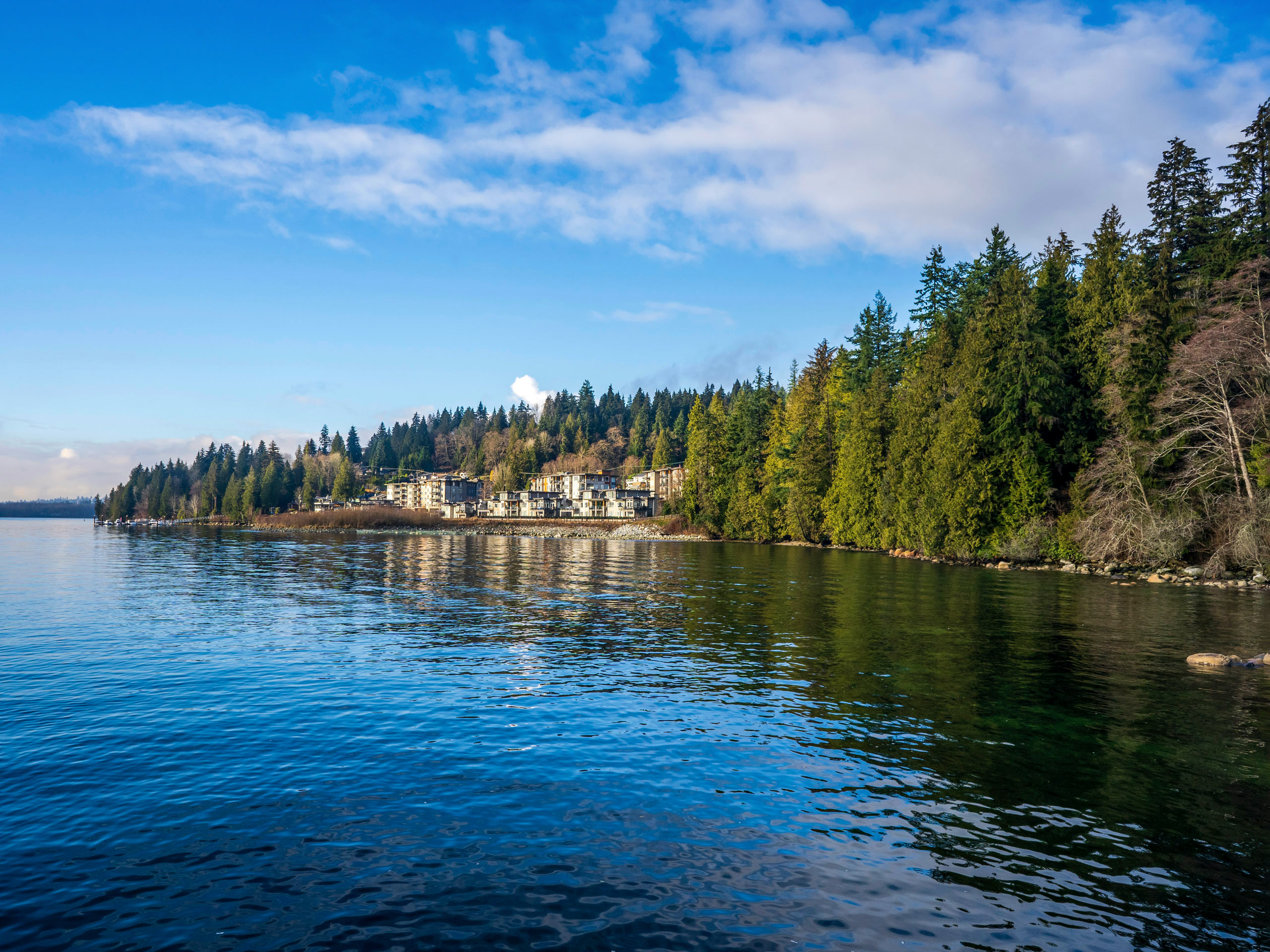
Cates Park Loop
Difficulty Rating:
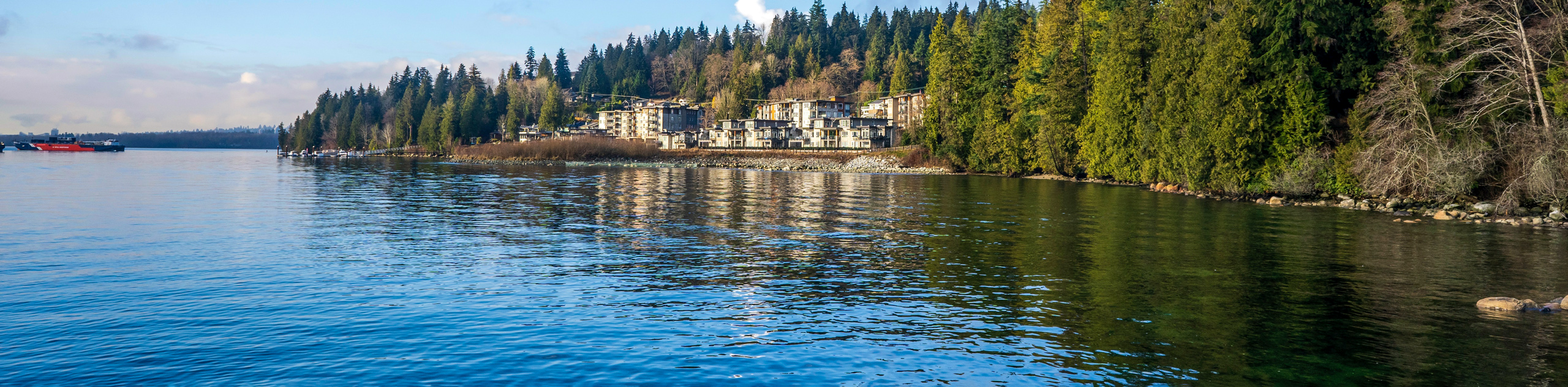
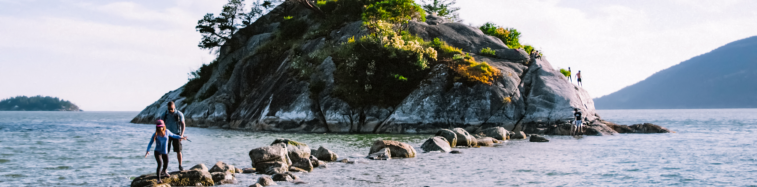
The Cates Park Loop is a short 1.5mi trail near Deep Cove that offers access to a variety of other outdoor activities, such as boating, canoeing, and kayaking. Known to local Indigenous peoples as Whey-Ah-Wichen, this park offers beautiful views out over the Burrard Inlet from the rocky beaches of Roche Point. This easy loop has all of the ingredients for a fun day in the sun.
Getting there
To get to Cates Park from Vancouver, drive north on the Trans Canada Highway/BC1-W and cross over the Ironworkers Memorial Bridge. Take exit 23B toward Dollarton Highway and follow it for 3.1mi. Turn right onto Cates Park Road to enter the park and access its parking areas.

About
| When to do | Year-Round |
| Backcountry Campsites | No |
| Pets allowed | Yes - On Leash |
| Family friendly | Yes |
| Route Signage | Average |
| Crowd Levels | Moderate |
| Route Type | Circuit |
Cates Park Loop
Elevation Graph
Weather
Cates Park Loop Description
The Cates Park Loop runs through a waterside recreational area that is popular with runners, dog walkers, and even boaters due to the park’s boat launch area. As such, the park can get busy with people taking advantage of its numerous amenities. Even with its popularity, the area has ample parking facilities that can be found at multiple locations throughout the park. Hikers and trail runners should note that the southern portion of this route near Roche Point does not have an actual trail. To continue around the loop, you can make your way across the green space, heading past the canoe area to the east of Roche Point if you are travelling counterclockwise or past the boat launch to the west if you are travelling clockwise around the trail.
This is an easy half-day hike to take the whole family on, especially if you are looking to do more activities beyond hiking the trails. Cates Park is a popular spot for canoeing and kayaking along the water’s edge, and the northeast corner of the park has a playground, as well as the ruins of an old mill that kids can explore. The trails themselves are easy-going and largely forested, offering beautiful views of the Burrard Inlet from the rock beach along Roche Point. Don’t forget to hit up Wally’s Burgers in the centre of the park after your day of adventure to grab some crazy good food at a popular local spot.
Setting out from the parking area near the Cates Park boat ramp, head east through the trees, as there is no trail on the southern portion of the route. Make your way down to Roche Point on the southern tip of the park, where you will have great views of the Burrard Inlet and the many ships streaming by as you stand on the rocky beach. Behind you will be Wally’s Burgers, a popular spot with some delicious (if messy) burgers.
Continue east around the point, making your way past the canoe area until you reach the Malcolm Lowry Trail. This path will traverse the eastern edge of the park, as you make your way through a thick covering of forest up toward the area known as “Little Caters Park”. This section of the park is not a part of the main recreation area but it does offer a few amenities, such as tennis courts, a playground, and the ruins of an old mill that can be explored.
Making your way around the northeast corner of the park, you will reach Sea Shell Lane. From here, hikers can either walk along the road or simply cut across the park to pick up the Upper Anchor Trail on the other side of the tennis courts.
Shortly after entering back into the tree cover, you will reach a four-way junction in the trail. Pass straight through the junction to keep on the Upper Anchor Trail for another 300m as you make your way through the trees. As you reach a small parking lot, there will be a trail to your right. Follow this trail to skirt around the north side of the parking lot, meeting up with Cates Park Road. Keep straight along the road for 130m to pick the trail back up and re-enter the tree cover.
As you make your way along the northwest portion of the trail, you will round a corner and arrive back at the parking lot where you started the hike. After completing the Cates Park Loop you can continue on to enjoy the many amenities that the park has to offer. Spend the day exploring the beach, kayak or canoe along the water’s edge, or dive into a delicious Wally Burger. However you decide to finish off your day in the sun, there is no shortage of activities on offer in Cates Park/Whey-Ah-Wichen.
Insider Hints
There are multiple parking lots located throughout the park.
The lower portion of the route has no trail. Follow the beach around Roche Point to continue the trail at the canoe area in the east, or past the boat launch in the west.
Stop at Wally’s Burgers in the centre of the park for a great burger experience.
Similar hikes to the Cates Park Loop hike
Whytecliff Park - Panorama Ridge Trail
The Panorama Ridge Trail is a short trail within Whytecliff Park that is perfect for an afternoon stroll to get…

Goldie and Flower Lake Loop
The Goldie and Flower Lake Loop is a short trail that makes its way through the peaceful terrain surrounding these…
Dinky Peak Trail
The Dinky Peak Trail is a less-travelled path in Mount Seymour Provincial Park, partly because it can be tricky to…
Comments