Thunder Creek Trail hike
View Photos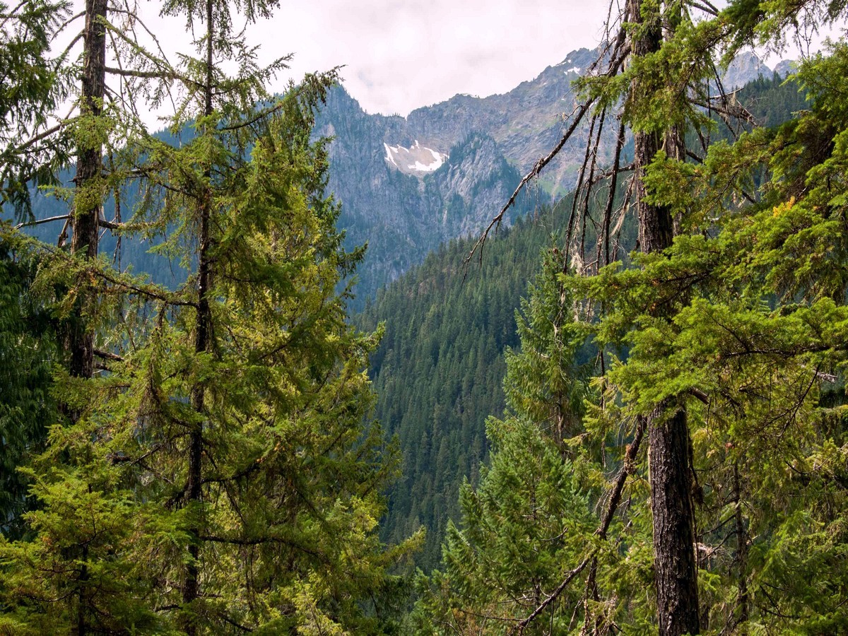
Thunder Creek Trail hike
Difficulty Rating:
Hiking along the Thunder Creek Trail can be as short or long as you want. The Thunder Creek Trail stretches over 30.0mi into the North Cascades backcountry, providing hikers with great daytrips and multi-day backpacks.
Getting there
From Newhalem head east on Highway 20 for 9.5mi to Colonial Creek Campground. Turn right into the campground (milepost 130). Follow signs to the trailhead near the amphitheater.

About
| When to do | Spring - Fall |
| Backcountry Campsites | Yes |
| Toilets | Yes |
| Family friendly | No |
| Route Signage | Average |
| Crowd Levels | Moderate |
| Route Type | Out and back |
Thunder Creek Trail
Elevation Graph
Weather
Route Description for Thunder Creek Trail
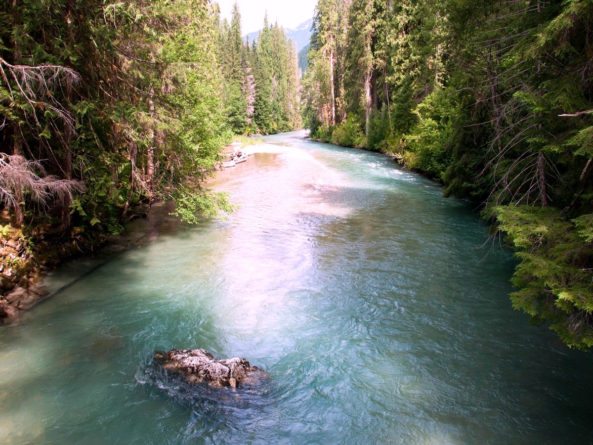
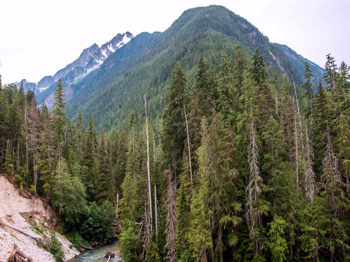
The Thunder Creek Trail is a backpacker’s gateway to the North Cascades. Beginning from Colonial Creek Campground on the shores of Lake Diablo, the trail takes off south, paralleling Thunder Creek for 1.0mi. Hikers can spend days exploring the trail and its numerous offshoots. For a solid day hike, make McAllister Camp your destination.
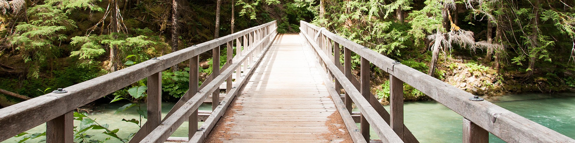
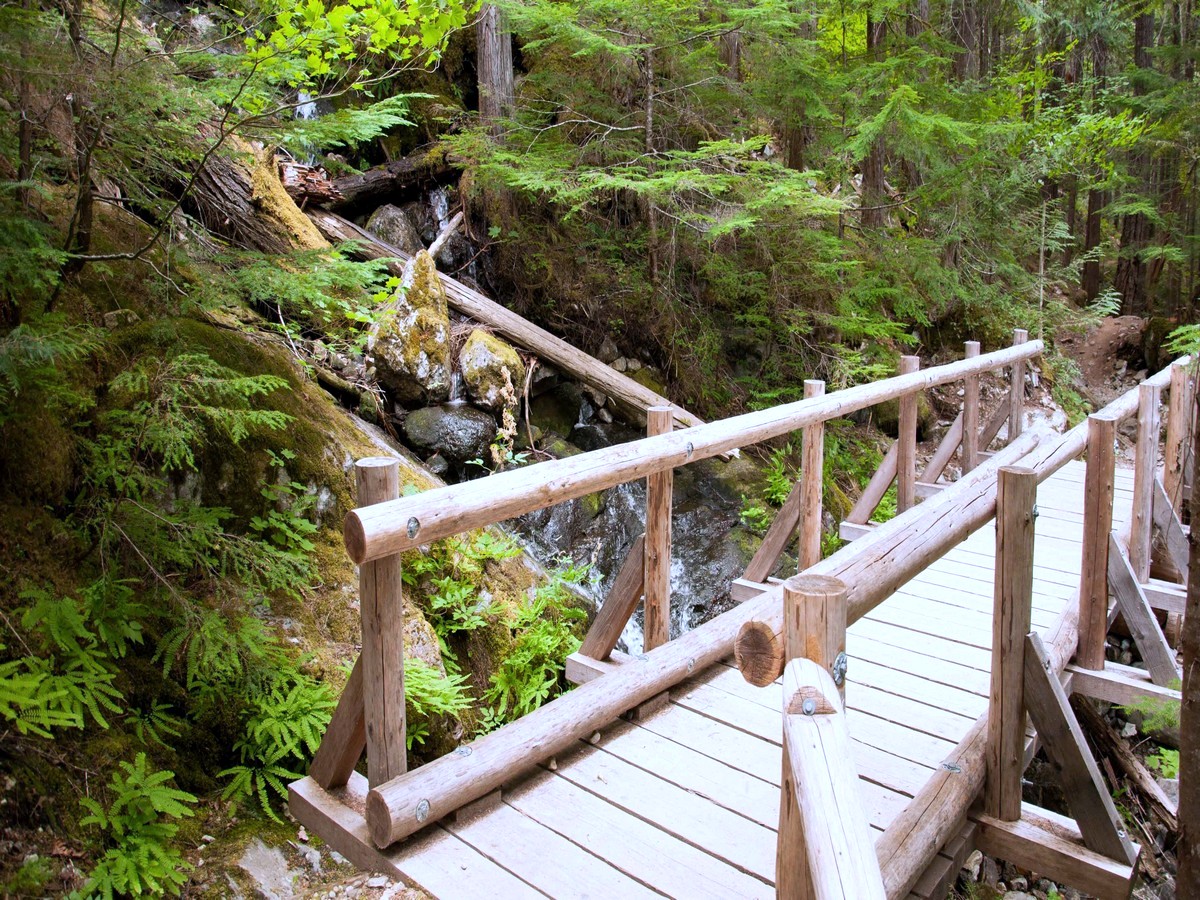
From the signed trailhead, begin hiking along the forested Thunder Creek Trail. Diablo Lake’s Thunder Arm accompanies you along the way, eventually narrowing to form the trail’s namesake Thunder Creek. This first 1.0mi or so is relatively flat, rolling gently as it follows the creek. Big, old growth trees decorate the trail. At 1.4mi, cross the footbridge over Thunder Creek and arrive at the first backcountry site, Thunder Camp. Privy available.
The trail begins to steepen as you continue along, reaching a junction at 1.7mi. The trail to the left climbs approximately 2000ft in 2.5mi to Fourth of July Pass – an alternate destination with bigger views if you’re up for the challenge. Stay right for Thunder Creek Trail. Continuing along, you’ll pass Neve Camp in another 0.3mi. From here, Thunder Creek Trail climbs higher above Thunder Creek, offering peekaboo views of North Cascade peaks through the trees.
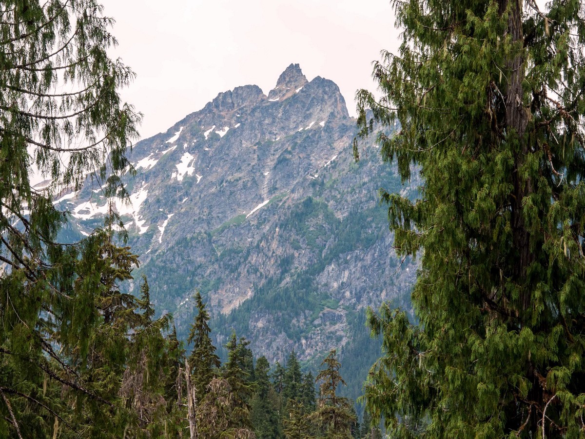
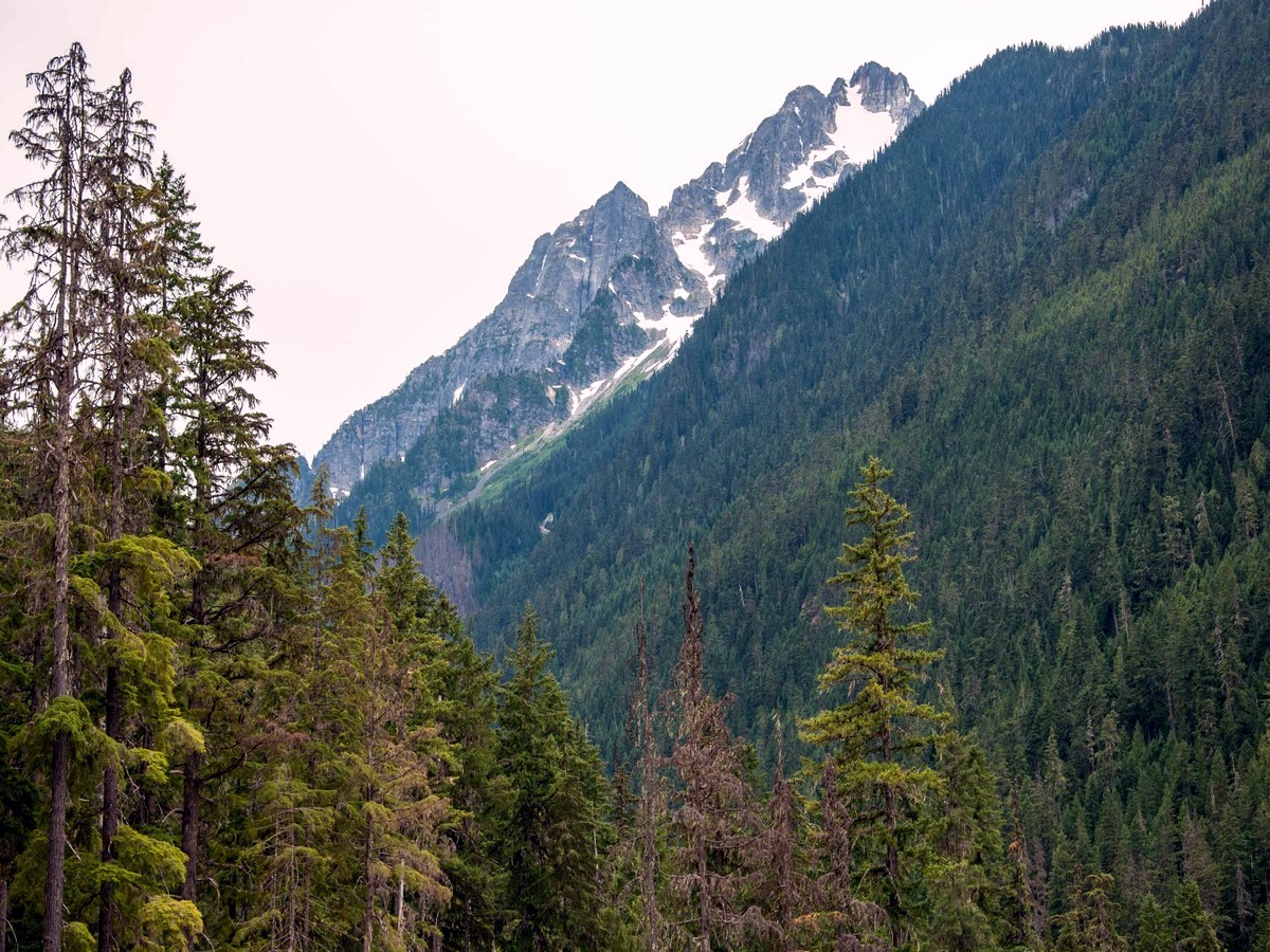
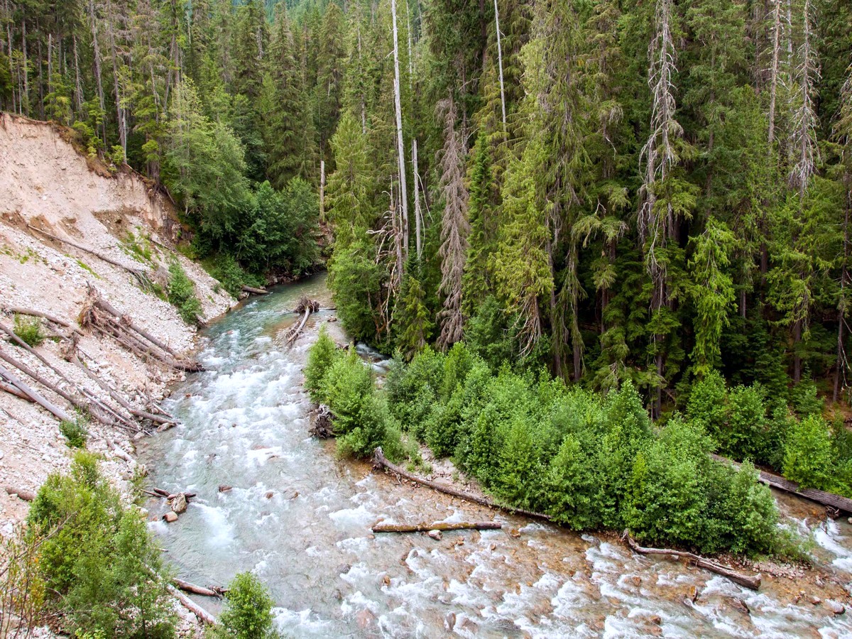
At 6.0mi reach the McAllister Horse Camp – not to be confused with McAllister Hiker Camp which is a little further along. The horse camp provides a good turnaround point, high above a big bend in the creek and a massive washout. Tricuoni Peak (8102ft) is clearly visible from here, along with numerous North Cascade mountains to the southwest and northwest. Return the way you came.
Want to find other amazing hikes in North Cascades National Park? Check out the Diablo Lake trail, Maple Pass Loop or the Cascade Pass trail.
Insider Hints
A free backcountry permit is required to camp overnight in North Cascades National Park. Stop at the Wilderness Information Center in Marblemount to obtain permits.
Camp at Colonial Creek Campground for easy access to the trail.

Similar hikes to the Thunder Creek Trail hike
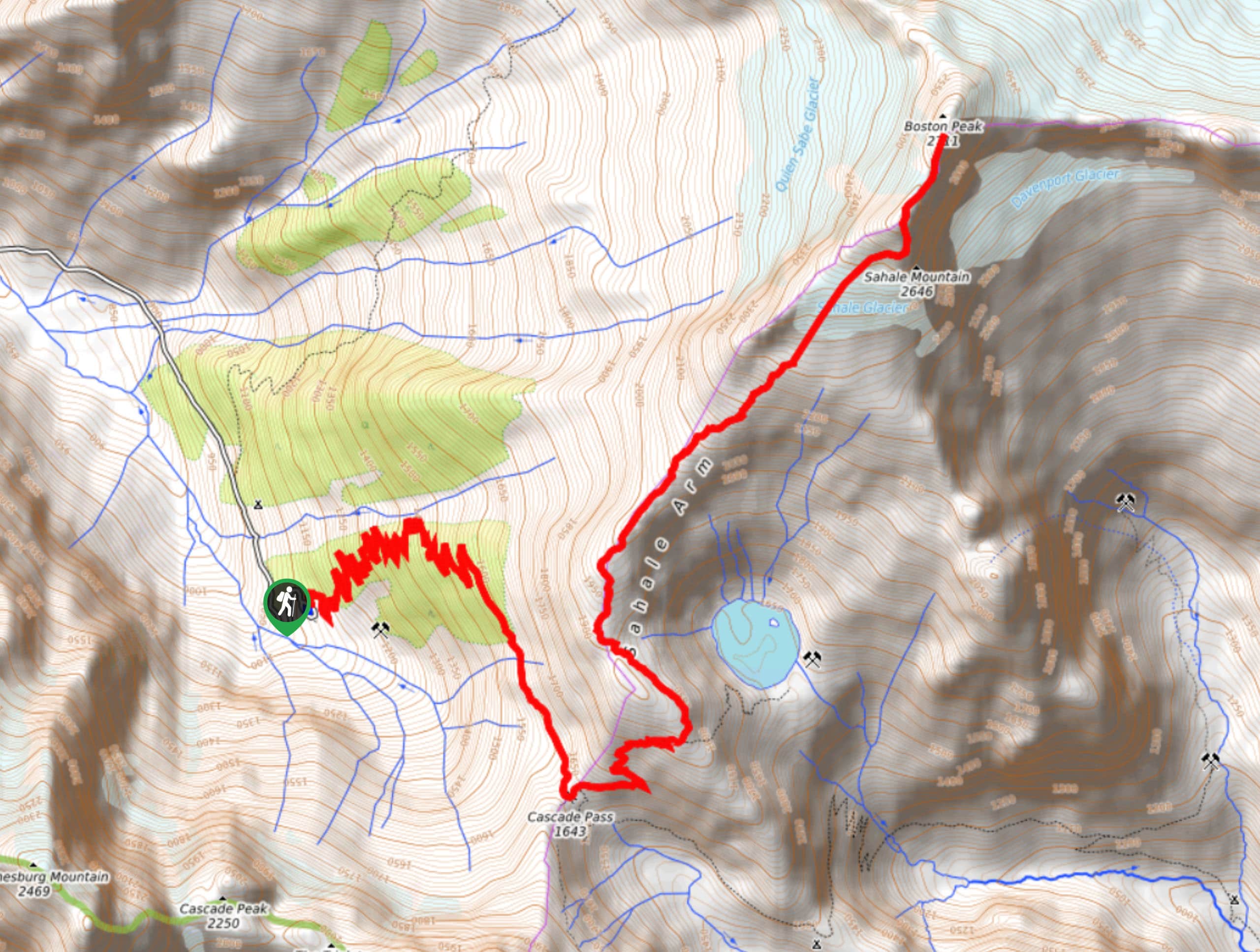
Sahale Arm Trail to Quien Sabe Glacier
Hike through one of the most jaw-dropping locations you can reach on foot in North Cascades National Park on the…
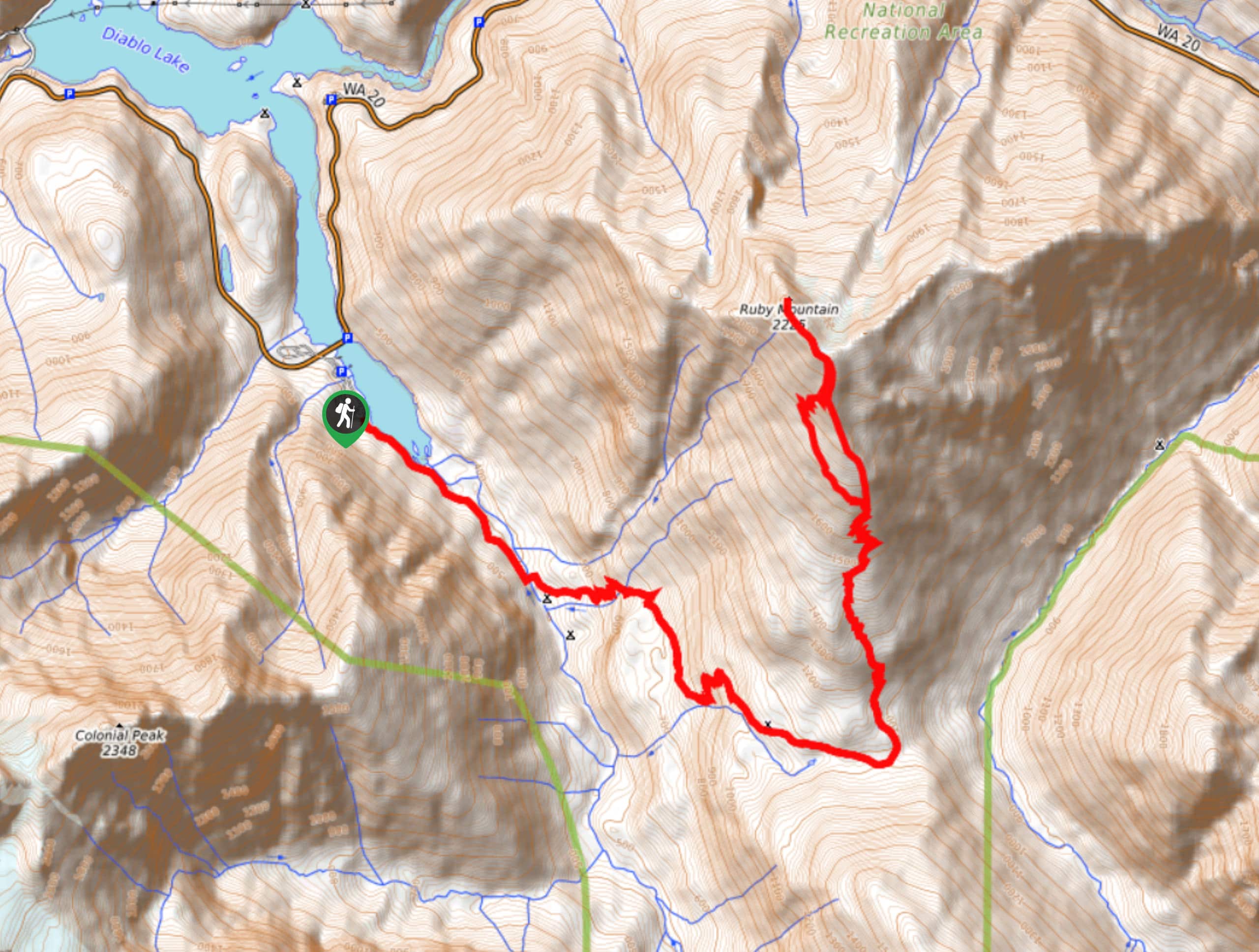
Ruby Mountain Summit via Fourth of July Pass and Thunder Creek
Ruby Mountain Summit via Fourth of July Pass and Thunder Creek is a hard hike used by both day hikers…
McGregor Mountain Trail
McGregor Mountain is a physically demanding trail with over 4265ft of elevation gain in North Cascades National Park.…
Papa smurph 4 years ago
Great trail! very easy and pretty
maxjohanson 4 years ago
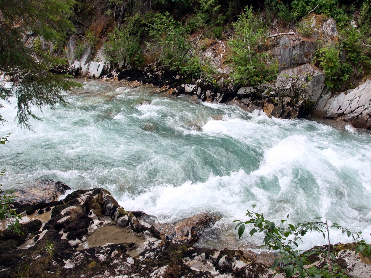
The color of the water and the mountains were amazing.
Abra Pepel 4 years ago
We has a pleasant daytrip! Looking forward to get a free backcountry permit next time to camp overnight.
Sally S. Norbert 4 years ago
It’s easy with little elevation gain. Wonderful place!
Lambert O 4 years ago
First time camping in Washington. Amazing experience!
Aleysha C. 4 years ago
what an awesome place! this was a great trail!
Miranda Q. 4 years ago
It was a cool hike. There are enough signages. I also appreciate the well-maintained paths.
Eli-Tim 4 years ago
A great backcountry experience! Thunder creek was majestic as well!
Wicked T 5 years ago
Loved the hike. did not plan to do a longer hike that day. Will consider making it a backpack in the future. Thanks for the tip
Cykelly 5 years ago
Thunder Creek was a nice day hike I've done. I expected a little more from it though. Moderate hike.