Maple Pass Loop
View Photos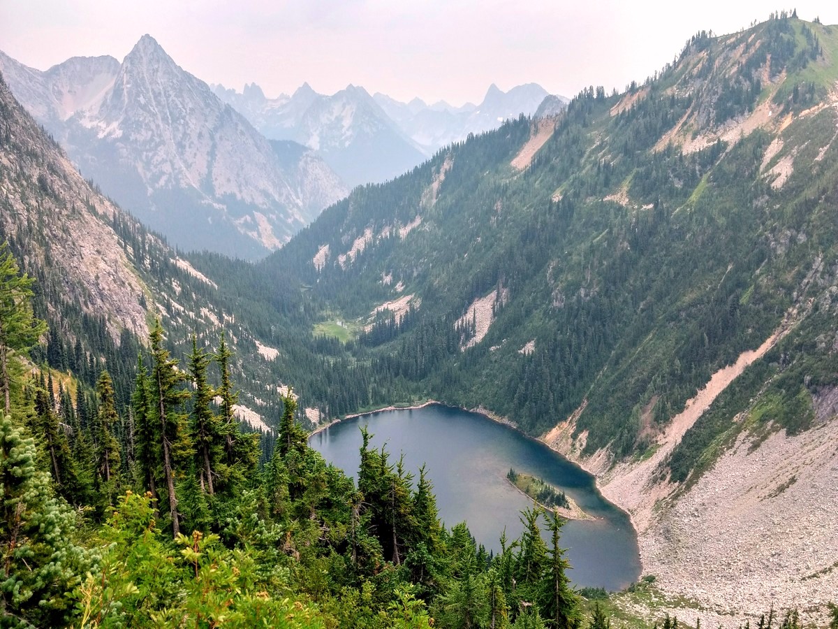
Maple Pass Loop
Difficulty Rating:
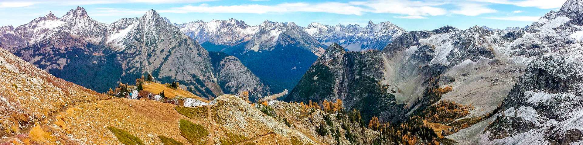
Hiking the Maple Pass Loop in the North Cascades is a gem. This is one of the finest trails in the North Cascades, and Maple Pass Loop is a stunner during its short season. Climbing high above alpine lakes, it skirts the North Cascades National Park boundary for views deep into the rugged and remote North Cascades. If you have time for just one North Cascades trail, this is the one.
Getting there
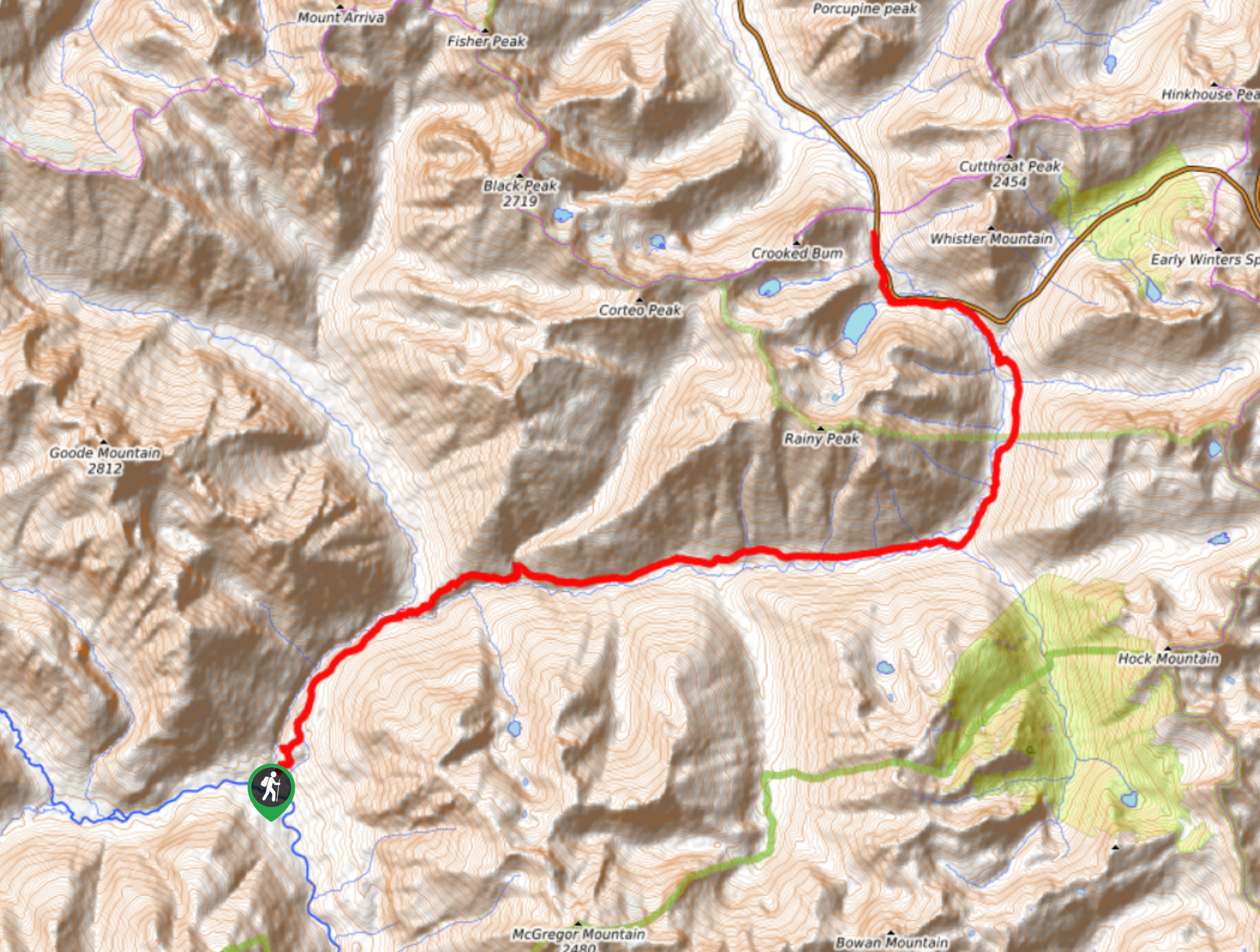
To get to the Maple Pass Loop trailhead, from Newhalem, drive 37.0mi east on Highway 20. The signed Rainy Pass Picnic Area trailhead is on the right (milepost 157). Northwest Forest Pass required.

About
| When to do | July to October |
| Backcountry Campsites | No |
| Toilets | Yes, at trailhead |
| Family friendly | No |
| Route Signage | Average |
| Crowd Levels | High |
| Route Type | Circuit |
Maple Pass Loop
Elevation Graph
Weather
Maple Pass Loop Trail Description
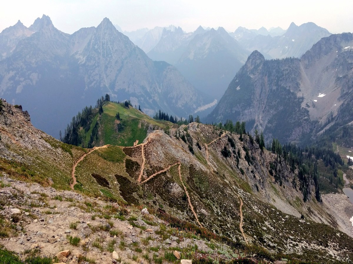
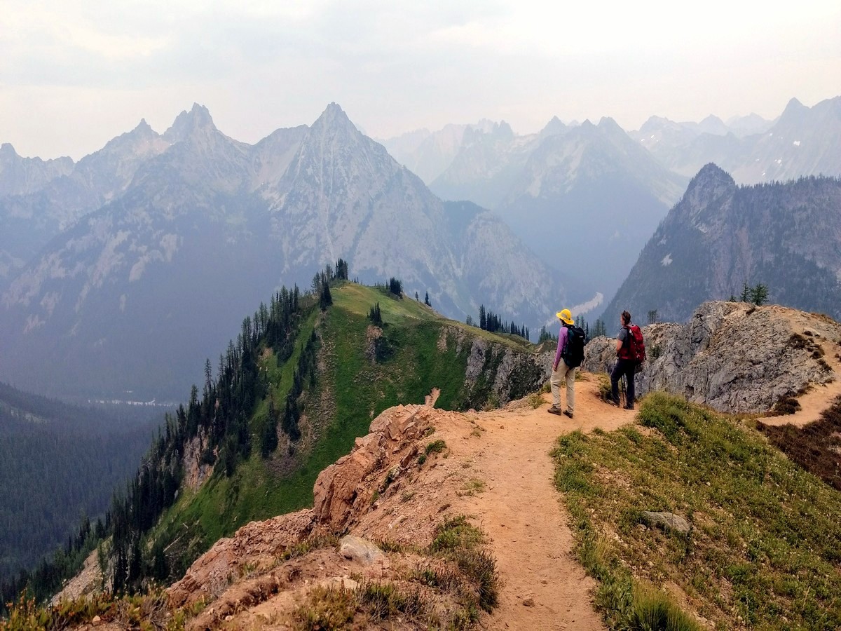
Wildlife, wildflowers, and wilderness – the Maple Pass Loop has it all. This hike takes you to a cirque-set alpine lake via a circuitous route around it. Those seeking a favorable bang-to-buck ratio need look no further – Maple Pass Loop is as good as it gets. The only thing you might miss here is solitude, as the easy trailhead access and stunning scenery make for a very popular trail.
Follow “Lake Trail” signs south from the parking area to the trailhead. Soon you’re presented with an option: to hike the trail clockwise or counter-clockwise. While both directions are of equal merit, we describe it counter-clockwise here. Take a right at the junction to begin climbing steadily through the forest.
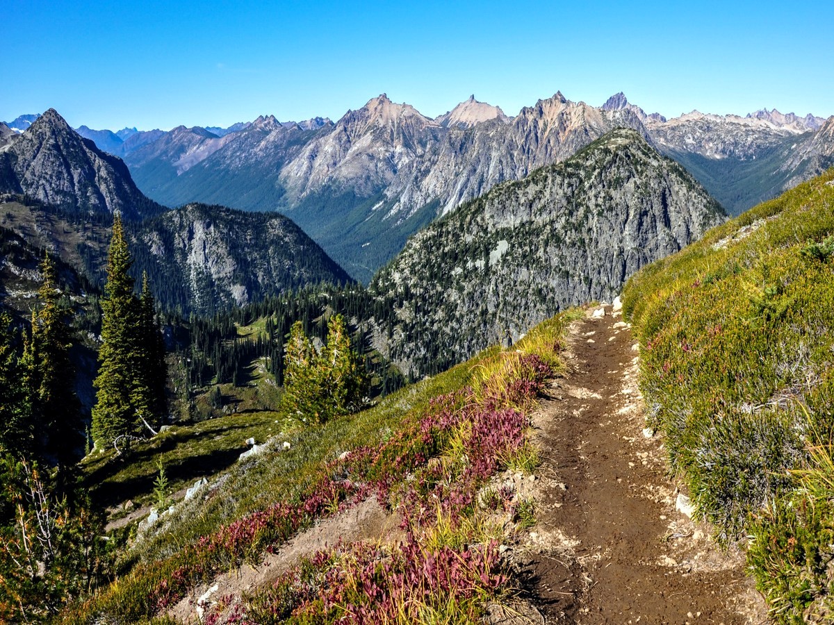
At 1.4mi, reach a junction. Stay right to continue on the main trail to Maple Pass, or take the short (0.5mi) detour out to Lake Ann. It’s worth the effort if you have time. Continuing on the main trail, views begin to open up over the lake. Switchbacks climb to Heather Pass at 2.4mi, where a sign announces the National Park boundary.
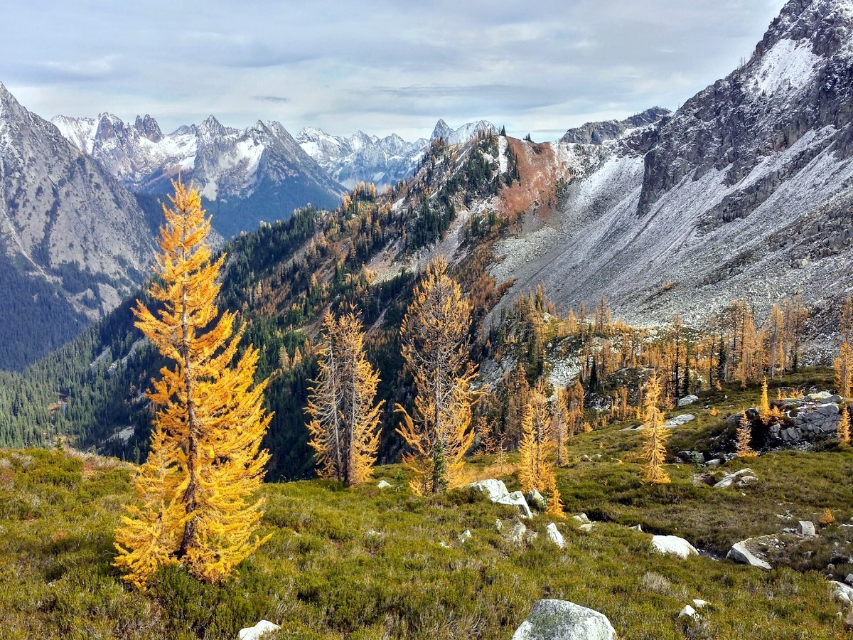
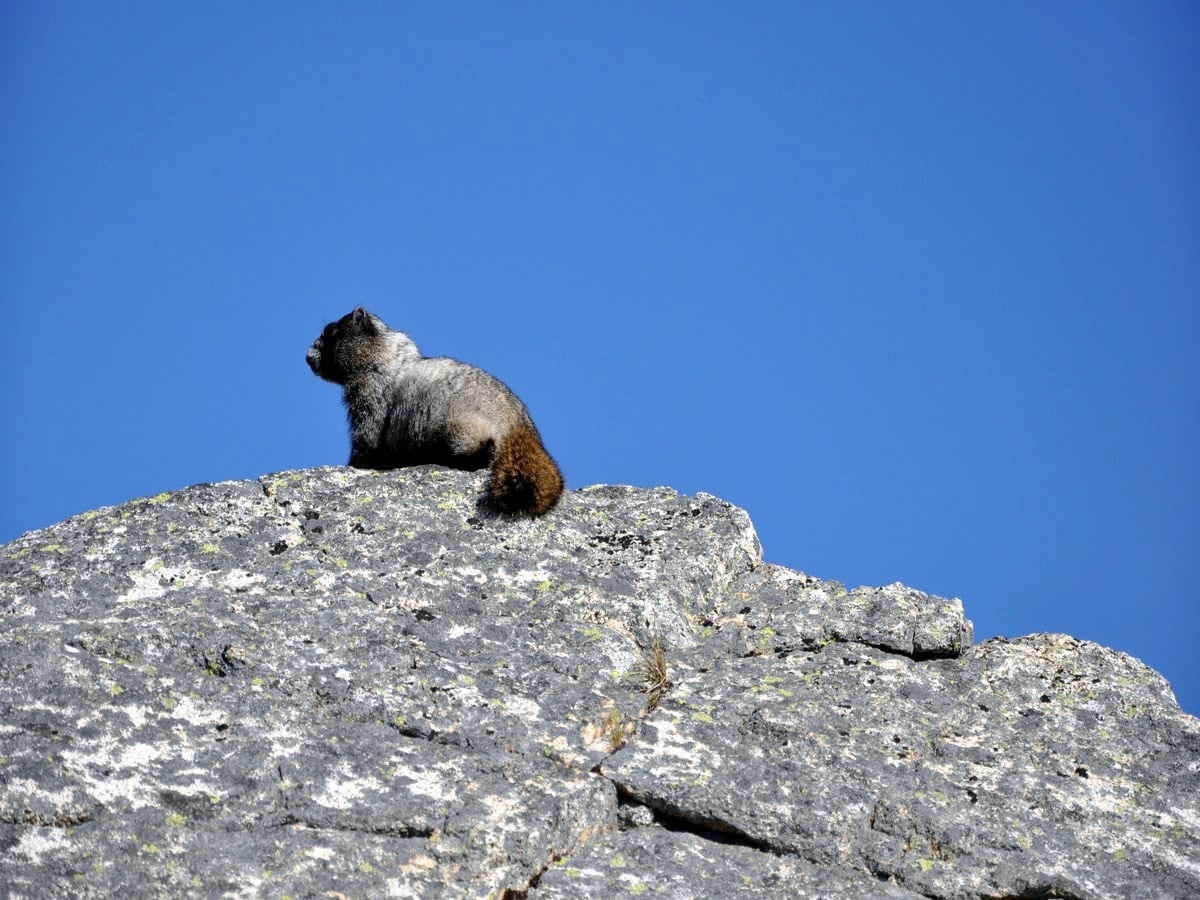
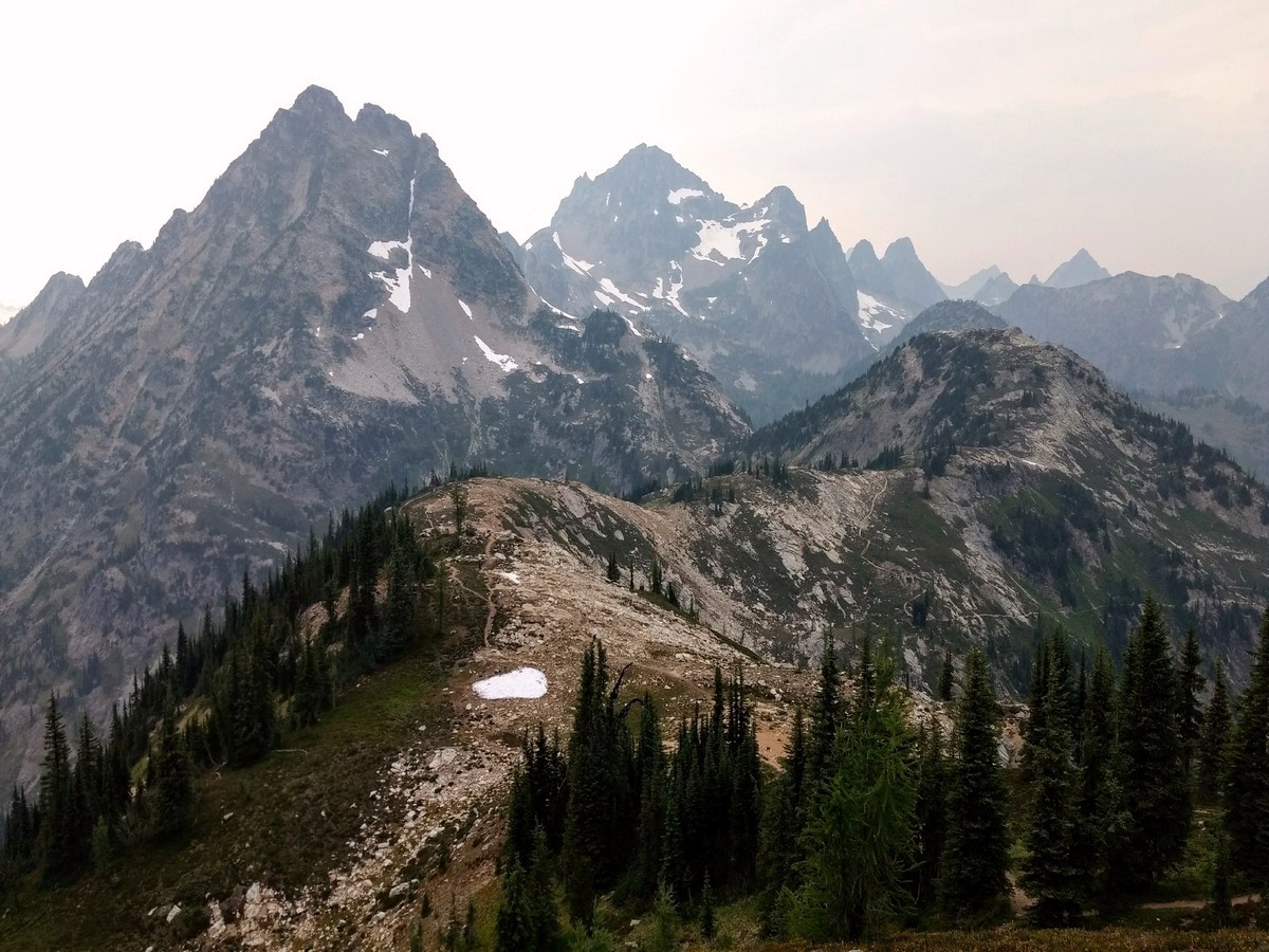
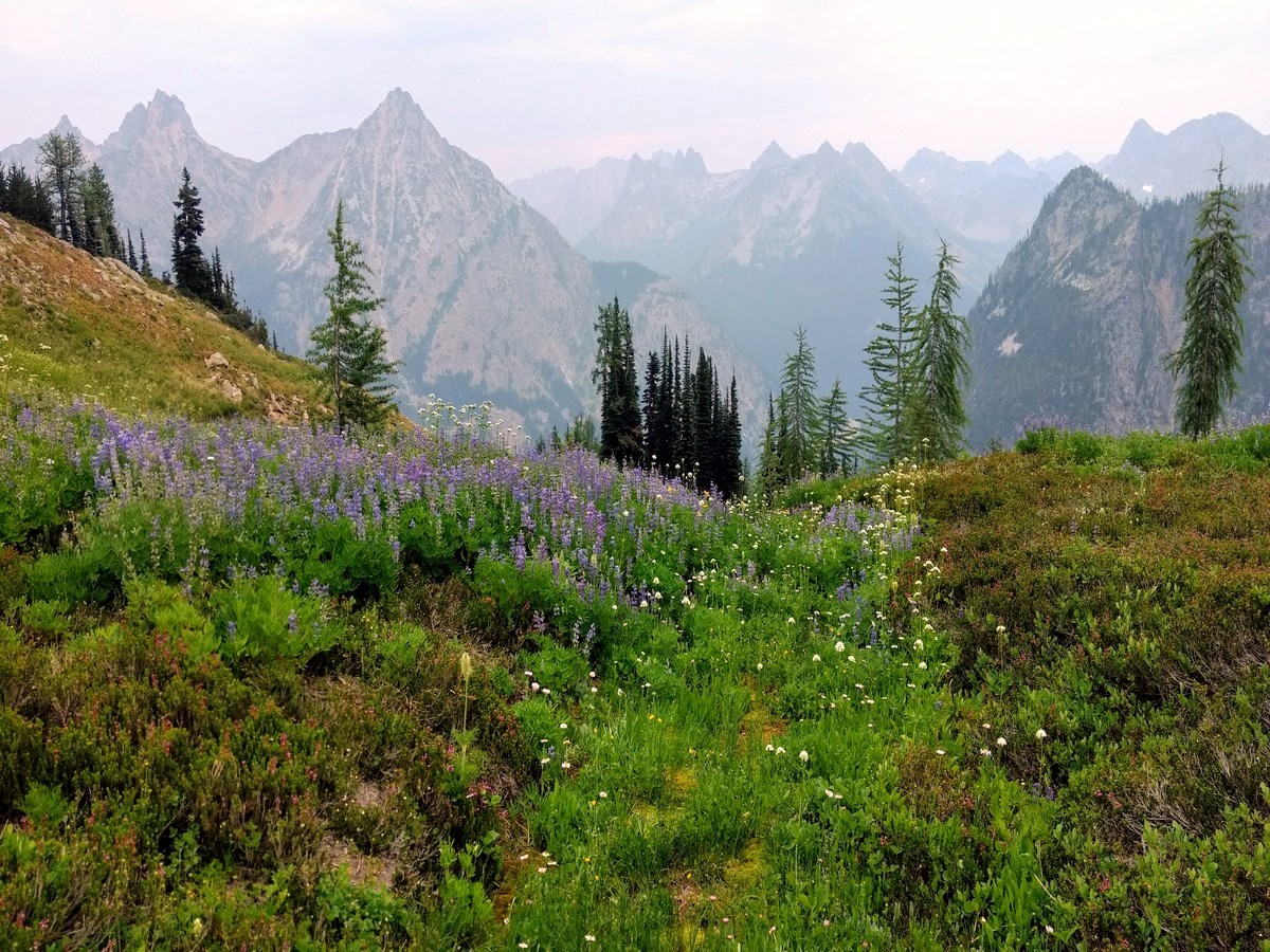
Hike along the wildflower-strewn ridgeline before climbing to Maple Pass – a high alpine zone above the treeline. Marmots like to sun themselves on the rocks in this area, so listen for their whistles. Views along this stretch are incredible in every direction. A few notable, nearby summits include Corteo Peak, Black Peak, Cutthroat Peak and Whistler Mountain – but there are far too many to name. To the south, Glacier Peak is visible on clear days.
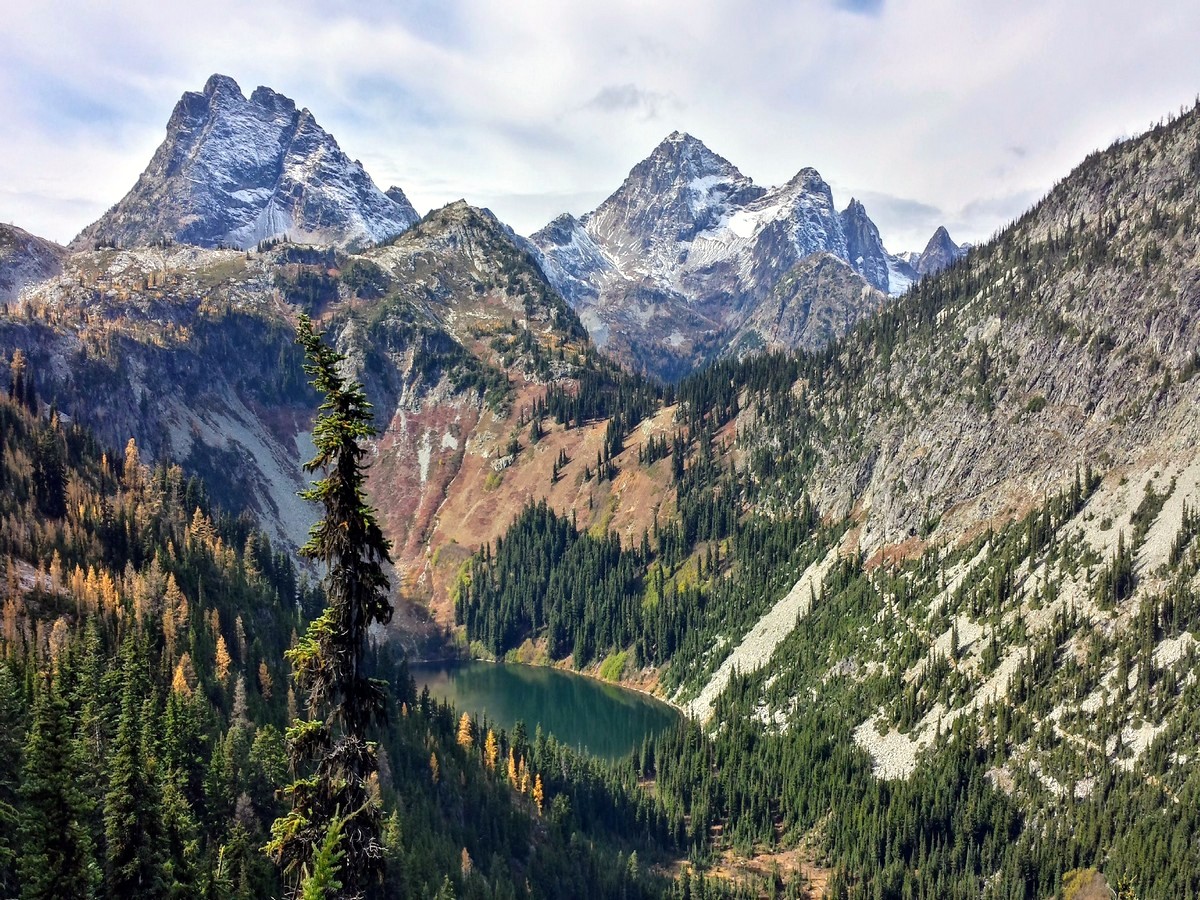
From the Maple Pass trail’s high point of nearly 7000ft, it drops rapidly along the ridgeline between Lake Ann and Rainy Lake. You’ll soon re-enter the forest, with peak-a-boo views down to Rainy Lake – fed by waterfalls – on your right. At 6.7mi reach a junction with the Rainy Lake Trail. Head left to follow this flat, paved trail back to the trailhead.
Hiking Trail Highlights
Cutthroat Mountain
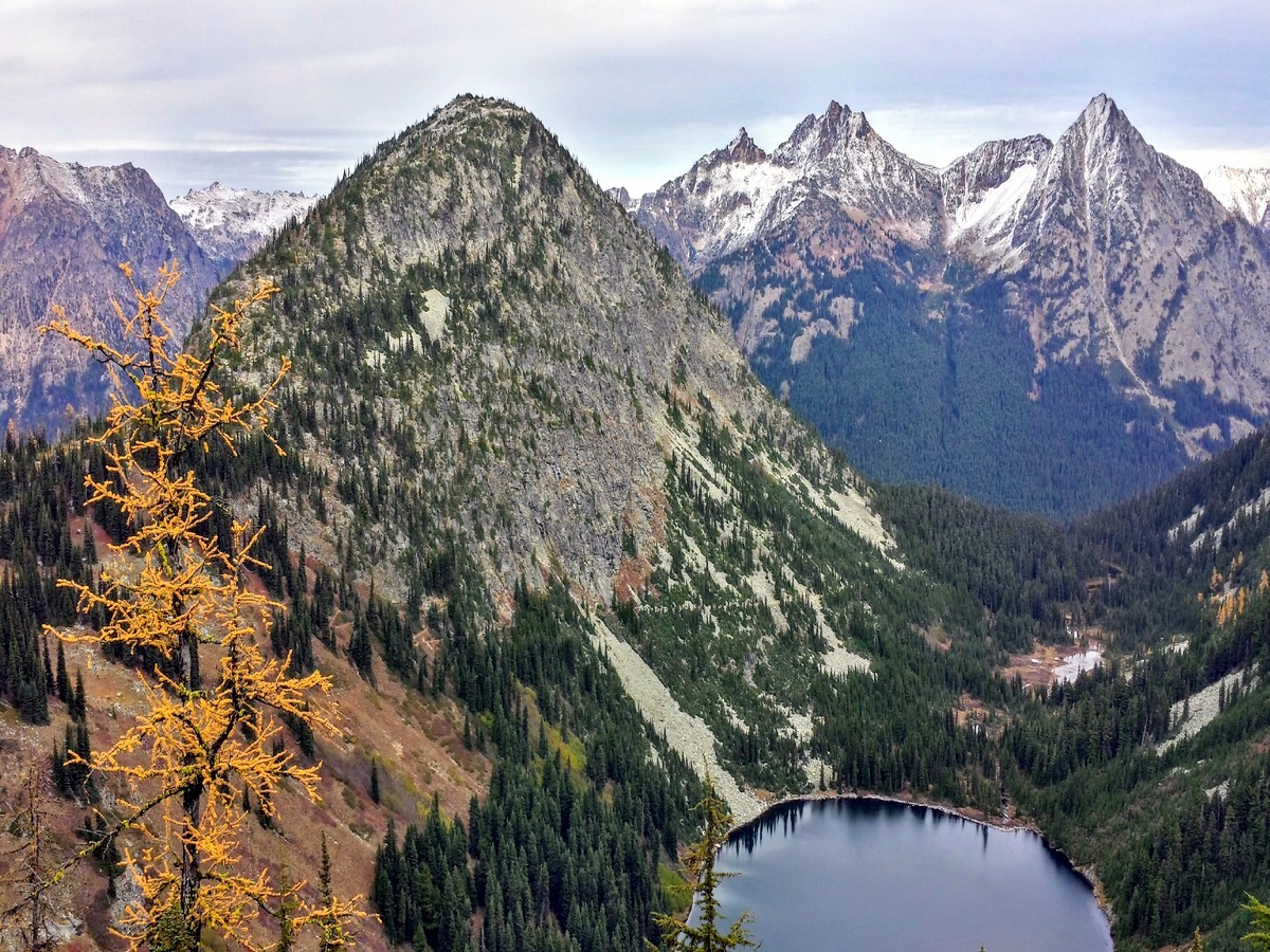
Cutthroat Mountain is a distinctive, rugged peak in the heart of the North Cascades, reaching an elevation of 8038ft2450m above sea level. Although from most perspectives it appears as a solitary, stand-alone tower, the mountain actually has two peaks, one to the north and one to the south.
Although Cutthroat Mountain, Cutthroat Pass and Cutthroat Lake (all found in the same vicinity) may sound rather ominous, the name comes from an unexpected source. Instead of referring to deadly bandits or murderous periods in the region’s history, the name is taken from the species of trout that populates the lake and nearby creek. Today, the threatening name contrasts with the serene tranquility of this beautiful part of the North Cascades.
Black Peak
Standing tall at an elevation of 8976ft, Black Peak is the 20th-highest peak in Washington State. This dark, looming mountain is especially rugged, even by North Cascades standards, and stands out from the rest of the peaks on this stunning hike. Surrounded by high mountain lakes, stunning larch forests, beautiful meadows and plunging cliffs, Black Peak is one of the most striking areas in the North Cascades range.
Lake Ann
Lake Ann sits just outside the boundaries of the North Cascades National Park, but it is certainly one of the prettiest lakes in the region. Set in a dramatic cirque and surrounded by dark, craggy rocks, the view over the lake from the main Maple Loop Pass hike is simply spectacular. A small, picturesque island sits in the middle of the lake, and the view over the turquoise waters from high on the trail is magnificent. It’s no wonder that this lake features on many classic photos of the North Cascades region.
Want to find other amazing hikes in North Cascades National Park? Check out the Diablo Lake trail, or the Cascade Pass trail.
Insider Hints
Visit Maple Pass during the fall for spectacular fall colors. Golden larches are a big attraction here.
Bring plenty of water, as there are no sources above the lakes.
Please respect the fragile meadows and wildlife by staying on the trail.

Similar hikes to the Maple Pass Loop hike
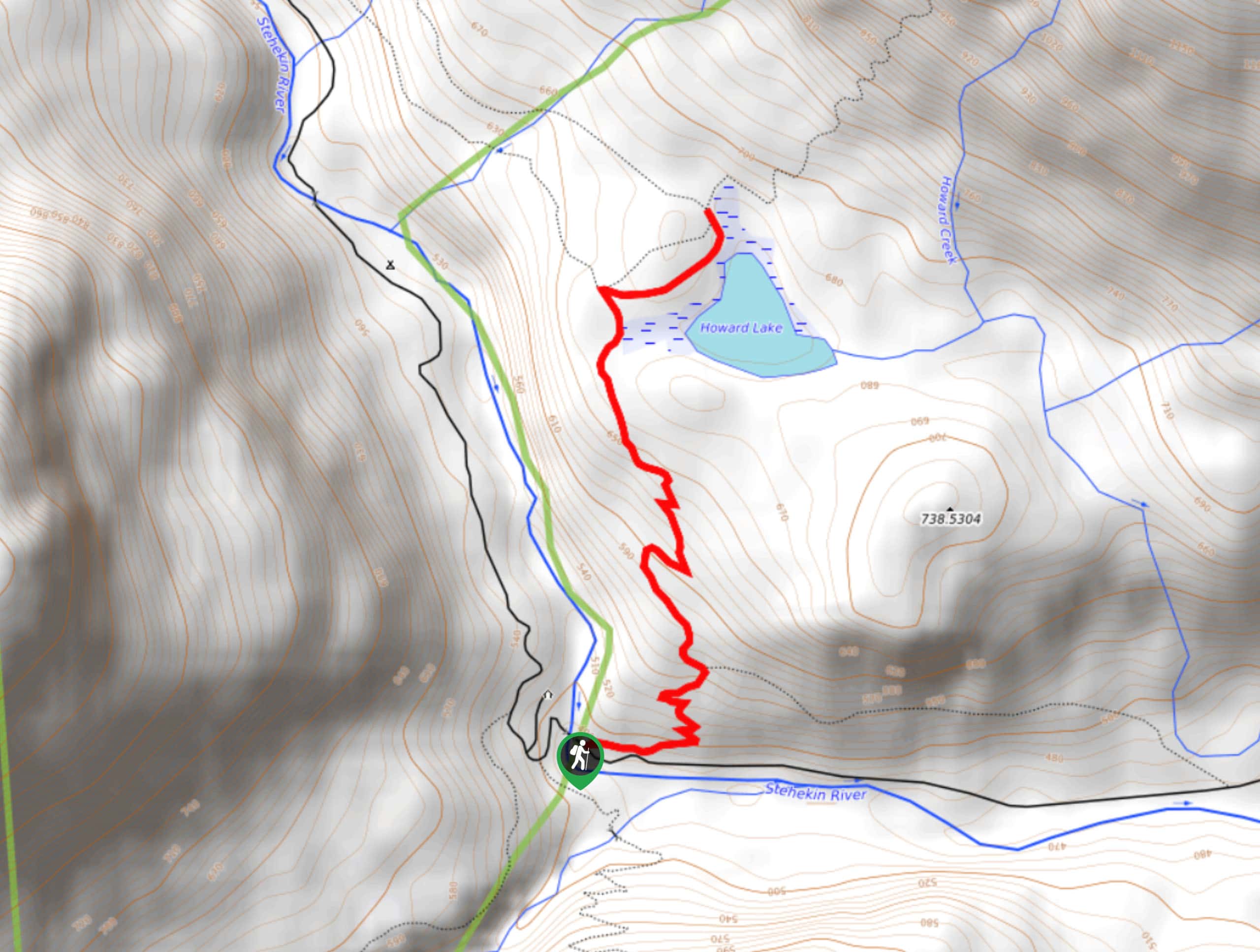
Howard Lake via PCT
Howard Lake via PCT is a pretty hike through the woods. It’s consistently uphill for its short ascent, but you’ll…
Bridge Creek Trail
Bridge Creek Trail is a 13.9mi route in North Cascades National Park that is considered hard. This is…
Old Wagon Trail
The Old Wagon Trail is a moderate trail that runs the Pacific Crest Trail. A hike on Old Wagon takes…
Miranda Q. 4 years ago
For me Black Peak is the highlight of the trip. it was very unique and charming!
maxjohanson 4 years ago
Wonderful place! Would love to visit again!
E.david 4 years ago
There is so much beauty in this hike.
Sally S. Norbert 4 years ago
The views from Maple pass trail are amazing. The wildflower fields and valley views were gorgeous.
Lambert O 4 years ago
Not too hard trail with beautiful views
Jellybean 4 years ago
Beautiful from ground to peak! Lakes, snow capped mountains, waterfalls, wildlife. It’s all there.
Aleysha C. 4 years ago
It is gorgeous with many off shute trails to Lakes. Wonderful hike!
Stewart Graham 4 years ago
This trail can get busy because of easy access but the higher you go, the fewer the people and the better the views.
footfall 4 years ago
Pretty moderate hike with a high reward of incredible views all the way up!
HIllaryPNW 4 years ago
Probably one of the most beautiful hike I have ever done. You must be a seasoned hiker to do this loop.