Cutthroat Pass hike
View Photos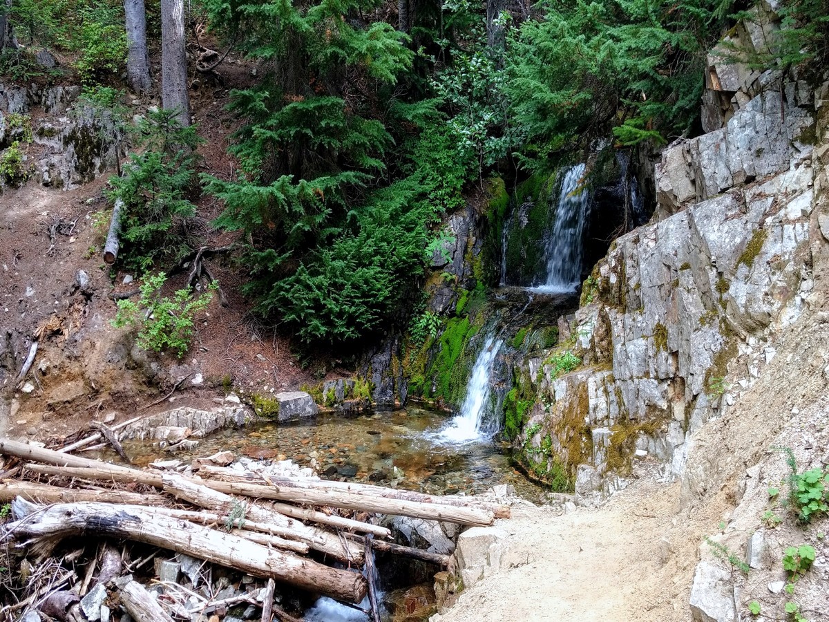
Cutthroat Pass hike
Difficulty Rating:
The Cutthroat Pass hike is said to be one of the most scenic stretches of the Pacific Crest Trail in Washington State. This moderate, 10.2mi hike offers outstanding mountain views from the 6800ft Cutthroat Pass. We Love it!
Getting there
From Newhalem, drive east on the North Cascades Highway (Highway 20) for 37.0mi to Rainy Pass. Turn left into the signed trailhead parking area on the north side of the road. Northwest Forest Pass required.

About
| When to do | July - October |
| Backcountry Campsites | No |
| Toilets | Yes, at trailhead |
| Family friendly | No |
| Route Signage | Average |
| Crowd Levels | High |
| Route Type | Out and back |
Cutthroat Pass
Elevation Graph
Weather
Route Description for Cutthroat Pass
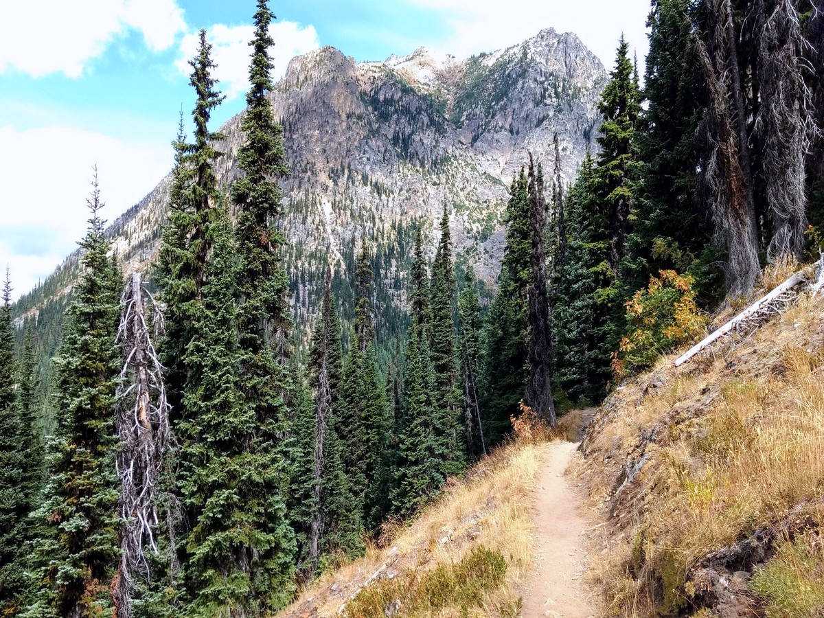
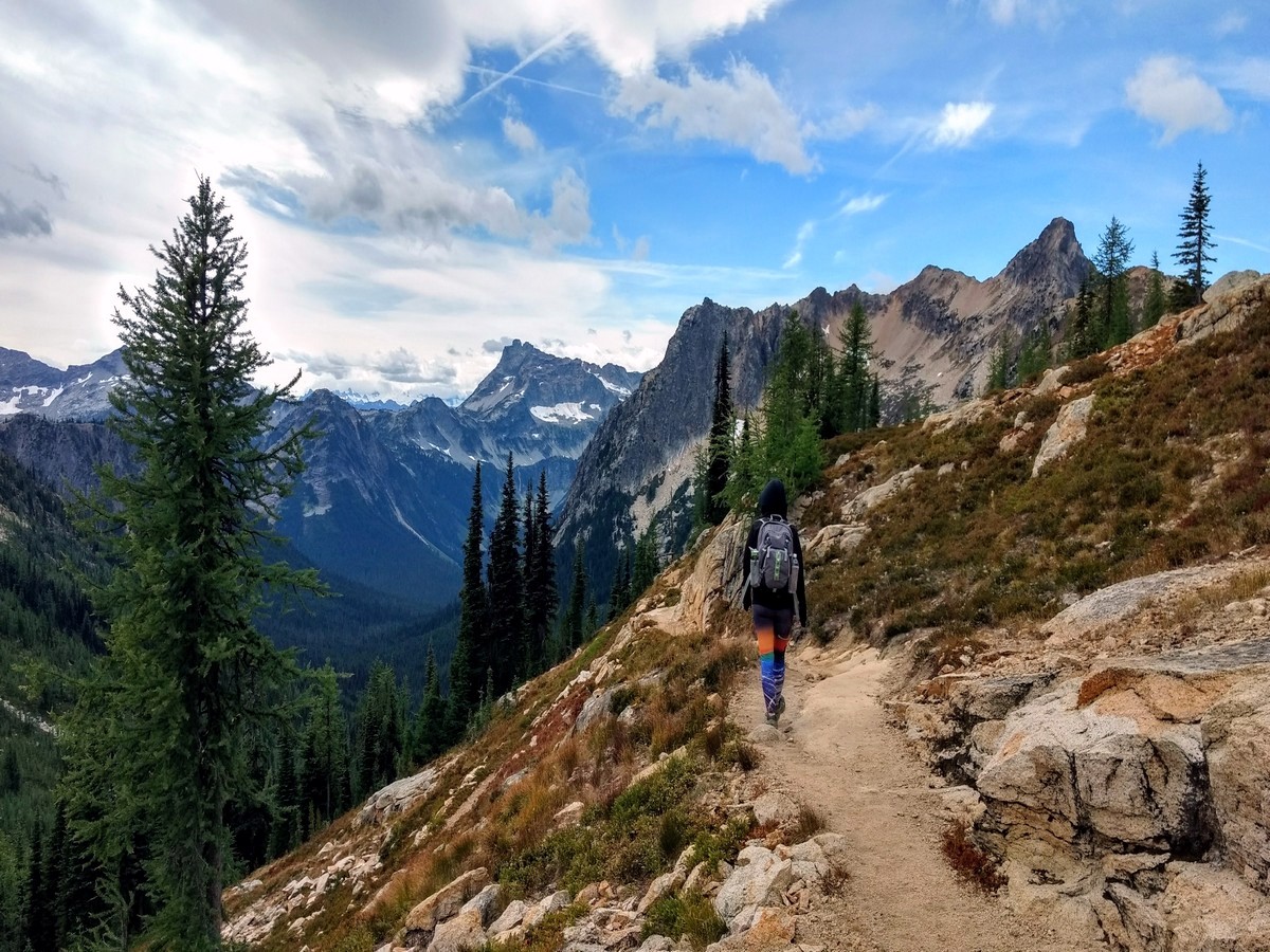
There is more than one way to reach Cutthroat Pass. By hiking the Pacific Crest Trail (PCT) north from Highway 20, you can enjoy a wide, moderately graded, and well-maintained path the entire way. Because it was originally graded for pack animals, the PCT never gets too steep. The miles breeze by with little effort, and before you know it you’ll be at Cutthroat Pass.
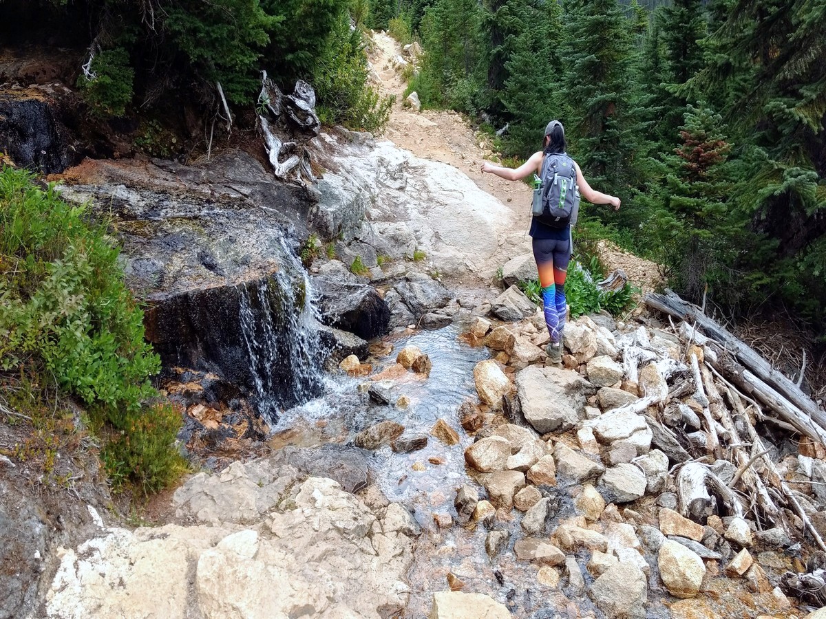
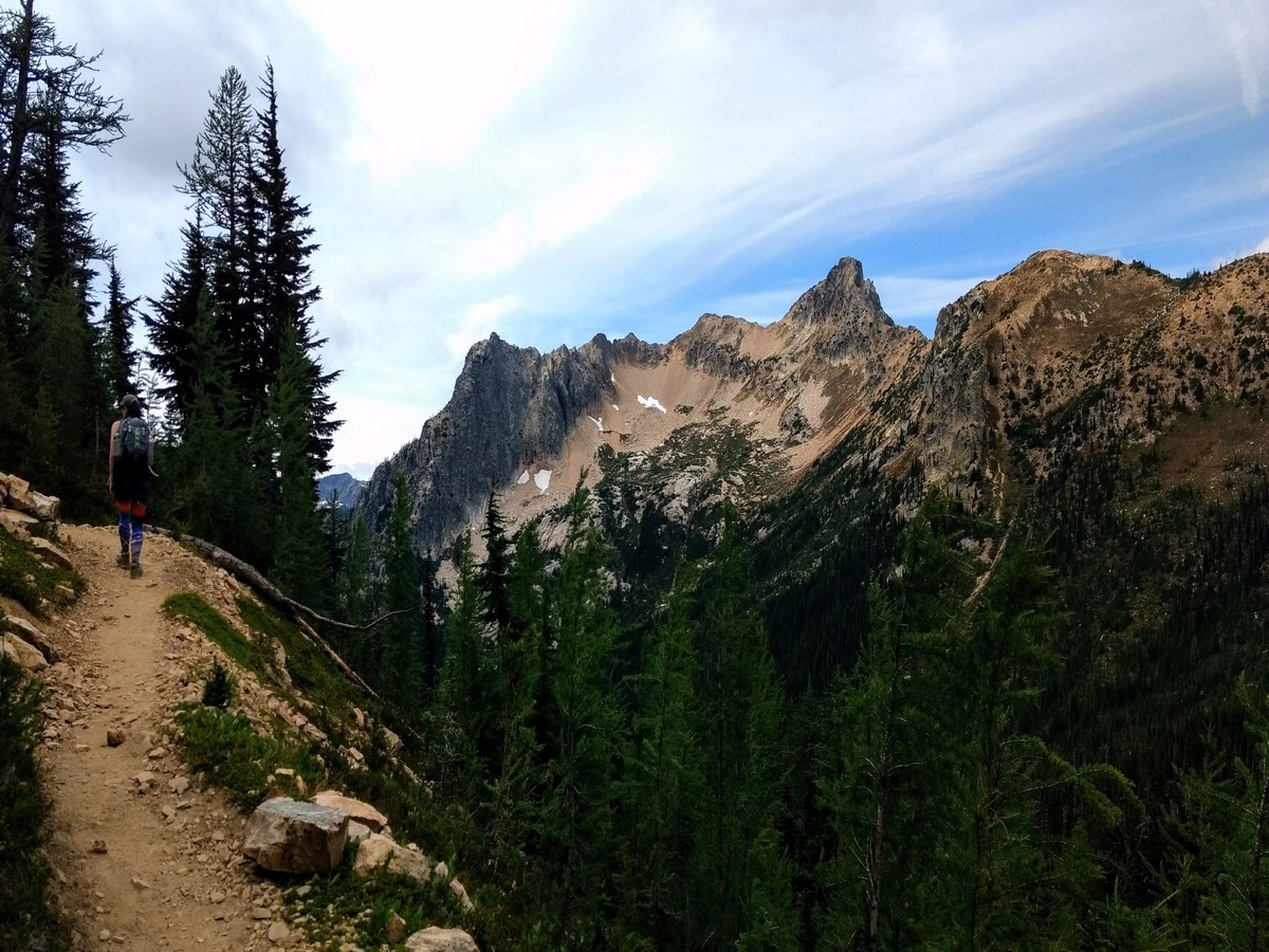
Begin hiking north through dense forest. Creek crossings keep it interesting along the way, though they are generally easy to pass. The first views open up at 1.0mi – a small glimpse of what’s to come. At 1.8mi cross Porcupine Creek, then begin to climb more steadily. Trees thin over the next 1.0mi or so, and the trail pops out into alpine scenery around the 3.0mi mark.
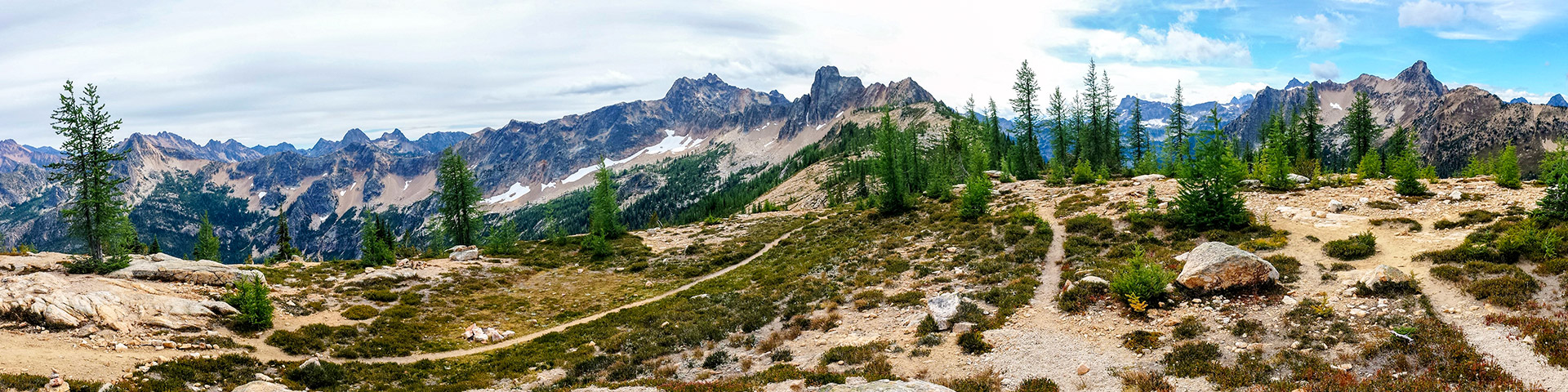
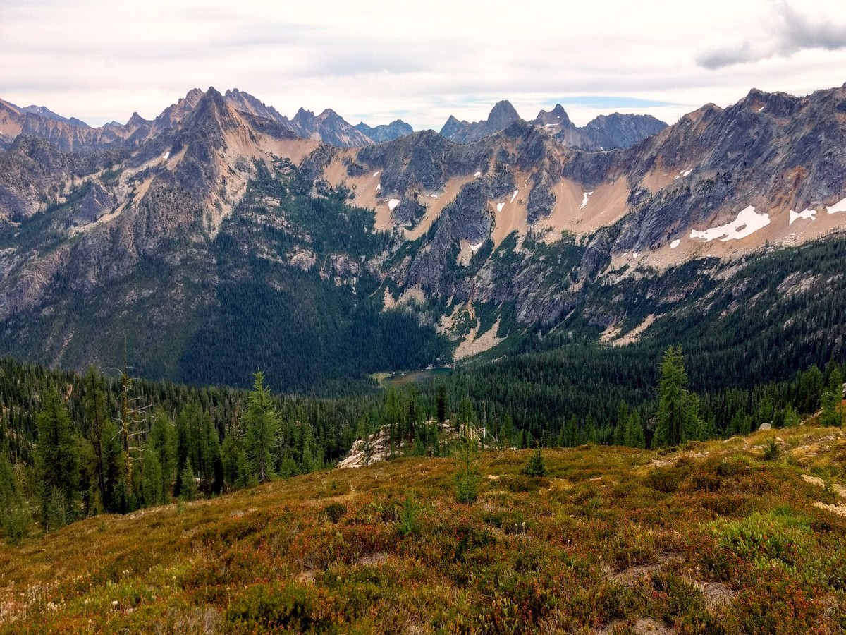
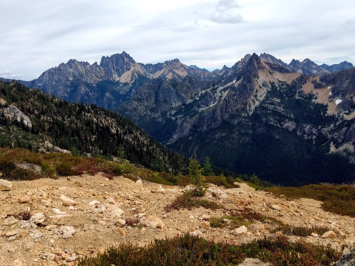
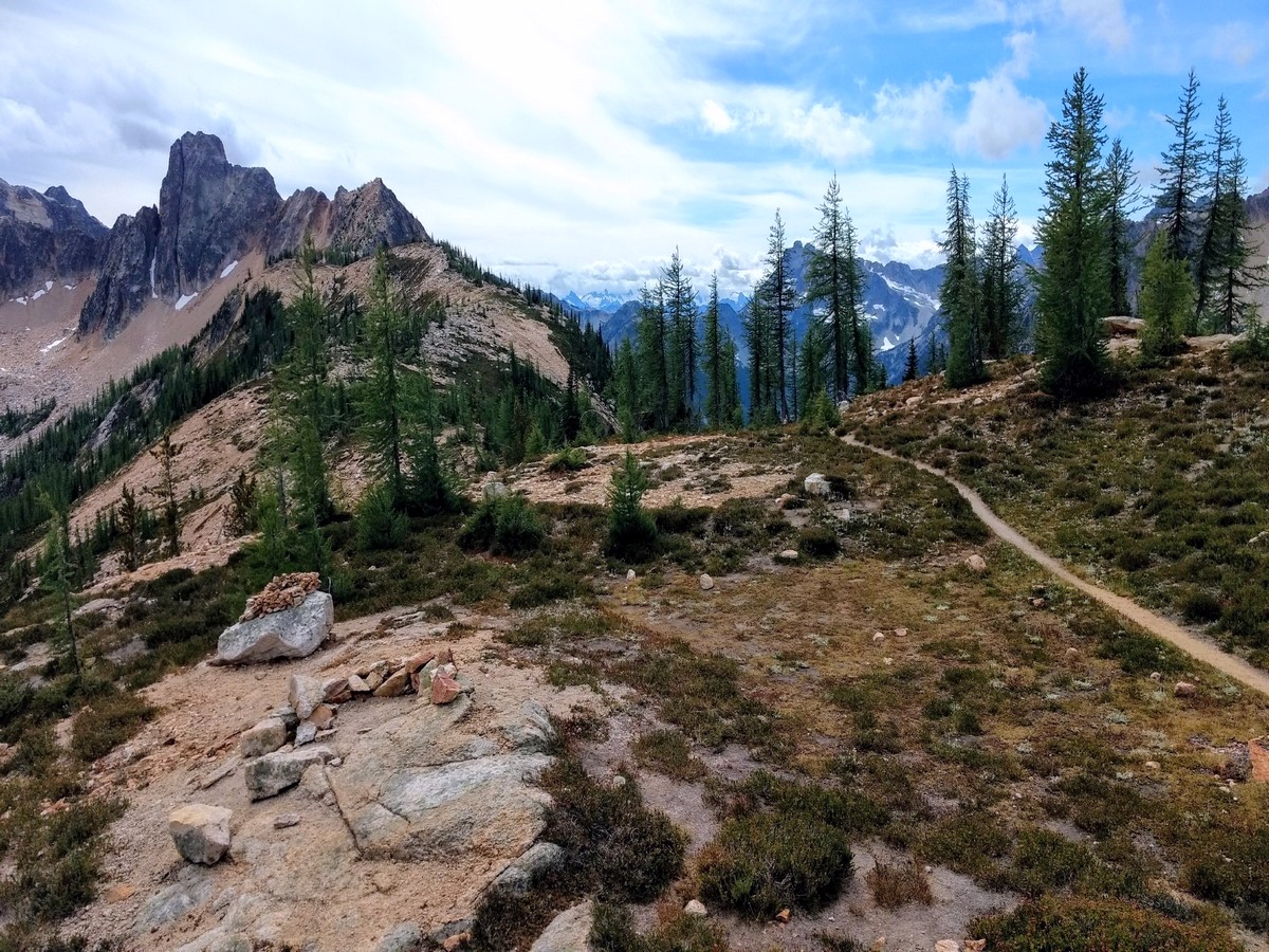
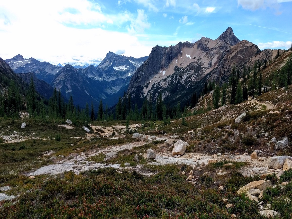
In another 1.0mi the switchbacks begin, eventually delivering you to Cutthroat Pass. Views throughout this section are wide open towards Porcupine Peak, and larches line the trail. At 10.0mi, reach Cutthroat Pass and a junction. The PCT continues north from here to Canada, while the trail to the right drops to Cutthroat Lake – visibly sparkling below.
Find a lunch spot among the granite here, and see how many mountains you can name. Consider a short side trip to the knoll south of the pass. From here, 360-degree North Cascade mountain views await. Hinkhouse Peak, Silver Star Mountain, and of course Cutthroat Peak dominate the skyline.
Want to find other amazing hikes in North Cascades National Park? Check out the Diablo Lake trail, Maple Pass Loop or the Cascade Pass trail.
Insider Hints
Hike to Cutthroat Pass during fall to see the golden larches.
Consider extending your hike one mile north on the PCT to Granite Pass for additional wonderful views.

Similar hikes to the Cutthroat Pass hike
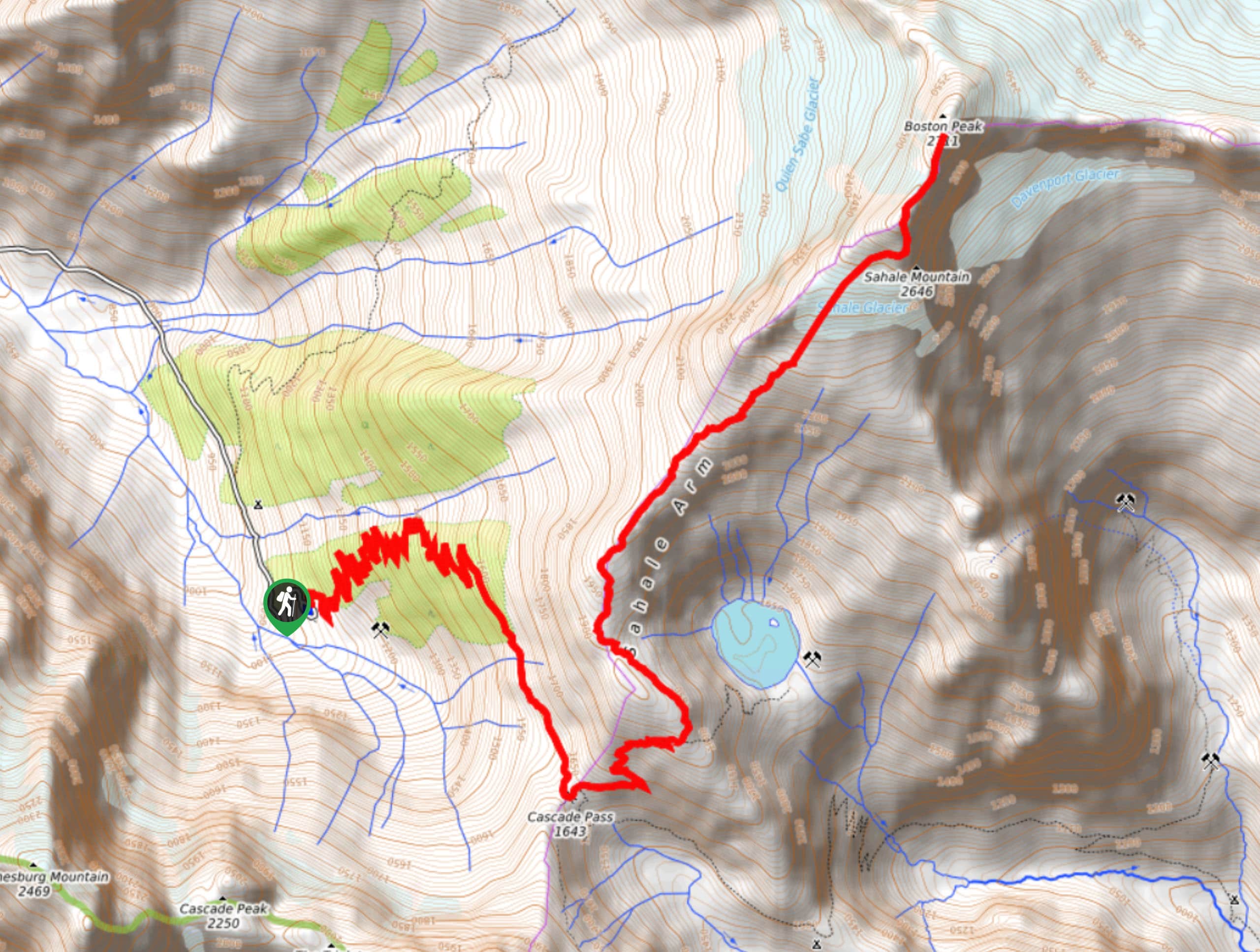
Sahale Arm Trail to Quien Sabe Glacier
Hike through one of the most jaw-dropping locations you can reach on foot in North Cascades National Park on the…
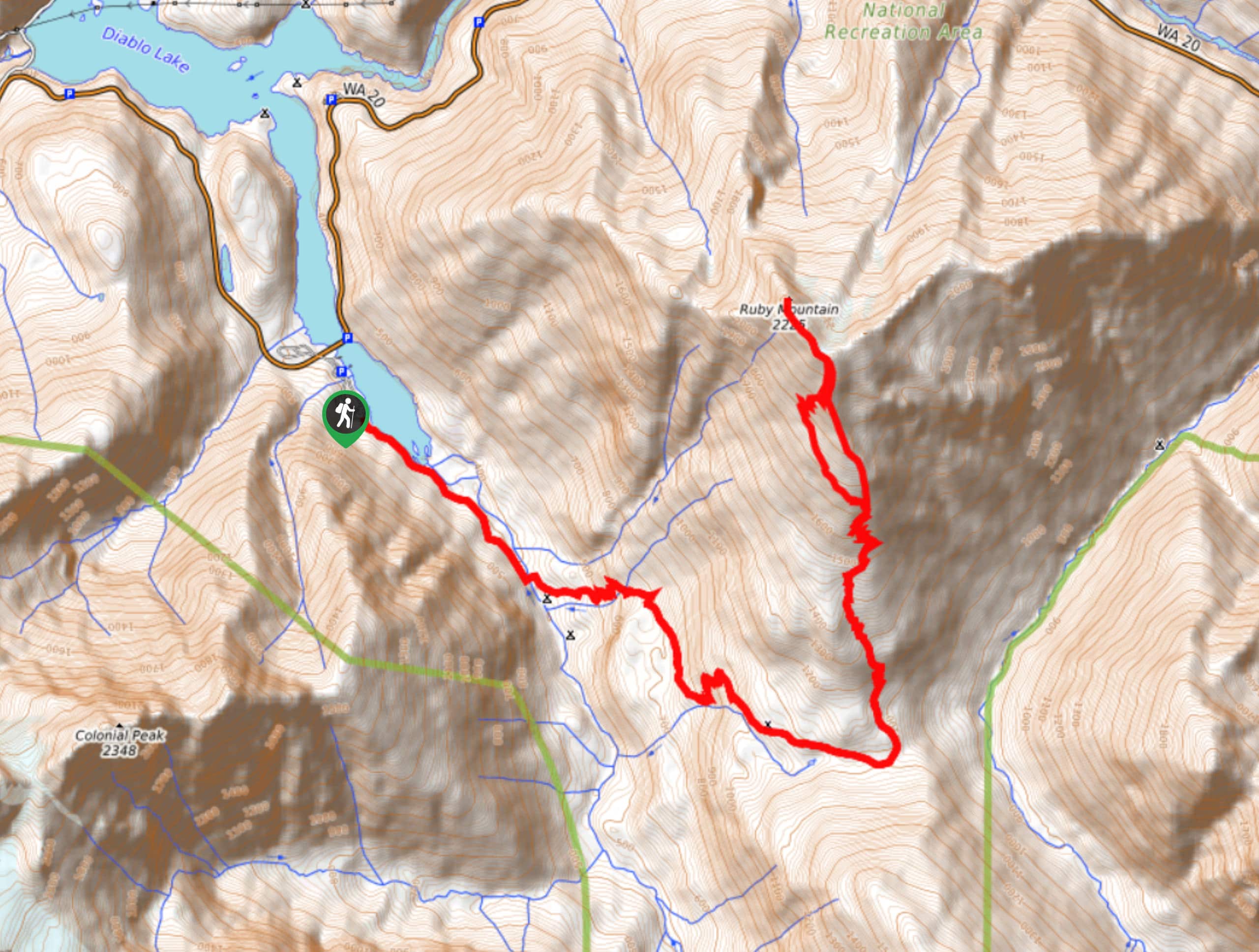
Ruby Mountain Summit via Fourth of July Pass and Thunder Creek
Ruby Mountain Summit via Fourth of July Pass and Thunder Creek is a hard hike used by both day hikers…
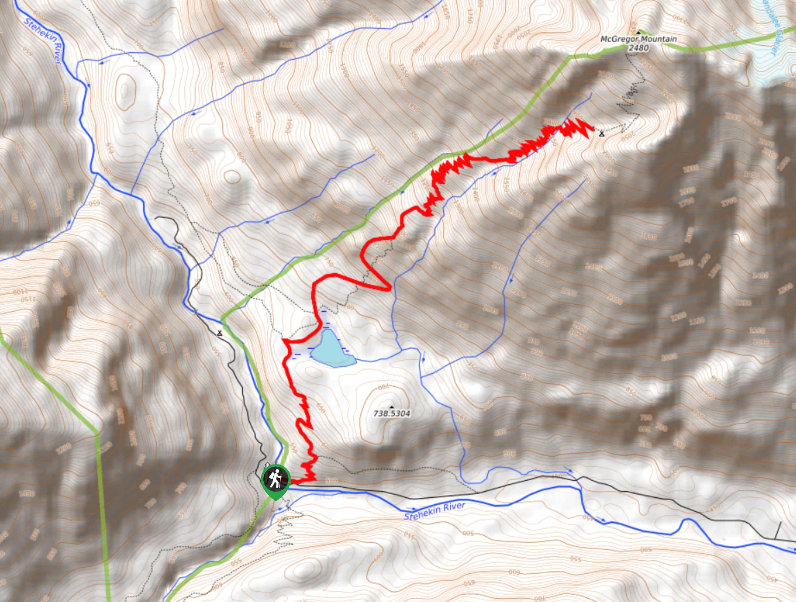
McGregor Mountain Trail
McGregor Mountain is a physically demanding trail with over 4265ft of elevation gain in North Cascades National Park.…
Papa smurph 4 years ago
Mountains dotted with yellow larches come into view, and you quickly get up close and personal to these deciduous conifers on the way to the pass. Gorgeous!
Kohaku Ichinose 4 years ago
It was popular. I just found out when I did it. They all busy taking pictures. ◔_◔
Lambert O 4 years ago
Awesome hike!! This was one of the most beautiful trails that I have ever done
Aleysha C. 4 years ago
The road up to Hart's Pass is rough but well worth the effort. Camping at the pass is great.
Felipe III 5 years ago
Worth every effort! Nice views at the top. Interesting trails with some creek crossings.
Seymor H. 5 years ago
It was one hell of a climb, but It's absolutely awesome! One of the most scenic hikes in the park.
Jordan Cohen 5 years ago
Phenomenal scenery! The flora and fauna in this hike were incredible.
Allon FT 5 years ago
Amazing hike to do! The alpine scenery was magnificent.
Otis 5 years ago
Reaching Granite pass is worth adding to this hike as it's not too far away and offers different views
Cykelly 5 years ago
A bit crowded for the level of effort. Usually the harder the hike, the fewer the people. But Cutthroat pass was quite a popular destination the day I went.