Skutz Falls to 66 Mile Trestle
View Photos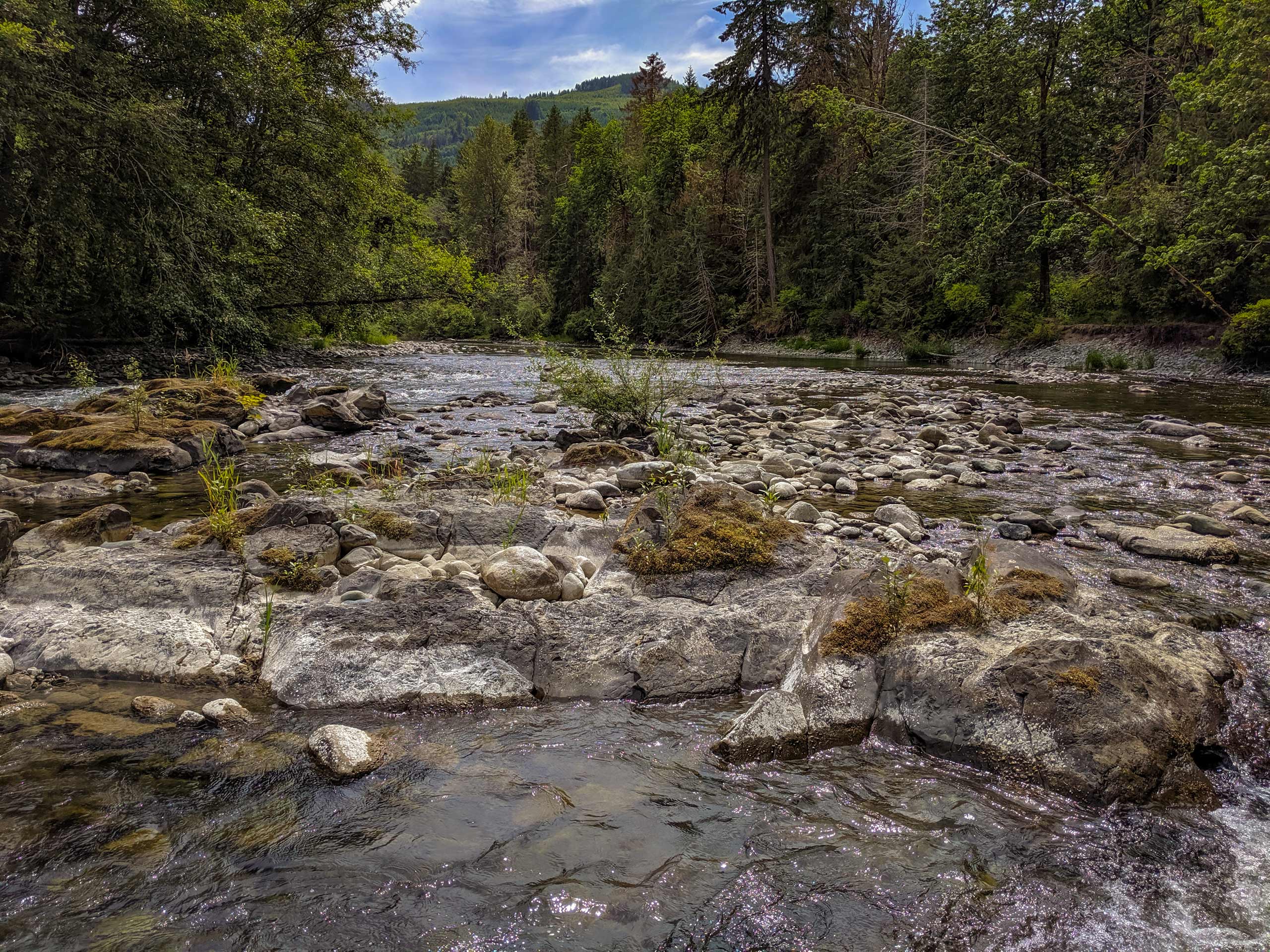
Skutz Falls to 66 Mile Trestle
Difficulty Rating:
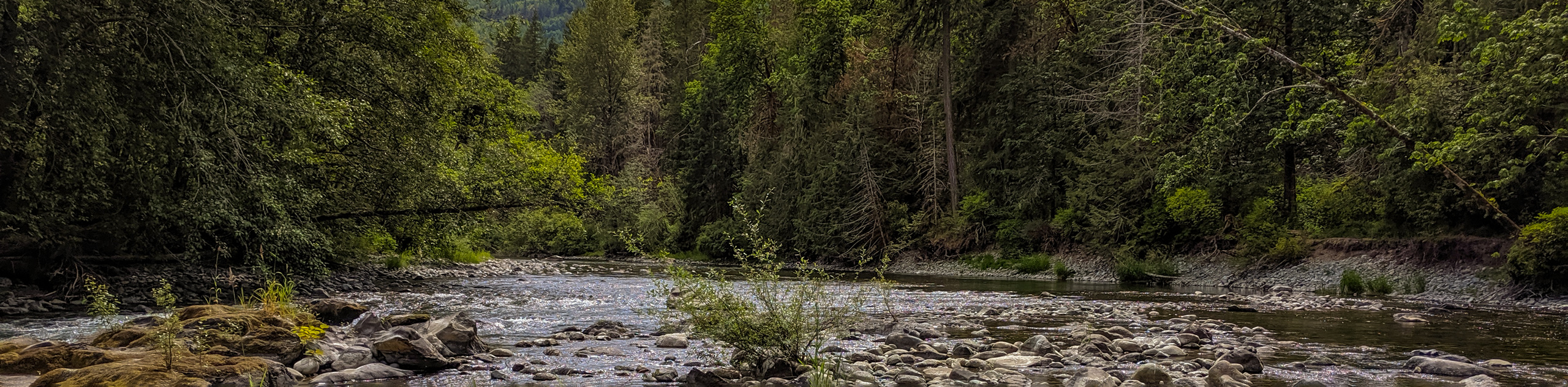
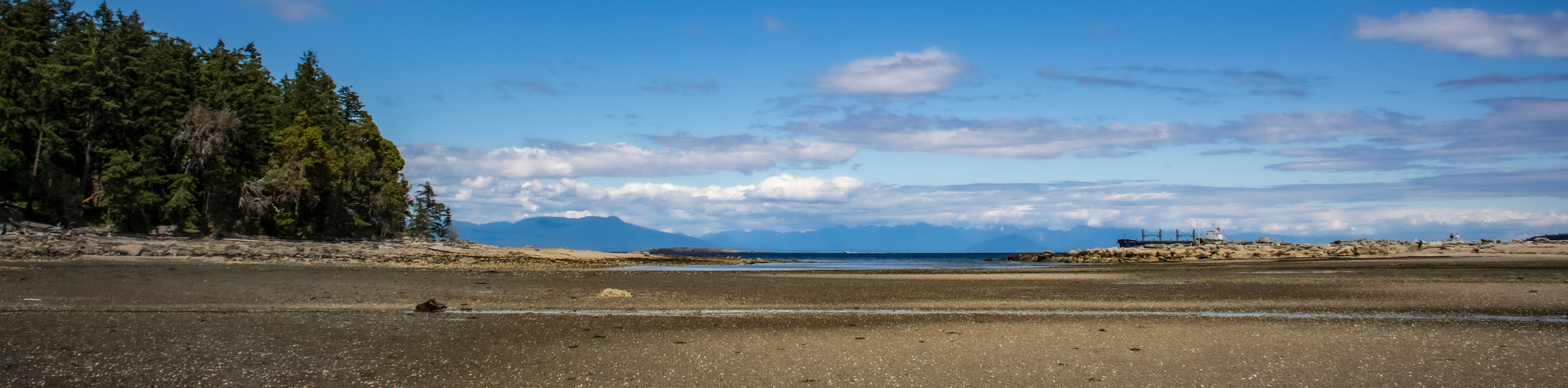
The Skutz Falls to 66 Mile Trestle trail is a 4.3mi hiking circuit west of Duncan, BC that loops around the Cowichan River to provide views of a beautiful old railway trestle. While out on this hike, you will enjoy a peaceful forest setting with breathtaking views across the rushing water of the river, gushing waterfalls, and of course the mammoth wooden structure of the trestle standing high above the valley floor. Combine this hike with a weekend of camping at the Horseshoe Bend Campsite for a fun multi-day adventure filled with amazing sights and exploration of the trails.
Getting there
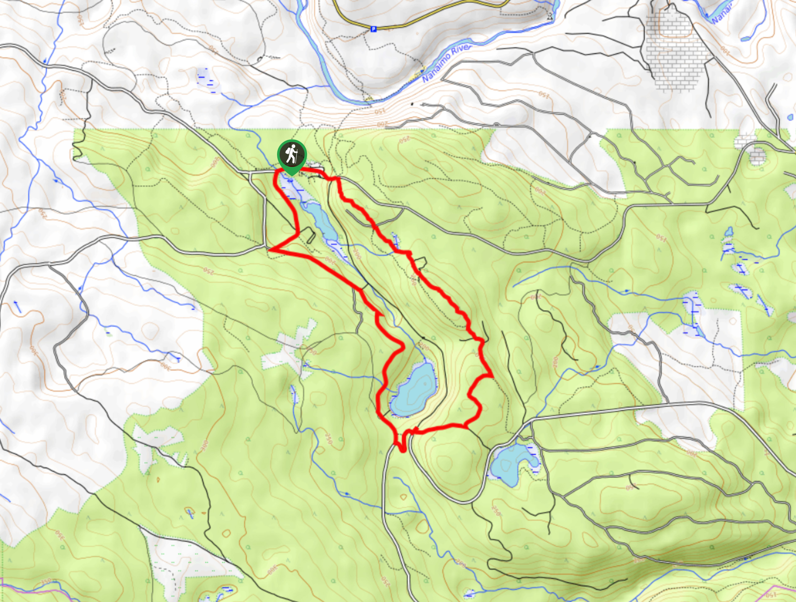
To reach the Skutz Falls trailhead from Duncan, head west on BC-18 for 11.7mi and turn left on Skutz Falls Road. Make a quick left after 148ft onto Cowichan Lake Road and follow it for 2133ft to reach Mayo Road. Turn right and continue on for 1.7mi to arrive at the parking area off Riverbottom Road.

About
| When to do | April-September |
| Backcountry Campsites | Horseshoe Bend Group Campsite |
| Pets allowed | Yes - On Leash |
| Family friendly | Older Children only |
| Route Signage | Average |
| Crowd Levels | Moderate |
| Route Type | Circuit |
Skutz Falls to 66 Mile Trestle
Elevation Graph
Weather
Skutz Falls to 66 Mile Trestle Description
Due to the easy accessibility, breathtaking scenery, and relatively easygoing nature of the route, the Skutz Falls to 66 Mile Trestle Trail is a popular hike in the Cowichan Valley. Because of this, hikers looking to enjoy the trail without throngs of crowds present will need to either attempt this hike on an off-peak day or arrive early enough to secure parking and get a bit of solitude while out on the trail. While the route isn’t overly difficult, the south side of the river is a bit more challenging due to a few steep sections and the fact that the trail can be fairly muddy early/late in the season. Make sure to wear proper hiking footwear to stay comfortable along the trail.
This hike is packed full of amazing scenery and great terrain that will make for an awesome day of adventuring along the Cowichan River. The trail sets out from the parking area near Skutz Falls and traverses the south side of the river before passing by the scenic Horseshoe Falls and arriving at the Mile 66 Trestle. Here, hikers can relax in the picnic area before heading out along the North Side Trail to enjoy a few final views of the coursing river. For the amount of effort required, this is a fantastic route that can be enjoyed by hikers of most skill levels.
Setting out from the parking area, head to the southwest and cross over the bridge to enjoy some views of the rapids that lead to Skutz Falls on your right, before entering into the forest along the South Side Trail. From here, follow the forested path as it works closely alongside the coursing waters of the Cowichan River towards the southeast. There are some steeper sections of trail along this part of the hike with some drop offs towards the river below, so take your time and enjoy the amazing scenery of the river valley.
After roughly 1.3mi of hiking, you will have some partial views of the Horseshoe Falls along the river in the valley below before continuing along the forested trail for another 1.0mi to arrive at the awesome sight of the Mile 66 Trestle. As you make your way along the wooden structure that stands high above the river valley below, you can almost imagine the old lumber-carrying rail cars barrelling through the picturesque landscape as they transported their precious cargo.
Take some time to enjoy the area around the trestle and spread out in the picnic area for a nice lunch before continuing your hike along the North Side Trail. This portion of the hike is a lot more easygoing than the South Side Trail, so enjoy the breathtaking views of the Cowichan River as you stroll along its forested banks and pass by the Horseshoe Campground.
After passing by the campground, take in the natural beauty of the peaceful forest setting as you hike the final 1.0mi along the edge of the river and back towards the parking area where you began.
Insider Hints
This trail can be muddy at certain times of the year, so make sure to wear proper hiking footwear to stay dry and comfortable on your hike.
Take advantage of the picnic area near the trestle for a relaxing lunch with scenic views.
Bring bear spray and make plenty of noise along the trail.
Arrive early to secure parking at the trailhead.
Similar hikes to the Skutz Falls to 66 Mile Trestle hike
Crystal and McKay Lakes Loop Trail
The Crystal and McKay Lakes Loop Trail is a 4.1mi hiking circuit southwest of Nanaimo that winds through…
Benson Creek Falls Trail
The Benson Creek Falls trail is a 1.8mi out-and-back hiking route near Nanaimo, BC, that will lead you…
Newcastle Island Bates Trail
The Newcastle Island Bates Trail is a 6.4mi lollipop hiking route just off the coast of Nanaimo, BC,…
Comments