Christie Falls Trail
View Photos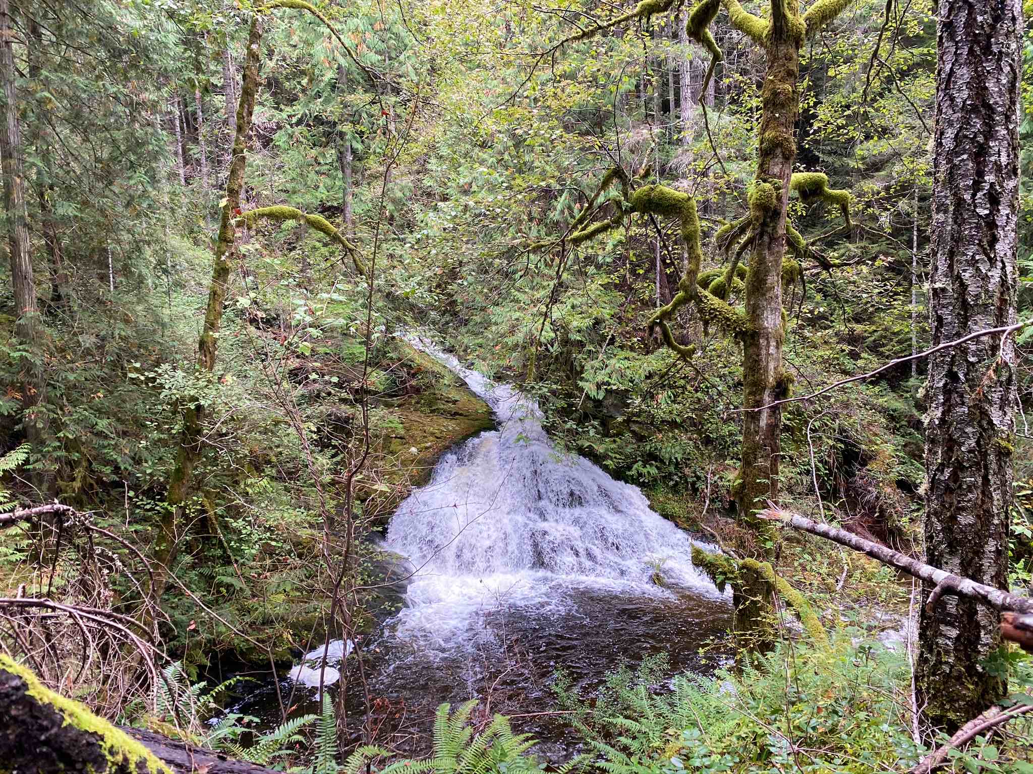
Christie Falls Trail
Difficulty Rating:
The trek to Christie Falls follows a 4.2mi lollipop hiking route just outside of Ladysmith, BC, that leads you through the rainforest to a scenic waterfall. Along the trail, you will pass by large mature trees as you experience the natural beauty and thick foliage of the West Coast temperate rainforest atmosphere before arriving at the cascading falls. This trail is perfect for a fun day of exploring the wilderness and is suitable for hikers of all skill levels.
Getting there
To reach the Christie Falls trailhead from the Ladysmith Intermediate School, head northwest on 4th Avenue for 2461ft and turn right onto Christie Road. Follow this for 1.4mi, and make a left turn onto Arroyo Road. In 689ft, you will arrive at the trailhead on your right.

About
| When to do | Year-Round |
| Backcountry Campsites | No |
| Pets allowed | Yes - On Leash |
| Family friendly | Yes |
| Route Signage | Average |
| Crowd Levels | Moderate |
| Route Type | Lollipop |
Christie Falls Trail
Elevation Graph
Weather
Christie Falls Trail Description
The hike to Christie Falls is fairly straightforward; however, the route is poorly marked in some areas and might require a GPS or trail map for navigation, especially in the area around the falls themselves. Additionally, the route is well-maintained throughout the duration of the hike, but the upper portion to gain access to the falls is a bit steep and narrow in places. This might slow travel for some hikers, so make sure to come prepared with proper hiking footwear and poles if you think you might need them.
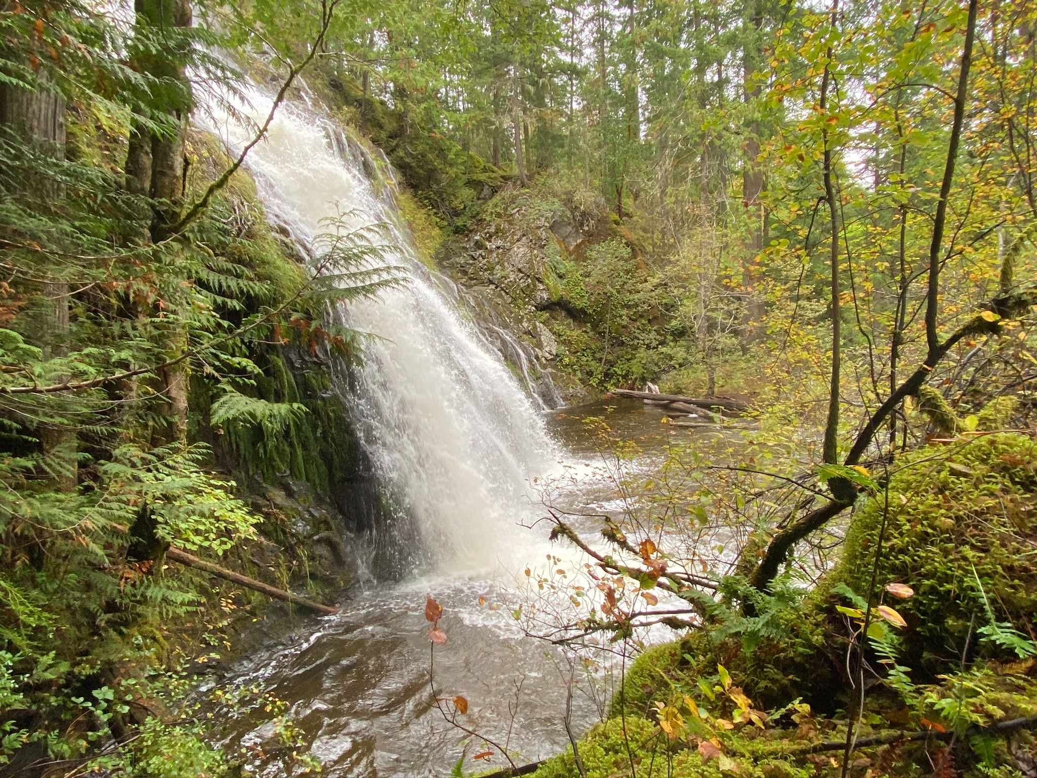
Although the majority of the hike will be through the dense cover of the temperate rainforest, this is an amazingly scenic hike that will truly make you feel as though you are on a proper adventure. As you work towards the falls, you will pass by giant trees and countless ferns scattered across the forest floor before crossing over some log bridges to arrive at the huge rock wall of Christie Falls with its torrent of rushing water. This is a great half-day hike that you’d be hard-pressed not to enjoy.
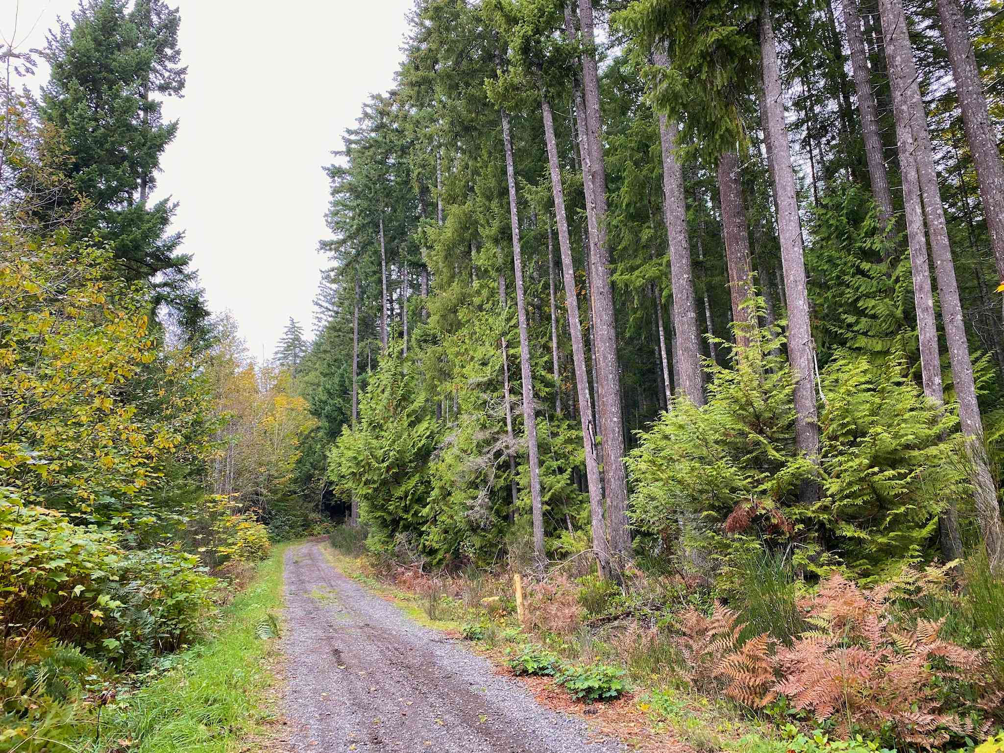
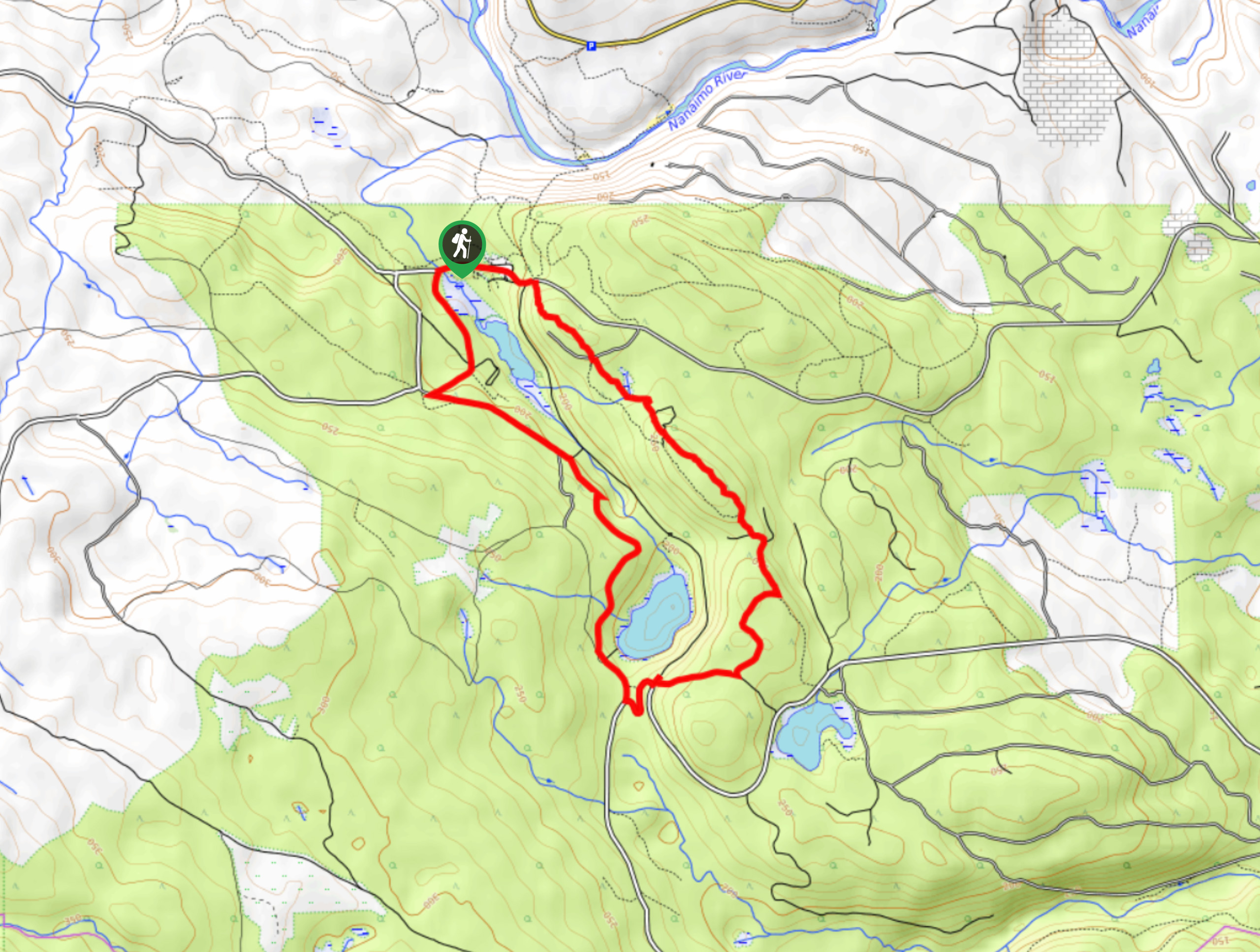
Setting out from the trailhead off Arroyo Road, make your way south along the road and follow the trail as it begins to veer toward the west. Here, the trail will enter into the thick cover of the forest and provide a nice amount of shade to hike under as you make your way toward the falls. You will gain a small amount of elevation as you hike along the route, and after 2.1km, you will come to a junction in the trail.
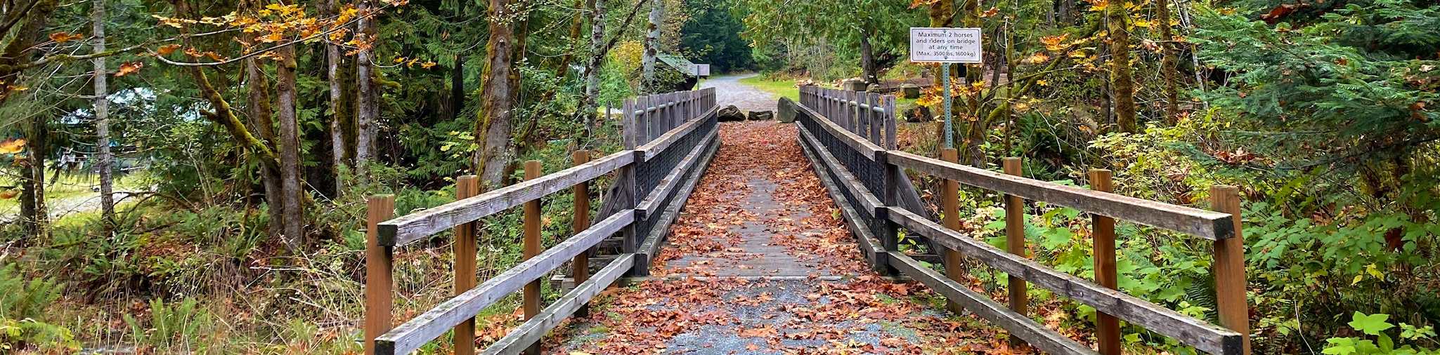
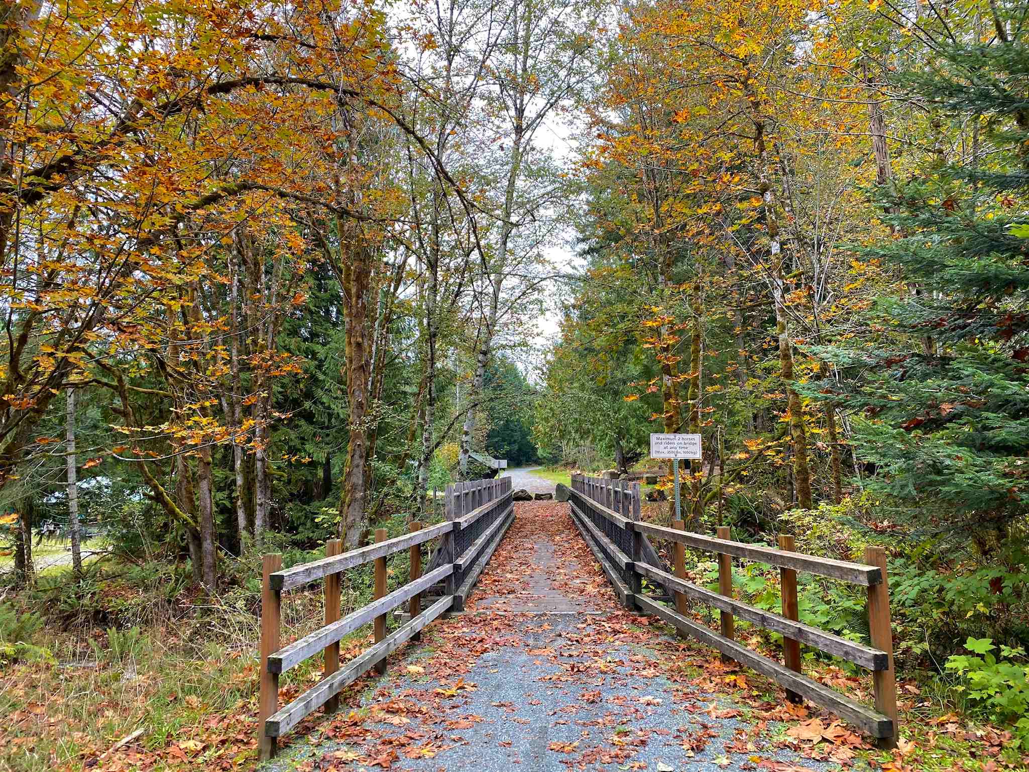
Head right and continue on for about 2231ft to pass by the Bush Creek Fish Hatchery on your right and visit a beautiful wooden bridge that spans the rushing water of the creek. Don’t cross over the creek. Instead, turn back and retrace your steps for 328ft to a junction on your right. Follow this trail on a path that runs parallel to the creek and will take you to the falls.
Keep steady along the trail for 1476ft as it heads to the southwest and eventually arrives at the flowing water of the Christie Falls. This is not the end of your journey, however, so follow the trail closer to the edge of the creek and you will find a dark brown log bridge that will take you over the water and up toward the larger waterfall that is the main attraction of the hike.
After making your way up this slightly steeper portion of the trail, you will be greeted by some amazing views of the cascading water of the falls that trickles down the face of the rock and crashes into the pool below, giving the appearance of a bridal veil. After taking in the views, head back down the trail and cross back over Bush Creek.
About 230ft from the bridge, you will come to a junction in the trail that offers an alternate loop back to the trailhead. Take this path to the right and follow it for about 2297ft through the dense canopy of the temperate rainforest to arrive back at the main trail. Take the main trail to the right to head back to the parking area where you began your hike.
Insider Hints
The final portion of the hike up to the falls is a bit steep and narrow. Make sure to wear proper hiking footwear for the best traction along the trail.
When you reach the first waterfall, search for the log bridge to gain access to an even larger waterfall.
Parts of the trail are poorly marked, so remember to bring a trail map or GPS along for the hike.
Similar hikes to the Christie Falls Trail hike
Crystal and McKay Lakes Loop Trail
The Crystal and McKay Lakes Loop Trail is a 4.1mi hiking circuit southwest of Nanaimo that winds through…
Living Forest River Walk
The Living Forest River Walk is a wonderfully scenic out-and-back trail in Nanaimo that will take you along the edge…
Benson Creek Falls Trail
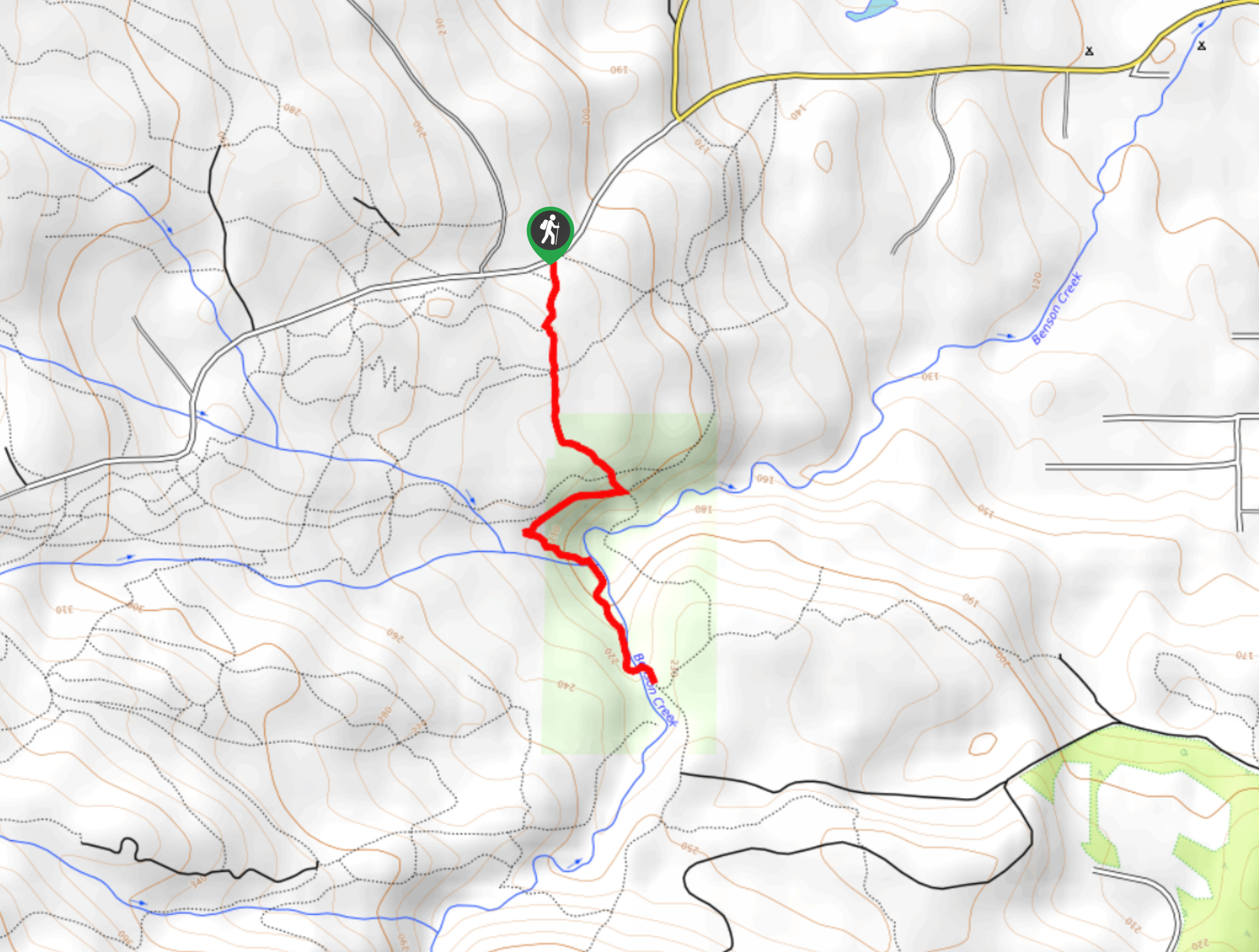
The Benson Creek Falls trail is a 1.8mi out-and-back hiking route near Nanaimo, BC, that will lead you…
Comments