Glen Loin and Coiregrograin Walk
View Photos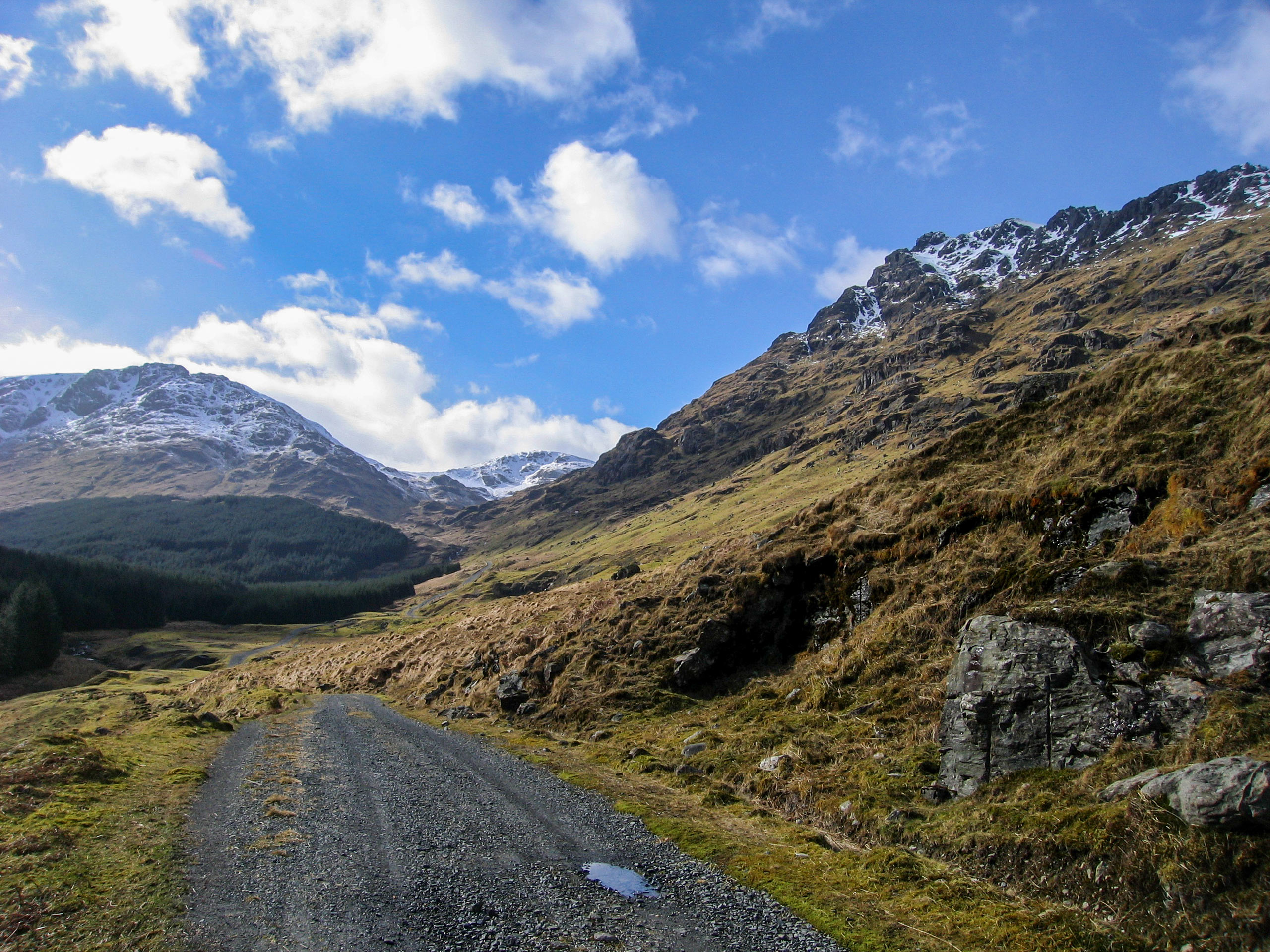
Glen Loin and Coiregrograin Walk
Difficulty Rating:
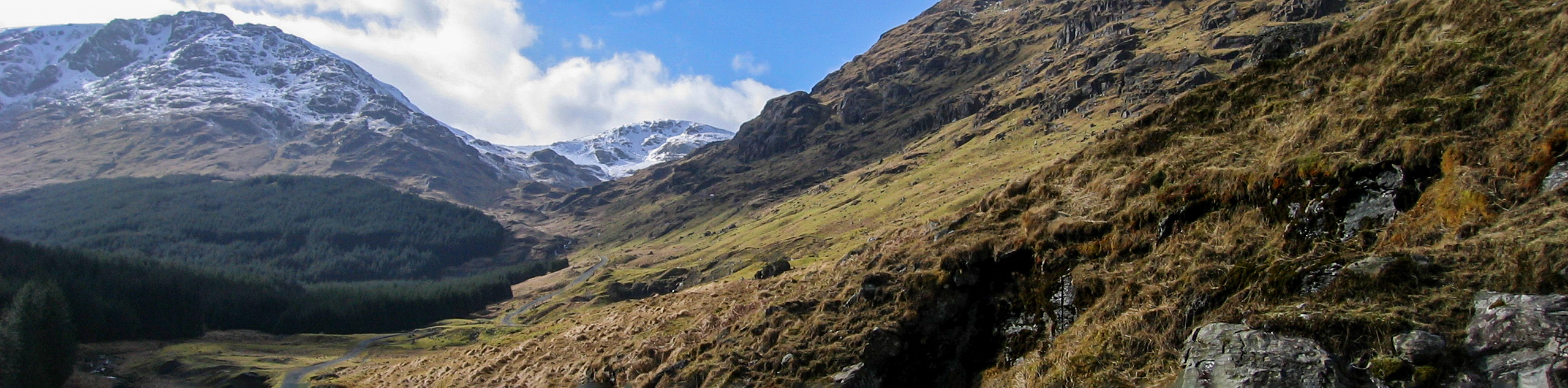
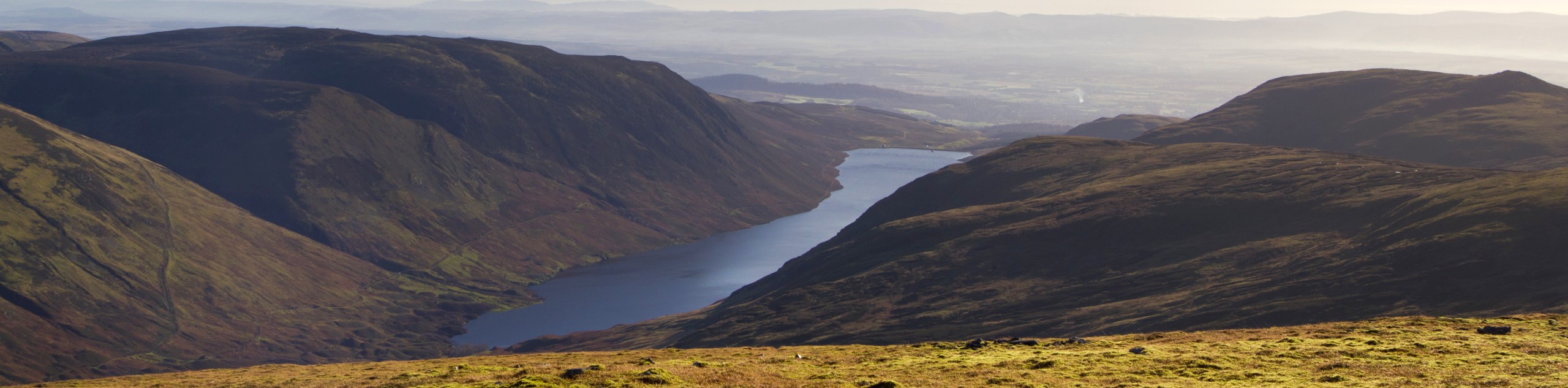
A great walk for those looking to experience the beauty and might of the Arrochar Alps while enjoying a lengthy circuit without any significant climbs. Views throughout include Beinn Narnain, A’Chrois, Ben Vorlich, Ben Vane, Ben Lomond and more! This is a great route to practice photography, due to the diverse scenery and a solid path on a good road.
Getting there
To get to the Glen Loin and Coiregrograin Walk from the center of Arrochar, drive north on the A83 headed towards the A814. After 0.7mi, turn into the Loch Long Car Park where the walk begins.

About
| When to do | Year-Round Access |
| Backcountry Campsites | Wild camping (permit required) |
| Pets allowed | Yes - Off leash |
| Family friendly | Older Children only |
| Route Signage | Average |
| Crowd Levels | Moderate |
| Route Type | Circuit |
Glen Loin and Coiregrograin Walk
Elevation Graph
Weather
Glen Loin and Coiregrograin Walk Description
Take the paved road that leads from the Loch Long car park in Arrochar, turning left to follow it. When you reach the bridge suspended over the Loin Water, don’t cross, but instead head right onto the path that leads upstream, looking for the Cowal Way signage. As you approach a farm seen in the distance, follow the path as it veers left, bypassing the fork that leads to the Arrochar-Tarbet Link trail.
Making your way up into the stunning glen, you’ll enjoy some great views of Beinn Narnain and A’Chrois on your left. This initial section through the Glen Loin is pleasant and flat and will soon cross a small footbridge made of wood, leading to a section characterized by ascent. You’ll spot the southern end of Ben Vorlich rising ahead as you pass through a gate and continue the path alongside the trees. A curve in the path marks its joining alongside a firebreak—continue straight.
The road opens to gorgeous views ahead as you cross another bridge, this time over the Inveruglas Water. Keep an eye out for the path on the far side that beckons you up a tarmac road that runs along the glen, making a right onto it. Here, you’ll be met with dramatic views of Ben Vane and Ben Vorlich– a true taste of the might and majesty of the Arrochar Alps that will no doubt leave you feeling inspired.
Continue the path, peeking over your shoulder for some excellent views of Ben Lomond in the background. When you reach a fork, veer left, taking the left-hand track across a bridge and spotting the Loch Sloy dam up ahead in the glen on your right. Ignore the path the veers towards Ben Vane and continue the track, which begins a gently, lengthy climb up the east slopes of Coiregrograin. You’ll find yourself surrounded by remarkable views at this point, most notably Beinn Ìme (3317ft) and Beinn Narnain flanking the glen. You’ll reach the highest point on the trail when you arrive at the sluice gate, above a rushing burn. A downhill section then unfolds as you pass through another gate and enter the forest.
When you reach a small dam, head left to join a more rugged track, crossing the burn (usually dry) and then heading up the far side of the damn. The track loops now and leads you on a descent of the far side of Coiregrograin, venturing the lower slopes of A’Chrois.
Continue as the path veers to the right, initiating your journey back down through Glen Loin and rewarding you with further views of Ben Lomond. The final section passes up above Succoth before joining at a junction where you’ll take a sharp left to proceed downhill through the belly of Glen Loin. Reach the forest edge, where you’ll find another junction and pursue the track that heads out of the trees. Make a right and enter the tiny hamlet of Succoth, then at a T-junction, take a left, heading towards a collection of homes. Take the path that leads away from the road, cutting across to head for the Arrochar car park. Cross the small footbridge that leads to the A83, then cross the road and join the path on the far side before crossing a final footbridge to return to the car park where the walk began.
Similar hikes to the Glen Loin and Coiregrograin Walk hike
Big Tree Walk
The Big Tree Walk is a lovely 1.6mi, waymarked forest trail beside the Benmore Botanic Gardens. The route…
Arrochar Caves Walk
The Arrochar Caves Walk, found in Arrochar, UK, is a 2.8mi trail that leads through a scenic forest,…
Ben Chonzie Walk
The Ben Chonzie walk invites hillwalkers to venture up the highest summit in the immediate area to reach an exciting…
Comments