An Caisteal and Beinn a'Chròin
View Photos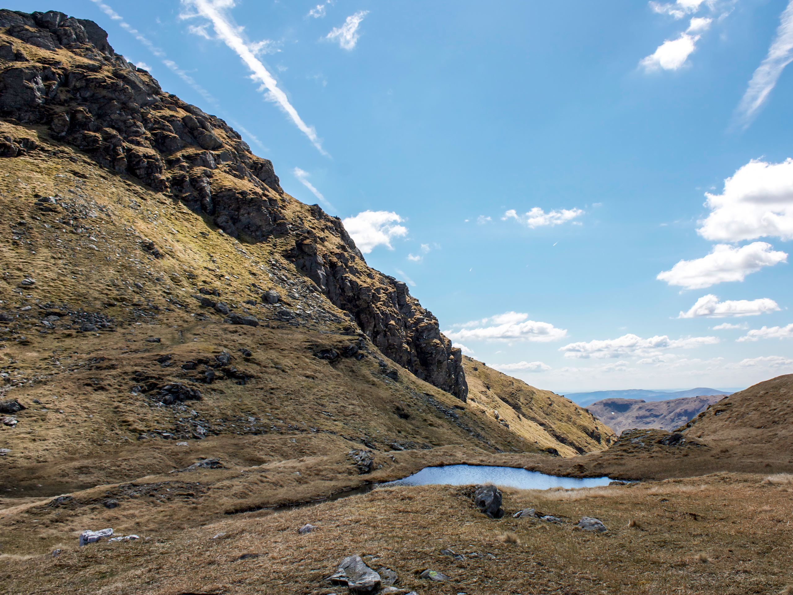
An Caisteal and Beinn a'Chròin
Difficulty Rating:
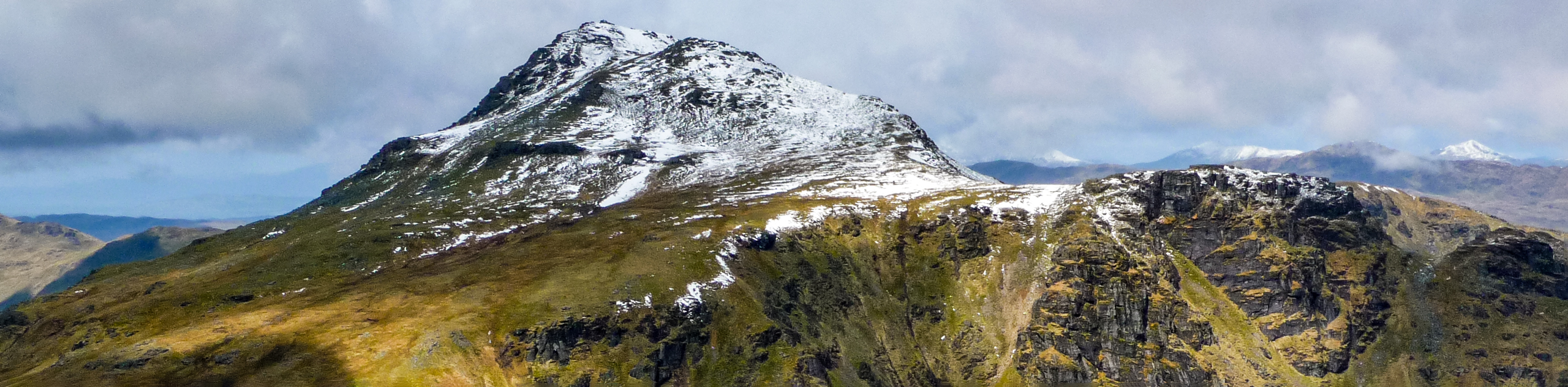
The An Caisteal and Beinn a'Chròin Walk rewards hillwalkers for their efforts to reach 3428ft with sensational views across the Loch Lomond and Trossachs National Park, including Loch Lomond and Ben Nevis. Much of the route unfolds on amicable grassy ground with brilliant stretches of ridge walking. Check off two spectacular Munros on the An Caisteal and Beinn a'Chròin Walk as you enjoy a thrilling climb to both mountain summits.
Getting there
From Crianlarich, head south on the A82 for 2.5mi, locating the parking layby just off the A82 where the walk begins.

About
| When to do | Year-Round Access |
| Backcountry Campsites | No |
| Pets allowed | Yes |
| Family friendly | No |
| Route Signage | Average |
| Crowd Levels | Moderate |
| Route Type | Lollipop |
An Caisteal and Beinn a'Chròin
Elevation Graph
Weather
An Caisteal and Beinn a'Chròin Description
Seize the opportunity to conquer two fine Scottish Munros on the An Caisteal and Beinn a’Chròin Walk. With an ascent of 3428ft, this walk isn’t for those looking for a dainty stroll but instead features a challenging route to ascend two fine summits. Much of the route unfolds on good, grassy paths up the slopes, but boggy sections are likely, especially following rain. Waterproof footwear is recommended for this walk and tackling these two peaks in the winter requires proper equipment (ice axe, crampons) and a good working knowledge of winter hillwalking.
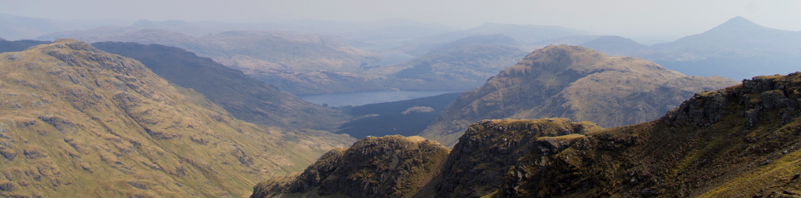
The An Caisteal and Beinn a’Chròin Walk is a gratifying hike and provides the great opportunity to test your endurance to reach an epic height of 1045m. As you can imagine, from the vantage point of the summits, the views over the Loch Lomond and Trossachs National park are nothing short of surreal, and your efforts during this climb won’t go unrewarded.
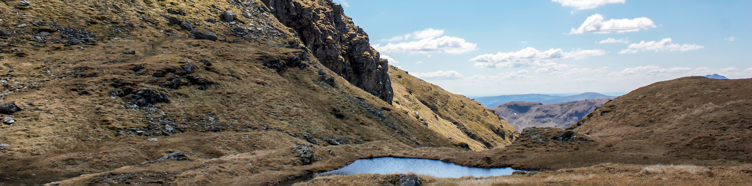
From the parking layby off the A82, join the path that heads under the railway via an underpass, maintaining the track leading to a bridge over the River Falloch, which you’ll cross. The track continues with a gentle incline as you spot Sròn Gharbh’s grassy flank up ahead. Opt to continue the path for 0.6mi and then turn right following the second gate, or take on the head straight over the bumpy ground ahead, crossing a fence to return to the path.
As the ascent begins, prepare for some rocky sections as you start to rise, enjoying your first taste of the grand views to come. You’ll soon reach the top of Sròn Gharbh, and at this point, you’ll continue on the relatively defined path up the Twistin Hill ridge before sweeping around a rocky knoll, which sets you up for the climb to An Caisteal’s summit. Reach the summit at 3264ft, then continue on a small path that carpets the ridge, soon reaching the Belach Buidhe. Head southeast, veering slightly right from the bealach, taking on a rocky slope that leads to the buttress of Beinn a’Chròin.
Continue on the defined path with your sights set on the small cairn that sits atop the mountain’s highest point. From the summit of Beinn a’Chròin, you’ll revel in the beauty of the Trossachs from above, as a sense of accomplishment sets in, having reached the second summit.
To descend, depart from the summit northbound, returning down the same path of ascent for a short distance before continuing straight to walk the grassy ridge that leads downhill. Some erosion on the path and steep sections make it a reasonably challenging descent, but fix your eyes on the confluence of the two streams ahead, crossing them before they meet. Follow the path that hugs the west side of the River Falloch, perhaps taking a dip to cool off before continuing your descent. Pass the hydro works, then pick up the hydro track that eventually leads you to rejoin the outward track. Continue on this track which returns to the bridge from the beginning of the walk, pass under the railway via the underpass and return to the parking layby off the A82, where the walk began.
Similar hikes to the An Caisteal and Beinn a'Chròin hike
Beinn Ime and Beinn Luibhean Walk
The walk of Beinn Ime (3317ft) and Beinn Luibhean (2815ft) invites hillwalkers to tackle two steep…
The Brack and Cnoc Còinnich Walk
Rugged paths, steep ascents, and spellbinding scenery sum up The Brack and Cnoc Còinnich Walk best. The 9.6mi…
Beinn Narnain Circular Walk
The Beinn Narnain Circular Walk is an epic hike interspersed with a few exhilarating scrambles to reach the summit of…
Comments