Kings Creek Falls Trail
View Photos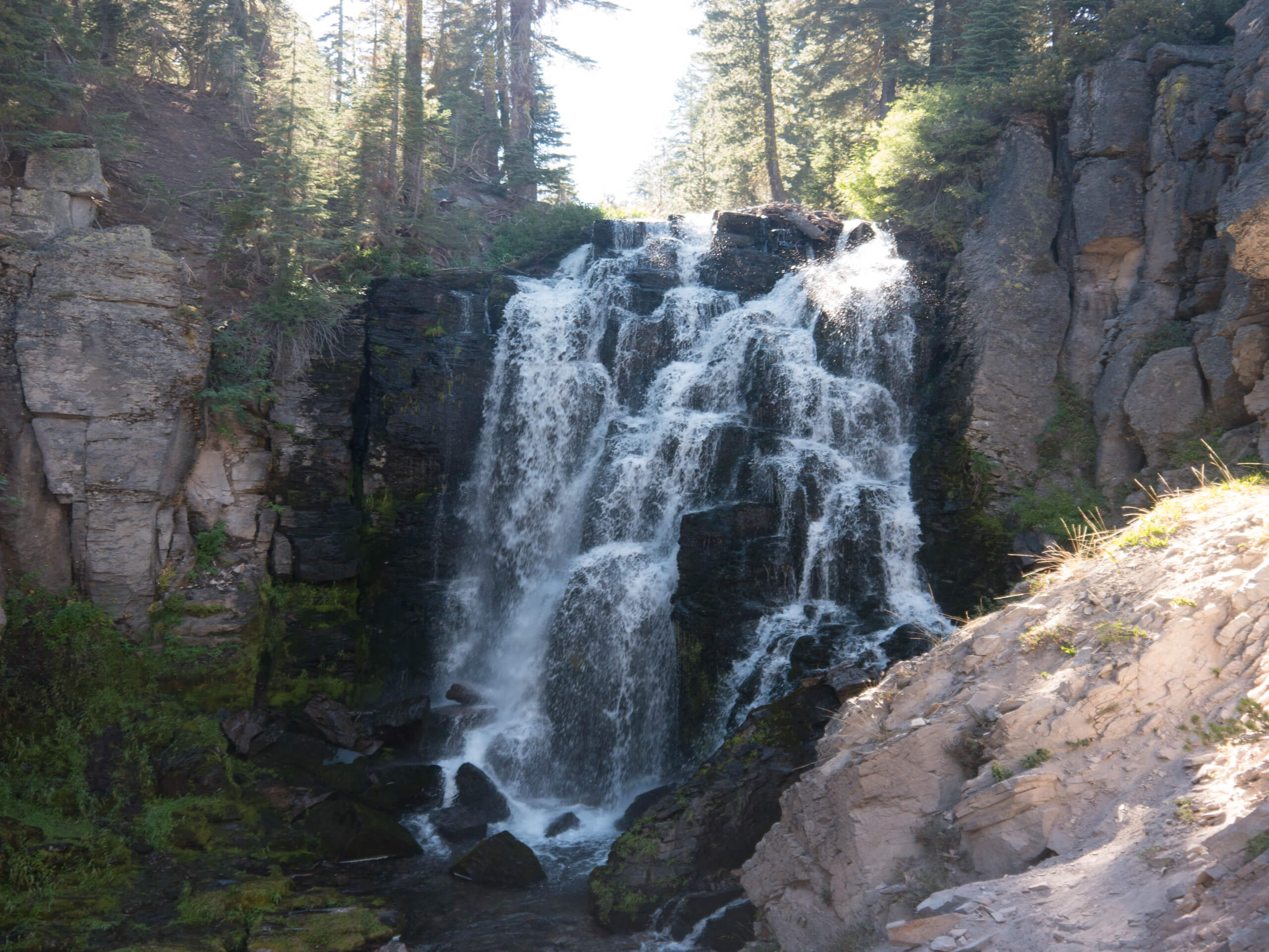
Kings Creek Falls Trail
Difficulty Rating:
Taking you through charming meadows and picturesque creeks before delivering you to two beautiful waterfalls, the Kings Creek Falls Trail is a lovely route within Lassen Volcanic National Park. Fairly short in distance and with a reasonable elevation incline, the route is perfect for casual hikers and families with young children.
NOTE: The overlook on this trail is currently closed due to damage from the Dixie Fire.
Getting there
The trailhead of Kings Creek Falls Trail is located off of Lassen Peak Highway.

About
| Backcountry Campground | No |
| When to do | May-October |
| Pets allowed | No |
| Family friendly | Yes |
| Route Signage | Good |
| Crowd Levels | High |
| Route Type | Lollipop |
Kings Creek Falls Trail
Elevation Graph
Weather
Kings Creek Falls Trail Description
Large sections of the Kings Creek Falls trail lack much shade, so it is important that you prepare yourself accordingly. We recommend wearing sunscreen and a good hat to help protect you from the effects of the sun. Similarly, especially during the hotter summer months, we suggest that you bring ample amounts of water to stay hydrated throughout the route’s duration.
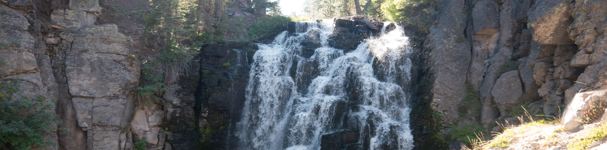
The Kings Creek Falls Trail is a great route within Lassen Volcanic National Park because it is both easily accessible and boasts great scenery. The meadows along the route are charming, the creeks are peaceful, and the waterfalls are impressive and imposing. Sweetening the deal further, the route is neither excessively long nor excessively steep – making it a route that can be enjoyed by most!
With your vehicle parked, follow the Kings Creek Horse Trail as it makes its way southwest adjacent to the creekside. Passing several meadows as it goes, the route will arrive at a junction within the trail. At the junction, stay on the Kings Creek Horse Trail by taking the northern pathway. After a few hundred feet of walking, you will arrive at another junction in the trail.
At this junction, take the northern pathway onto the Horse Loop Trail and stay on the pathway as it passes several junctions over the next few hundred feet. The Horse Loop Trail will then veer sharply to the south, inclining in elevation as it goes. Having arrived at the northern shore of Kings Creek, you will be delivered to another junction within the trail, where you are to take the eastern pathway onto Kings Creek Horse Trail. With Kings Creek Falls visible to your south, the trail will end at a scenic overlook of the stunning waterfall. Once you’re ready, backtrack your steps and rather than go north at the Horse Loop Trail, simply stay along Kings Creek Falls all the way to the trailhead.
Insider Hints
The mosquitoes along the route can be numerous - bring bug repellent!
Speaking of bugs, tics are prevalent in the area. Check yourself thoroughly!
Being a popular route, parking for the Kings Creek Falls Trail can be hard to find. We recommend doing the hike earlier in the day in order to avoid the midday crowds.
Similar hikes to the Kings Creek Falls Trail hike

Subway Cave Trail
The Subway Cave Trail is an incredible route within Lassen National Forest that is appropriate for all ability levels. Leading…
Chaos Crags Trail
Guiding you through the stunning alpine environment of Lassen Volcanic National Park, the Chaos Crags Trail is ideal for intermediate…
Terrace, Shadow, and Cliff Lakes Trail
The Terrace, Shadow, and Cliff Lakes Trail is a beautiful route within Lassen Volcanic National Park. Leading you along the…
Comments