Cinder Cone Nature Trail
View Photos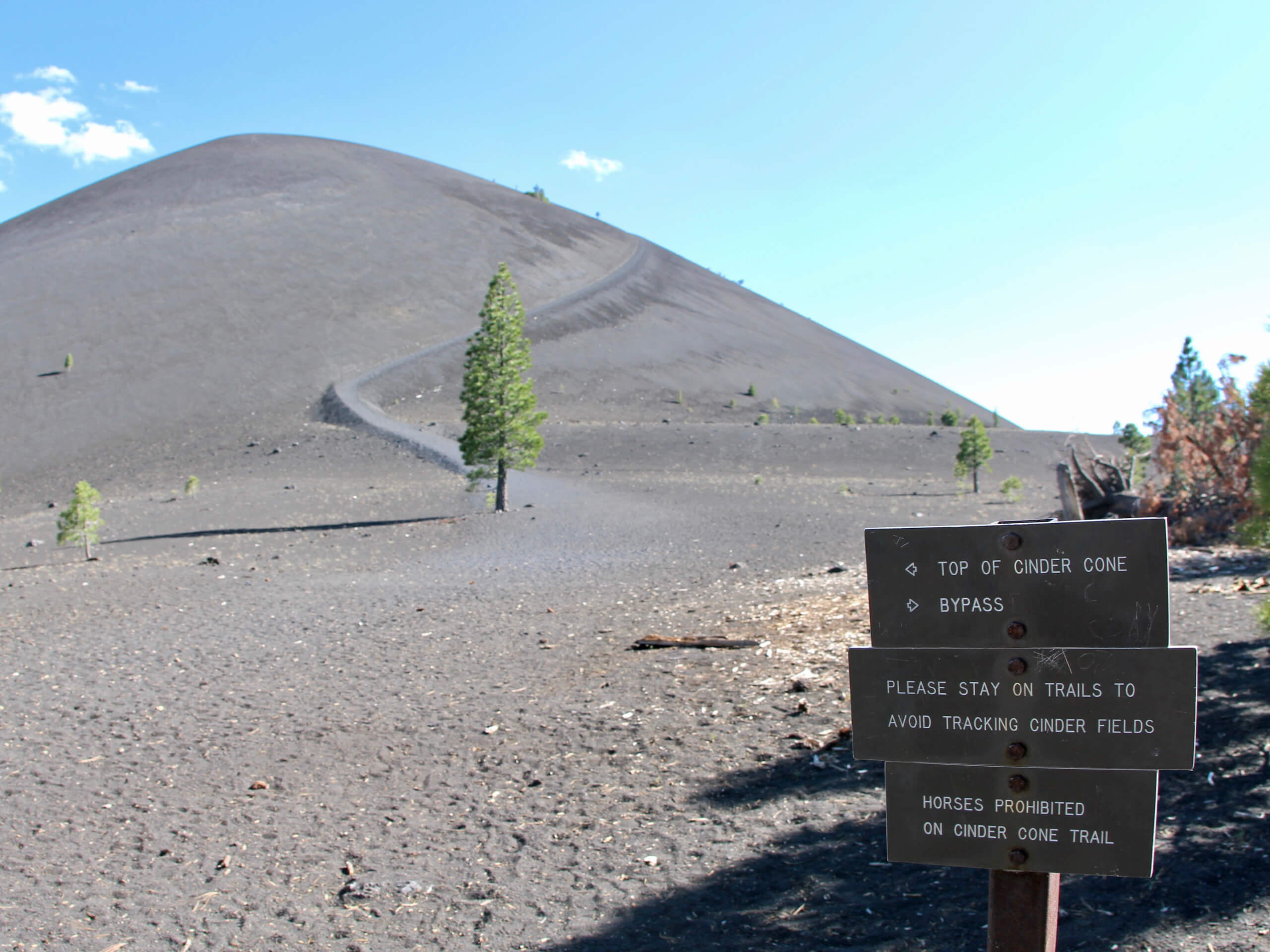
Cinder Cone Nature Trail
Difficulty Rating:
Short in distance and with a moderate amount of elevation incline, the Cinder Cone Nature Trail is a family-friendly route with lots to offer! Leading you on a fascinating and informative journey throughout an incredible volcanic formation, the trail is mesmerizing in its uniqueness. In addition to its intriguing geology, the views found throughout the Cinder Cone Nature Trails duration are sublime.
Getting there
The trailhead for Cinder Cone Nature Trail is located at a parking lot off of Butte Lake Road.

About
| Backcountry Campground | |
| When to do | May-October |
| Pets allowed | No |
| Family friendly | Yes |
| Route Signage | Good |
| Crowd Levels | Moderate |
| Route Type | Lollipop |
Cinder Cone Nature Trail
Elevation Graph
Weather
Cinder Cone Nature Trail Description
As most of the elevation incline along the Cinder Cone Nature Trail is on the Cinder Cone itself, this section is rather steep. We, therefore, recommend wearing a good pair of hiking boots and bringing a set of hiking poles to help aid you on the steep gradient. Also, expect to hike up sand! You may look at the numbers and think, “Hmm the elevation gain doesn’t look so bad,” but ascending sandy terrain adds another level of difficulty to this hike. Likewise, not much shade exists throughout the route, so we suggest wearing sunscreen and a good hat to help protect you from the sun.
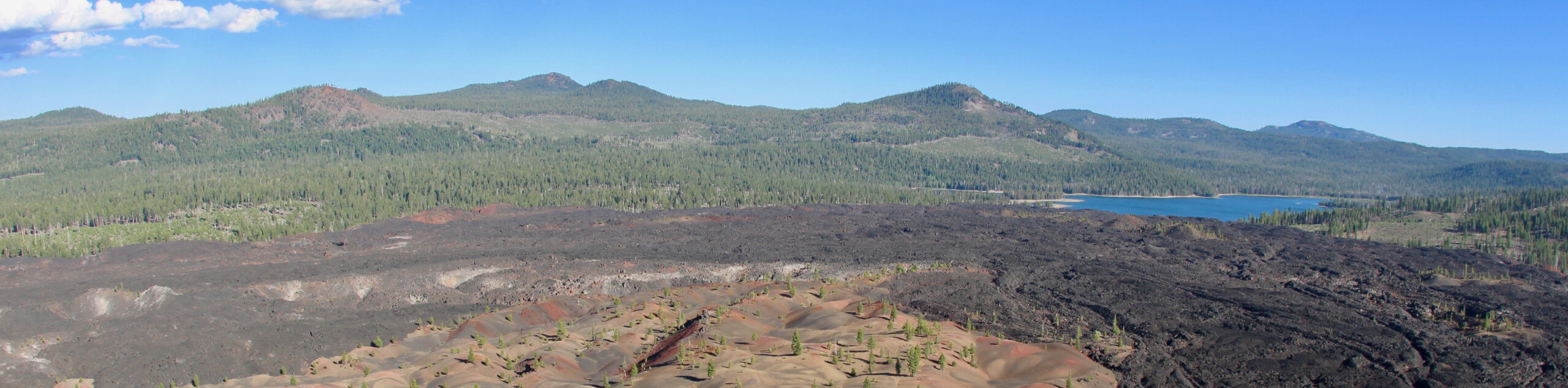
The Cinder Cone Nature Trail is an incredible route because of how unique it is. Not many routes offer both incredible sightlines of the surrounding area and the chance to walk along a fascinating geological formation – and yet the Cinder Cone Nature Trail boasts both! Having parked your vehicle, follow the Butte Lake to Snag Lake Trail to make its way southwest. The terrain is relatively flat at first and possesses little elevation incline. However, you will soon arrive at a junction within the trail, where you are to continue along the Butte Lake to Snag Lake Trail by taking the southern pathway.
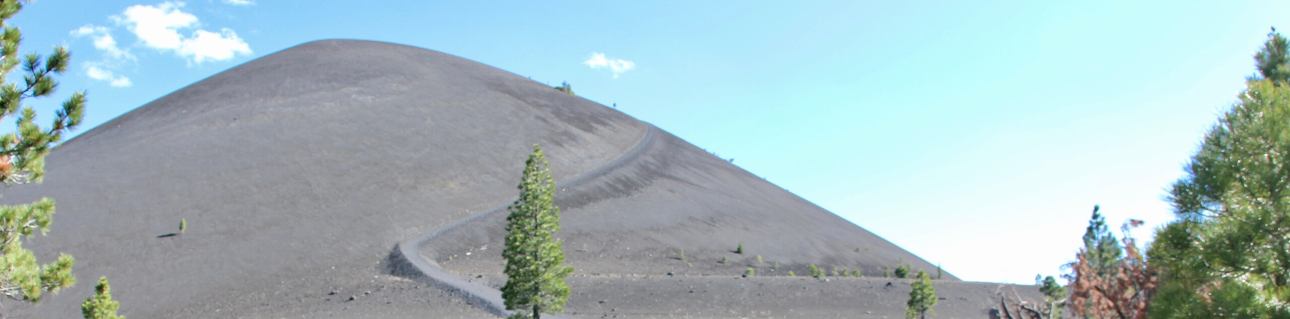
The elevation will begin to incline slightly as you approach Cinder Cone and, having reached the Cinder Cone Junction, follow the eastern pathway as it makes its way up the northern side of Cinder Cone. Here, the elevation becomes rather steep, so take your time and watch your footing. You will soon arrive at the summit of Cinder Cone, where you should take some time and explore its crater and admire the views of the surrounding landscape.
Once you’re ready, continue on along Cinder Cone Trail as it makes its way down the southern side of Cinder Cone and then travels around its western side to deliver you back at Cinder Cone Junction. From Cinder Cone Junction, all you need to do to get back to the trailhead is backtrack your steps.
Trail Highlights
Lessen Cinder Cone
The Lassen Cinder Cone is a 784ft high cinder cone volcano within Lassen Volcanic National Park. An incredible geological feature, the Lassen Cinder Cone was created during eruptions that sent gases and hot magma bursting through the earth’s crust. During two eruptions in the 1650’s, the Lassen Cinder Cone established its characteristic shape when debris from the eruption fell from the sky and began to cool in a cone shape around the volcano’s vent.
Insider Hints
It can get dusty along the route, so sunglasses are suggested!
Bring lots of water - it can get hot.
Butte Lake is excellent for a post-hike swim!
Keep an eye out for wildlife. While the terrain might not seem like it, it is teeming with life.
Similar hikes to the Cinder Cone Nature Trail hike
Chaos Crags Trail
Guiding you through the stunning alpine environment of Lassen Volcanic National Park, the Chaos Crags Trail is ideal for intermediate…
Terrace, Shadow, and Cliff Lakes Trail
The Terrace, Shadow, and Cliff Lakes Trail is a beautiful route within Lassen Volcanic National Park. Leading you along the…
Butte and Snag Lake to CInder Cone Loop
The Butte and Snag Lake to Cinder Cone Loop is a beautiful route within Lassen Volcanic National Park. Leading you…
Comments