Bumpass Hell Trail
View Photos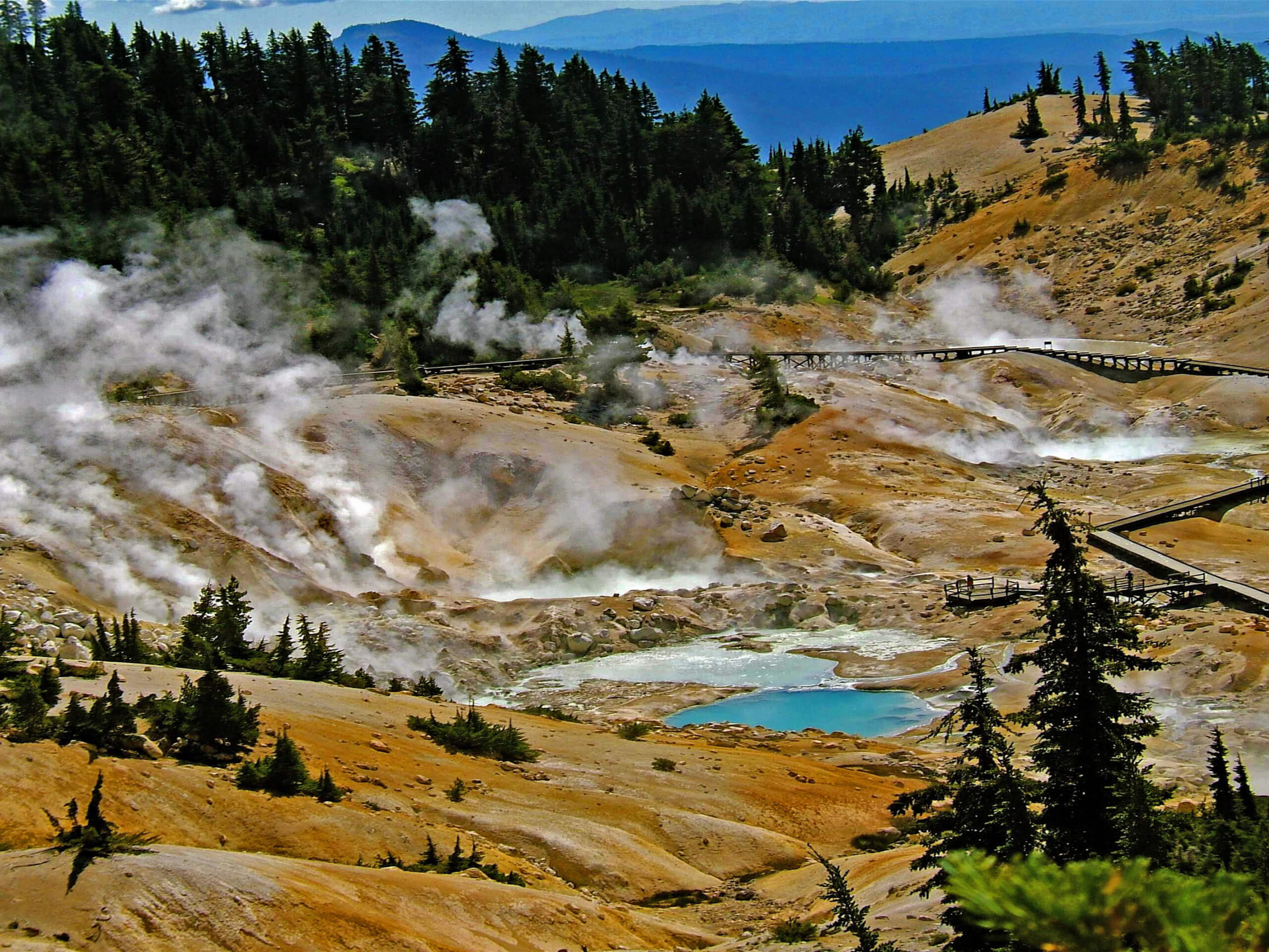
Bumpass Hell Trail
Difficulty Rating:
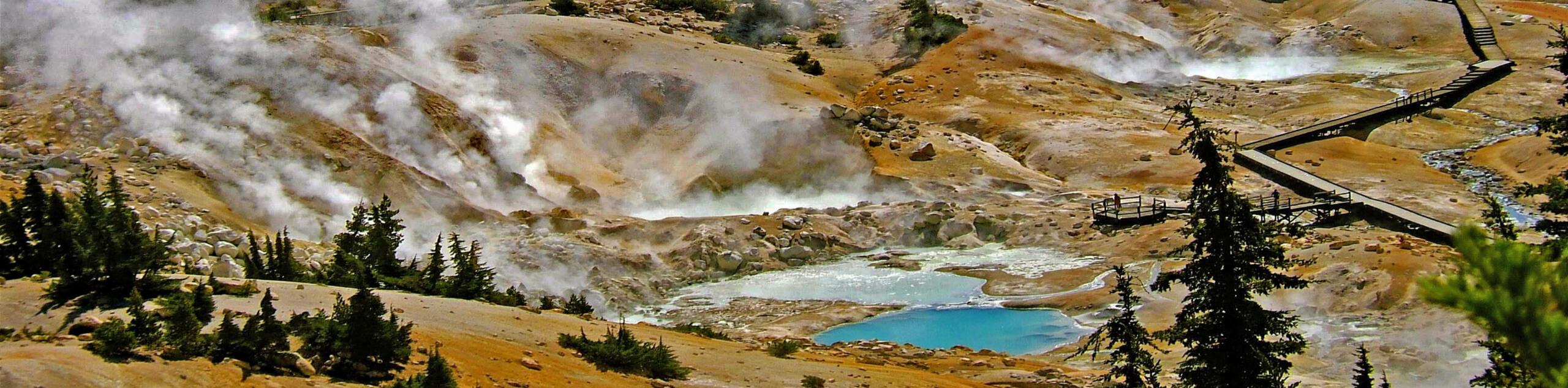
Bumpass Hell Trail is an extraordinary route within Lassen Volcanic National Park. A short route that can be enjoyed by the entire family, Bumpass Hell Trail delivers you to an otherworldly landscape of magnificent geothermal activity. With an abundance of informative plaques to help educate you on what you are seeing, the Bumpass Hell Trail is an incredible route that will not leave you disappointed!
This trail was minimally impacted by the Dixie Fire. It is expected to open for the summer 2022 season.
Getting there
The trailhead for Bumpass Hell Trail is located at a parking lot off of Lassen Peak Highway.

About
| Backcountry Campground | No |
| When to do | April-October |
| Pets allowed | No |
| Family friendly | Yes |
| Route Signage | Good |
| Crowd Levels | High |
| Route Type | Out and back |
Bumpass Hell Trail
Elevation Graph
Weather
Bumpass Hell Trail Description
Bumpass Hell Trail is a highly frequented route within Lassen Volcanic National Park and can therefore become rather crowded – especially on weekends and holidays. To beat the midday crowds, we suggest arriving to do the trail earlier in the morning or later in the afternoon. Lastly, the geothermal activity along the route can be dangerous, so it is important you don’t leave the trail!
When visiting Lassen Volcanic National Park, Bumpass Hell Trail should undoubtedly be on your list of must-do hikes! Not only is the geological activity stunning and incredibly intriguing, but the views of the surrounding landscape found along the route duration are breathtaking and should not be understated. Likewise, the Bumpass Hell Trail is fairly short and lacks much elevation fluctuation. This means the route is appropriate for families with young children and practically anyone else who may be interested.
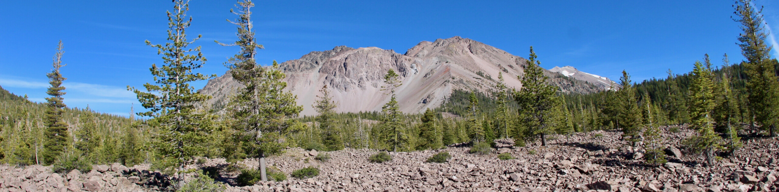
Having arrived at the trailhead, follow the Bumpass Hell Trail as it makes its way north from the parking lot. Traveling over flat terrain, the route will then begin to veer to the east before delivering you to a beautiful vista where scenic views of Lassen Peak and Lake Helen can be enjoyed. Once you’ve taken some time to take in the sightlines, follow the trail as it veers south.
The pathway will continue along its southern heading for a few hundred feet before veering sharply to the east. With Bumpass Mountain visible to your east, the Bumpass Hell Trail will cross a creek and arrive at the mesmerizing Bumpass Hell geological feature. Having taken some time to explore, simply backtrack your steps towards the trailhead and your waiting vehicle.
Frequently Asked Questions
Why is it called Bumpass Hell?
Bumpass Hell was given its name in the late 1800’s by a man named Kendall Bumpass. Bumpass was showing the geological feature to some regional politicians when he slipped and – rather embarrassingly – fell into one of the boiling sulfuric pits. Burning his leg in the process, Bumpass’s last name was forever linked to the area.
What kind of volcanic features is Bumpass Hell?
Bumpass Hell is a hydrothermal geological feature. This means that groundwater is being heated and turned into steam from geothermal vents originating deep within the earth’s crust.
Insider Hints
Do not leave the trail! The hydrothermal ground can be dangerous.
Extra parking can be found along the eastern shore of Helen Lake.
Not much shade exists throughout the route, so bring sunscreen and a good hat!
Keep your eyes peeled for wildlife!
Similar hikes to the Bumpass Hell Trail hike

Subway Cave Trail
The Subway Cave Trail is an incredible route within Lassen National Forest that is appropriate for all ability levels. Leading…
Chaos Crags Trail
Guiding you through the stunning alpine environment of Lassen Volcanic National Park, the Chaos Crags Trail is ideal for intermediate…
Terrace, Shadow, and Cliff Lakes Trail
The Terrace, Shadow, and Cliff Lakes Trail is a beautiful route within Lassen Volcanic National Park. Leading you along the…
Comments