Fletcher Peak hike
View Photos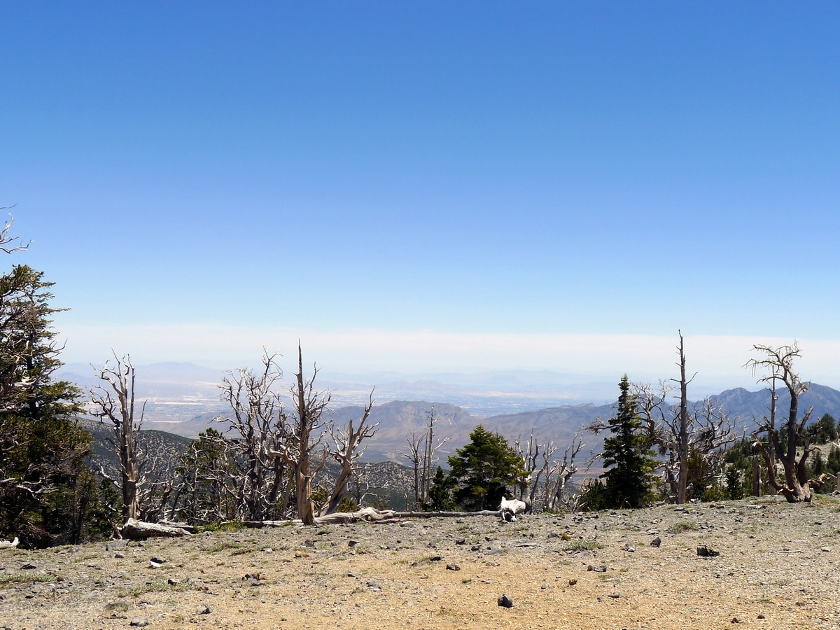
Fletcher Peak hike
Difficulty Rating:
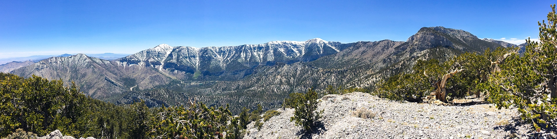
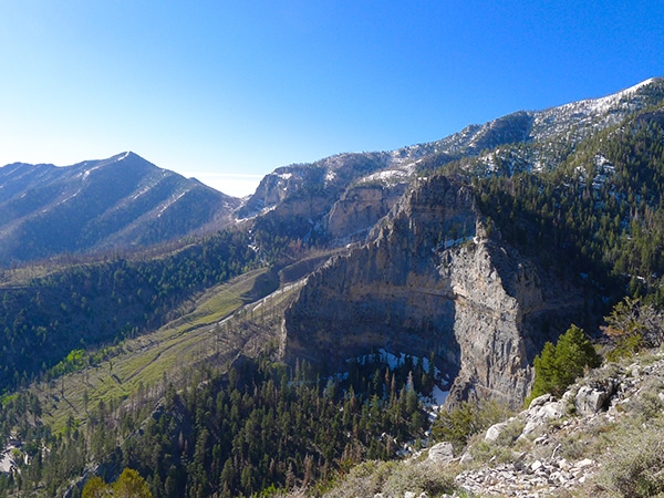
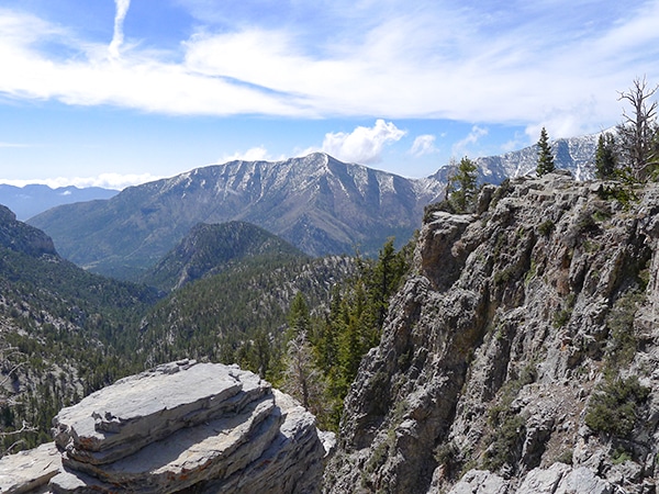
Fletcher Peak is not only one of the easiest mountains to climb in the park, but also the sixth highest point in all of Nevada. Here, you will experience spectacular views of the surrounding landscape, including the Spring Mountains. This is truly a beautiful half-day hike that is nothing short of fantastic!
Getting there
To get to the Fletcher Peak Trailhead from Las Vegas, follow Route 95 North until just after you pass the city limits. From here, watch out for Nevada 157, with signs towards Mt. Charleston. Turn left here and continue along this gradually climbing road for just over 17.0mi. Turn right on Route 158 heading north, and drive up this steeper highway for 5.0mi, watching diligently for the North Loop Trailhead on the left. This small parking area comes up super fast, and it’s very easy to miss.

About
| When to do | May through September (depending on snow) |
| Backcountry Campsites | Yes; Dispersed Camping |
| Toilets | None |
| Family friendly | No |
| Route Signage | Poor |
| Crowd Levels | Low |
| Route Type | Out and back |
Fletcher Peak hike
Elevation Graph
Weather
Fletcher Peak Trail Description
To begin the Fletcher Peak Hike, follow the North Loop Trail that leads out from the parking lot and takes you uphill, gaining elevation as you traverse the switchbacks up the ridge. Starting at approximately 8501ft and going higher, this route is at quite a high elevation. Go slow and don’t push yourself too hard!
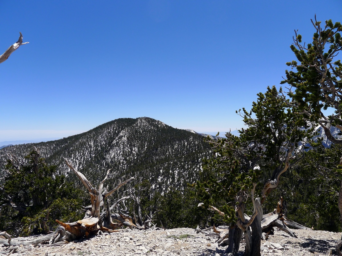
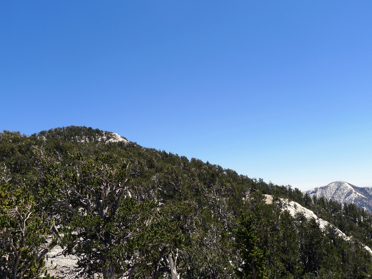
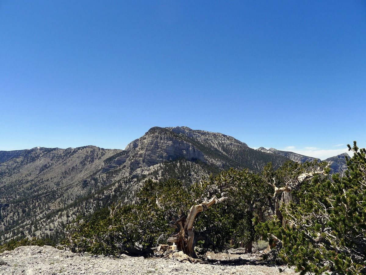
There are two sets of switchbacks that are separated by a short exposed plane. The trail here is obvious and well graded, making the climb feel easier. At the end of the second set of switchbacks you will find a clear knoll, at which point, the trail will lead you to the left around the first false summit. Climbing up to the false summit can afford a fantastic view of the area, however the official trail leads around to the left.
As you hike further along the trail, you will skirt around the right side of a second false summit and the trail will begin to lose elevation. Shortly after this, you will reach an obscure, unmarked trail junction where you will turn left.
The junction is right before the point where the main trail starts to veer right. This unofficial route is sometimes difficult to follow, but it’s hard to get completely lost. In a worst case scenario, you can simply backtrack along the ridge to reach the knoll where the main trail turned left — it’ll only cost you a bit of extra ascending.
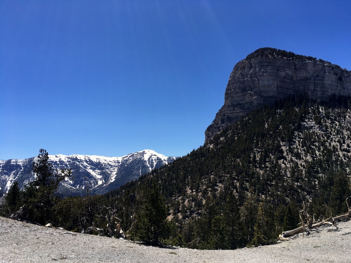
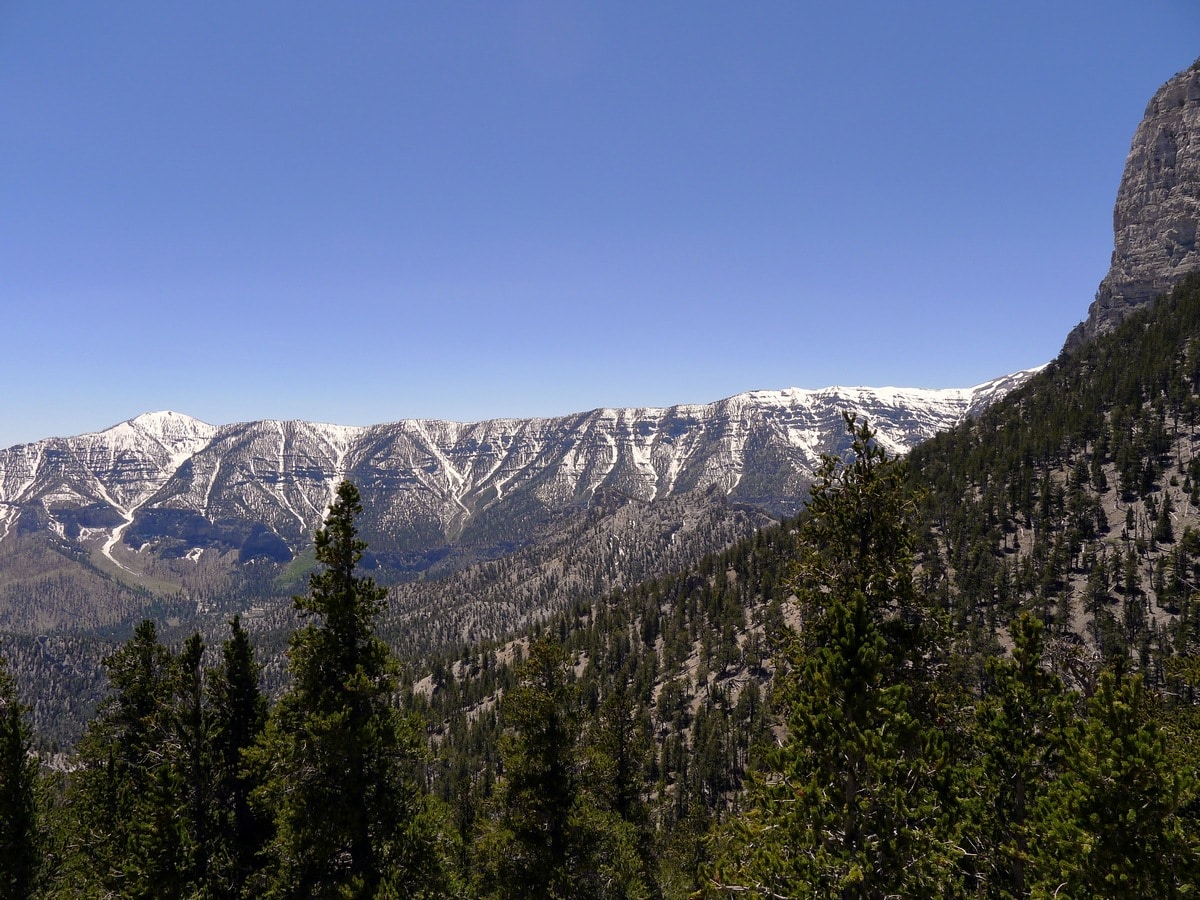
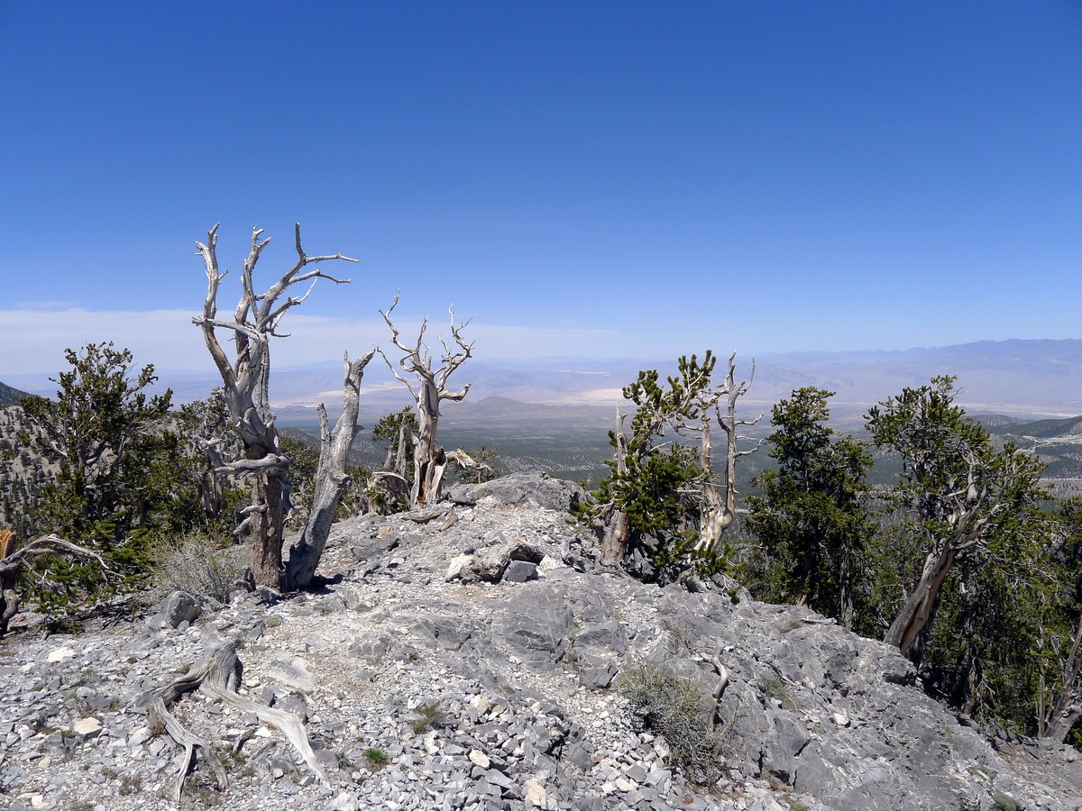
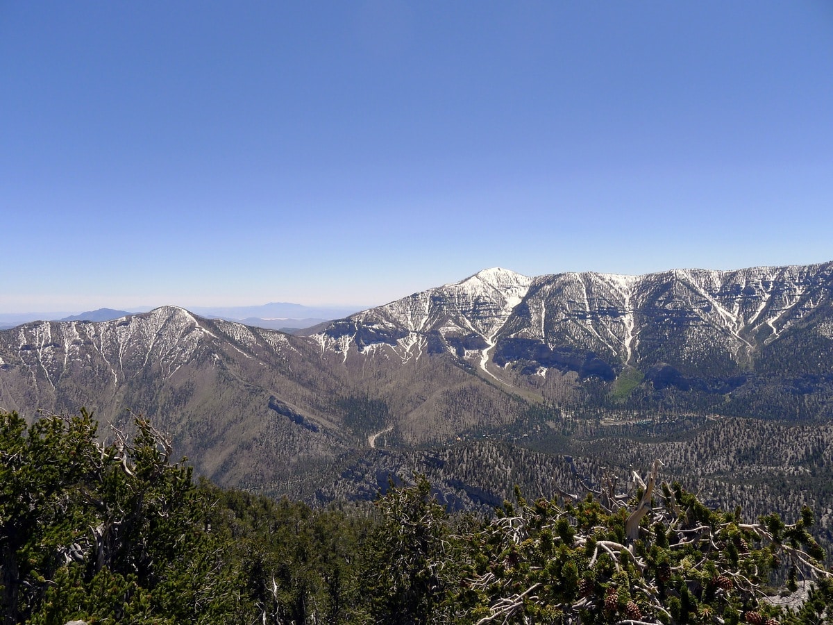
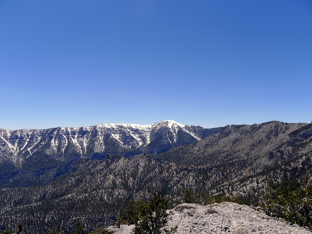
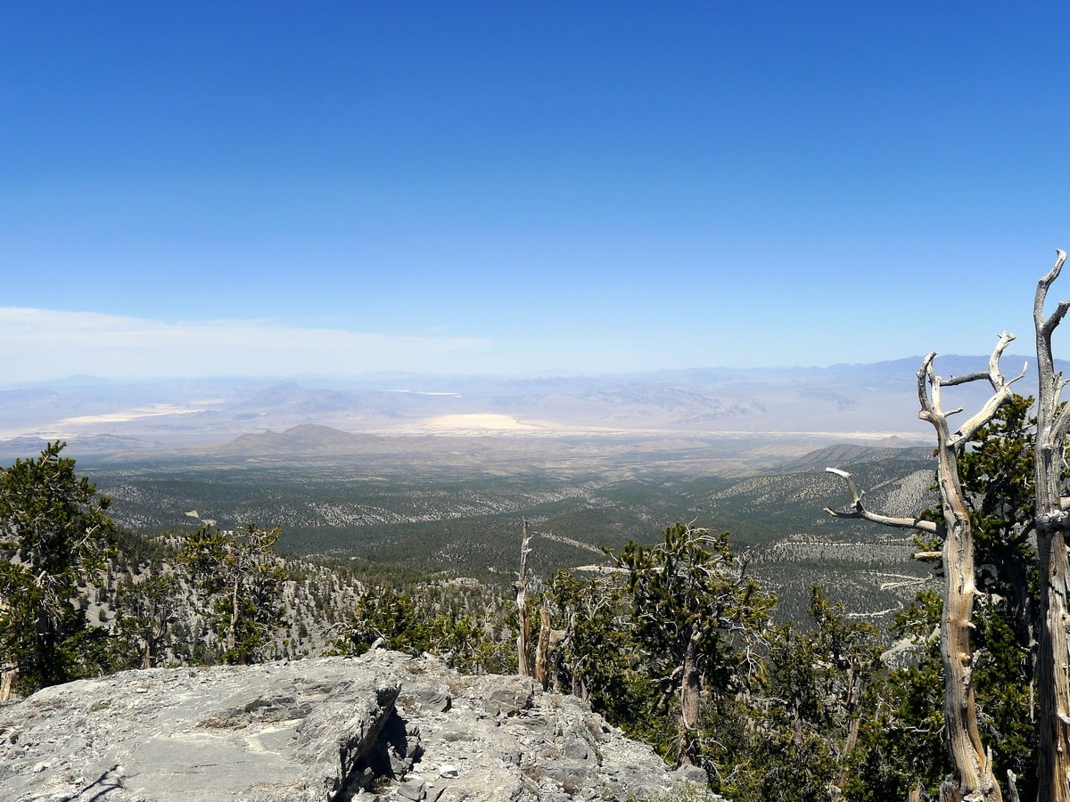
Continuing along the unofficial trail as it climbs up towards the rocky summit of Fletcher Peak, you will reach the summit and find a small ammunition container that holds the summit register. Here, you will also experience panoramic views of Charleston Peak and its summit ridge, as well as Griffith Peak to the left. Also, you can see Mummy Mountain close by, just to the right of Charleston Peak. If you look directly below and to the right of your view of Charleston you can see the final pass of the Trail Canyon Hike, also detailed on this page!
Return the way you came and take extreme care while descending the uneven and often loose, unofficial trail.
Hiking trail highlights
Spring Mountains
Located in Southern Nevada, the Spring Mountains can be found just west of Las Vegas along the California border. While there are a number of rugged peaks within the Spring Mountain Range, the highest is Mount Charleston at 11918ft.
Named after the plentiful amount of natural springs that can be found in recesses throughout the Red Rock Canyon Conservation Area on the eastern side of the mountains, the landscape here is part of a sky island ecosystem that likely features the most biodiversity in all of Nevada.
Check out more amazing hikes around Las Vegas:
Insider Hints
This hike can be very snowy in the early season. Phone the visitor centre before committing to the drive from Las Vegas.
A GPS unit can be extremely helpful in making sure you are in fact at the summit of Fletcher. There are numerous false summits!

Similar hikes to the Fletcher Peak hike hike
White Rock Trail
Stunning panoramic views of the La Madre Mountains are the reward for this seldomly-travelled trail. As you ascend along a…
Cathedral Rock Trail
This stunning, popular hike in the Spring Mountains leads up a handful of switchbacks to a rocky promontory, granting sunning…
Trail Canyon Trail
Climbing up to a ridge with fantastic views of the Spring Mountain and Mt. Charleston, this hike is a true…
Clara Fields 4 years ago
Fantastic view of the entire Lee Canyon, and the other side you can see N. Las Vegas. Beautiful!
Miri K. 4 years ago
This hike is nothing short of beautiful places! GPS works well around the area, very helpful.
TailBlazer 4 years ago
This is uphill hike going in, and I agree with the moderate difficulty. I went up with a couple of buddies and it was more then a work out for some but the views are really worth it.
Bill Parks 4 years ago
This hike offers rewarding views once you reach the summit. It's not that brutal, but there are few challenges.
Angel Wu 5 years ago
This hike is easier than I imagined. The views were really awesome. Highly recommended!
Elsa K. 5 years ago
This hike is very memorable for me. It's one of those places that's very hard not to love.
Cisco K. 5 years ago
Tons of great up and down trails. Changing terrain was remarkable.
Emma Paxton 5 years ago
Beautiful hike with decent amount of elevation. Love the extensive scenery from the summit.
Sow Sage 5 years ago
It was a tough hike in the beginning. There were also some challenging switchbacks. It's not entirely easy. But it's worth it!
WalkingLilly 5 years ago
Fletcher Peak hike was tiring. It was a really hot day and the climb, though not too hard in general, became somewhat exhausting.