Watendlath to Stonethwaite Circular Walk
View Photos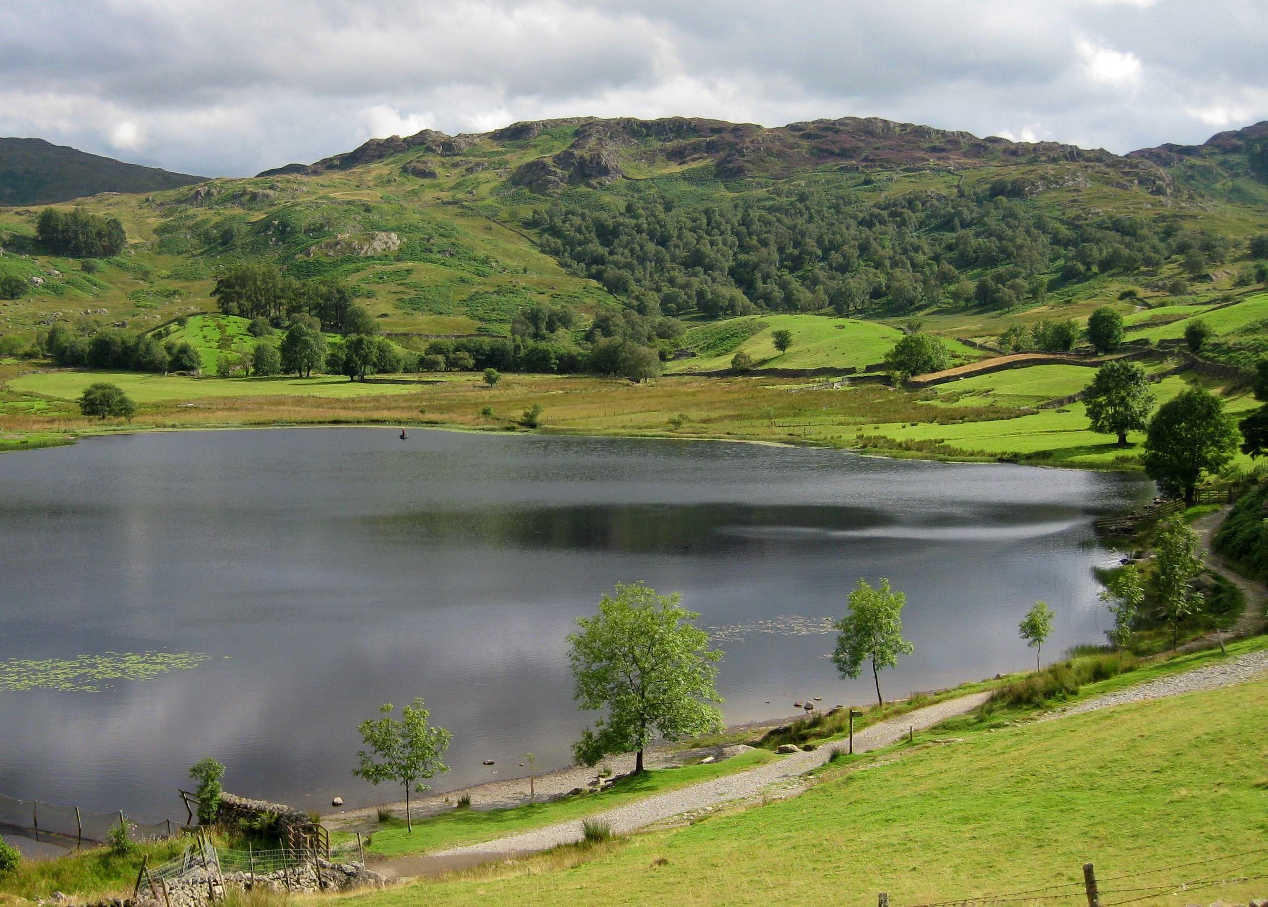
Watendlath to Stonethwaite Circular Walk
Difficulty Rating:
The Watendlath to Stonethwaite Circular walk is a scenic adventure that will take you from the village of Watendlath into the valley of Stonethwaite Beck for views of nearby fells within the Lake District terrain. While out walking the trail, you will pass by Watendlath Tarn and descend into the valley before climbing up the steep hillside to pass by Dock Tarn and Great Crag on the return leg of the journey. While there are some challenging parts, this is a great route for casual walkers.
Getting there
To reach the car park for the Watendlath to Stonethwaite Circular Walk from Keswick, drive southeast on Borrowdale Road /B5289 for 1.7mi and make a slight left to continue on for another 0.7mi. Turn right here and follow the road for 2.1mi, before making a slight left to arrive at the car park.

About
| When to do | March-November |
| Backcountry Campsites | No |
| Pets allowed | Yes - On Leash |
| Family friendly | Older Children only |
| Route Signage | Average |
| Crowd Levels | Moderate |
| Route Type | Lollipop |
Watendlath to Stonethwaite Circular Walk
Elevation Graph
Weather
Watendlath to Stonethwaite Circular Walk Description
Walking the Watendlath to Stonethwaite Circular is a great outdoor activity in the Lake District that will take you through several types of terrain and steep sections of trail. In order to better traverse the changing terrain types, make sure to wear proper walking boots and bring poles for stability along the steep slopes. You can also bring your canine friends along for this walk, but make sure to keep them on leash in areas where livestock may be present.
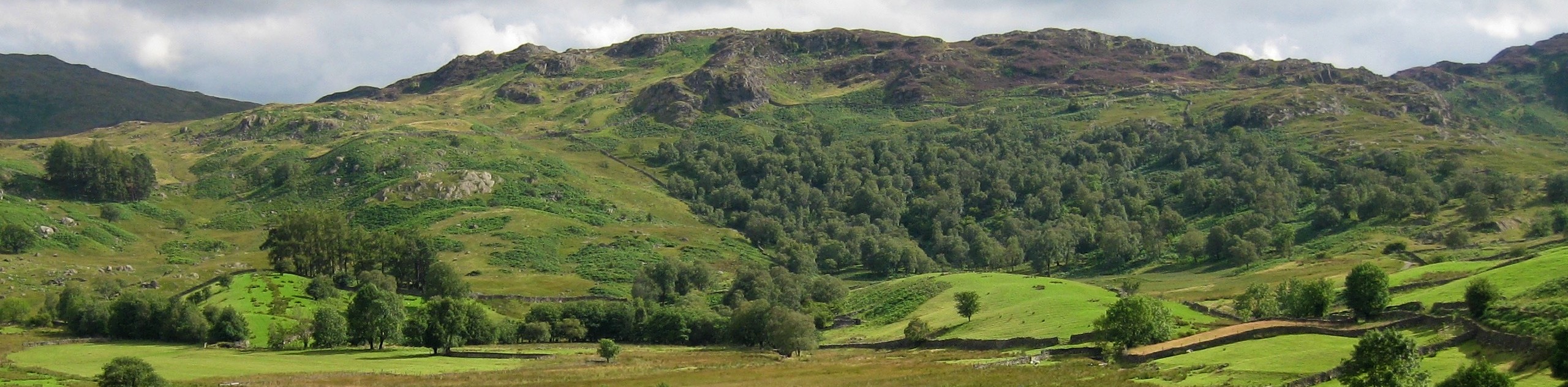
The nice thing about the variety of terrain and changes in elevation along this route is that it will expose you to some amazing scenery over the surrounding woodlands, farm fields, lakes, and rugged fells that characterize the landscape here. Along the trail, you will pass several charming tarns and descend into a gorgeous valley that is flanked by beautiful peaks in several directions. If you don’t mind a bit of uphill walking, then this trail makes for a perfect weekend outing.
Setting out from the trailhead in the village of Watendlath, make your way northwest around the Caffle House Tea Room and cross over Watendlath Beck. From here, turn left to briefly follow the path along the edge of the water, before passing through a gate to head right at the fork. Keep left for the next 0.5mi, as the trail begins to climb uphill through Bracken Wood to bring you to an intersection in the trail.
Head straight through and pass through the gate, bearing left at the fork to continue downhill along the trail for another 0.4mi. At the junction, head left and cross over Frith Gill, keeping right along the trail to descend further down the hillside and pass through several gates, eventually meeting up with the banks of Stonethwaite Beck. Cross over the lane and pick up the trail on the opposite side, following it south along the beck for the next 1.0mi. Along this portion of the walk, you will pass through a series of gates as you walk along the valley floor and enjoy the views of the rugged fells that flank the landscape on either side.
Arriving at a fork in the path, head left to begin the steep climb uphill that runs alongside Willygrass Gill. Follow this route for 0.7mi, crossing over a series of three stiles as you traverse the hillside and woodland terrain before arriving at a fork. Take the path on the right and continue straight until you arrive at the edge of Dock Tarn. Enjoy the views across this charming body of water, keeping right along the trail for another 0.5mi as you head north to pass by the rugged summit of Great Crag on your left.
From here, follow the path as it descends slightly on the return leg of the journey back to the village of Watendlath. Keep right along the trail and enjoy the views along the final 1.1mi of the walk. Here, you will have a great sightline across the calm waters of Watendlath Tarn before arriving back in the car park where you began the Watendlath to Stonethwaite Circular Walk.
Insider Hints
Public toilets can be found near the trailhead.
This route features some steep uphill climbs. Wear proper walking footwear and bring plenty of water and snacks to stay fueled.
The Caffle House Tea Room in Watendlath is a great place to stop for pre/post-walk refreshments.
Similar hikes to the Watendlath to Stonethwaite Circular Walk hike

Osprey Viewpoint & Bassenthwaite Lake Walk
The Osprey Viewpoint & Bassenthwaite Lake Walk is a scenic Lake District adventure that will expose you to some beautiful…

Hawkshead, Wray Castle, and Windermere Walk
The Hawkshead, Wray Castle, and Windermere Walk is a fantastic journey that will lead you through some picturesque locations that…

Pike of Blisco and Crinkle Crags Walk
The Pike of Blisco and Crinkle Crags Trail is a challenging adventure that will see you climb several rugged peaks…
Comments