Watendlath Circular Walk
View Photos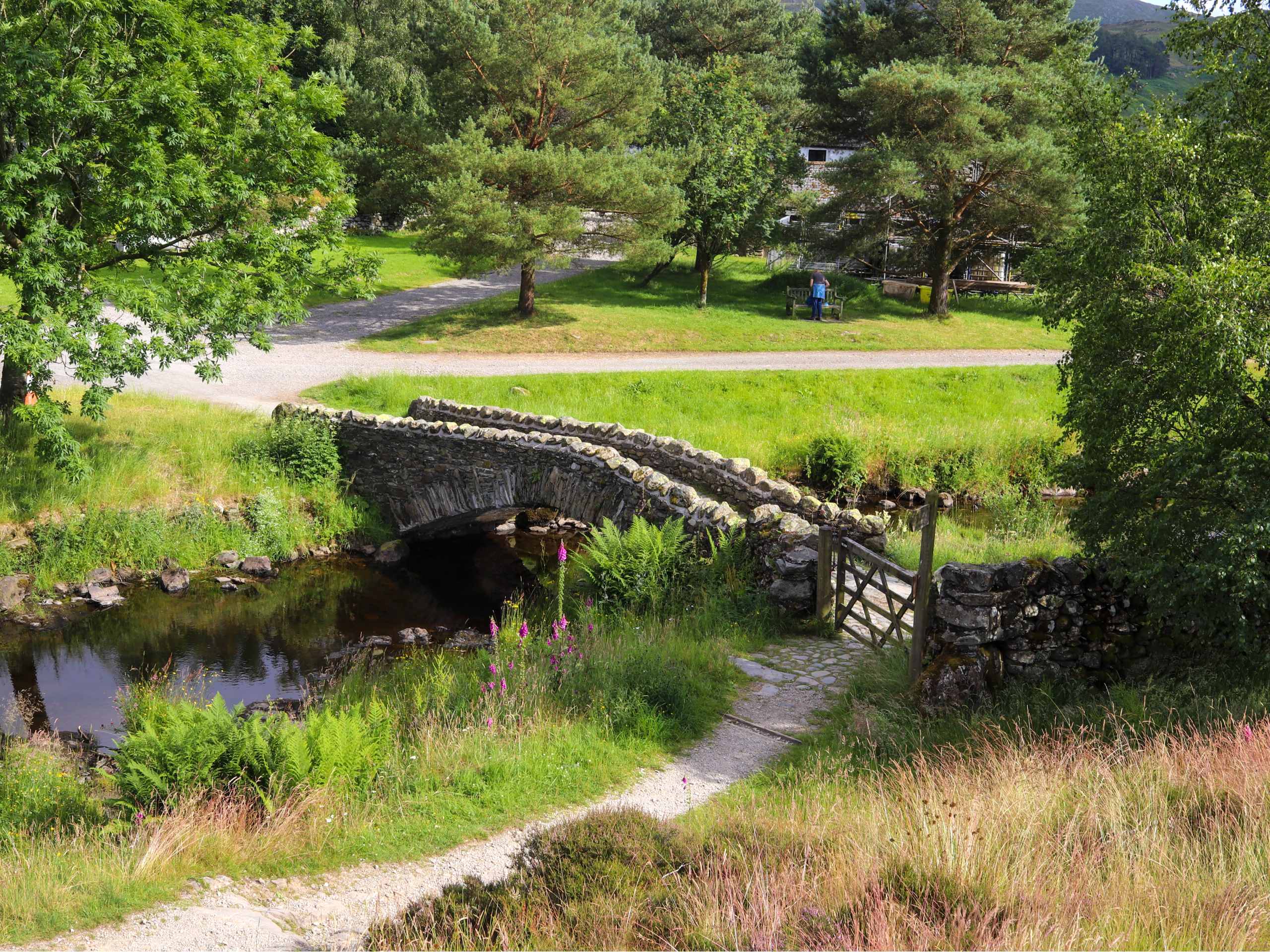
Watendlath Circular Walk
Difficulty Rating:
The Watendlath Circular Walk is a 8.2mi adventure in the Lake District that will take you through a valley to the edge of Derwent Water before circling around the village of Watendlath and the rugged terrain of Grange Fell. While out on the trail, you will traverse a variety of terrain, including open farmland, serene forests, and sections of steep incline. This is a beautiful walking route for a leisurely weekend stroll through the Cumbrian countryside.
Getting there
To reach the car park for the Watendlath Circular Walk from Keswick, drive south on Heads Rd/B5289 for 0.3mi and take the first exit at the roundabout onto Borrowdale Road/B5289. After 4.3mi, you will find the car park on the left.

About
| When to do | March-November |
| Backcountry Campsites | Hollows Farm Campsite |
| Pets allowed | Yes - On Leash |
| Family friendly | Older Children only |
| Route Signage | Average |
| Crowd Levels | Moderate |
| Route Type | Circuit |
Watendlath Circular Walk
Elevation Graph
Weather
Watendlath Circular Walk Description
The Watendlath Circular Walk is a great adventure due to the good variety of terrain that you will be exposed to on the trail. In order to better traverse the open farmland, dense forests, and rugged hilltops, be sure to wear proper walking footwear. Additionally, there are a few steep ascents and descents that can be found along the route. These are more than manageable for walkers of most skill levels, so just take your time when traversing these areas.
The variety of terrain on this walk might make travel a bit more challenging for some walkers, but it also produces a variety of beautiful scenery that can be enjoyed by all. While out on this walk, you will be exposed to views of the scenic Derwent Water, several small waterfalls, a quaint tarn, and the rugged hilltop of Grange Fell. Add in the fact that there are several charming villages along the route where you can stop for refreshments, and this walk has all the ingredients necessary for a pleasant weekend adventure.
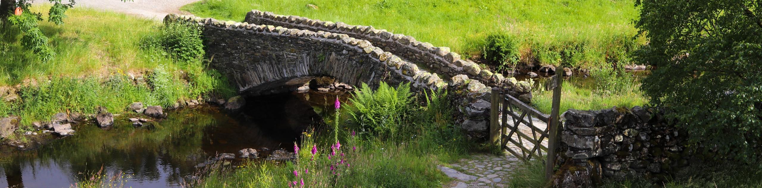
Setting out from the car park, head right along the B5289 for 0.4mi and turn left along the road to cross over the River Derwent and enter into the village of Grange. Here, you will find several cafes where you can buy some snacks for your walk. Continue along the road for 0.7mi, picking up a trail on the right shortly after you cross over Ellers Beck. Follow this track to the northeast for the next 0.5mi, keeping right to pass through a kissing gate and a regular gate as you traverse the open farmlands and intermittent cover of the forest. Eventually, you will arrive at the edge of the Great Bay on the southern shore of Derwent Water.
After taking in the beautiful views across the calm waters of the lake, continue east along the trail for 0.4mi, passing through a series of four gates and traversing a boardwalk, before crossing the footbridge over the River Derwent to arrive at the edge of the road. Head left here and follow the road for 0.3mi, where you will find a trail on the right that enters into the dense canopy of Lodore Wood.
Head south into the tranquil forest and follow the trail as it climbs sharply uphill for views of Lodore Falls and Watendlath Beck before meeting up with a trail that will take you through another stretch of woodland terrain known as Mossmire Coppice. Turn left here and follow the trail south along Watendlath Beck for another 1.7mi, taking in the scenic views of the rugged terrain that flanks the valley floor before passing through the village of Watendlath to arrive at the edge of Watendlath Tarn.
Enjoy the views across this quaint body of water as you continue straight along the trail for the next 0.7mi, walking gradually uphill along the edge of the Bracken Plantation before arriving at a junction. Turn right here and continue uphill for another 0.1mi, crossing over a small stream to arrive at another junction. Turn right and pass through the gate, continuing on for another 0.4mi with the rugged summit of Grange Fell straight ahead of you to the north.
Shortly after passing through a kissing gate, you will come to a four-way intersection in the trail. Turn left here and follow the path as it begins to descend the steep hillside along Frith Gill, leading you towards the valley floor below. Keep straight through the serene expanse of Frith Wood, making your way past the mature trees until you arrive at the edge of the B5289 with Castle Crag in the backdrop to the west. From here, turn right and follow the trail north for 0.8mi, as it runs parallel to the River Derwent and brings you back to the car park where you began the Watendlath Circular Walk.
Insider Hints
This route features some steep and rugged terrain. Be sure to wear proper walking boots.
Keep any dogs on a leash in areas where livestock are present.
Pair this walk with a fun weekend of camping outdoors at the Hollows Farm Campsite.
Similar hikes to the Watendlath Circular Walk hike

Osprey Viewpoint & Bassenthwaite Lake Walk
The Osprey Viewpoint & Bassenthwaite Lake Walk is a scenic Lake District adventure that will expose you to some beautiful…

Hawkshead, Wray Castle, and Windermere Walk
The Hawkshead, Wray Castle, and Windermere Walk is a fantastic journey that will lead you through some picturesque locations that…

Pike of Blisco and Crinkle Crags Walk
The Pike of Blisco and Crinkle Crags Trail is a challenging adventure that will see you climb several rugged peaks…
Comments