Black Combe Walk
View Photos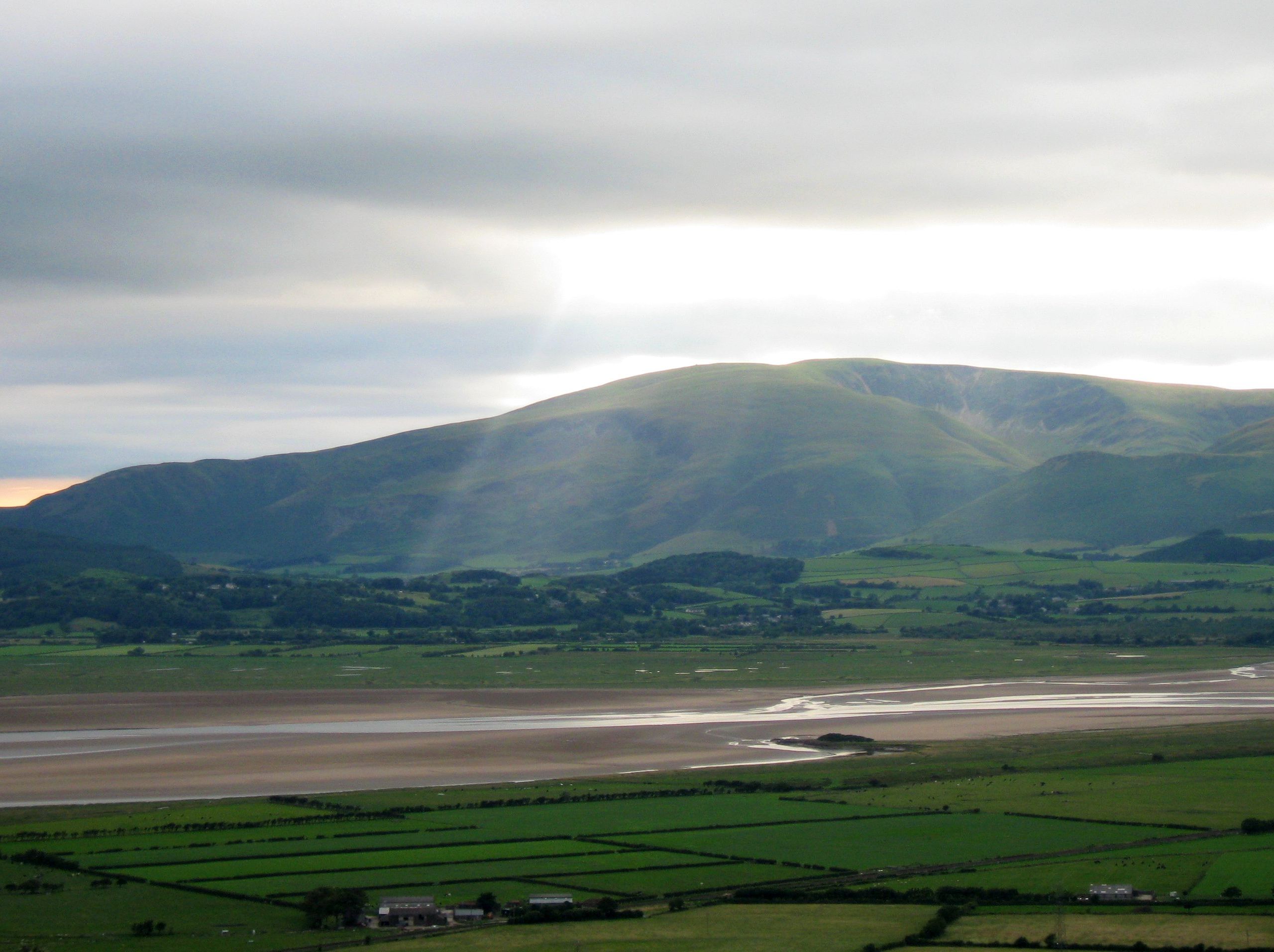
Black Combe Walk
Difficulty Rating:
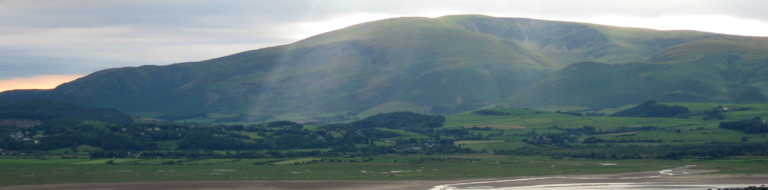
The Black Combe Walk is a spectacular outdoor experience in the Lake District that will take you uphill along an overgrown path to reach the summit of the mountain. While out on the trail, you will experience some wonderfully scenic views that sweep across the western seaboard and include Scotland, Wales, England, and the Irish Sea on a clear day. Make sure to bring a GPS for this walk, as navigation can be tricky along the relatively unmarked path.
Getting there
To reach the car park for the Black Combe Walk from Millom, drive northeast on Station Road/A5093 for 3.6mi and turn right onto the A595. After 217ft, turn right onto Chapel Brow, and you will arrive at the church car park.

About
| When to do | March-October |
| Backcountry Campsites | Baystone Bank Farm Camping Site |
| Pets allowed | Yes |
| Family friendly | Older Children only |
| Route Signage | Poor |
| Crowd Levels | Low |
| Route Type | Lollipop |
Black Combe Walk
Elevation Graph
Weather
Black Combe Walk Description
Walking the Black Combe Trail is an amazingly scenic – albeit rugged and unmaintained – route that will expose you to overgrown trails that can be challenging to navigate. To safely make your way through this area to enjoy the views, be sure to utilize a GPS to stay on the correct path. Additionally, the conditions along the trail and the rough terrain make sturdy walking boots with good ankle support essential.
Although you will need to use your route finding skills and keep your GPS handy for this less-travelled trail, part of its charm comes from the fact that you will need to traverse the rugged landscape and possibly even blaze new trails to reach the viewpoint at the summit. Once there, the breathtaking scenery across the Irish Sea to the west, and of the entire western seaboard are more than enough reward for your troubles.
Setting out from the car park at the church, follow the road east for 0.25mi and turn left, making an immediate left to pick up the trail. From here, follow it north alongside Black Beck for 0.8mi, passing through a number of gates and crossing several stiles along the open fields. Keep left at the fork and you will eventually arrive at the edge of the A595.
Cross over to the other side and head right at the fork in the road, continuing on for 0.1mi to meet up with a laneway on the left. Turn left here and follow the lane to pass through the grounds of Beck Bank Farm. After passing through a gate and crossing over Black Beck, head northwest across the open terrain and cross over two stiles to meet up with the road. Keep left along the road for the next 1.0mi, following it gradually uphill until you come to a gated path on your right. Follow this for a brief detour to visit the site of a ceremonial Bronze Age stone circle near Swinside.
Returning to the road, head right and follow the road for 0.12mi before following the path to the left around the buildings. Here, you will pass through a series of three gates before breaking away from the path to climb uphill along the slopes of Ravens Crag. Keep an eye on your GPS as you traverse the rugged and unmarked terrain of the moor to the west before meeting back up with the trail.
Turn left along the trail and make your way to the southwest, keeping right for the next 2.6mi as you take in the beautiful views of the surrounding terrain on the way to the summit of Black Combe. After passing by the scree slopes that give the peak its name and climbing a bit further uphill, you will arrive at the summit viewpoint. From this elevated position, you will have some truly spectacular views across the western seaboard that stretches from Scotland to Wales on a clear day.
After enjoying the scenery along the Irish Sea, retrace your steps for 1.4mi to slightly descend toward a junction in the path just after the White Combe Screes. Turn right here and begin the steep descent along the hillside to the southeast, utilizing the GPS to help navigate the rugged and unmarked terrain on this final portion of the walk.
After roughly 1.8mi of challenging terrain that includes crossing over Stoupdale Beck, you will arrive at the edge of Baystone Bank Lane. Turn left here and follow the lane past the campsite, continuing east across the open countryside to pass by Bank House Farm and eventually arrive back at the church car park where you began the Black Combe Walk.
Insider Hints
Parking at the church is free; however, there is a community donation box if you are feeling charitable.
This walk is very overgrown and poorly marked. Make sure to keep an eye on your GPS and give yourself some extra time in the event of troubles with navigation.
Wear sturdy walking boots for this rugged adventure.
Similar hikes to the Black Combe Walk hike

Osprey Viewpoint & Bassenthwaite Lake Walk
The Osprey Viewpoint & Bassenthwaite Lake Walk is a scenic Lake District adventure that will expose you to some beautiful…

Hawkshead, Wray Castle, and Windermere Walk
The Hawkshead, Wray Castle, and Windermere Walk is a fantastic journey that will lead you through some picturesque locations that…

Pike of Blisco and Crinkle Crags Walk
The Pike of Blisco and Crinkle Crags Trail is a challenging adventure that will see you climb several rugged peaks…
Comments