The Crinkle Crags Walk
View Photos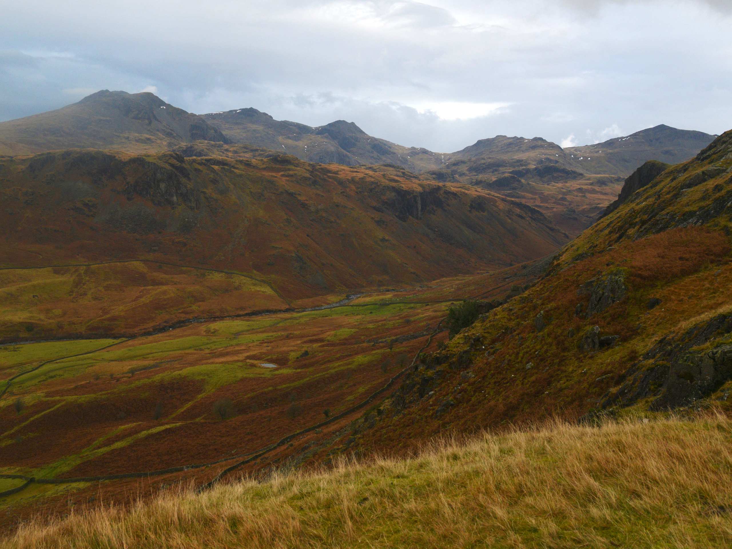
The Crinkle Crags Walk
Difficulty Rating:
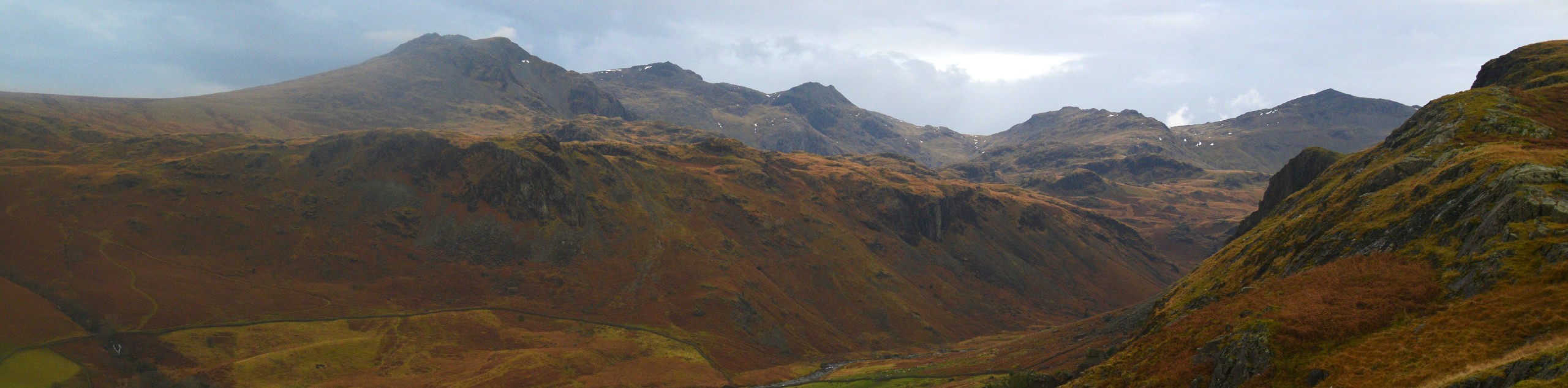
The Crinkle Crags Walk is a 8.8mi lollipop route that will see you set out from the valley of Great Langdale and climb uphill to the summit of the fell. While out on the trail, you will traverse some rocky and rugged terrain to gain an amazing vantage point overlooking the valley and surrounding mountains of the Lake District. The views along the walk are a great reward, but make no mistake, your body will let you know when you’ve reached the end of this tough trail.
Getting there
To get to the car park for The Crinkle Crags Walk from Skelwith Bridge, drive west along B5343 for 4.2mi and make two immediate left turns to arrive at the car park.

About
| When to do | Marc-October |
| Backcountry Campsites | Great Langdale Campsite` |
| Pets allowed | Yes - On Leash |
| Family friendly | Older Children only |
| Route Signage | Average |
| Crowd Levels | Moderate |
| Route Type | Lollipop |
The Crinkle Crags Walk
Elevation Graph
Weather
The Crinkle Crags Walk Description
The Crinkle Crags Walk is a rugged adventure that will see you climb uphill along an undulating ridgeline for views of the valley. In order to gain the best footing on the challenging terrain and steep hillsides, be sure to wear sturdy walking books. Additionally, this route can see its fair share of bad weather, so bring all necessary gear and clothing that you will need for the walk.
Although the route might be a bit of a rugged one, the trail is easy to navigate and offers some amazing views overlooking both the Great Langdale and Upper Esdale valleys. The trail will likely also be less busy than other nearby routes like the Langdale Pikes, so if you don’t mind a bit of scrambling, then this might just be your next adventure.
Setting out from the car park, walk west along the road for 1.4mi and take in the beautiful views of the surrounding valley landscape, before passing by Stool End Farm and arriving at a junction with a trail on your right. Follow this path to begin making your way uphill along the rugged terrain of the moor.
Continue along for the next 1.8mi, keeping left as you slog up the steep terrain of the hillside and eventually come to the edge of Buscoe Sike. Continue west along the trail and keep left at the junctions to pass by a series of three tarns. Here, the trail will turn south and traverse the undulating summit ridgeline that gives The Crinkle Crags its unique name.
After 0.9mi of trekking along this rugged terrain, you will arrive at the highpoint of the summit, which is known as Long Top. Take some time to appreciate the amazing views that sweep across the Great Langdale valley to the east and the Upper Eskdale valley to the west. Once you have taken in the sights, continue along the ridge for 0.4mi to traverse South Top and arrive at a junction.
Head left here and make your way downhill for 0.4mi, where you will find a junction branching off to the left that will take you to the summit of Great Knott. If you do not want to take this detour, head right and continue down the hillside, keeping straight for the next 0.7mi to cross over Browney Gill.
Immediately after crossing the stream, turn left along the trail to skirt around the foot of Pike of Blisco, carrying on straight for the next 1.0mi. Here, you will continue to head downhill, passing through several gates and crossing Oxendale Beck before arriving back at the edge of the road. Follow the road right for 0.5mi to arrive back at Stool End Farm near the trail where you started the uphill climb.
For the final leg of the journey, continue heading east along the road, retracing your steps from the initial part of your journey to bring you back to the car park where you began The Crinkle Crags Walk. if you are looking to unwind after your journey, cross over the B5343 and walk up the road to reach Sticklebarn for some post-walk drinks.
Trail Highlights
Crinkle Crags
Located near the centre of England’s Lake District, Crinkle Crags is a unique fell that serves as a part of two rings of mountains surrounding the Great Langdale and Upper Eskdale valleys. The summit of the fell is very distinct, as it is comprised of five rises and drops, giving it a crinkled appearance that stands in contrast to the surrounding valley landscape.
Insider Hints
This route features some rugged and rocky terrain leading up the hillside that can be slippery in wet weather. Be sure to wear proper walking boots for the best footing along the trail.
Although you can bring your dog on this walk, the rocky portions of terrain might be a bit difficult to traverse. Be aware of this before setting out on your adventure.
Pair this with an overnight stay at the Great Langdale Campsite for a fun weekend of outdoor activities.
Toilet facilities can be found near the trailhead.
Similar hikes to the The Crinkle Crags Walk hike

Osprey Viewpoint & Bassenthwaite Lake Walk
The Osprey Viewpoint & Bassenthwaite Lake Walk is a scenic Lake District adventure that will expose you to some beautiful…

Hawkshead, Wray Castle, and Windermere Walk
The Hawkshead, Wray Castle, and Windermere Walk is a fantastic journey that will lead you through some picturesque locations that…

Pike of Blisco and Crinkle Crags Walk
The Pike of Blisco and Crinkle Crags Trail is a challenging adventure that will see you climb several rugged peaks…
Comments