Helvellyn via Swirl Edge
View Photos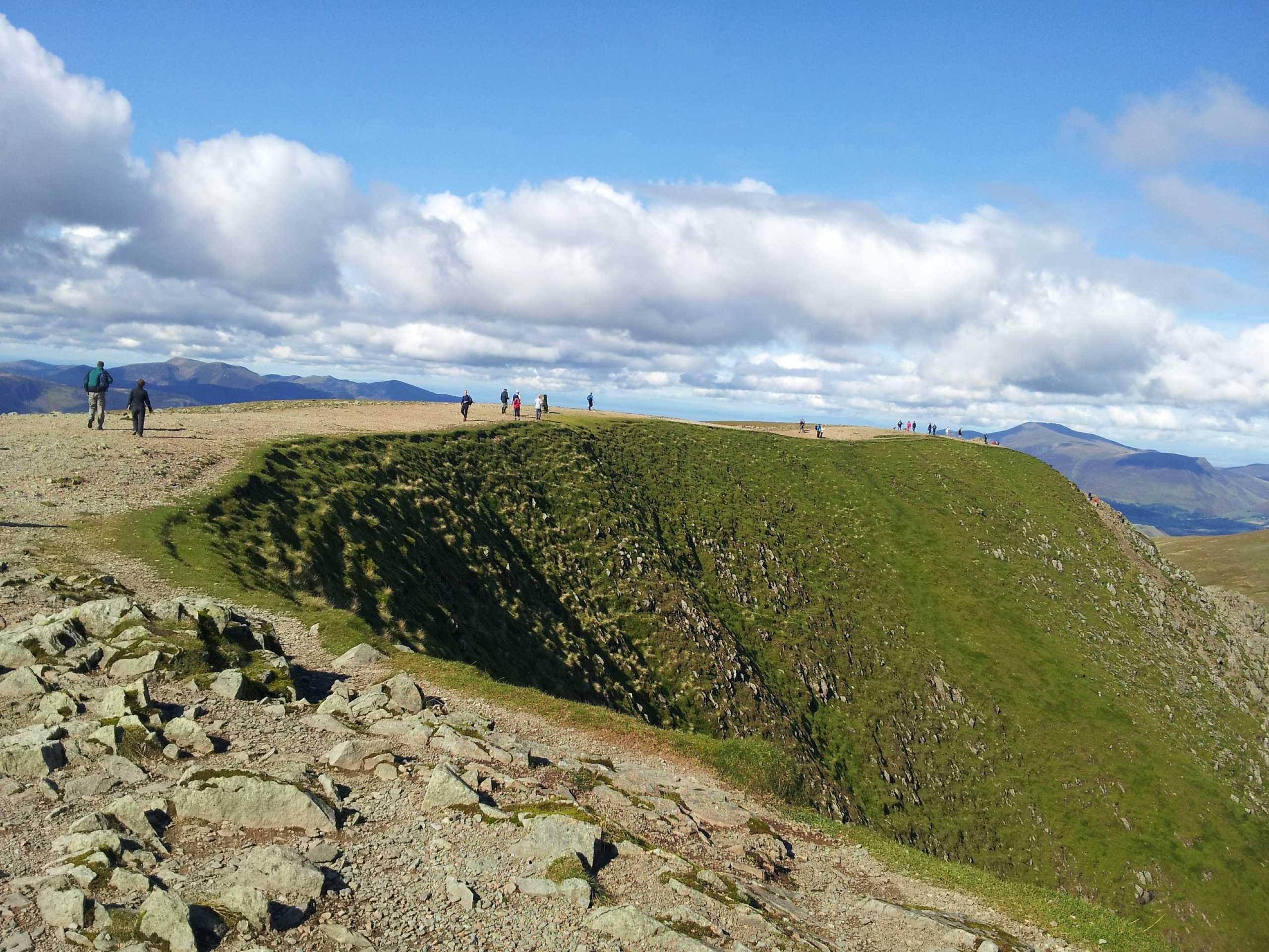
Helvellyn via Swirl Edge
Difficulty Rating:
Walking to Helvellyn via the Swirral Edge is a beautiful but rewarding route in the Lake District that will take you uphill to visit the summit of the third-highest point in England. While out on the trail, you will experience some breathtaking views overlooking a number of nearby fells, as well as the snaking expanse of Ullswater to the east. Portions of this trail might be a bit tricky and weather can change rapidly, but if you catch it on a good day you will be wowed by the amazing scenery.
Getting there
To reach the car park for the Helvellyn via Swirral Edge Trail from the A592 in Glenridding, turn off onto Greenside Road and follow the road as it veers right. In 400ft, turn left to stay on Greenside Road and follow it for 1.4mi to arrive at the car park.

About
| When to do | March-October |
| Backcountry Campsites | No |
| Pets allowed | Yes - On Leash |
| Family friendly | Older Children only |
| Route Signage | Average |
| Crowd Levels | Moderate |
| Route Type | Lollipop |
Helvellyn via Swirl Edge
Elevation Graph
Weather
Helvellyn via Swirl Edge Description
The Helvellyn via Swirral Edge Trail is an amazing walking route in the Lake District that features a bit of steep and rugged terrain that could pose a problem for less skilled walkers. Be sure to wear proper walking boots in order to have the best footing on the trail. Additionally, make sure to keep an eye on the weather, as conditions near the summit of the mountain can change rapidly.
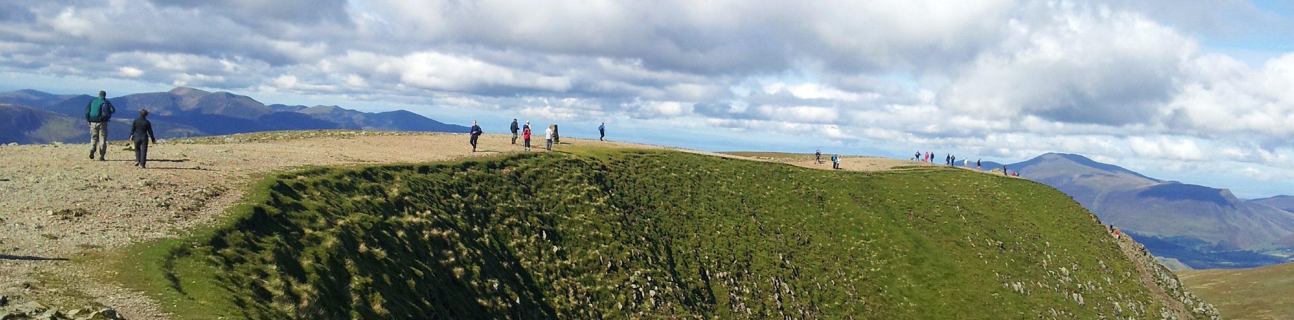
Even with the steep sections of terrain, this is a spectacular route that is popular with many walkers because of its amazingly scenic views. With a great sightline overlooking Ullswater and a number of surrounding fells, you won’t be short on picturesque scenery. With the added bonus of reaching the third-highest point in England, there aren’t many reasons why not to attempt this awesome trail.
Setting out from the car park, follow the trail west for a short distance and take the first path on the right to climb slightly uphill. From here, keep left along the trail for the next 1.0mi and follow closely alongside the winding banks of Glenridding Beck as you gradually climb uphill and arrive at a fork.
After turning right along the path, you will notice that the slope will begin to steepen drastically. Make your way up the sweeping switchbacks and enjoy the views as you gain elevation along the hillside to arrive at another junction. Turn left here and follow the trail around the edge of the steep hillside for 0.7mi, where you will come to the summit of White Side at 2831ft above sea level.
Enjoy the amazing views overlooking the undulating landscape of the Lake District and Ullswater off in the distance, as you continue south along the ridge for the next 1.1mi and keep left to traverse the summit of Lower Man on the way to another junction. Turn right here and follow the trail for a short distance to arrive at the summit of Helvellyn, England’s third-highest point.
Upon experiencing the feeling of reaching this highpoint, retrace your steps back to the junction and head right, following the trail northeast to descend along the steep and rugged terrain of Swirral Edge for 0.3mi. Keep right here and descend further along the hillside to work past Red Tarn, keeping straight along the trail for 1.1mi to arrive at a junction near the banks of Red Tarn Beck.
Head right here and keep straight for the next 1.0mi, at first walking north along Red Tarn Beck before turning northeast to follow closely along Glenridding Beck for the final leg of the journey. Reaching a junction next to a bridge, turn left and cross over to the other side to continue on to the car park where you began the Helvellyn via Swirral Edge Trail.
Trail Highlights
Helvellyn
Standing at a height of 3117ft, Helvellyn is the third-highest point in both England and the Lake District, and is also the highest point of the Helvellyn Range. This mountain has been a popular destination for walkers dating back to the late 18th Century and features a number of different routes up to the summit, making it accessible in almost every direction.
Frequently Asked Questions
Is Helvellyn dangerous?
While Helvellyn is a popular destination for many walkers, conditions atop the peak can be dangerous at all times of the year. Even in the summer, the exposed terrain is subject to rapid changes in weather conditions that will reduce visibility and pose a potential risk. Make sure that you understand the risks of climbing in the area and bring all necessary gear to safely and successfully navigate the trail.
Insider Hints
This route features some steep and uneven terrain. Be sure to wear proper walking boots.
Weather conditions atop Helvellyn can change rapidly, so make sure to plan ahead and bring any necessary clothing and equipment.
Arrive early to secure parking, as the area can become quite busy during peak times.
Similar hikes to the Helvellyn via Swirl Edge hike

Osprey Viewpoint & Bassenthwaite Lake Walk
The Osprey Viewpoint & Bassenthwaite Lake Walk is a scenic Lake District adventure that will expose you to some beautiful…

Hawkshead, Wray Castle, and Windermere Walk
The Hawkshead, Wray Castle, and Windermere Walk is a fantastic journey that will lead you through some picturesque locations that…

Pike of Blisco and Crinkle Crags Walk
The Pike of Blisco and Crinkle Crags Trail is a challenging adventure that will see you climb several rugged peaks…
Comments