Swirl How and Wetherlam Circular Walk
View Photos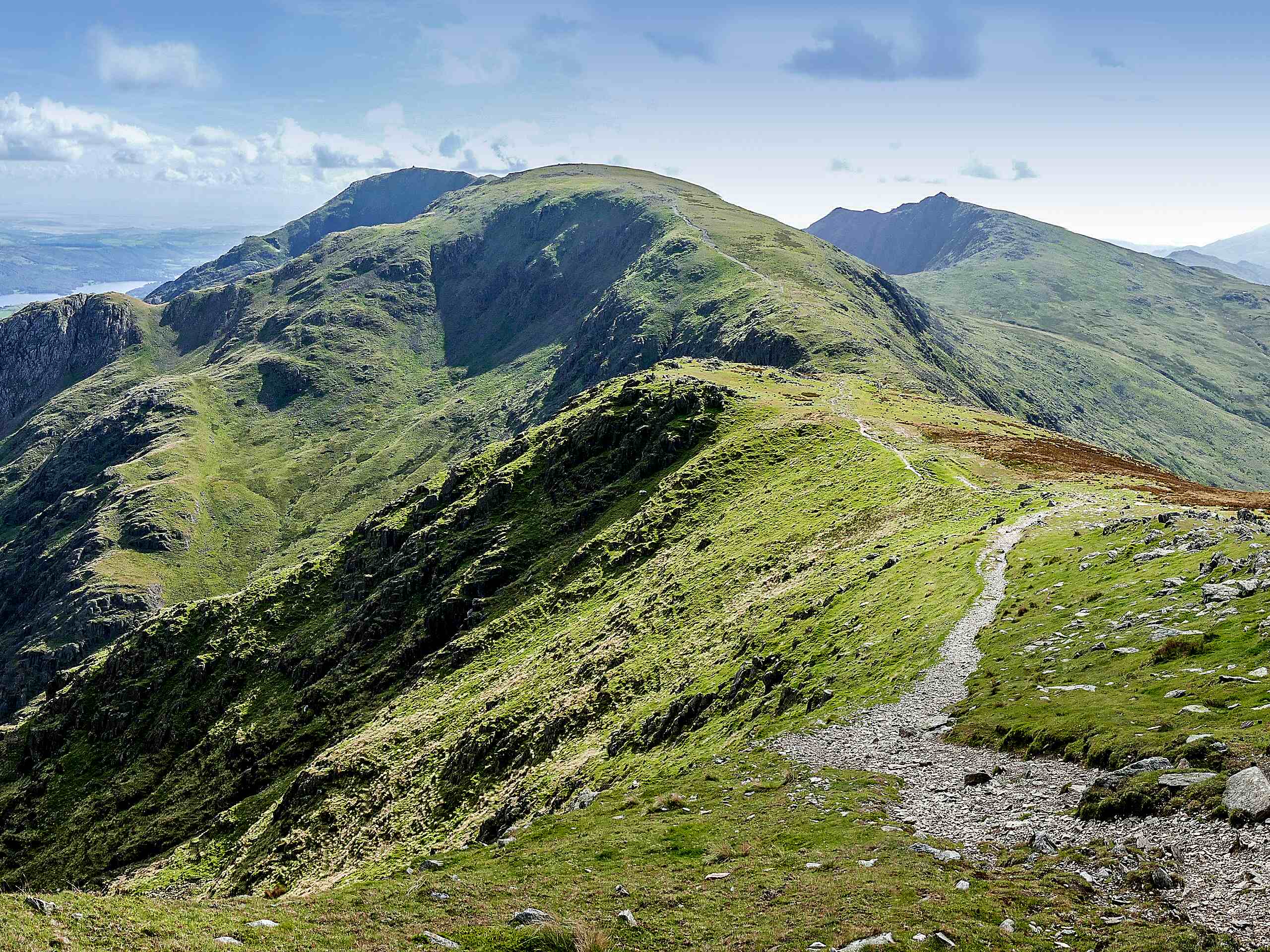
Swirl How and Wetherlam Circular Walk
Difficulty Rating:
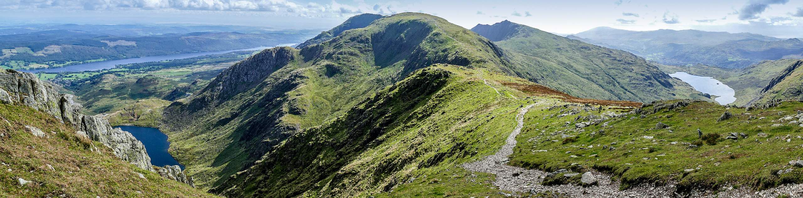
Walking the Swirl How and Wetherlam Circular is an amazing adventure that will lead you over several summits for some breathtaking views overlooking the surrounding valleys and fells of the Lake District. While out on the trail, walkers will traverse some open farmland and cross the River Brathay before climbing up the steep hillside to reach a series of scenic viewpoints. This route will give you the opportunity to summit Great Carrs, Swirl How, and Wetherlam, all while taking in the views of Greenburn and the Little Langdale Valley further afield.
Getting there
To reach the parking area for the Swirl How and Wetherlam CircularWalk from Skelwith Bridge, drive southwest on A593 for 1.0mi and make a right, continuing on for the next 0.4mi. Make a left onto Side Gates and follow it for 1.9mi, keeping left onto Wrynose Pass. After 0.4mi, you will find a layby on the left next to a trailhead.

About
| When to do | March-October |
| Backcountry Campsites | No |
| Pets allowed | Yes - On Leash |
| Family friendly | Older Children only |
| Route Signage | Average |
| Crowd Levels | Moderate |
| Route Type | Lollipop |
Swirl How and Wetherlam Circular Walk
Elevation Graph
Weather
Swirl How and Wetherlam Circular Walk Description
Although the Swirl How and Wetherlam Circular Walk features a fair bit of elevation gain and will see you traverse several peaks, it is surprisingly not too difficult or technical. Still, there are some sections of rocky terrain and a few inclines, making proper walking boots a necessity. Be sure to arrive early to secure parking, as the layby next to the trailhead is very small.
Setting out from your vehicle, the trail will take you to the southwest across an open stretch of farmland, before crossing over the River Brathay to begin the climb up the hillside. Here, you will traverse the rugged terrain of Wet Side Edge and Little Carrs before continuing along the escarpment to reach Great Carrs and Swirl How. This section of the walk features some beautiful views overlooking the Greenburn Reservoir below, so make sure to enjoy them as you trek across the rocky landscape. Continue along the trail to the northeast for a slight climb uphill that will bring you to the summit of Wetherlam. After taking in some more amazing views, the trail will lead you downhill into the valley to cross over Greenburn Beck and the River Brathay once more on the return to the trailhead where you began.

Similar hikes to the Swirl How and Wetherlam Circular Walk hike

Osprey Viewpoint & Bassenthwaite Lake Walk
The Osprey Viewpoint & Bassenthwaite Lake Walk is a scenic Lake District adventure that will expose you to some beautiful…

Hawkshead, Wray Castle, and Windermere Walk
The Hawkshead, Wray Castle, and Windermere Walk is a fantastic journey that will lead you through some picturesque locations that…

Pike of Blisco and Crinkle Crags Walk
The Pike of Blisco and Crinkle Crags Trail is a challenging adventure that will see you climb several rugged peaks…
ChrisRamseyRPS 2 years ago
This is not an easy route! We were on all fours climbing up the side of the mountain. There was no path at all. Lovely views though!