Langdale Pikes Circular Walk
View Photos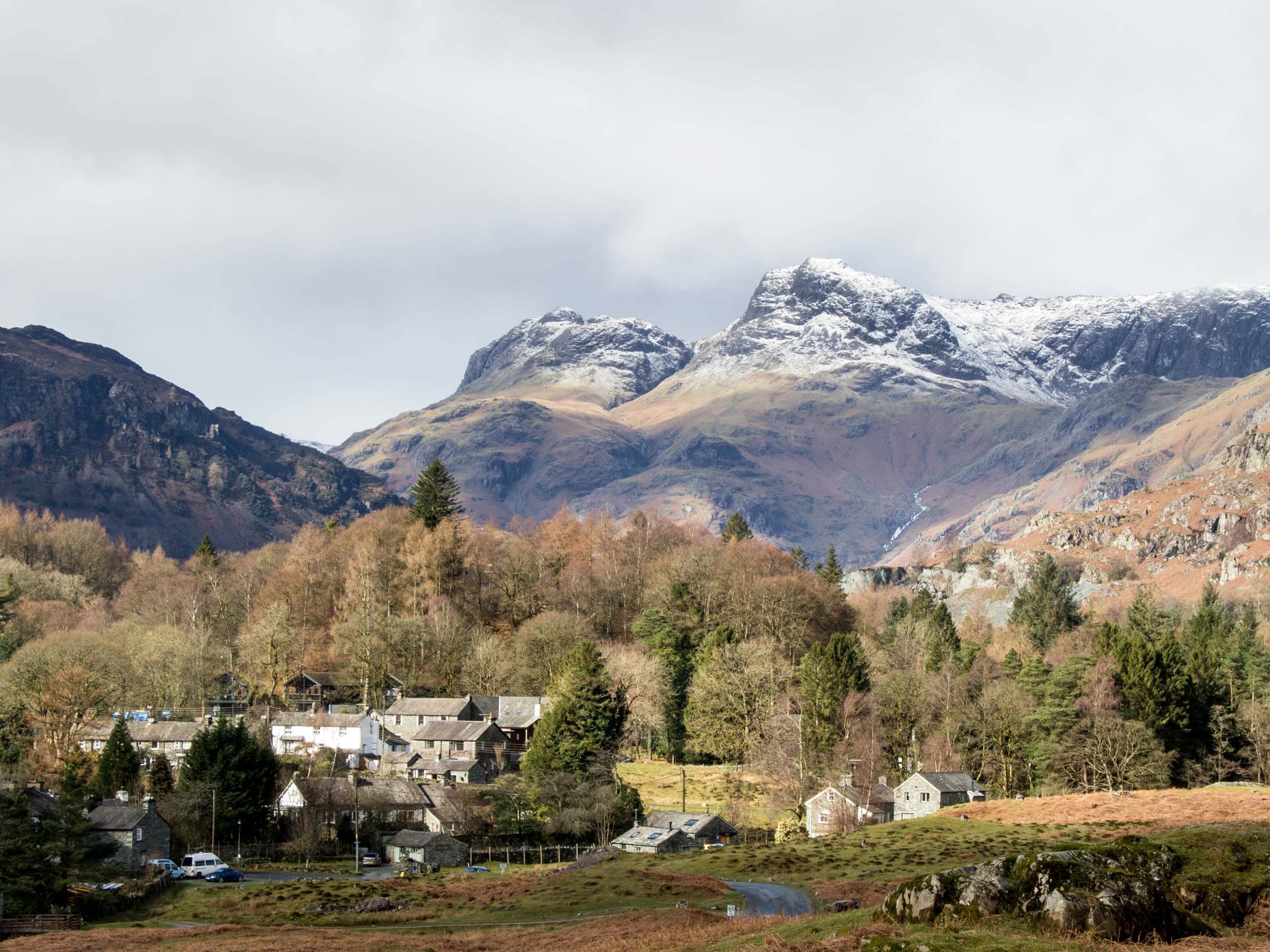
Langdale Pikes Circular Walk
Difficulty Rating:
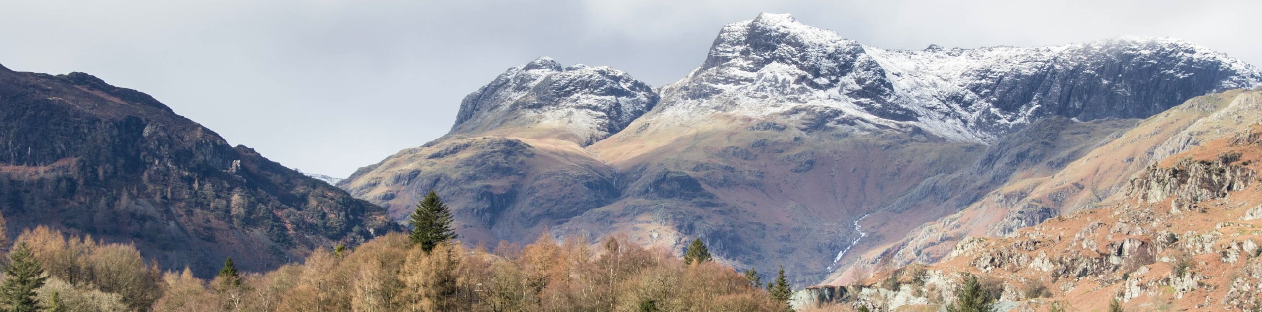
Walking the Langdale Pikes Circular is a challenging adventure in the Lake District that will take you uphill through some rugged terrain for amazing views overlooking the valley of Great Langdale. While out on the trail, you will traverse the summits of Blea Rigg, Sergeant Man, Thunacar Knott, Pavey Ark, Harrison Stickle, Pike of Stickle, and Loft Crag. If that doesn’t sound like enough of an exciting adventure for you, then the picturesque sights from these elevated positions will be sure to take your breath away.
Getting there
To reach the car park for the Langdale Pikes Circular from the village of Chapel Stile, drive northwest on B5343 for 2.2mi, and turn right to enter the car park.

About
| When to do | March-October |
| Backcountry Campsites | No |
| Pets allowed | No |
| Family friendly | No |
| Route Signage | Average |
| Crowd Levels | High |
| Route Type | Circuit |
Langdale Pikes Circular Walk
Elevation Graph
Weather
Langdale Pikes Walk Description
The Langdale Pikes Circular Walk is a lengthy journey to a number of summit viewpoints that will lead you through some rocky and rugged terrain. Because of this, it is recommended that you wear study walking boots with good ankle support to stay comfortable on the slow-going trail. The trail is also fairly exposed to the elements, so be sure to wear plenty of layers and pack any additional gear you may need.
Even though the trail is a bit rough and rugged, there is a good reason why it is one of the most popular walking routes in the Lake District. The path traverses a number of summit viewpoints that produce some truly spectacular views overlooking the valley of Great Langdale. This walk is pretty much a right of passage before moving on to some of the bigger fells in the district, so be prepared for an amazing journey with ultra-scenic views.
Setting out from the car park, head northeast along the trail and turn left at the first junction, following the path past the buildings and through the tree cover to arrive at a four way intersection in the trail. Head right here, keeping straight along the trail for the next 0.2mi to cross over Stickle Ghyll and Mill Gill, eventually reaching a junction. Turn right here and follow the path to begin the steep uphill climb through the rugged terrain that will take you roughly 0.9mi to the summit of Blea Rigg.
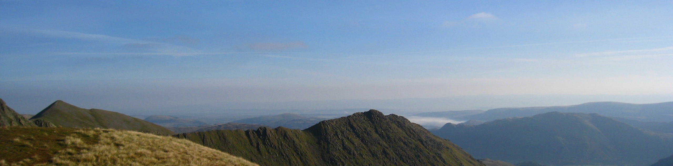
After arriving at the summit, head west along the trail and keep straight for 0.3mi before turning right to cut across a marshy stretch of terrain. From here, keep straight for the next 1.0mi to continue gaining elevation along the hillside until you arrive at the summit of Sergeant Man. There are a fair number of intersecting trails here, so keep an eye on your GPS and continue to the west as you enjoy the scenic views overlooking the waters of Stickle Tarn to the south and the rest of the peaks that lay ahead on the route.
From the summit of Sergeant Man, you will arrive at a junction in the trail in 0.8mi. Keep right here and you will climb slightly uphill to arrive at the summit of Thunacar Knott. From here, follow the path east for 0.3mi to reach the summit of Pavey Ark with its amazing views overlooking the tarn below. Turn right along the path here and keep right for the next 0.3mi to walk the edge of the hilltop and enjoy some breathtaking views over Great Langdale and the undulating landscape of the surrounding area.
At the junction, turn left and follow the trail south as it climbs slightly uphill along some rocky and rugged terrain to reach the summit of Harrison Stickle. From here, follow the trail to the northwest for 420ft, where you will come to a four-way junction. Turn left and descend the hillside for the next 0.5mi to eventually reach the craggy and easily recognizable summit of Pike of Stickle. This rocky peak offers a great view over the valley below and the fells directly opposite to the southwest.
After taking in the views, head southeast for 0.4mi to reach the summit of Loft Crag, before arriving at a junction. Turn right here and begin your descent along the rugged hillside, keeping straight along the trail for 1.0mi until you arrive at a viewpoint overlooking the rushing waters of Dungeon Ghyll Force. After taking in the sights of the waterfall, continue southeast along the trail for 0.4mi to arrive back at the car park having completed the Langdale Pikes Circular.
Trail Highlights
The Langdale Pikes
Constituting one of the most popular walks in the Lake District, the Langdale Pikes (Pavey Ark, Thunacar Knott, Pike of Stickle, and Harrison Stickle) are a series of rugged fells that are packed quite close together and stand high above the valley of Great Langdale. Most recognizable of the peaks is Pike of Stickle, which is an impressive lump of rock that looms over the valley.
Frequently Asked Questions
How many Langdale Pikes are there?
There are four different fells that make up the Langdale Pikes. These include Pike of Stickle, Harrison Stickle, Pavey Ark, and Thunacar Knott. Along this walk, you will also traverse Loft Crag, Sergeant Man, and Blea Rigg. Some walkers choose to extend the route a bit further north to include the summit of High Raise as well.
Insider Hints
There are some steep and rugged sections of trail on this walk, be sure to wear sturdy walking boots for the best footing.
If you want to extend your walk to include another peak, head north from Sergeant Man for a quick detour to High Raise.
Toilet facilities can be found near the trailhead.
Sticklebarn is a great spot for some post-walk drinks to celebrate conquering this trail.
Similar hikes to the Langdale Pikes Circular Walk hike
Nethermost Pike via East Ridge Walk
Walking to Nethermost Pike via East Ridge is a tough climb up several rugged fells that will expose you to…

Hawkshead, Wray Castle, and Windermere Walk
The Hawkshead, Wray Castle, and Windermere Walk is a fantastic journey that will lead you through some picturesque locations that…

Pike of Blisco and Crinkle Crags Walk
The Pike of Blisco and Crinkle Crags Trail is a challenging adventure that will see you climb several rugged peaks…
Comments