Dahachowk hike
View Photos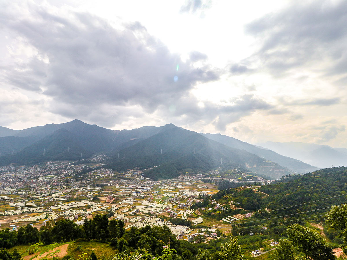
Dahachowk hike
Difficulty Rating:
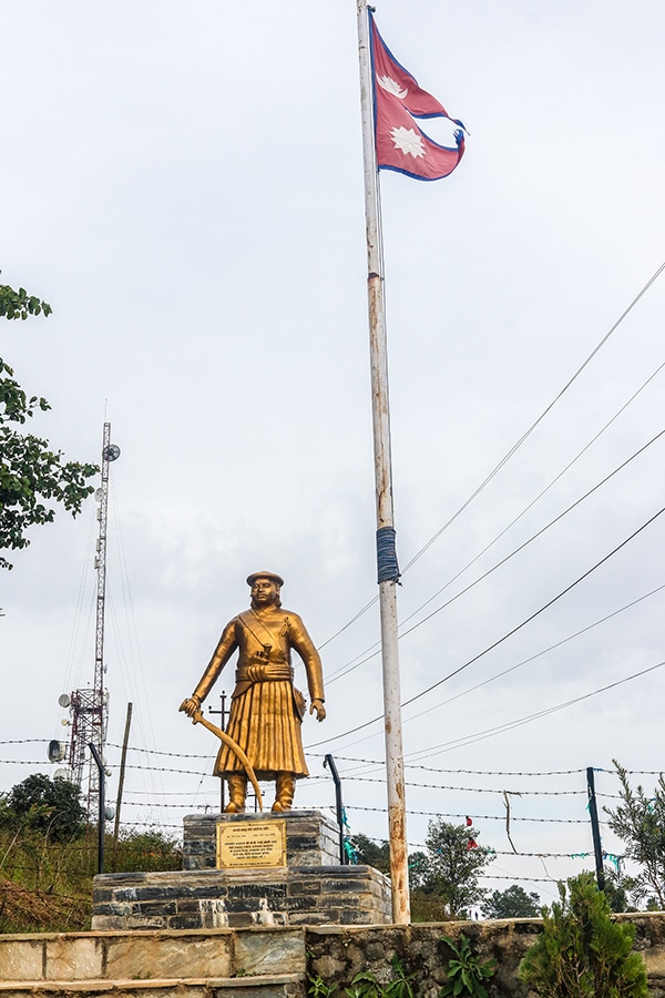
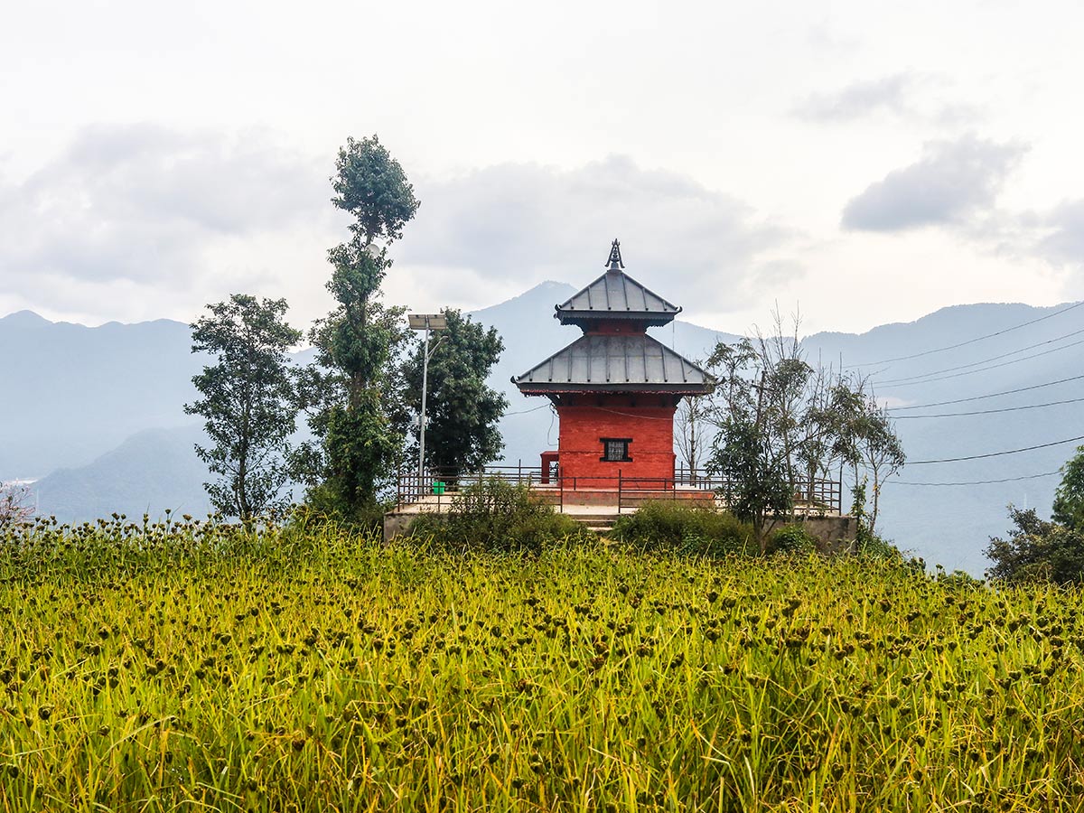
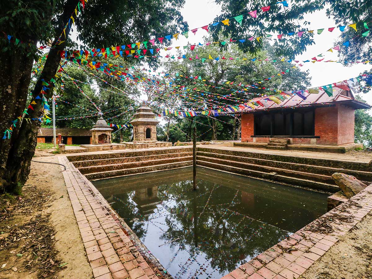
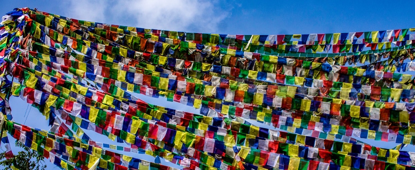
Dahachowk is a culturally and historically significant place in the western outskirts of Kathmandu Valley. Quiet hilltop villages can be found in abundance in Nepal, and Dahachowk is no different, making it an ideal destination for a day hike from Kathmandu. Dahachowk offers stunning 360-degree views, and it boasts of a sacred pond (Indra Daha) and has a memorial for the war hero, Kalu Pandey.
Getting there
Get to Naikap Football Ground by taxi or bus. You can also take a taxi and start from Totitol Chowk for a shorter hike.

About
| When to do | March to May and September to November |
| Backcountry Campsites | No |
| Family friendly | No |
| Route Signage | Poor |
| Crowd Levels | Moderate |
| Route Type | Out and back |
Dahachowk
Elevation Graph
Weather
Route Description for Dahachowk
Located just off the highway past Thankot, the Dahachowk hike is a secluded refuge from Kathmandu’s smog and traffic noise.
Start the hike from either the Naikap Football Ground or Totitol Chowk. If you decide to start from Naikap Football Ground, you must take a bus or taxi to the Football Ground and walk west for 2.3mi on an asphalt road. This is an ideal option if the road is free of traffic. However, your best option is to make your way to Totitol Chowk and take a short break for a light meal in a local restaurant. You might also consider stocking up on snacks and water due to the lack of shops and restaurants on the trails. Please note that this does not include the restaurants and resorts at the summit.
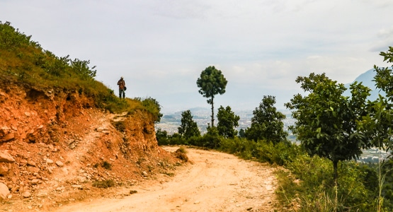
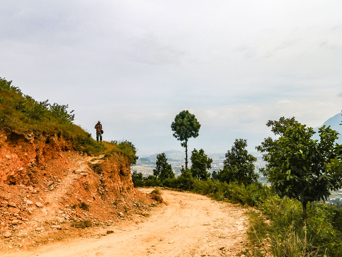
From Totitol Chowk, take a right in the northeast direction for 328ft until you reach the first fork in the trail. Make a left (south) and continue your way up to leave the smoke-polluting brick factories behind. The trail is mostly used by jeeps, which tend to kick up dust, so keep your facemasks and buffs ready. Soon you’ll pass through traditional village homes where you’ll have plenty of chances to interact with the locals. The trail hereafter is a steep incline to the top with an elevation gain of 1870ft.
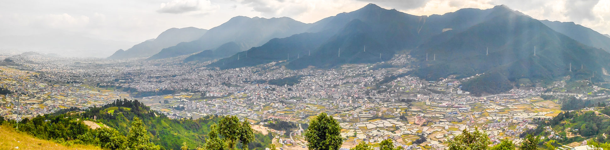
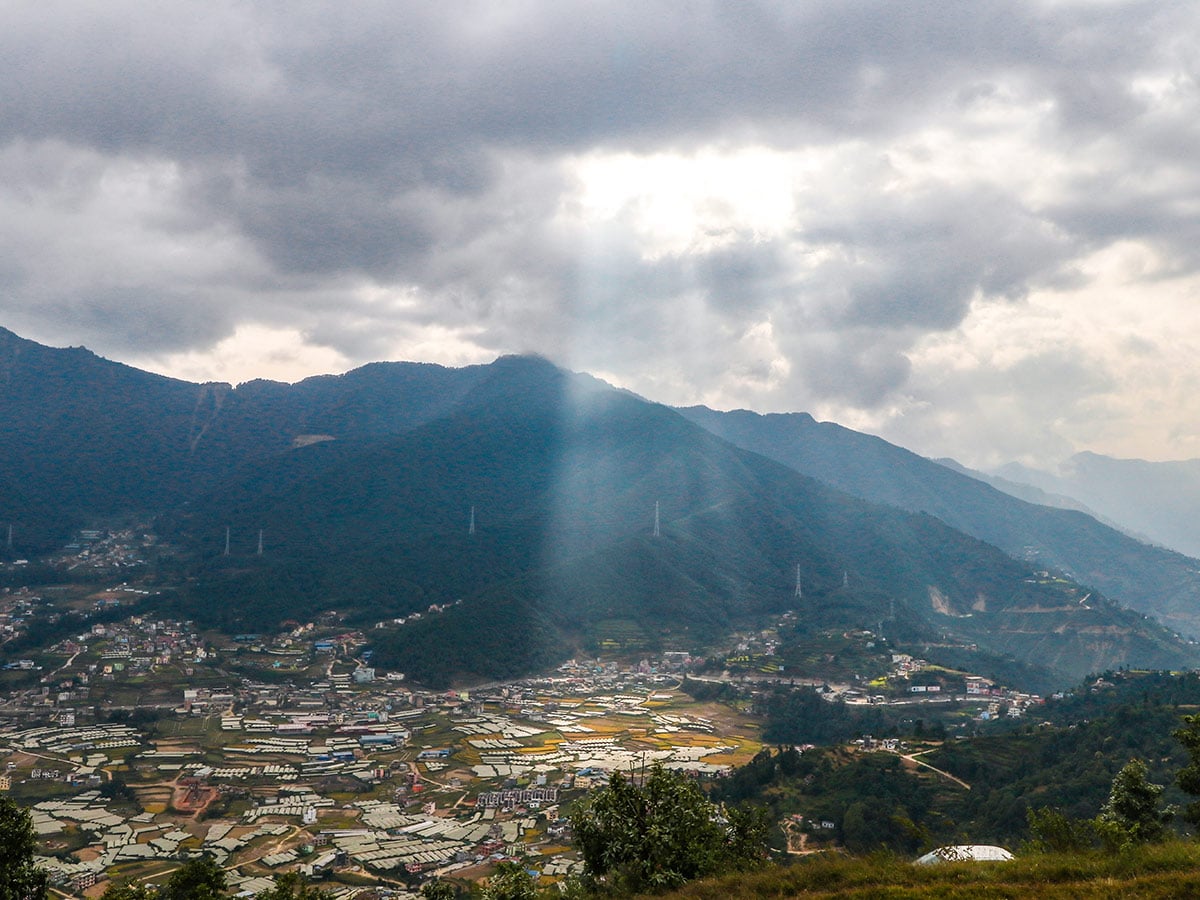
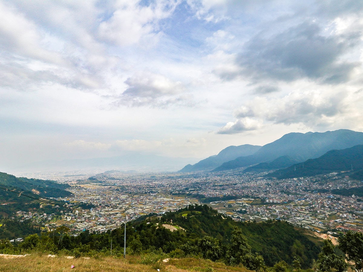
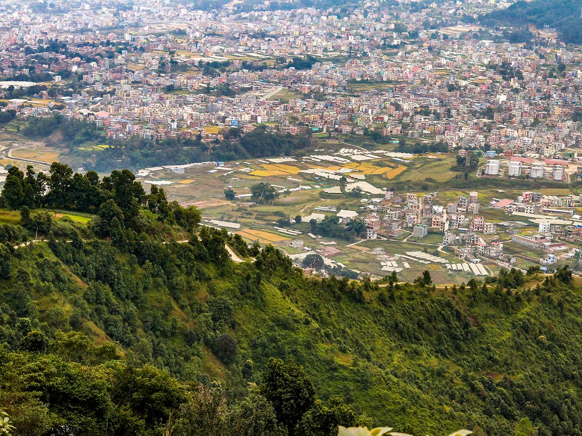
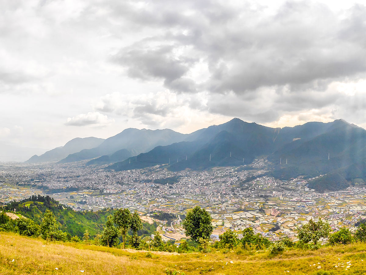
As you make the ascent, you’ll start to see the amazing view of the Chandragiri forest to the south. The dwindling series of hills seen on the west is a view to savor. As in the east, you see the view of densely populated Kathmandu. Take occasional breaks and keep hydrating your body and spend a little time capturing the stunning all-encompassing vistas. Walking further, you get to enjoy more views of the terraced fields and the green forest below, interspersed with some colorful trees. To see the colorful flowers, you must visit Dahachowk in the spring season.
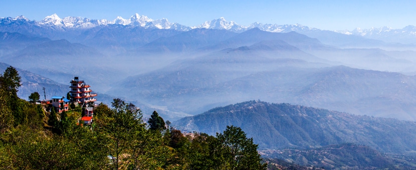
Continuing the ascent, you’ll catch a glimpse of the staggering high mountain views, which include the Langtang, Ganesh, and Manaslu Himal. But this will only happen if you’re walking on a day with no clouds in the sky. After walking for almost 3.0mi in a northwest direction, you’ll arrive at a small park known as the Kalu Pandey Memorial Park. The park is dedicated to Kalu Pandey, a war hero during the unification of Nepal. Rest your tired feet at this clean, lush park, where you can admire the statue of Kalu Pandey. On a clear day, you can witness a panoramic view of the Nuwakot, Kirtipur, and Kathmandu Valley.
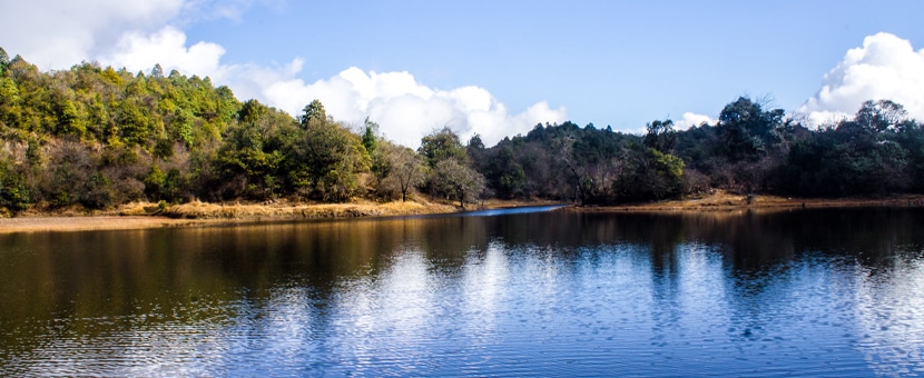
Have an appetizing meal at one of the summit restaurants while enjoying the magnificent panoramas. On your way back, continue for another 1234ft south until you reach a junction in the trail. Divert your way from the main trail and take a left to visit the Indra Daha, a sacred pond next to a temple. “Daha” is a pond in Nepali, hence the name of the place. After a small detour, make your way down the same path you came. Take a cab or a public bus back to Kathmandu.
Insider Hints
There are limited shops and restaurants along the trail, but you can expect a few restaurants and resorts at the summit.
It’s best to do this hike during the spring when colorful flowers dot the land.

Similar hikes to the Dahachowk hike
Sankhu to Nagarkot
Sankhu is an ancient Newari town on the eastern outskirts of Kathmandu Valley and is also home to the temple…
Panauti to Namo Buddha
Sitting at an altitude of 5709ft, Namo Buddha is a small village set atop a beautiful hill with…
Kathmandu to Chisapani
A small hill station in the northern outskirts of Kathmandu, Chisapani offers stunning views of lush green hills, deep valleys,…
Aizen 4 years ago
Amazing how calm and tranquil the whole are was. There are beautiful views everywhere you look.
Ryan S. 5 years ago
Enjoyed the various attractions in the area. The vistas and terrace field was fantastic.
Jess A. 5 years ago
Nice views of Kathmandu. Very peaceful and calm.
Chloe L. 5 years ago
Nice hike. Moderate uphill, I sweat a little, but It's all worth it.
Kimbra W. 5 years ago
Another remarkable hike in Nepal. The
jada kurt 5 years ago
Dahachowk has spectacular views. Highly recommended!
Ralph B. 6 years ago
Nice views of terraced fileds and village from above.