Sulphur Springs Trail
View Photos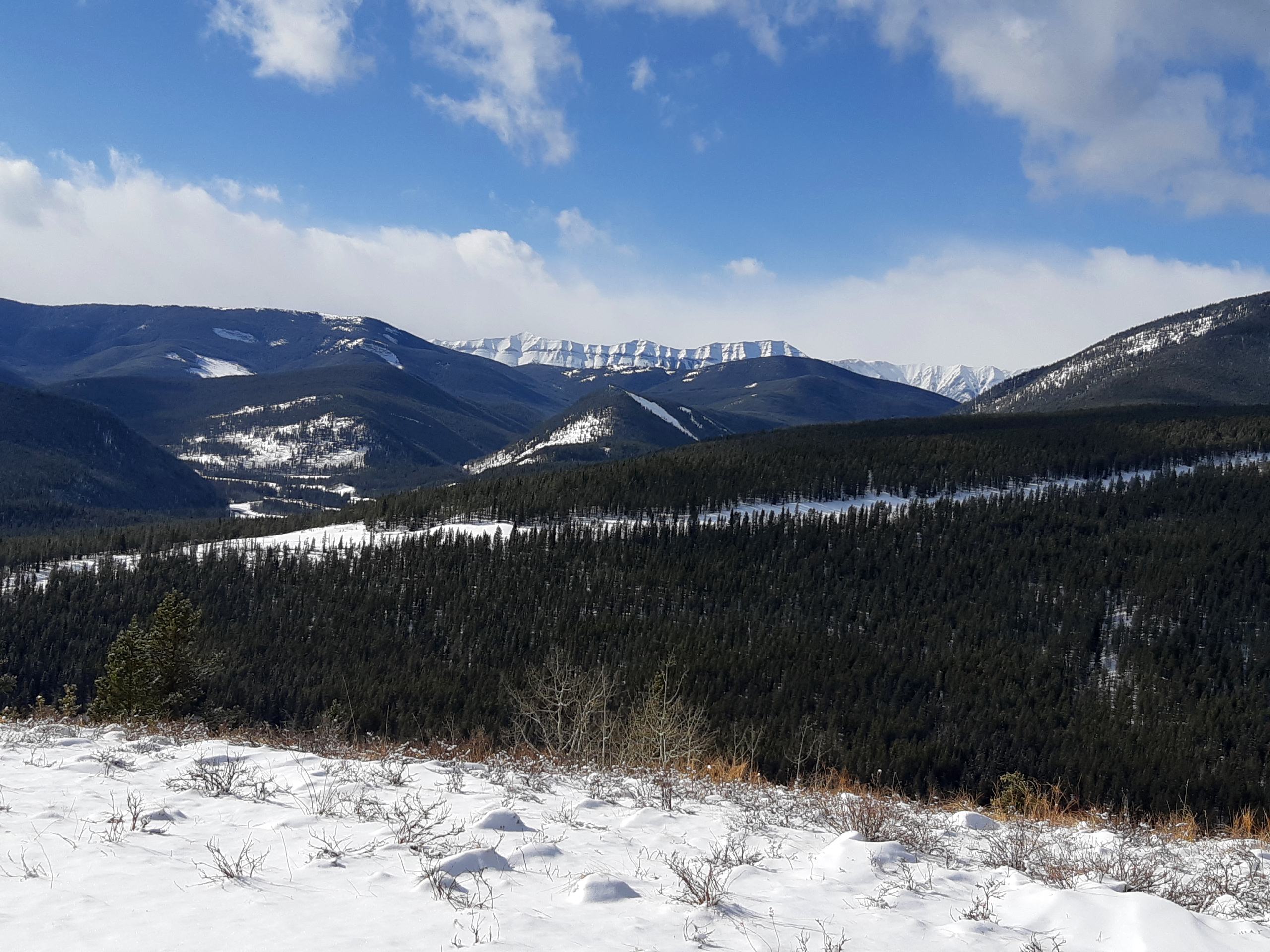
Sulphur Springs Trail
Difficulty Rating:
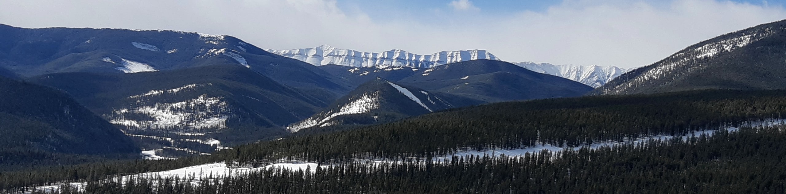
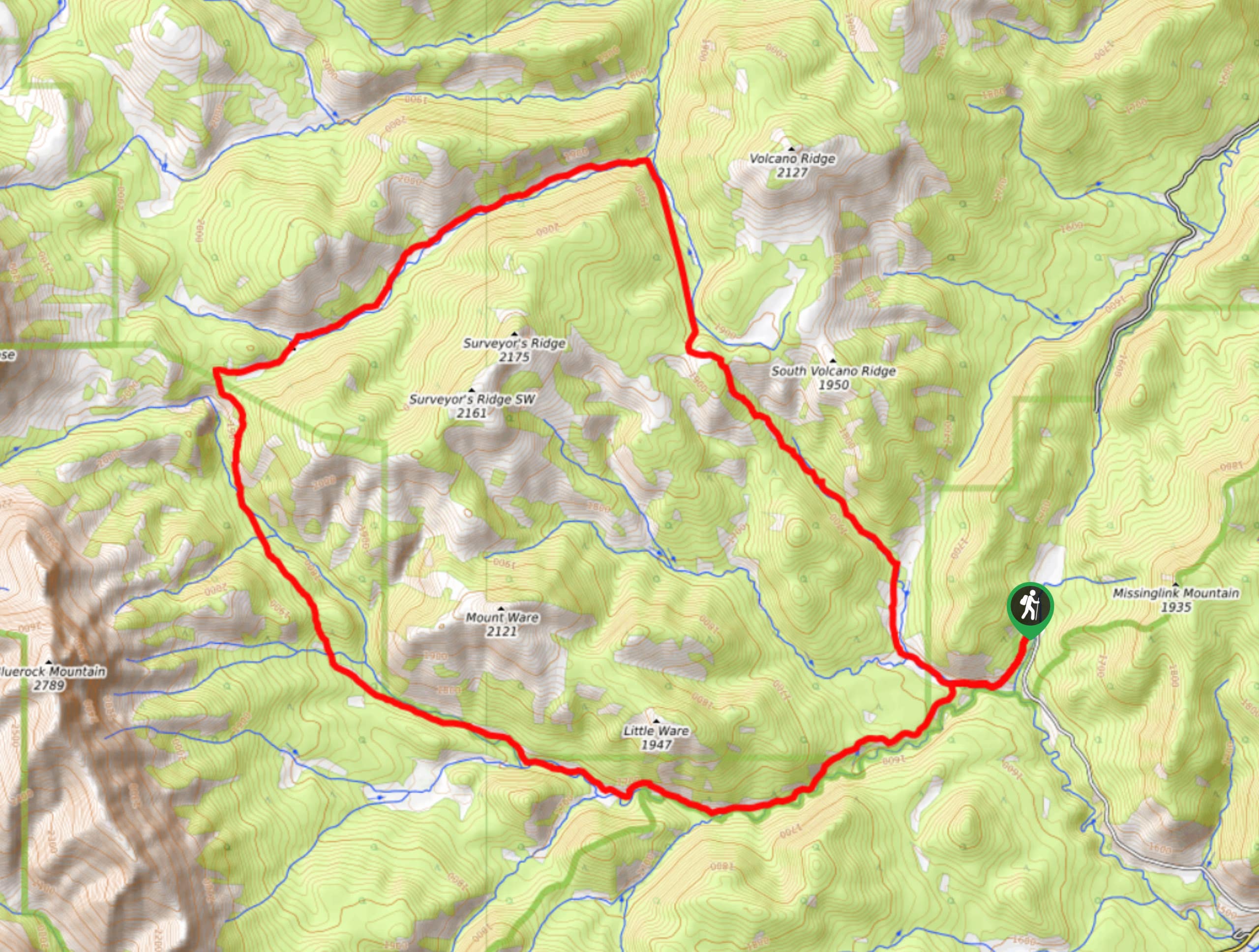
The Sulphur Springs trail in the Elbow River area is part of an extremely well-maintained multi-sport trail system. The trail is forested with many clearings that provide great views. There are lots of junctions along this route, so using a GPS is recommended. Join the Riverview Trail to create a full loop.
Getting there
From Calgary, take Highway 8 West to the roundabout at Highway 22. Take the third exit on the roundabout and join AB-22 South for 8.1mi, and turn right onto AB-66. Travel westbound on AB-66 for approximately 8.1mi to Patty’s Flat campground. Pull in here, and park. You’ll have to cross the highway to begin your hike.

About
| When to do | May-October |
| Backcountry Campsites | No |
| Pets allowed | Yes - On Leash |
| Family friendly | Yes |
| Route Signage | Average |
| Crowd Levels | Moderate |
| Route Type | Out and back |
Sulphur Springs Trail
Elevation Graph
Weather
Sulphur Springs Hike Trail Description
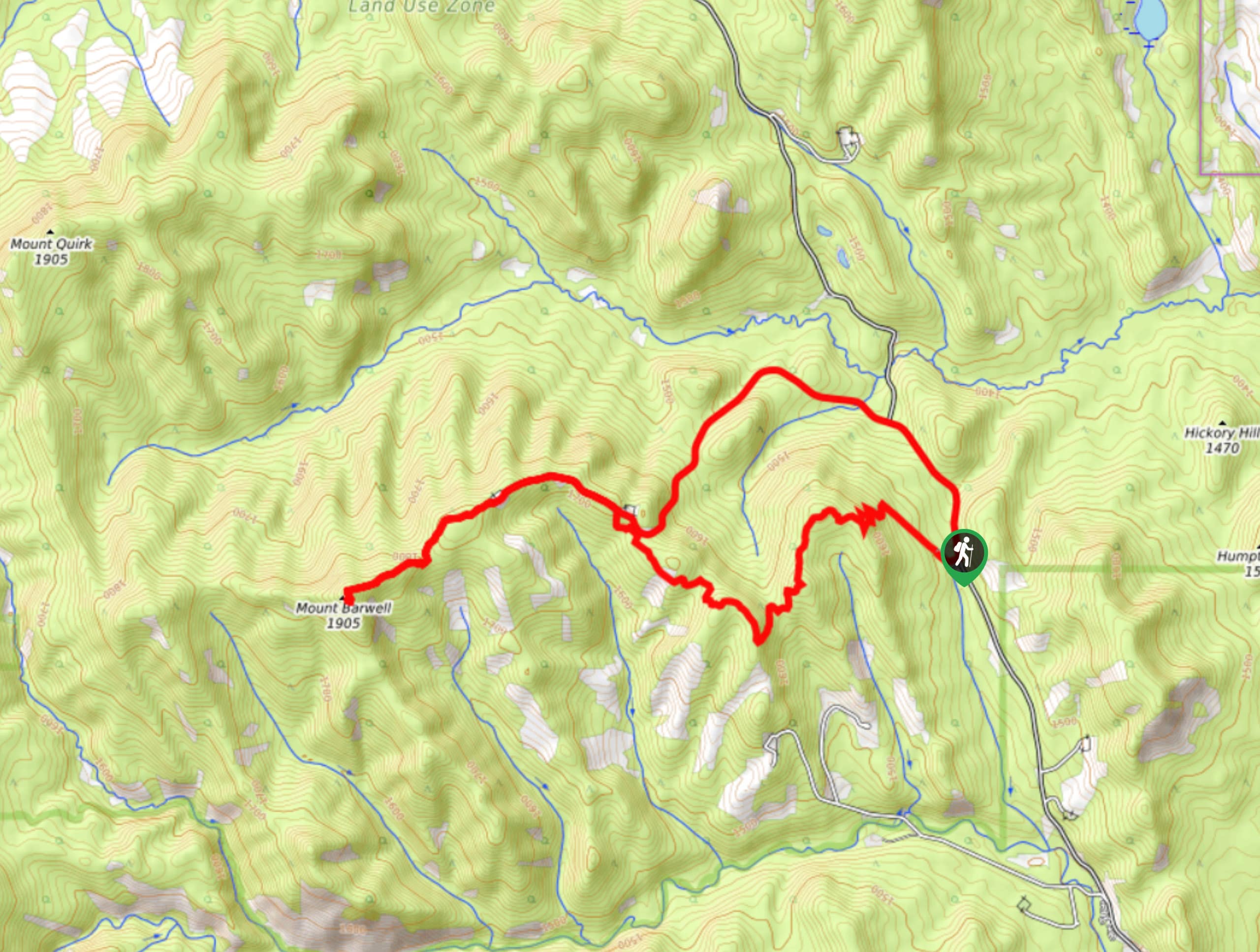
The trail for Sulphur Springs starts opposite the AB-66 from the parking area. Cross the highway and start up the clear trail. After 328ft, at the first junction, stay right. In 0.6mi, you will come to another junction, but you will stay left this time. The trails are well marked, wide, and clear so you won’t have to worry.
Enjoy the mellow grade and wide-open path as you continue another 0.6mi to a junction. Again, stay left here. The trail passes by aspen groves and offers clearings with beautiful views. In 1.2mi, you’ll come to various junctions that mountain bikers mostly use. Stay on the Sulphur Springs trail as signs guide you through the trail system. You’ll be travelling along some rolling elevation here.
At 3.6mi, you will reach a final junction, which is your turnaround point on the out-and-back. If you choose to make a full loop, you can follow the Riverside trail back to the campground instead of turning around.
Find other amazing hikes in Kananaskis Country
- Kananaskis – Smith Dorrien Trail: Chester Lake, Tent Ridge, Burstall Pass, West Wind Pass and Rummel Lake.
- Bragg Creek and Sheep River Provincial Park: Prairie Mountain, Powderface Ridge, Nihahi Ridge and ForgetMeNot Ridge.
- Kananaskis Trail: Troll Falls, Rawson Lake, Wasootch Ridge, Sarrail Ridge and Pocaterra Ridge.
Similar hikes to the Sulphur Springs Trail hike
Gorge Creek Loop
Hiking the Gorge Creek Loop requires some route knowledge and a bit of extra effort as it is not as…
Powderface Creek Trail
The Powderface Creek trail in Kananaskis is a popular hiking, biking, and horseback trail, so be aware of traffic when…
Barwell Trail
Hiking the Mount Barwell Trail is a half to full day effort that is very rewarding. With minimal crowds and…
Comments