
Sugar Momma Trail
View Photos
Sugar Momma Trail
Difficulty Rating:
Hiking the Sugar Momma trail near Bragg Creek is a great way to spend a half day. The multi-use trail offers some wide open clearings with excellent views of the foothills and the rockies in the distance. This is a popular trail that has plenty of opportunities to explore nearby and connecting trails, so if you would like to lengthen or even shorten your trip, this is a great trail choice with many options.
Getting there
From Bragg Creek, take the AB-22 southbound and merge onto the AB-66 westbound. Follow AB-66 to the Allen Bill day use area to park for the Sugar Momma trail.

About
| When to do | May-October |
| Backcountry Campsites | No |
| Pets allowed | Yes - On Leash |
| Family friendly | Yes |
| Route Signage | Average |
| Crowd Levels | High |
| Route Type | Circuit |
Sugar Momma Trail
Elevation Graph
Weather
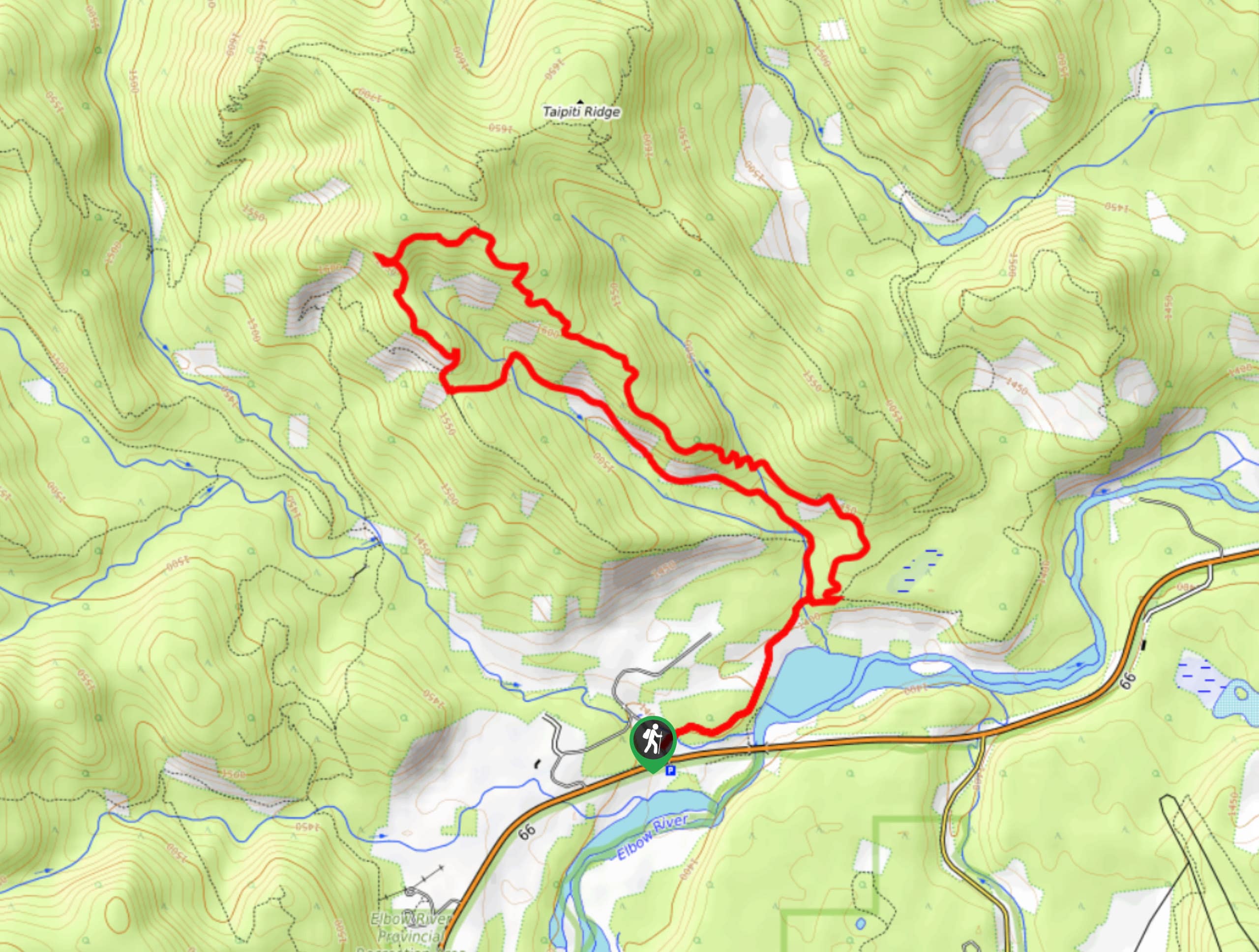
Sugar Momma Trail Description
From the Allen Bill day use area, you will have to cross AB-66 on Ranger road to the Iron Springs trailhead, where you will join the Elbow Trail on the right. Pay attention to your route and the signs which can be faded, as it is easy to mistake the Fullerton Loop for Sugar Momma. This is a common mistake, so having a GPS track with you is a great idea. The Fullerton Loop junction is roughly 0.7mi from the trailhead, and the Sugar Momma junction follows in 656ft.
The trail winds up in the woods, and creates a full loop joining the Bobcat Trail. There are many clearings and great views. If you would like to extend your trip, follow the maps at the beginning to join Sugar Daddy trail.
Similar hikes to the Sugar Momma Trail hike
Gorge Creek Loop
Hiking the Gorge Creek Loop requires some route knowledge and a bit of extra effort as it is not as…
Powderface Creek Trail
The Powderface Creek trail in Kananaskis is a popular hiking, biking, and horseback trail, so be aware of traffic when…
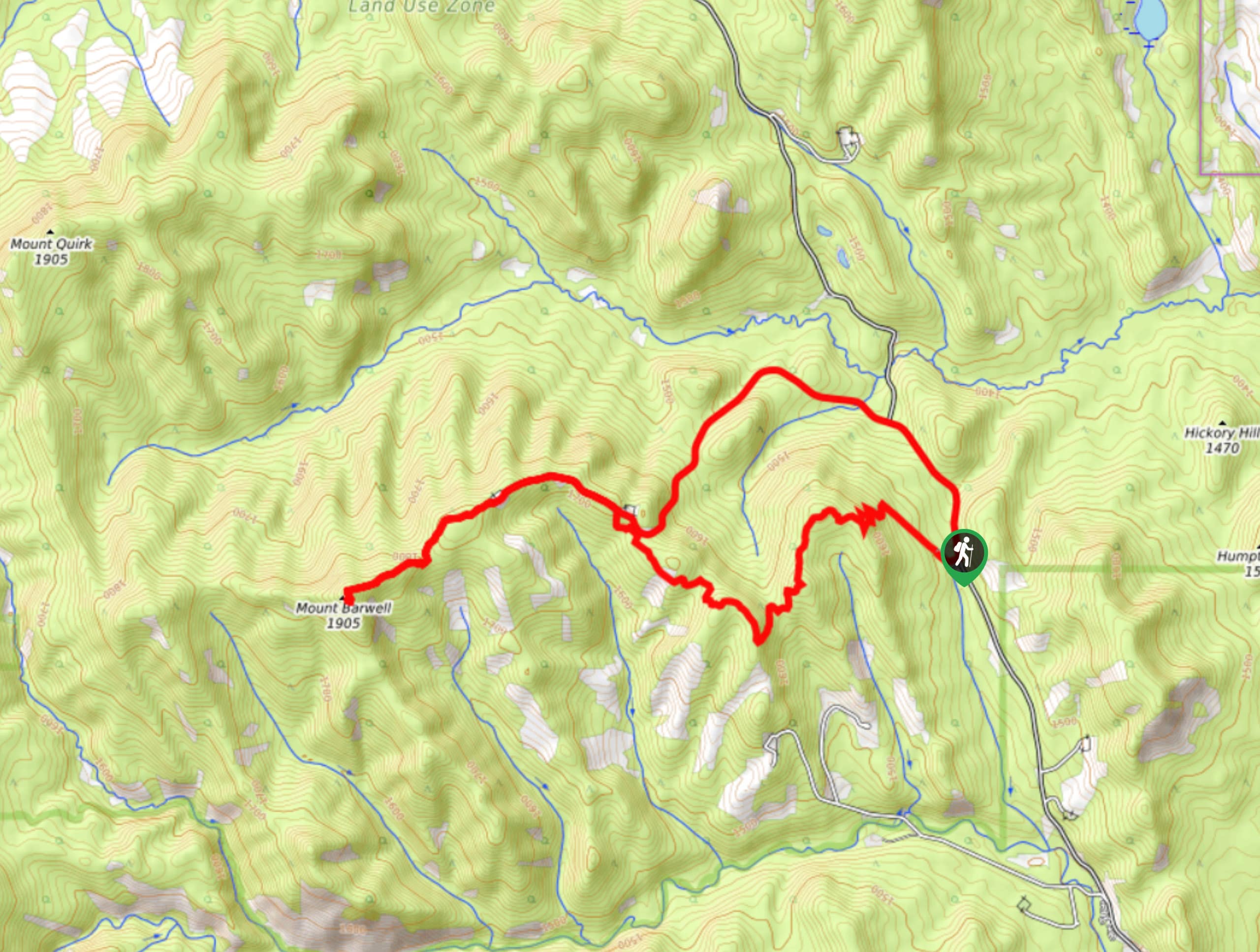
Barwell Trail
Hiking the Mount Barwell Trail is a half to full day effort that is very rewarding. With minimal crowds and…
Comments