Opal Ridge hike
View Photos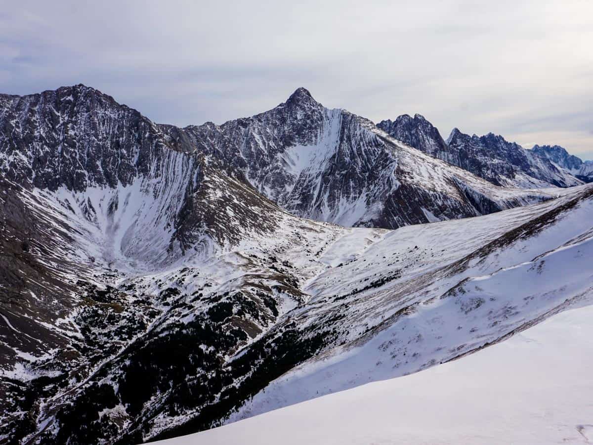
Opal Ridge hike
Difficulty Rating:
The hike along Opal Ridge is a wonderful hike. This steep hike requires the use of hands to steady you on the way up to Opal Ridge, however the views from the top are spectacular. We love the hike to Opal Ridge.
Getting there
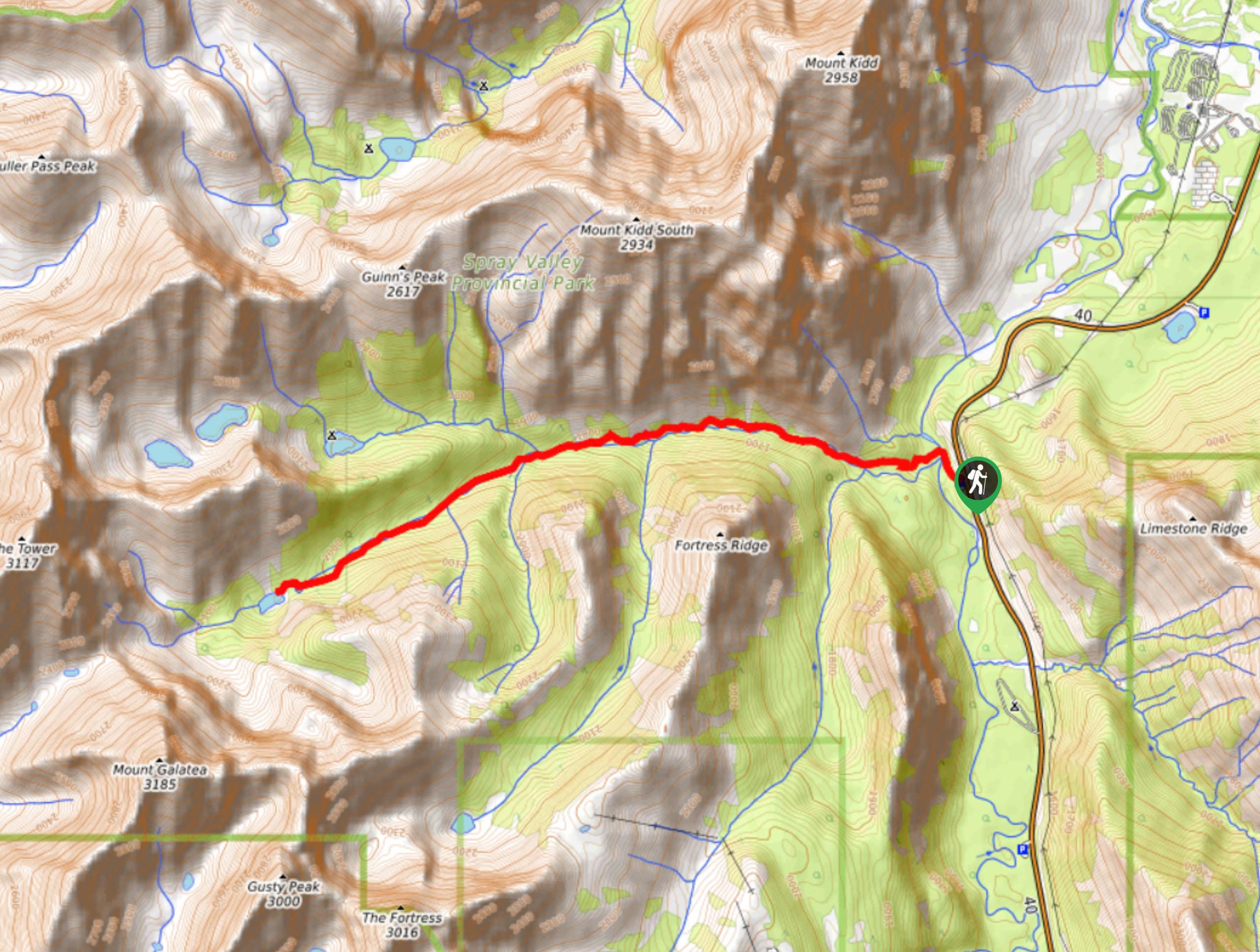
From the Stoney Nakoda Casino on the TransCanada, take Highway 40 south for roughly 25.5mi. Turn left into the Fortress Junction Service Station, and park at the northern end of the parking lot.

About
| When to do | June - October |
| Backcountry Campsites | No |
| Toilets | At Trailhead |
| Family friendly | No |
| Route Signage | None |
| Crowd Levels | Moderate |
| Route Type | Out and back |
Opal Ridge
Elevation Graph
Weather
Route Description for Opal Ridge
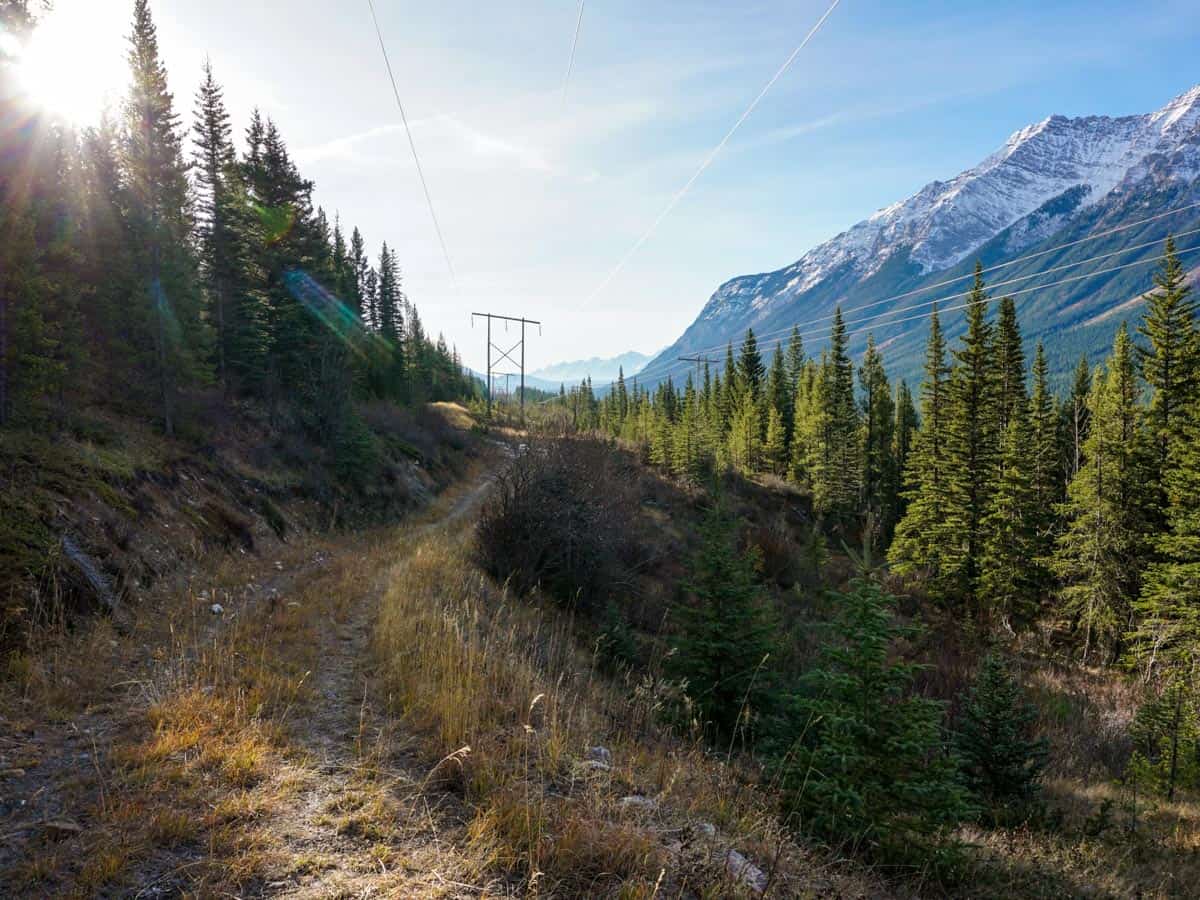
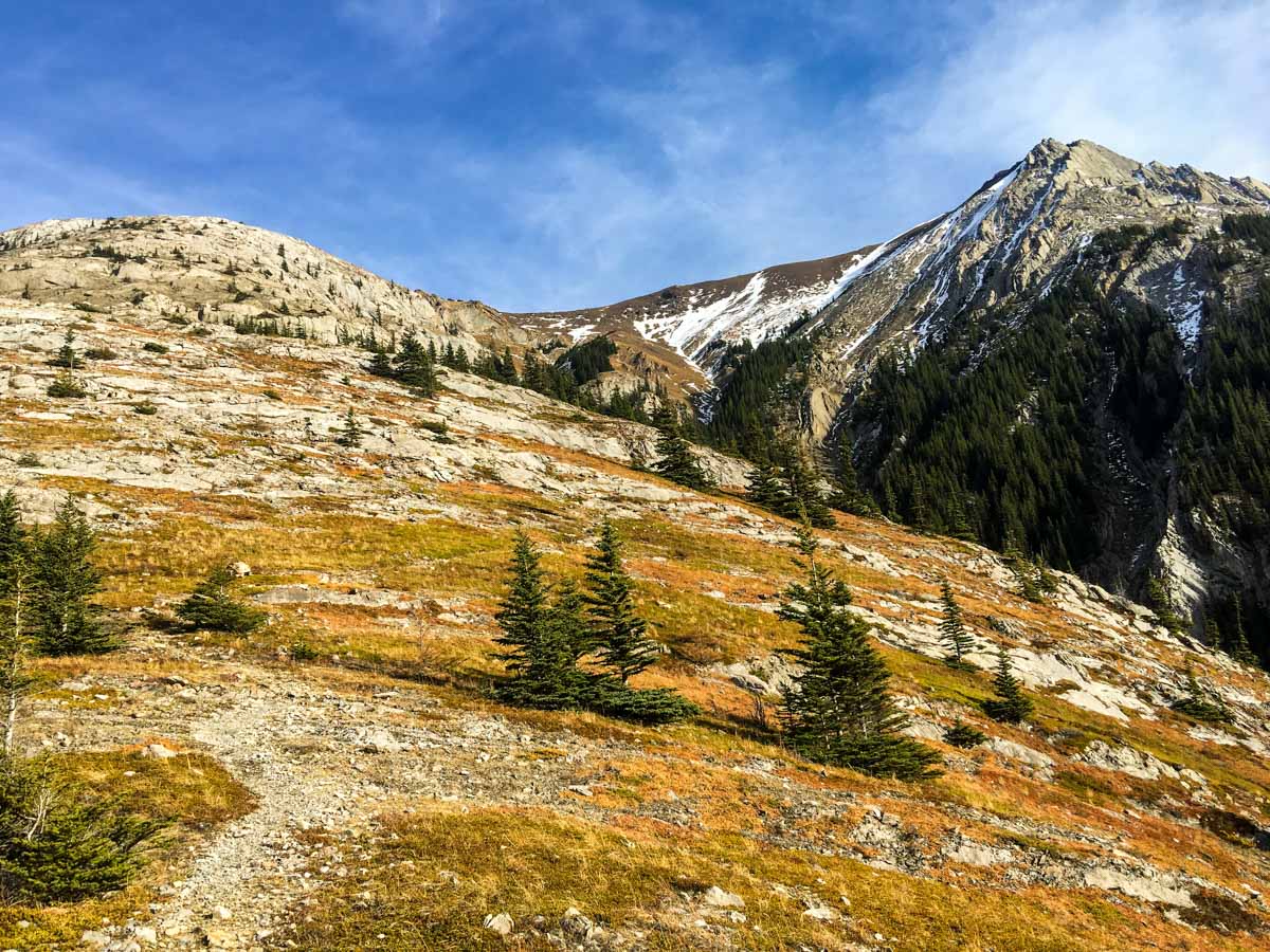
The path starts from the parking lot north of the gas station. If you look east to the power lines behind the parking lot, you can hear a stream trickling down from the forest. Find that stream, it’s your trailhead.
Walk up the left side of stream. As you go up, keep the stream to your right. The well-trodden path goes off to the left and you’ll begin to gain elevation. You’ll reach a broad path that runs under some power lines. Follow the path left. While on this path you will usually see a rock arrow on the ground. Follow these rock arrows, and remember them when you’re looking for your path on the way down.
As you hike up, you will pass another little stream and a stand of poplar. You will then see a path denoted by some orange tape and a rock cairn: go right here. This path will lead you through the forest for a very short while. Before you know it, you’ll be above the tree line and gaining elevation quickly.
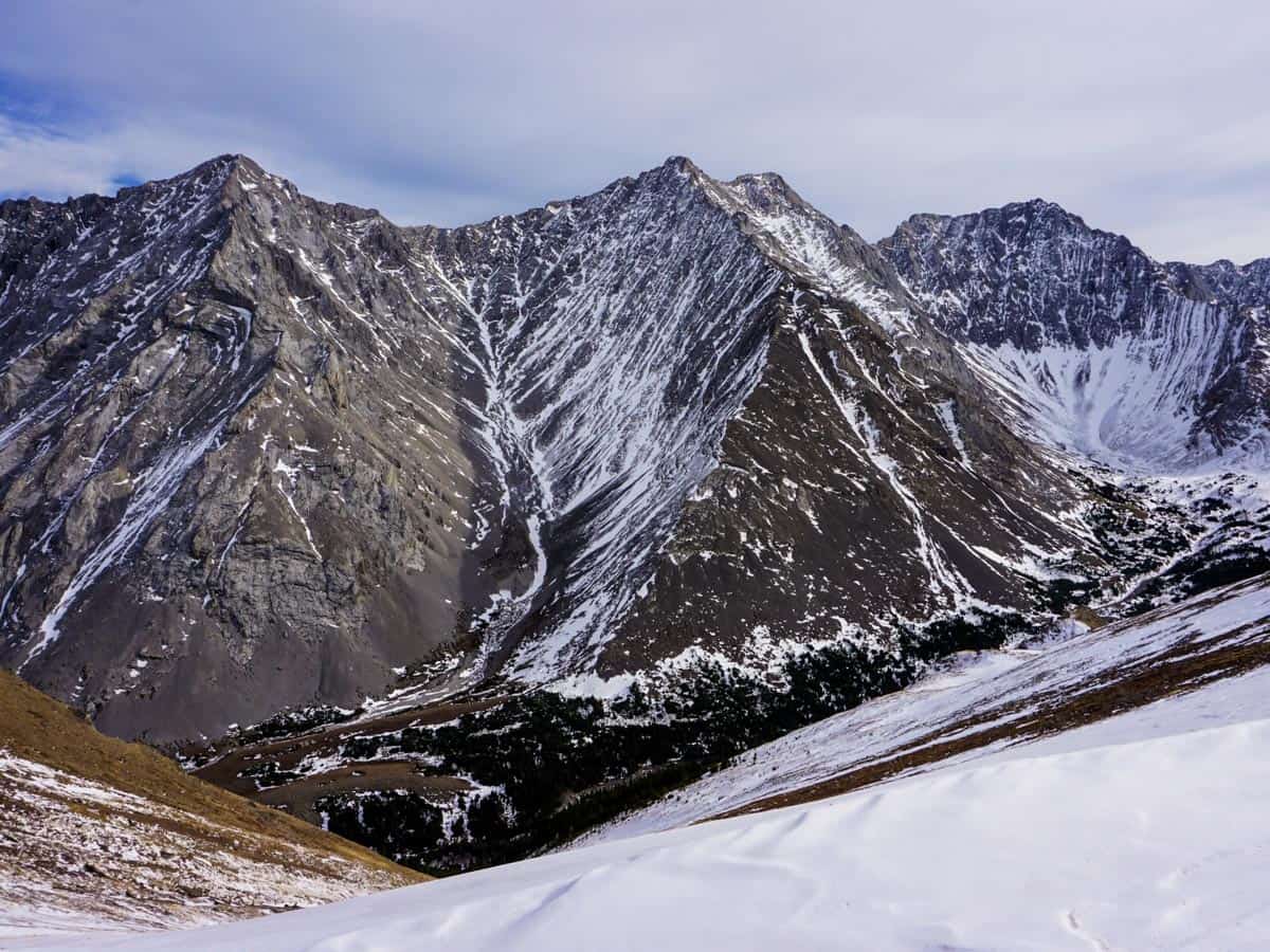
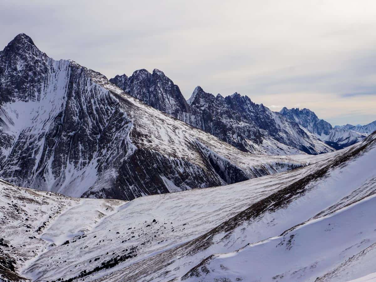
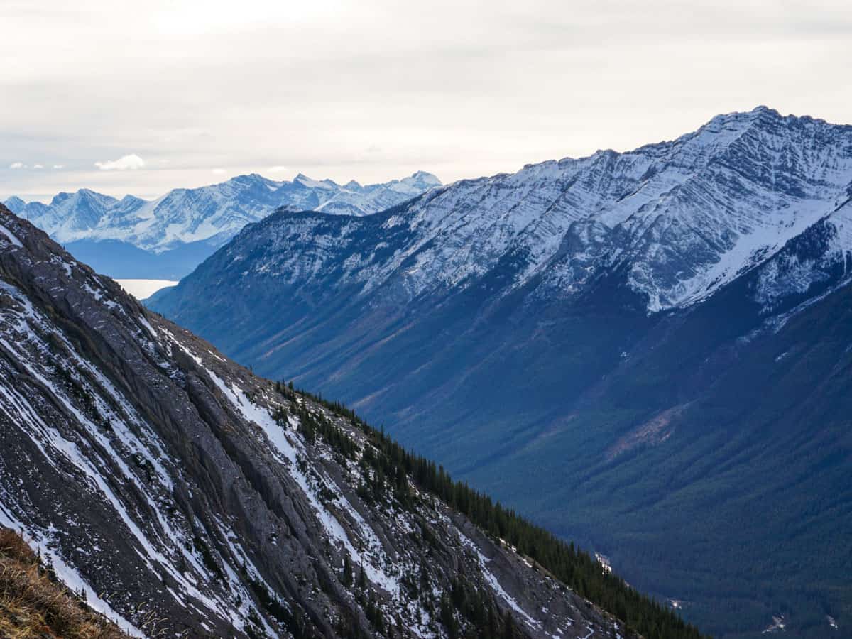
As you ascend up to Opal Ridge, take time to look back. You’ll be surprised at how quickly you gain elevation, and soon the highway looks tiny. Little toy trucks zip along the thin ribbon of tarmac below. When you’re roughly 45 min in and 919ft up there is a flat spot where you can catch your breath. Keep following the path going up.
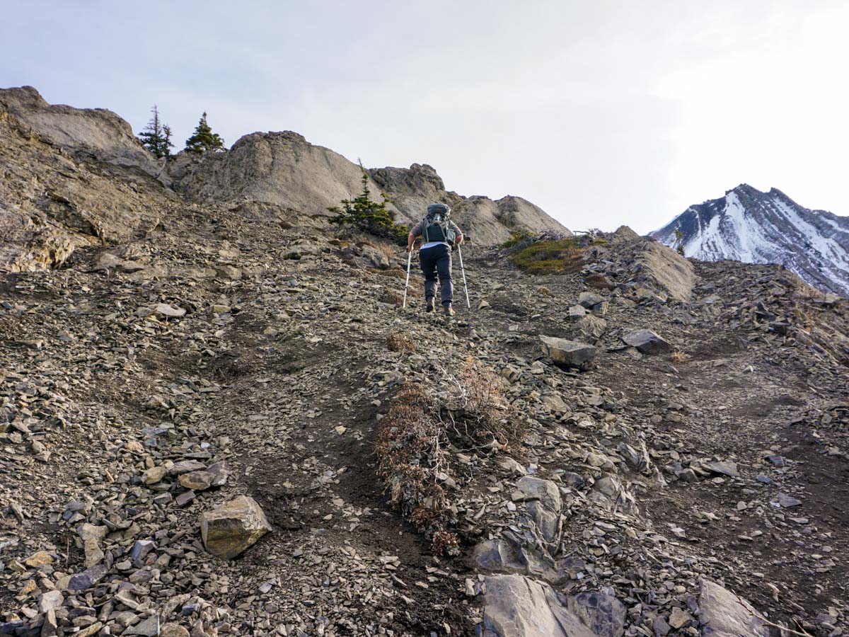
After 1722ft of elevation gain you might be wondering when the steep incline will end, but it will keep going, testing your limits. At every break you can look back at the beautiful mountains and monitor your progress as the cars get smaller and smaller.
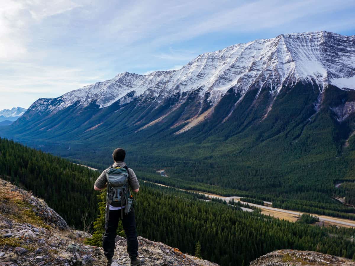
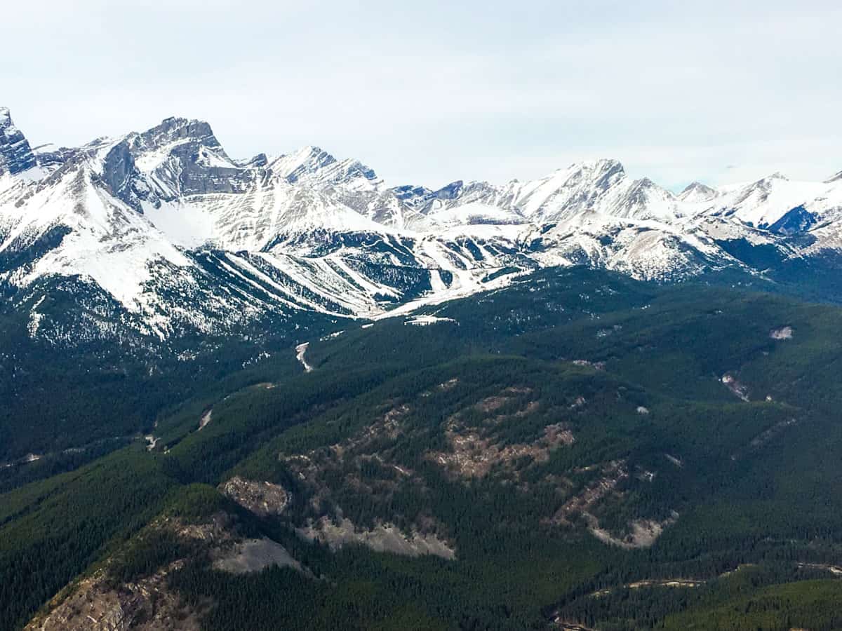
As you hike up you may notice what looks like a ski hill on the other side of the Kananaskis Valley and to your right. That’s the old Fortress Mountain Ski Resort. This abandoned resort opened in the late 60’s and was in full operation until 2004. Now it’s used for Cat Skiing, and in 2009 the climactic scene of Christopher Nolan’s movie Inception (2010) starring Leonardo DiCaprio was filmed there.
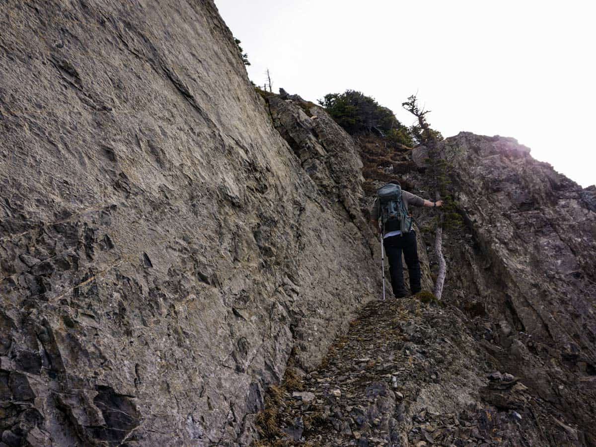
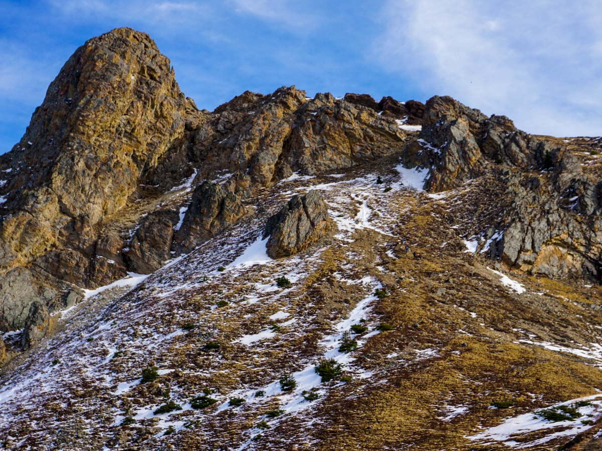
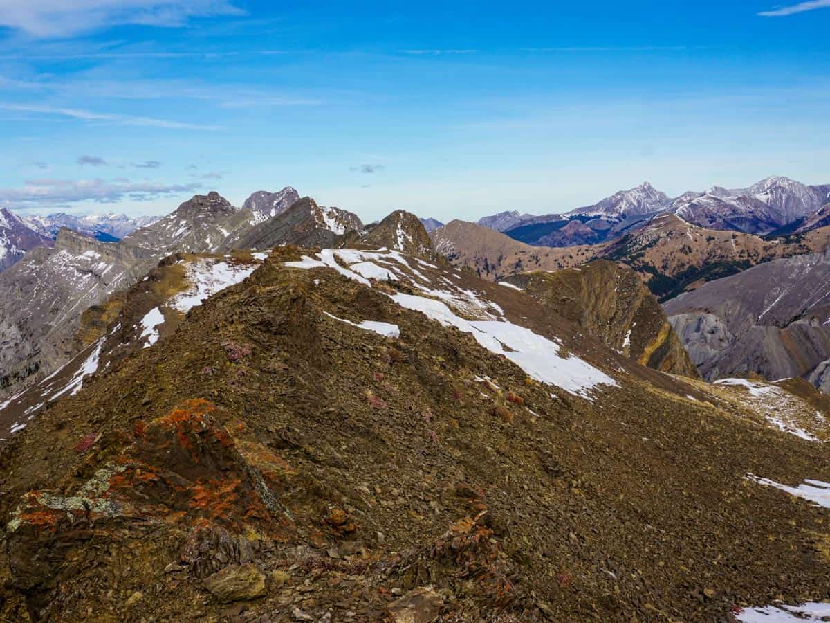
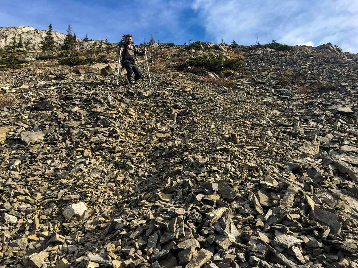
The trail soon begins to braid into many paths, and it’s tough to see just one way up. Keep pushing up that incline. At a rock face you can choose between scree (to the left) or a scramble (to the right). We like to scramble up and go scree down (and the map reflects this route). The scramble isn’t too hard, but you will need to use your hands fairly often.
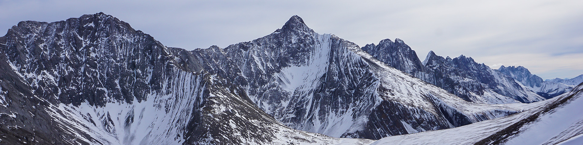
You can always see Opal ridge from this point on. Stay focused on that. We love this part, as you ascend, you’ll hike up between two rock pillars. The ground there is covered in small plants and grasses. It can be quite challenging to climb: take it slow. In the shoulder season this area can also get snow and ice, so have microspikes.
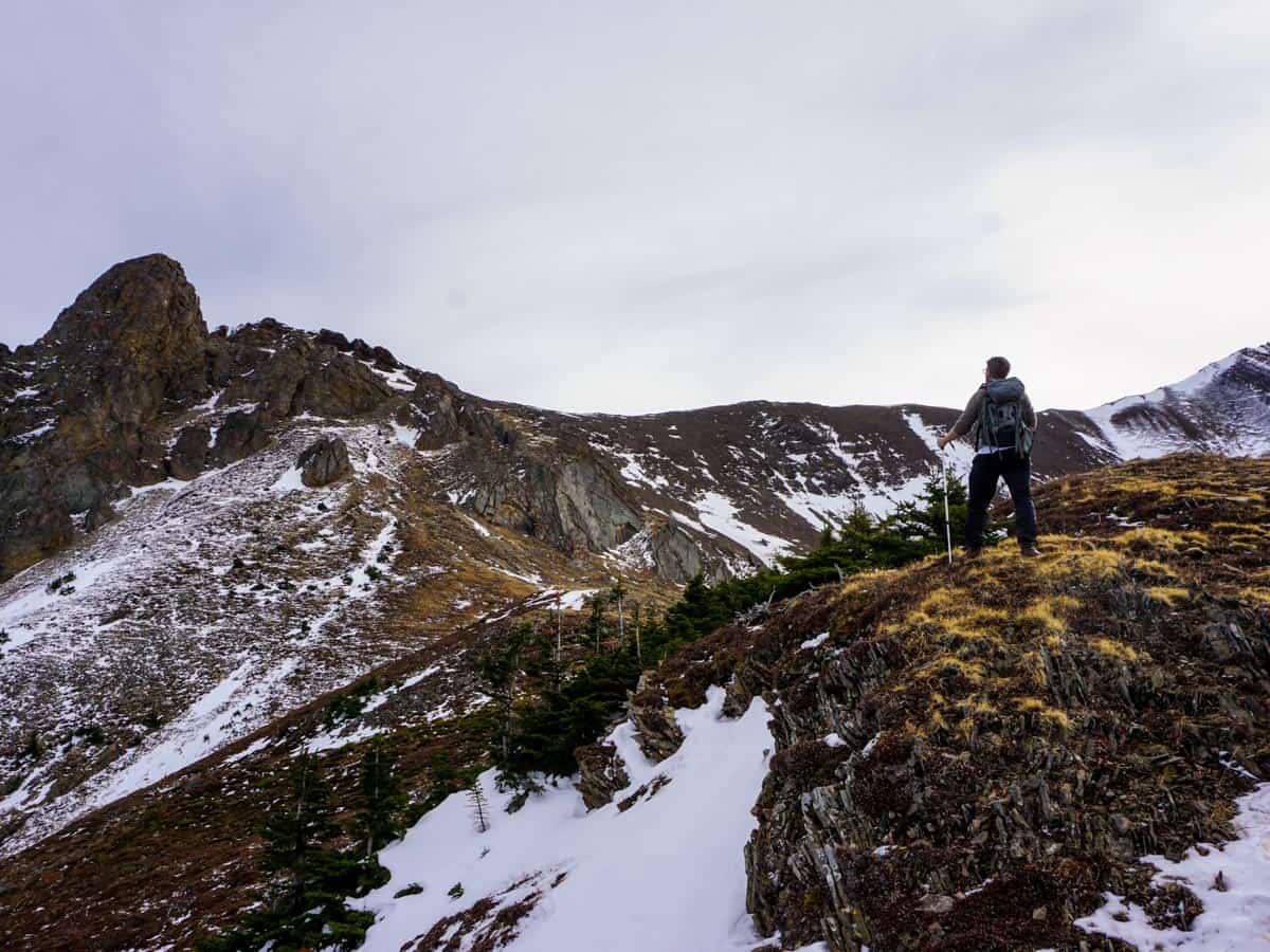
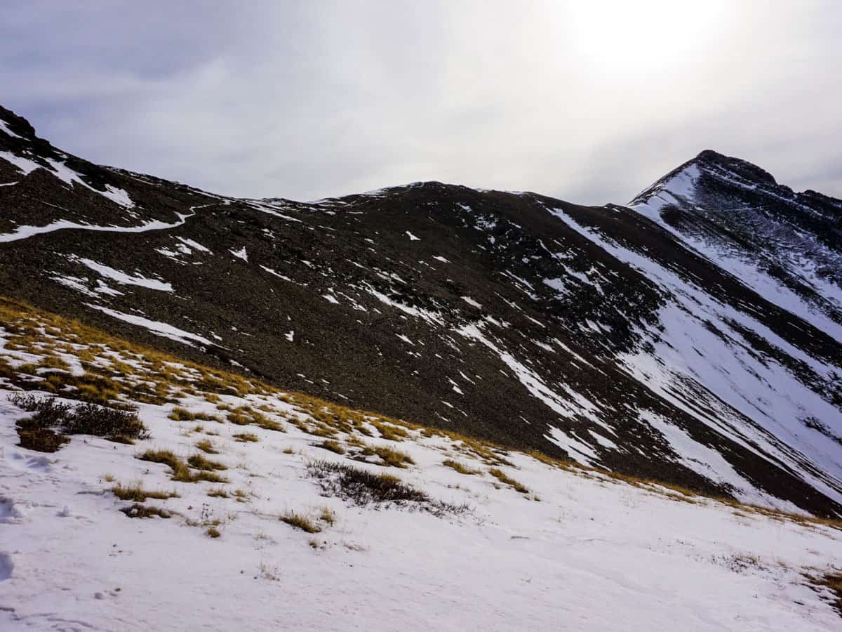
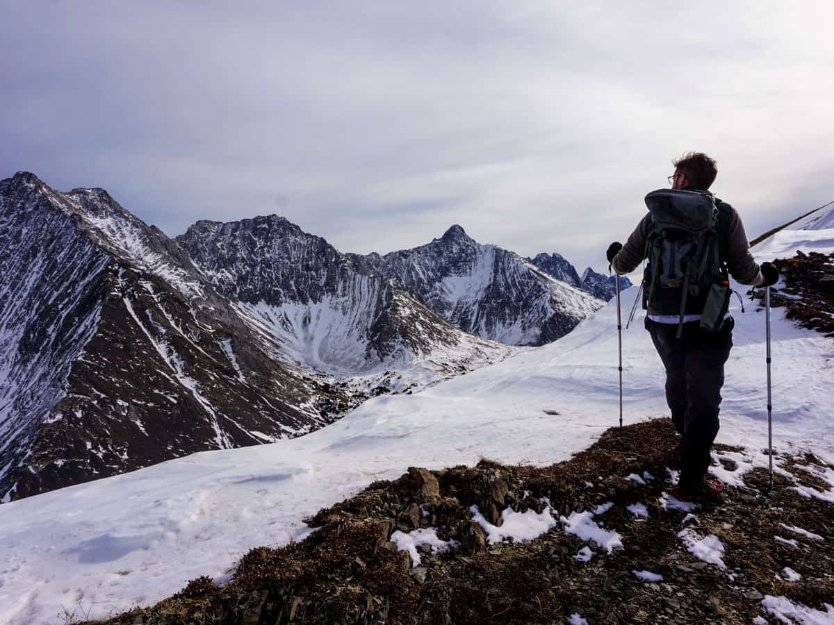
When you’re finally on the ridge you’ll be given sensational views. Our map shows only partway of Opal Ridge, which due to snow we didn’t complete. In good weather you can continue on the ridge farther to the summit. You will feel like you’re on top of the world here. Savour these views for as long as you like then begin your descent.
The descent from Opal Ridge is similar to the ascent, except remember you can take the scree path down. It can be more difficult to follow the trail on the way down, so make sure you stay safe and continue to head towards the highway. Stay on the ridge and avoid going down into the gullies.
Also remember those arrows showing you the path back once you reach the wide trail near the beginning of the hike.
Insider Hints
Hiking up Opal Ridge is a rocky trail and is very tough in icy or wet conditions. Take microspikes if it is icy, and consider a different trail if it is wet.
Poles are mandatory for this trail. You would be using your hands going up and crab walking going down without them!
The Fortress Junction Gas Station has limited hours in the off-season, but it makes for a good place to grab a snack after all that hard work.
The entire Highwood Pass area, including the southern portion of Highway 40, is closed from December 1st to June 14th each year. This hike can only be reached via a long bike ride while the highway is closed.

Similar hikes to the Opal Ridge hike
Lost Lake Hike
Hiking to Lost Lake begins on a very popular trail that leads to Lillian and Galatea Lakes. The trail becomes…
Terrace Trail
The Terrace Trail South is a great connecting trail that links Ribbon Creek with Galatea Creek. You can choose to…
Memorial Lakes Hike
The trail to Memorial Lakes begins in the central Kananaskis Village area, following the Ribbon Creek trail before branching off…
LaylaP. 5 years ago
I have to be honest, this place blew my mind away.
Nigel F. 5 years ago
This is a rocky path and is very tough in icy or wet conditions. Don't forget to bring poles or microspikes. It really takes a lot of effort to climb this trail.
LyleM 5 years ago
Pretty much a steep climb and scramble all the way to the top. Take it slowly, views is worth it.
Grant Ko. 5 years ago
Steep but picturesque hike to a lovely ridge and summit offering expansive views. Wear proper footwear and if possible bring a trekking pole with you. Take it slowly, views at the top is worth it. Don't miss this wonderful opportunity to take a lot of photos!
Heidon 5 years ago
It's a pretty steep trail but an overall remarkable hike.
Gregory J. 5 years ago
It was spectacular! Wherever I look I find something impressive!
Donald J. 5 years ago
It was challenging but I like it. The views were incredible.
kelsih_99 5 years ago
so pretty! lot of scrambling and definitely bring poles, it was no joke. love the ridge though
Diana C. 5 years ago
If you’ve never been here, it’s just a rush to all your senses. The scale is enormous, and the views of snow-capped mountains are marvelous.
Jeffrey Reagan 6 years ago
We had a marvelous visit to the snow-covered Opal Ridge The scenery is just spectacular when it is covered with snow. The trails can be difficult, so good boots (and crampons) are a necessity