
Sulphur Skyline hike
View Photos
Sulphur Skyline hike
Difficulty Rating:
Hiking in Jasper is exquisite when combined with a soak in a natural hot spring pool afterwards. Luckily for us, we have the Sulphur Skyline trail – naturally followed by a dip in the Miette Hot Springs making for a phenomenal day-trip in Jasper National Park.
Getting there
Head north from Jasper on Highway 16 and turn right onto Miette Rd. You will drive to the very end of the road where a large parking lot, picnic area and the Miette Hot Springs are located. The trailhead is on the same roundabout as the entrance to the hot springs.

About
| When to do | June through October |
| Backcountry Campsites | N/A |
| Toilets | Trailhead |
| Family friendly | No |
| Route Signage | Average |
| Crowd Levels | Moderate |
| Route Type | Out and back |
Sulphur Skyline
Elevation Graph
Weather
Route Description for Sulphur Skyline
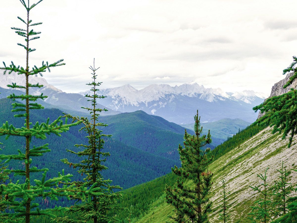
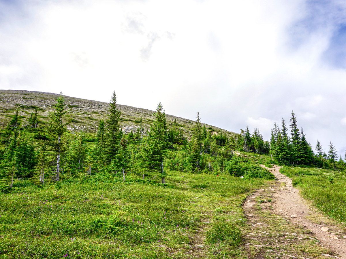
The trail starts out paved and extremely wide, but the pavement quickly ends after a few hundred meters, however the path remains broad and well signposted as you climb up a ridge through the trees. Across the valley you can also see the dome to which you will climb.
The entire hike is a uniform, continuous climb up to the summit. After 1.4mi of ascent you’ll reach a junction, approximately halfway up the trail. Turn right and start to switchback up even further, generally heading over to your right as you ascend.
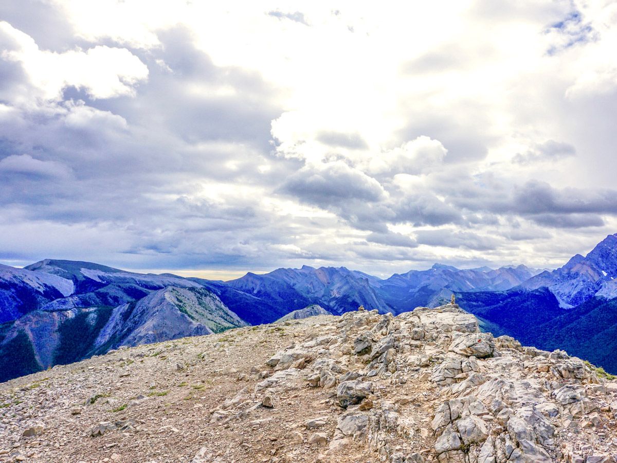
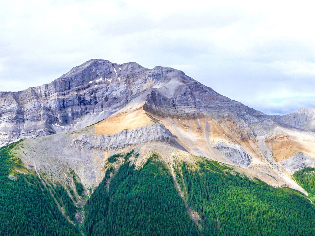
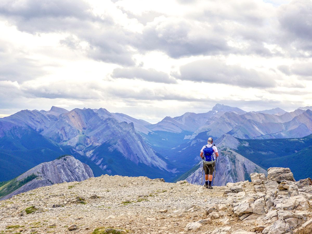
Finally you will pop out above the tree line beside a large white rock. The dome is clearly visible, as is the trail. The last section up to the summit is the steepest, but the views from the top are unbelievable. Countless mountains and valleys extend out from the peaks, as does a picturesque river, directly from the “arrowhead” of the topmost ridge. The most spectacular are Utopia Mountain to the south, Mount O’Hagan to the southwest, and Slide Mountain far out to the southeast. The wind really picks up at the top, so pack a windbreaker and a warm fleece!
Come down the way you came up. Watch your footing as you descend off the summit, as there is a lot of loose gravel and small rocks. The trees on the path provide good shelter if it starts to rain as you descend.
Don’t do this trip without stopping for a dip in the Miette Hot Springs at the hike base. The cost is cheap and there is no better way to sooth the tired muscles after over 2297ft of climbing!
Insider Hints
We love the Sulphur Skyline hike as we always finish off with a stay in the wonderful Miette Hot Springs at the base of the hike.
You can stay at the Miette Hot Springs Resort, just down the road from the Hot Springs. There are fun cabins and a 1960’s motel. Kids love the cabins and being able to go for an early-morning or after-dinner soak in the Hot Springs is a nice benefit.

Similar hikes to the Sulphur Skyline hike
Dorothy and Christine Lakes Hike
The Dorothy and Christine Lakes trail is a beautiful forested trail west of Jasper. It features stunning lakes and has…
Mary Schaffer Loop Trail
The Mary Schaffer loop trail is a gentle circuit that explores the shores of Maligne Lake, offering interpretive signage and…
Wapiti Trail
The Wapiti Trail is a beautiful way to see the Athabasca River and connect the campground to town. If you…
DesireeD. 4 years ago
The hike was so exciting and thrilling. There's a hot spring where you can also relax.
MayP 4 years ago
We enjoyed the hike, and we stayed at the Mietter Hot Springs Resort after to relax.
Greenlife 4 years ago
I like how the trails go up like a painting. you'll get drawn to it, or is it just was me? or was I too tired? nah. not me! loved this!
kathkirz2 4 years ago
Left the kids at the cabins and did this with my husband, as it's a bit long for them. We loved it though, and soaking in the hot springs after was just divine!
JMC 4 years ago
Sulphur Skyline was an awesome, rewarding and challenging hike in Jasper and it was one of my favorites in the park. Made it to the peak and the views were amazing.
LyleM 4 years ago
The trail is well marked. We went hiking in the morning to avoid the crowd. It's a bit of a steep climb but the view at the top is very rewarding
Alex Samuel 4 years ago
Very good area! Well, you can't just go here and not try dipping in their amazing hot springs! Make the most out of the trip.
Tomcote 4 years ago
The trail was a bit steep especially nearing the end, but it was all worth it!
Theodore R. 5 years ago
Incredibly beautiful! It was a phenomenal hike! We also enjoyed our dip on the hot spring. It's such a great way to unwind.
LaylaP. 5 years ago
Awesome experience! Hot springs are perfect for relaxing!