
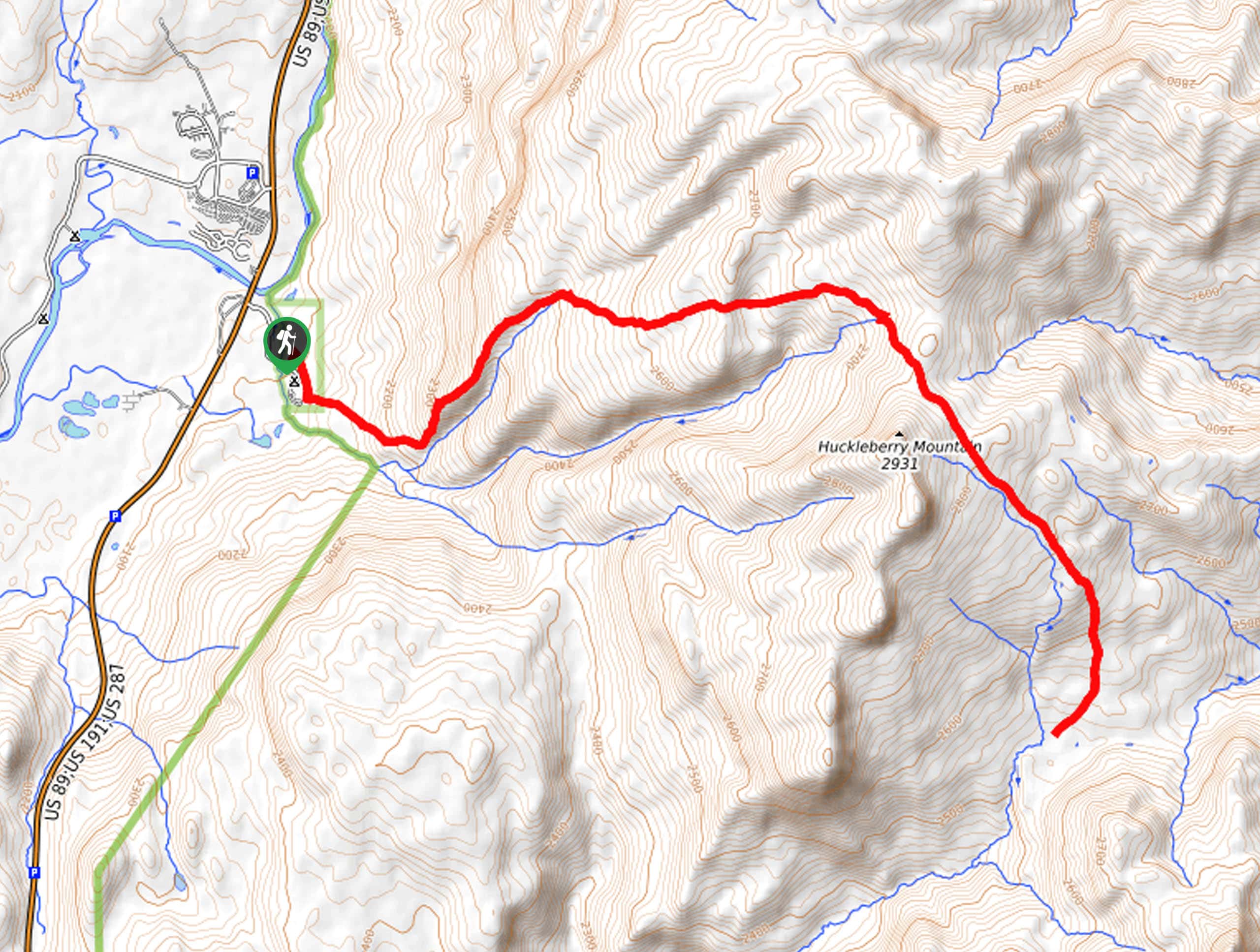
Hanging Canyon hike
View Photos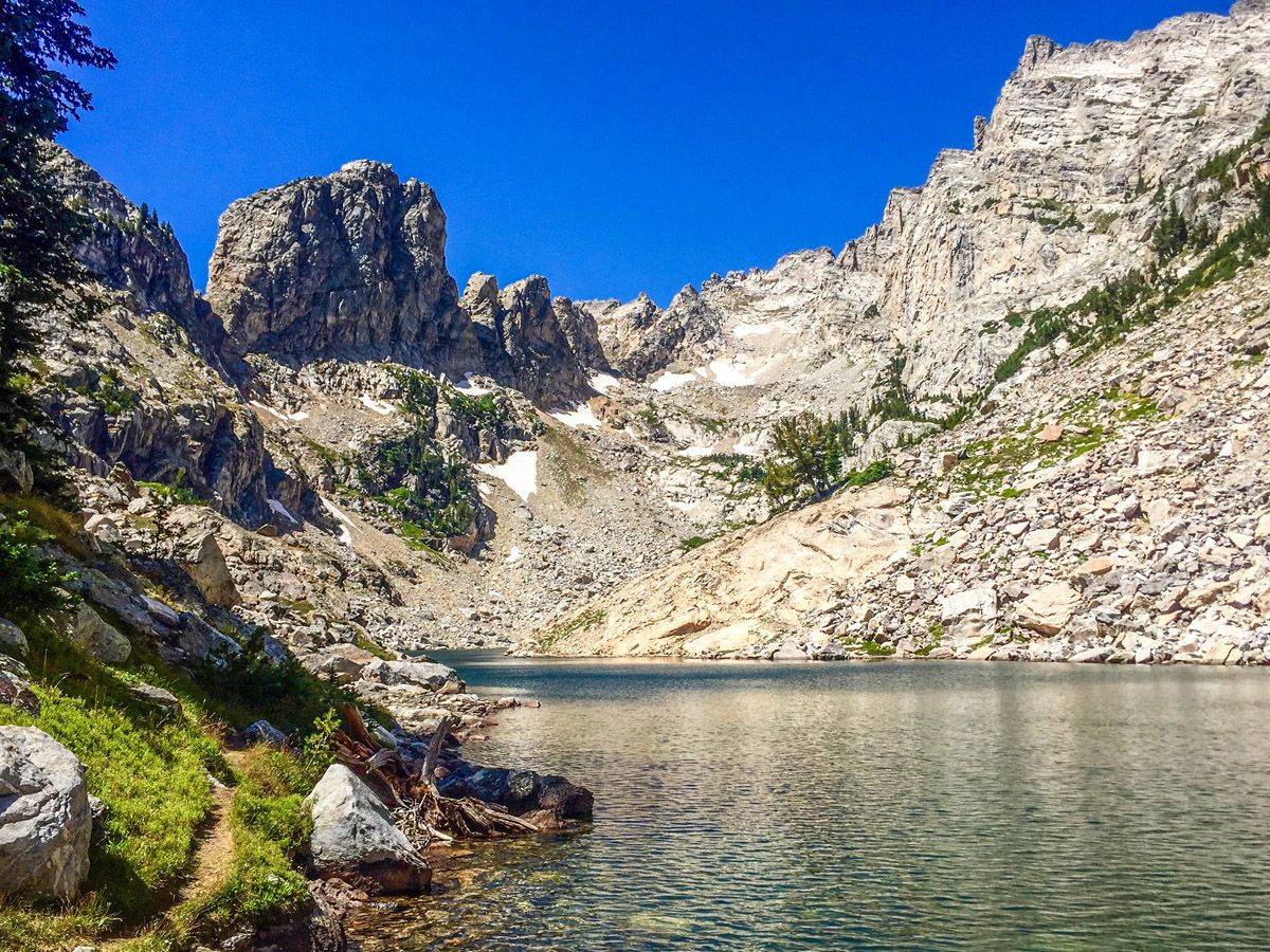
Hanging Canyon hike
Difficulty Rating:
The hike up Hanging Canyon to Lake of the Crags is one of the finest in Grand Teton National Park. We call this the “real” Lake Solitude – as it’s an unofficial trail you are unlikely to share the hike with many people. Good route finding skills, however, are a must.
Getting there
From Colter Bay, head south down the John D. Rockefeller Parkway. At the first intersection turn right down Teton Parkway towards Jenny Lake. After nearly 13.0mi, turn right at the South Jenny Lake junction. Alternatively, from Moose drive north on the Teton Parkway and turn left at the South Jenny Lake junction. Park anywhere – this lot fills up quickly!

About
| When to do | June through October |
| Backcountry Campsites | No |
| Toilets | Trailhead |
| Family friendly | No |
| Route Signage | None |
| Crowd Levels | Low |
| Route Type | Out and back |
Hanging Canyon
Elevation Graph
Weather
Route Description for Hanging Canyon
For this hike, we advise skipping the boring 2.5mi hike around the lake and instead take the Jenny Lake boat shuttle (see http://www.jennylakeboating.com/). The cost for an adult is $15 round trip. From the boat shuttle follow the trail signs going around Jenny Lake to the right. When we did the hike they were doing construction on one segment of trail, so we had to turn left off the boat and then take our first two rights. Don’t find yourself going up to Inspiration Point!
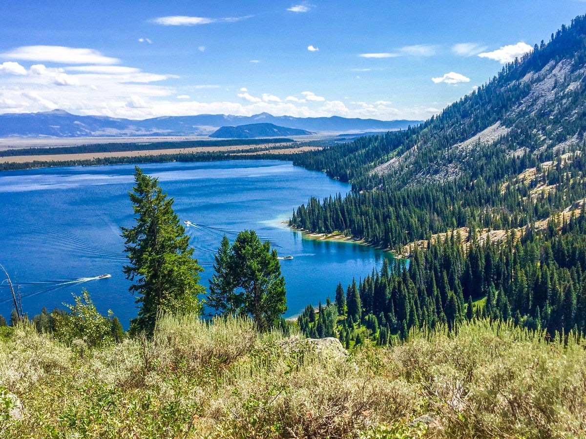
Continue along the trail around Jenny Lake. You will cross over several small bridges and then find a large, fallen tree running parallel to the trail. At the base of the tree is the trail going up Hanging Canyon. This is an unofficial trail, so is not regularly maintained, found in guidebooks, or patrolled by rangers. In fact, we wouldn’t know about it except a nice ranger told us it was the best hike in the Tetons – but nobody knows about it. Because of this we call it the real Lake Solitude, and if you leave by 8am you will almost certainly have Lake of the Crags all to yourself.
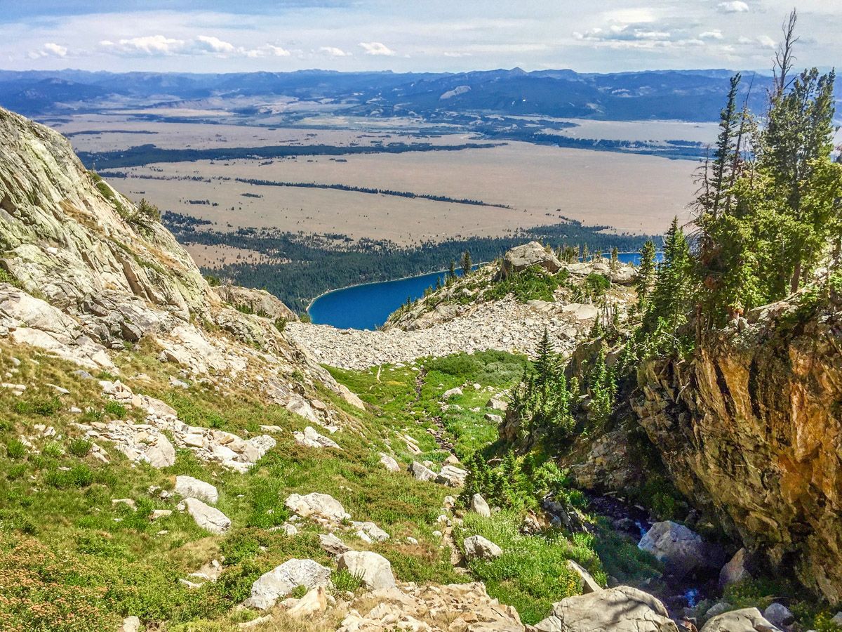
You’ll immediately start the steep climb that permeates the first two thirds of the hike. The trail will soon emerge out of the trees with views down to Jenny Lake (climbing without shade is yet another reason to leave in the cool morning!). This part of the trail is obvious and there is no way to lose your way. Continuing up the steep canyon, you will join the river running from the three lakes within, and will follow that river for the remainder of the hike.
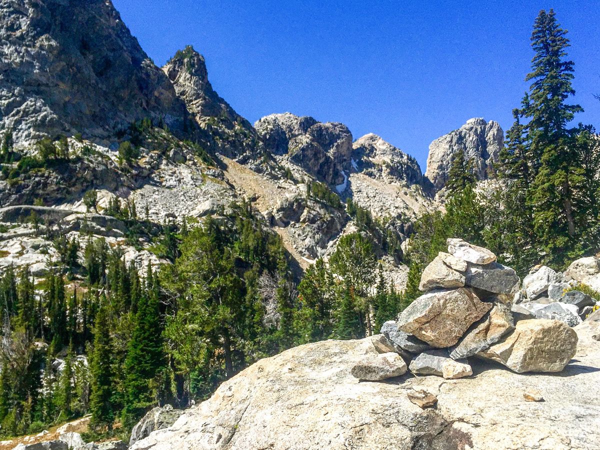
Shortly after you meet the river, the trail will fork. One trail goes up to the ridge on the right and the other stays close to the river. Do not go up to the right, it creates problems later on in the hike!
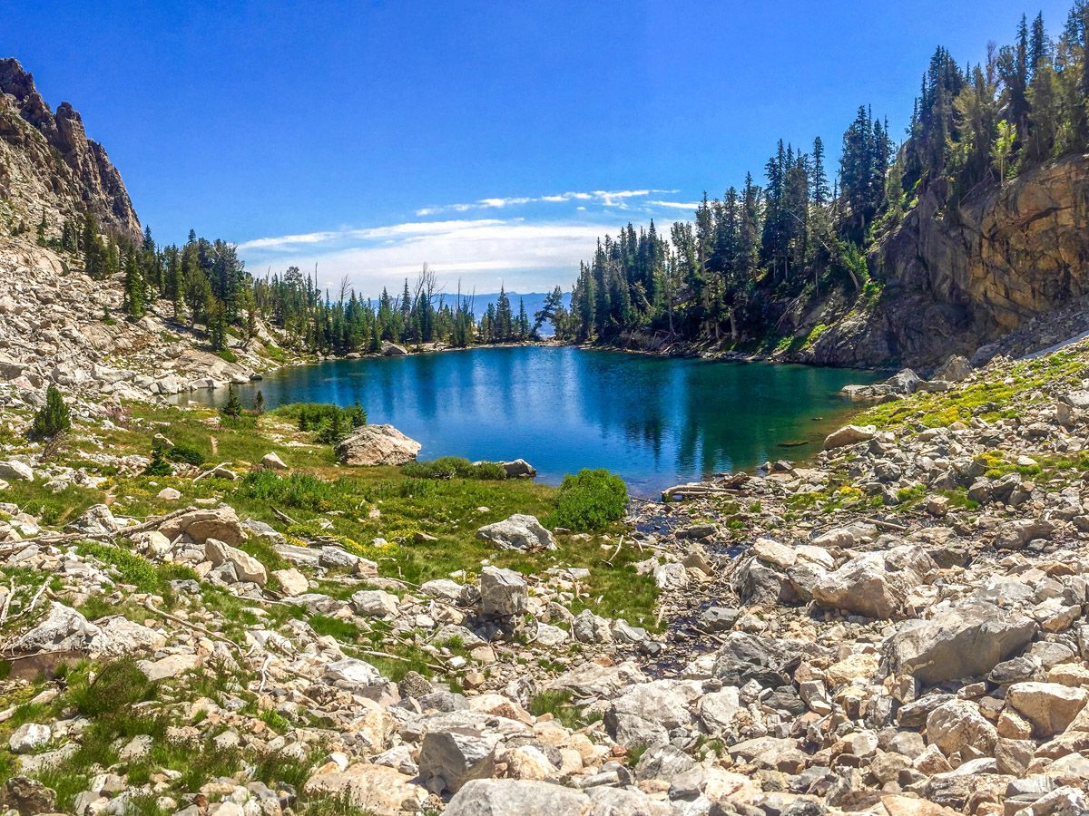
Continue following the river until you see a large boulder field. Here you will part from the river – as it visits the minuscule and marshy Arrowhead Pool – and climb through the boulders. There are several Cairns in the boulder field, however you should ignore them and head straight up. From its crest look down and see the continuation of the trail slightly to your left. Do not get confused if you see a trail up to the right. That is the other trail that led from the first fork.
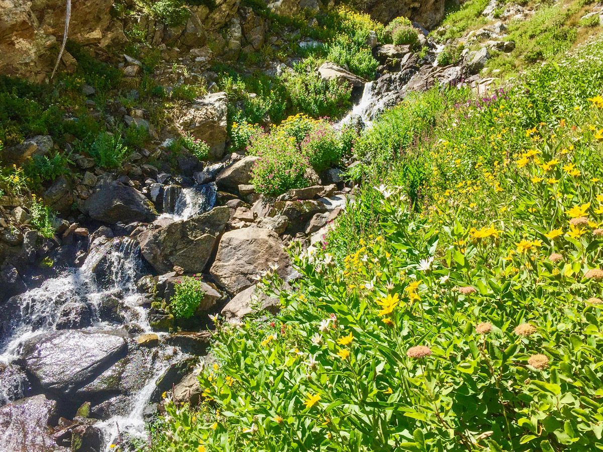
As you proceed after the boulder field, you will start hiking in a deepening ravine. Here you will see a multitude of wildflowers that surround the ever-steepening river. Along this path there are several sections that require you to scramble a little bit, but none of them pose a major threat.
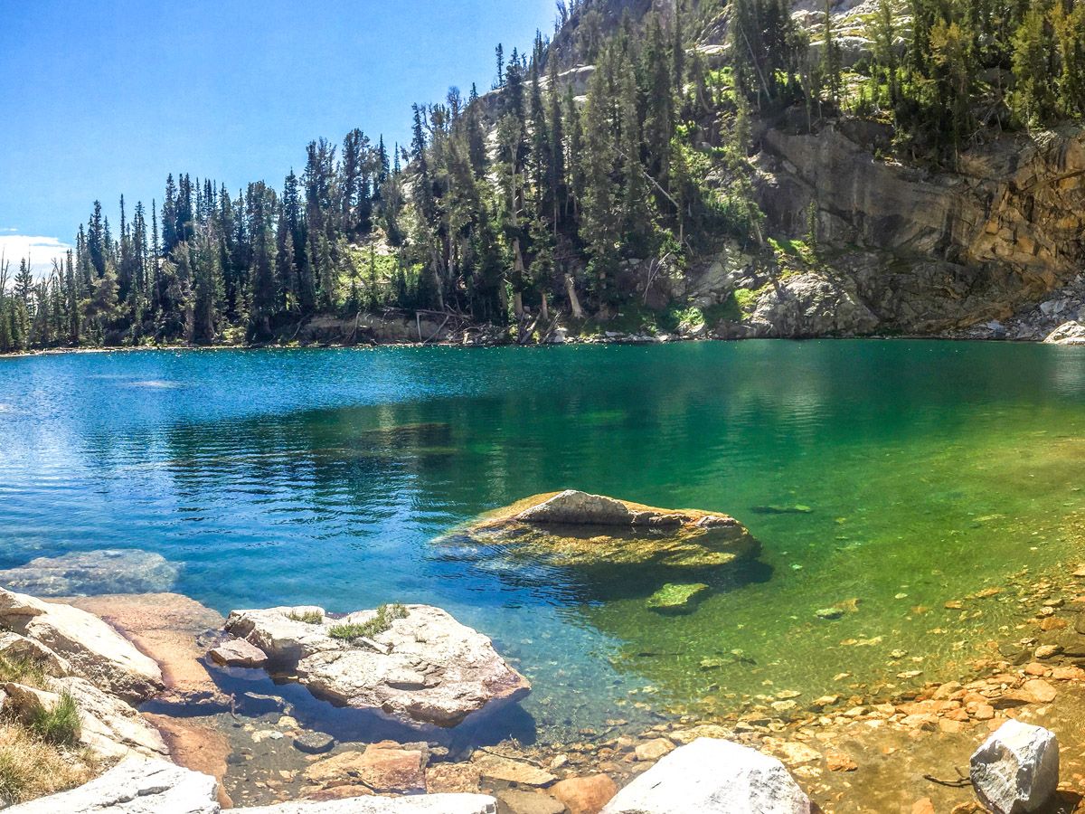
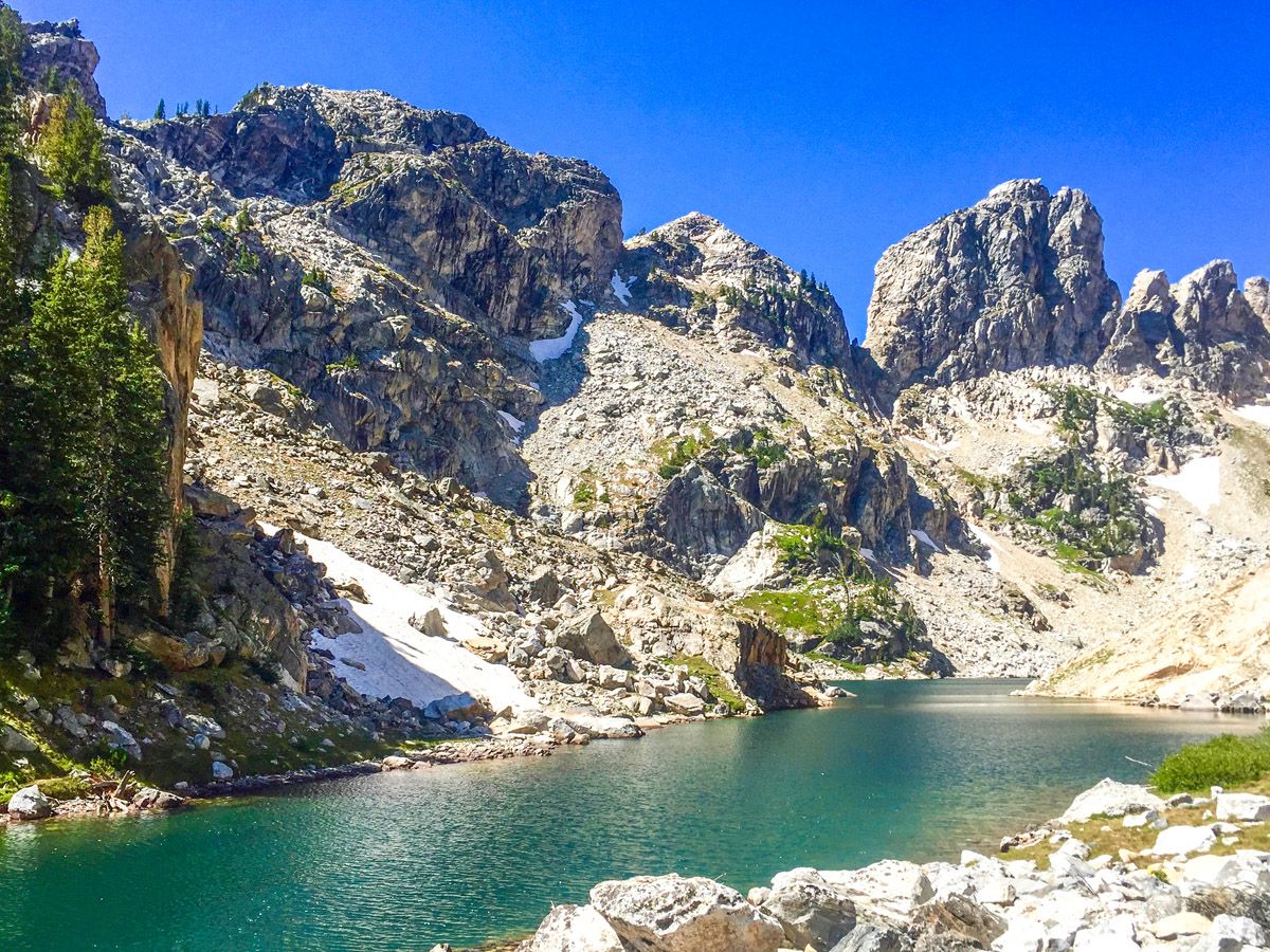
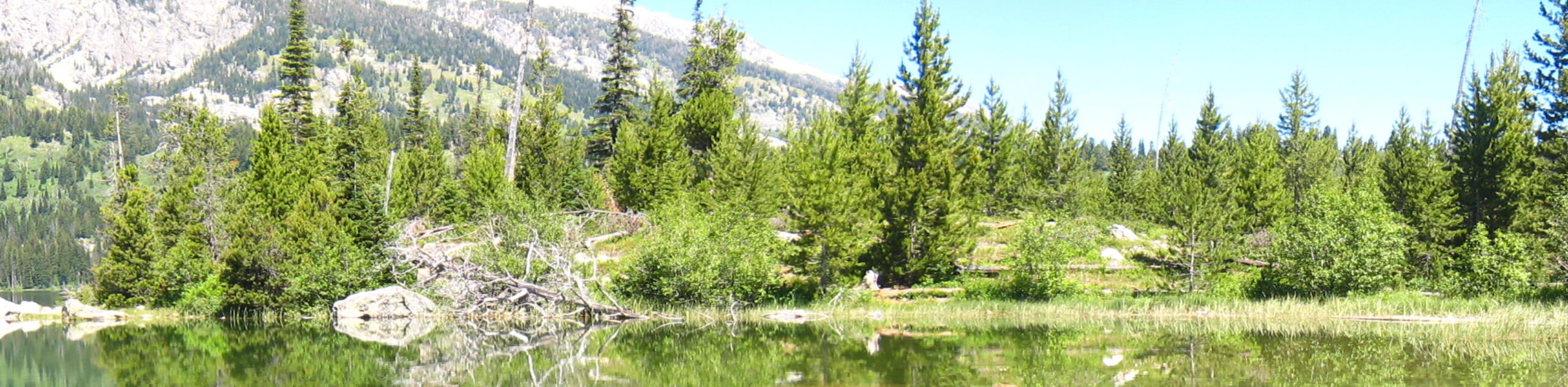
After climbing up the gully, you’ll enter a small wooded area as the trail flattens out and find yourself at Ramshead Lake. This stunning, blue-green lake is only a taste test for Lake of the Crags, however its beauty is truly magnificent. Go to the far side of the lake and look back at Symmetry Spire to its right.
Yet another boulder field separates you from Lake of the Crags, however this one is much smaller and no route-finding surprises await you at the top. Ascend through the boulder and walk around the left side of the lake. Stopping at a small rise beside the lakes narrowing allows for fantastic views up to Mount Saint John.
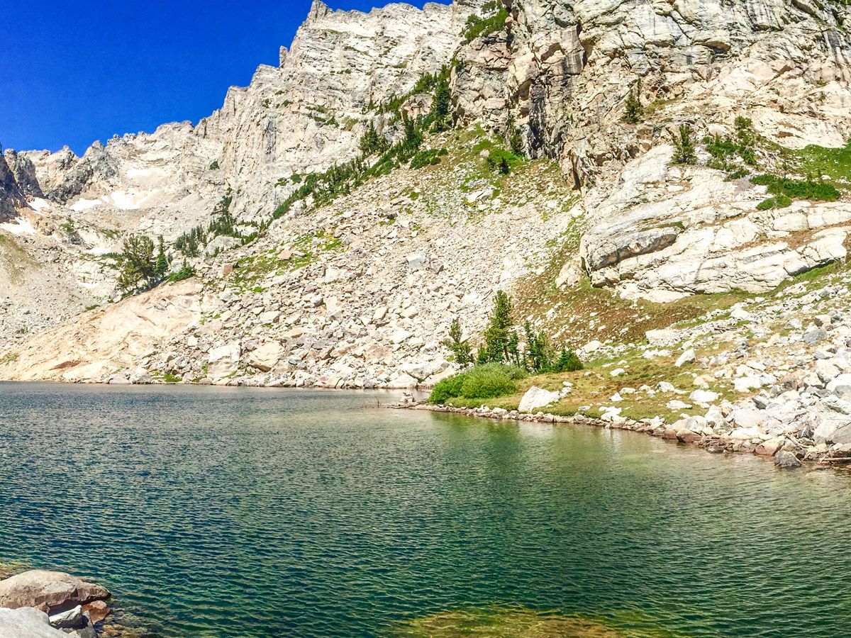
The beauty of this lake is hard to overstate. You are in a narrow alpine canyon beside a deep blue lake with lush green grass surrounding it. The sheer face of the cirque that surrounds the lake is magnificent, as is the view down the canyon towards Jenny Lake.
Take care when returning to ensure that you don’t slip down the extremely steep trail. Though this is a relatively short hike, the grade of the trail and the route finding required can be challenging.
Insider Hints
Bring layers to wear at the top. There can be quite a chill!
Having a GPS system or a phone app can ensure your en route.
Hiking poles are very useful for the steep descents and the challenging climbs.

Similar hikes to the Hanging Canyon hike
Sheffield Creek Trail
Located on the border of the Yellowstone and the Grand Tetons National Parks, the Sheffield Creek Trail has remained relatively…
Delta Lake via Taggart Lake Hike
Rise and shine, it's time to climb! The Delta Lake via Taggart Lake Hike is a marvelous adventure into the…
South Fork Cascade Canyon to Hurricane Pass Hike
Explore the alpine oasis and enjoy unrivaled views of the Teton Mountains as you trek the South Fork Cascade Canyon…
HikerNolifer 4 years ago
This is a fantastic hike! Highly recommended
Jane Watkinson 4 years ago
The trail was quite steep than I had expected but manageable. Another beautiful lake to admire in this hike.
Taylor Amanda 4 years ago
This is a fantastic hike! Enjoyed the gorgeous day!!
MissGiggles 4 years ago
Spectacular views. Would love to visit it again.
Polina Ivanov 4 years ago
It was a nice hike. Air is chilly so bring extra layers!
Matty E. 5 years ago
Awe-inspiring scenery. Lots of great spots to rest. Surroundings are serene.
Tati Max 5 years ago
It is one of those few hikes that satisfied me despite the minimal effort. It's not that easy, but it's not hard at all.
Minerva Y. 5 years ago
Great hike from the beginning until the end. It was a truly delightful experience.
Lou Sparks 5 years ago
Beautiful hike, full of adventures. It was moderately easy if not for the confusing route.
Hyro Stewart 5 years ago
Good hike. Had so much fun doing the trail. Lots of fantastic scenery around.