Tanner Trail
View Photos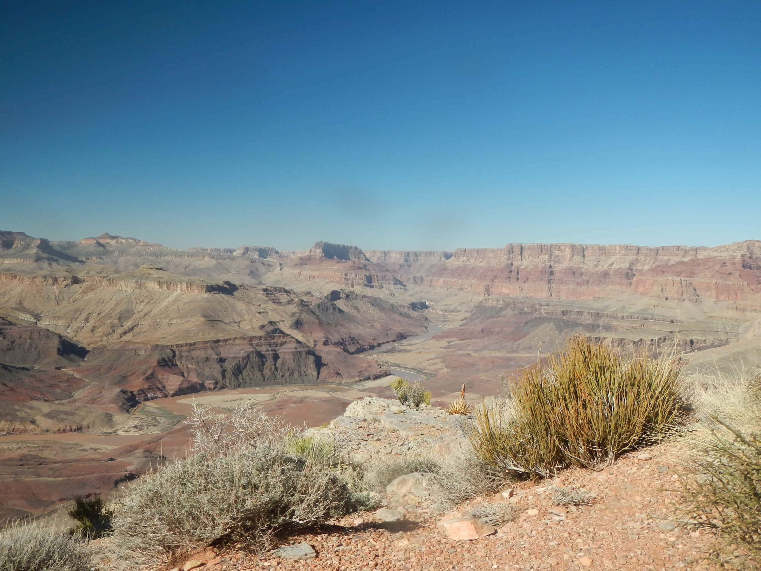
Tanner Trail
Difficulty Rating:
Tanner Trail is a hard 17.0mi hike in the Grand Canyon that goes from the South Rim at Lipan Point down to the Colorado River. Very strong hikers have done this route in a day with an early start, but most hikers may prefer to split it up over two days. The perk of this route is the light traffic, which allows you to enjoy some solitude along with your unforgettable views.
Getting there
The trailhead for Tanner Trail is at the end of Lipan Point Access Road.

About
| Backcountry Campground | No |
| When to do | April-October |
| Pets allowed | No |
| Family friendly | No |
| Route Signage | Average |
| Crowd Levels | Low |
| Route Type | Out and back |
Tanner Trail
Elevation Graph
Weather
Tanner Trail Description
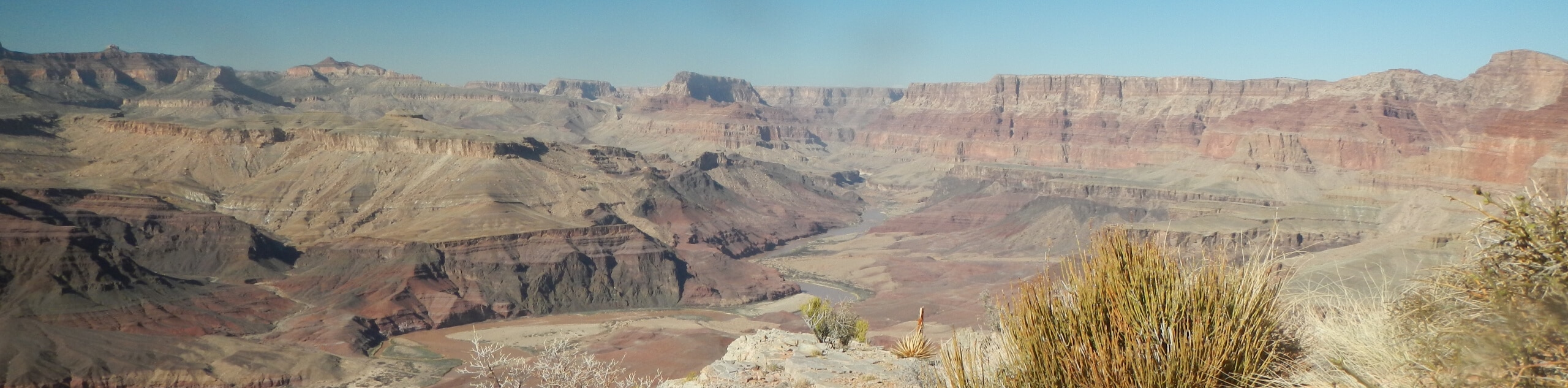
Tanner Trail is one of the lesser-used routes in the Grand Canyon, so you can go rim to river without the crowds that flock to Bright Angel or South Kaibab. The views are awesome and there aren’t any demanding technical sections on this route. We recommend the day trip for very strong hikers who can get an early start. If you don’t consider yourself a very fit hiker, you’ll probably want to split this up over two days.
There is no water on this route until you reach the Colorado River. Bring a filter to refill your reservoir at the river since the return trip is the most demanding part of the route and you won’t want to run out on the way back up. Additionally, poles will be very helpful for the steep descents and ascents on this route. Watch your footing where the trail gets rocky or a bit loose.
From the trailhead at Lipan Point, the route dips down over the rim over a series of steep switchbacks. Round the eastern arm of Escalante Butte, then hike around the eastern side of Cardenas Butte. Another steep descent takes you alongside the ridge that leads to the river. Rest up here before retracing your steps back to the trailhead.
Similar hikes to the Tanner Trail hike
Deer Creek to Colorado River Hike
The Deer Creek to Colorado River hike is a very challenging 18.0mi hike that leads you from the…
Waldron Trail
Waldron Trail is a hiking trail on the South Rim of the Grand Canyon that’s a bit of a hidden…
Powell Plateau Trail
Powell Plateau Trail is a hiking trail in the northwestern arm of the Grand Canyon. This spot in the canyon…
Comments