South Rim Trail
View Photos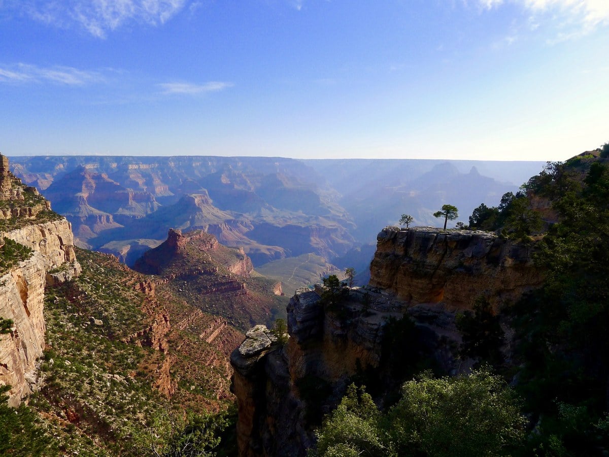
South Rim Trail
Difficulty Rating:
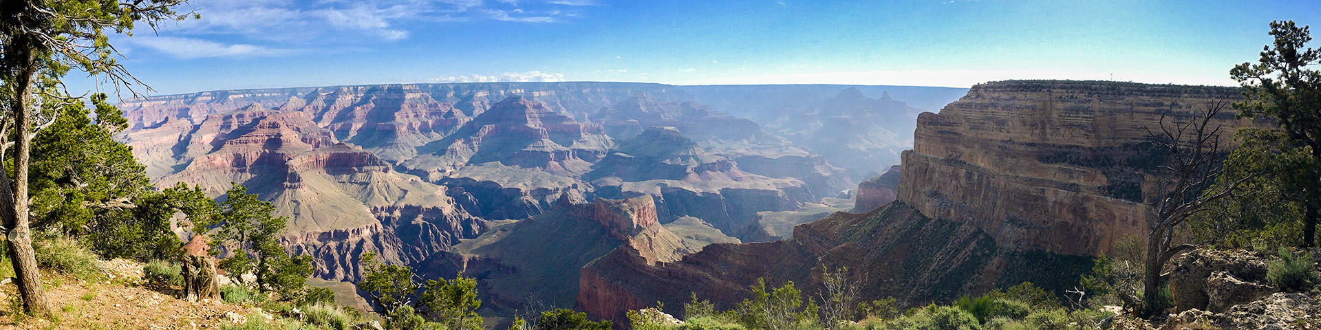
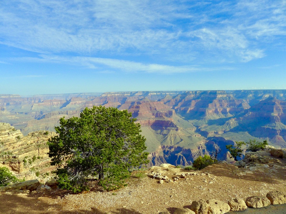
The South Rim trail is easily the most popular hike in the park – it’s generally flat, connecting Grand Canyon Village with Hermits Rest Point and boasts fantastic views of the Grand Canyon and Colorado River.
Getting there
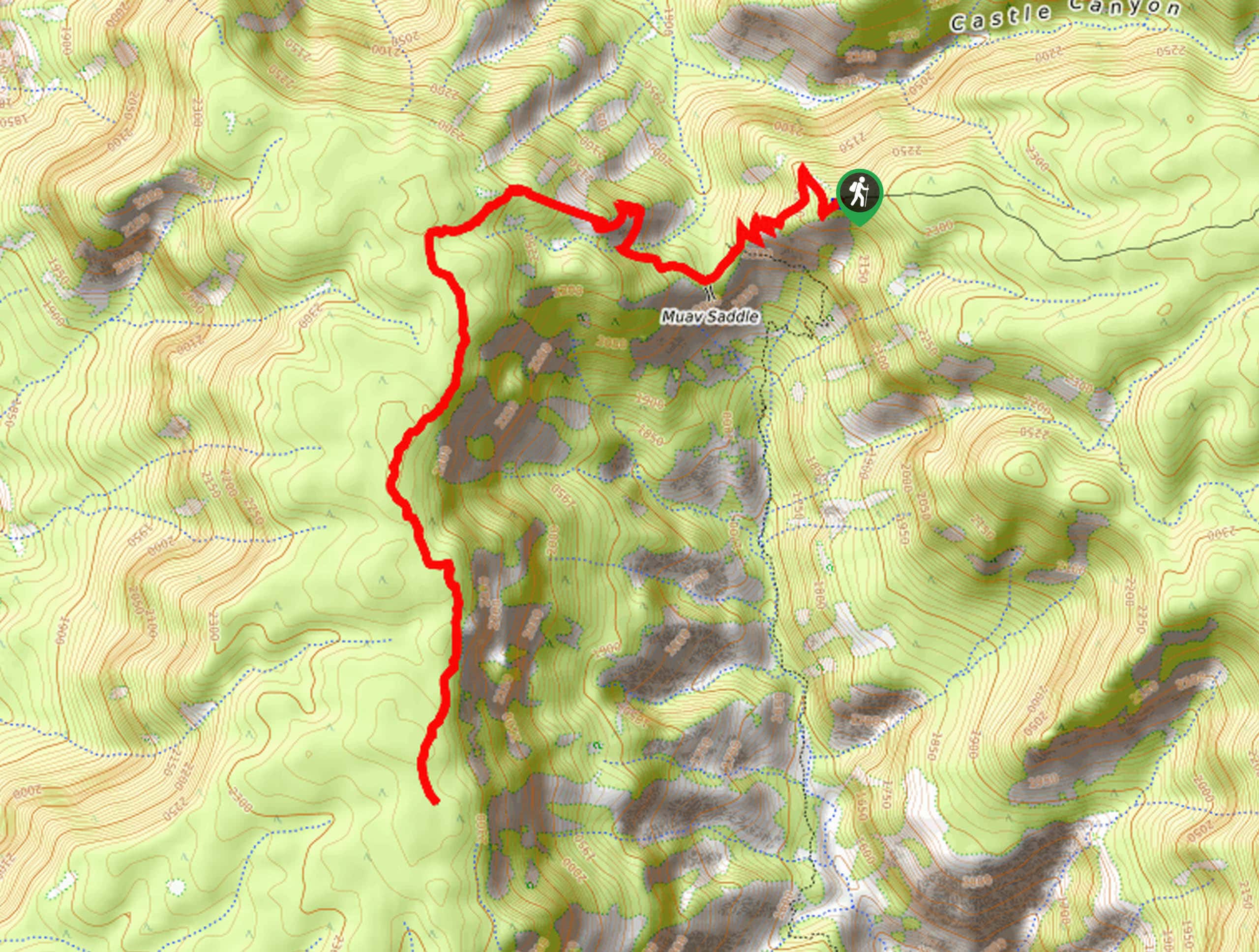
To get to the South Rim trailhead, park in any of the many parking lots in Grand Canyon Village. Walk towards the Bright Angel Hotel. Though the trail continues to the east of the Village, our favourite part starts at the Bright Angel Hotel and continues west towards Hermits Rest. The trailhead can be found just past the bus stop for Hermits Rest.

About
| When to do | Spring and Fall, avoid summer heat |
| Backcountry Campsites | None |
| Toilets | At trailhead and the trail’s end |
| Family friendly | Yes |
| Route Signage | Average |
| Crowd Levels | High |
| Route Type | One Way |
South Rim Trail
Elevation Graph
Weather
South Rim Trail Description
The South Rim hike offers tons of variability, as the Hermits Rest Bus makes a number of stops along the trail. You can hike for a while, then hop on the bus for a bit of a rest, then hike some more if you want! The bus makes all of its stops, while going out towards Hermits Rest, but only three on the way back. For this reason we recommend hiking on the way out, then taking the bus on the way back, saving you more time for hiking!
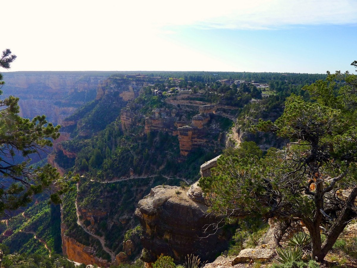
The majority of the trail is almost entirely flat, featuring a variety of dirt and paved trails. Notably, the first leg of the hike has the steepest uphill section. Though it is short, those wanting to avoid it can simply take the bus to the first stop and continue on their way! The first section of the trail also yields views of the Bright Angel Trail leading down towards Phantom Ranch. For those looking to do this hike, this could be a fantastic way to scout out the route, as you do get a fantastic appreciation for the amount of elevation that you gain on thetrail!
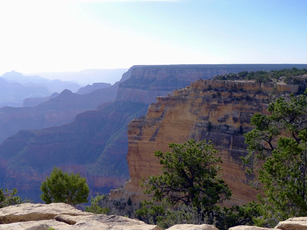
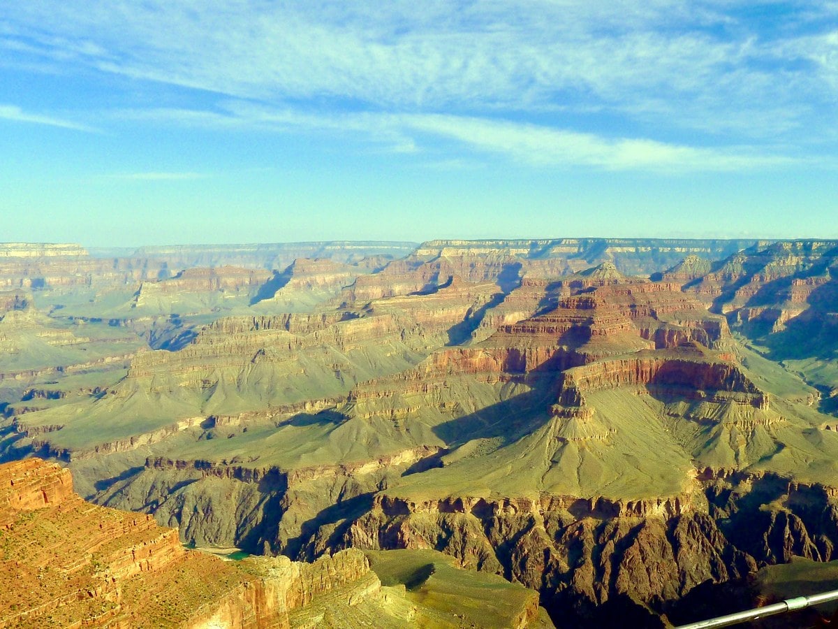
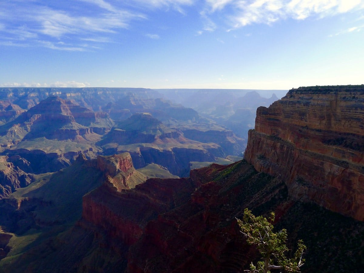
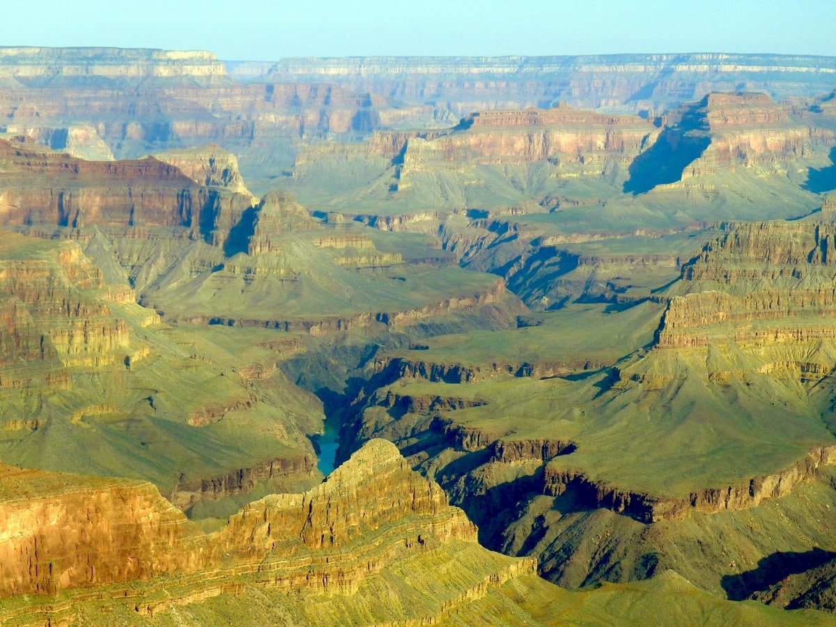
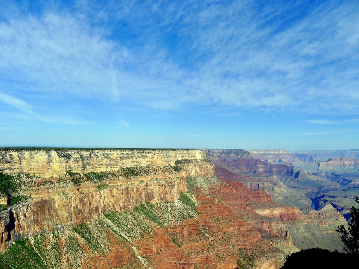
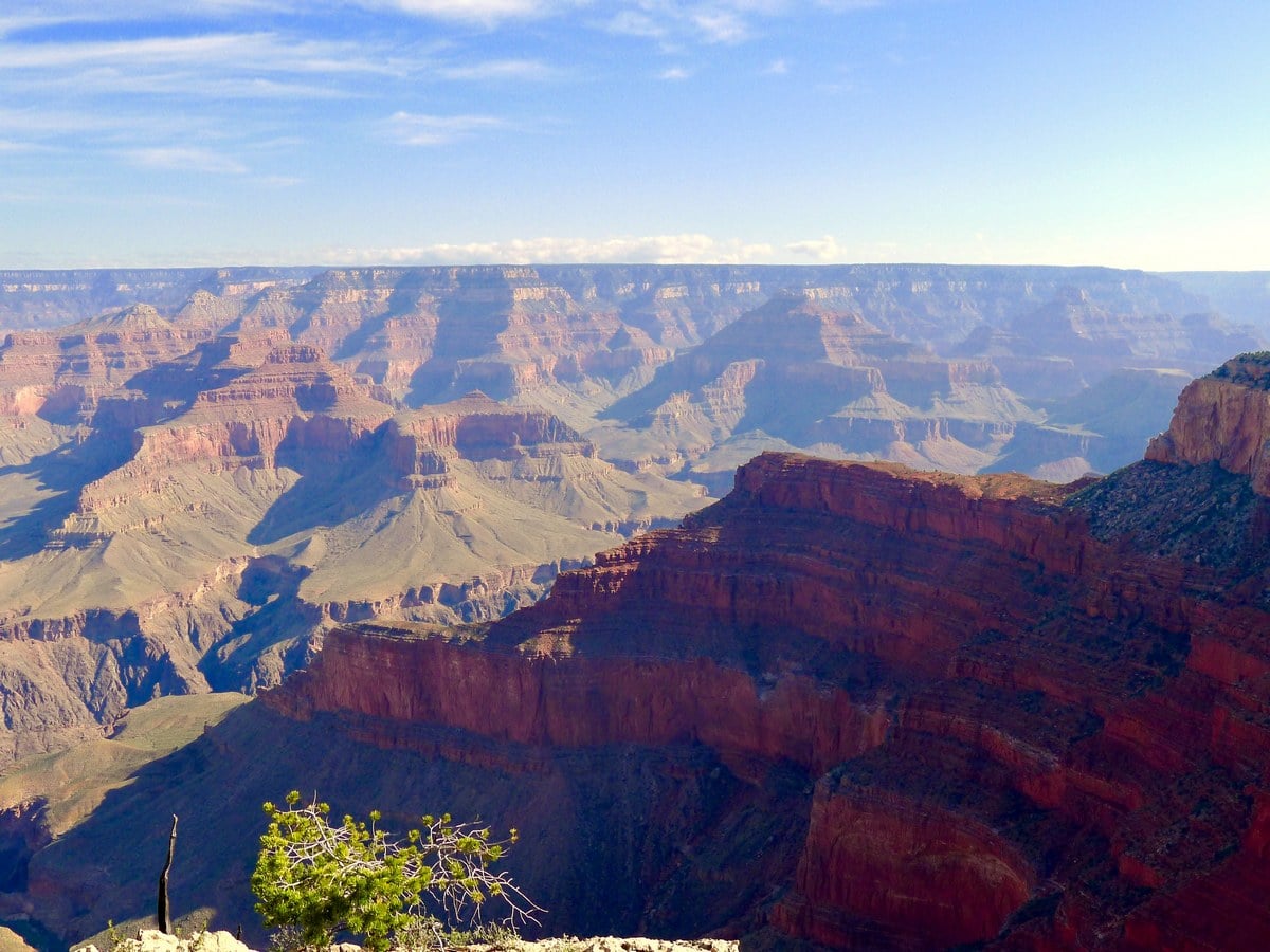
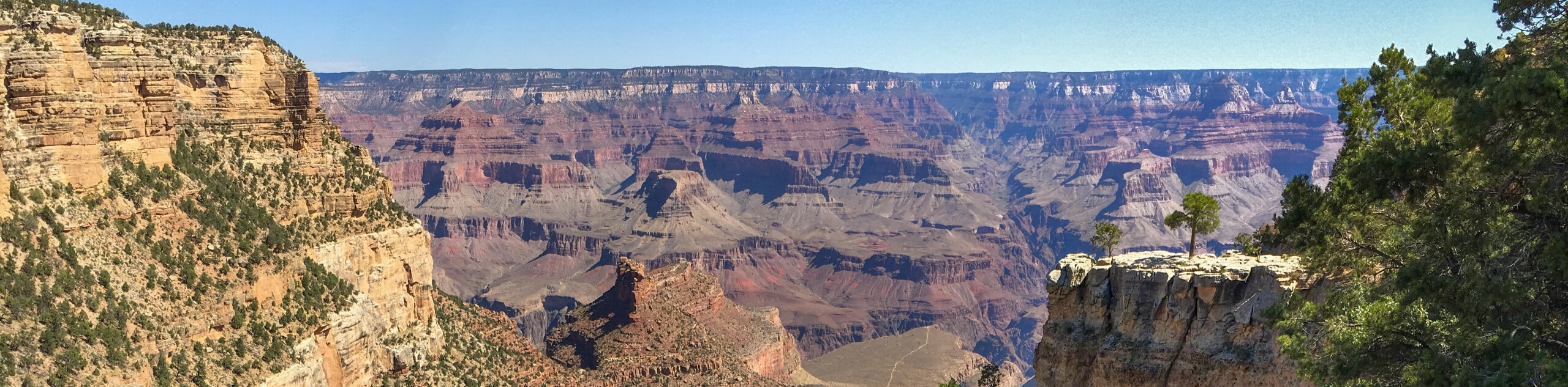
Several points along the trail hug the very edge of the rim of the canyon. These instances occur most frequently in the middle sections of the hike, though sporadically at others. At these points, you will be granted full panoramic views of the Grand Canyon. At some point you will be able to see the raging Colorado River, the whitewater rapids visible just under a mile up!
Additionally, there are points where the trail spurts you out onto the road. At these points, there are markers making sure the buses and cyclists won’t run you over. Don’t worry, these stints always last less than 295ft, and the mild inconvenience is usually a telltale sign of fantastic views coming up!
Throughout the entire South Rim Trail there are numerous signs which both tell you the distance to the next bus stop, as well as to Hermits Rest. These are great at helping you plan your rests, and also keep you motivated to keep going in the summer heat! On the note of heat, much of the trail is covered by trees and offers excellent shade throughout the majority of the day. Water can also be found at Hermits Rest, as well as Grand Canyon Village, but nowhere along the hike. So on the hottest days pack a ton of water and plan to leave early!
The final two legs of the hike are paved, and though they don’t offer the best views of the Canyon, they are excellent if you want to bring your child and their stroller along for part of the route. Finally, you will arrive at Hermits Rest, which has amazing views of the Canyon as well as a small snack bar and gift shop. This is also the trailhead for two of the other Top 10 hikes featured on 10Adventures! Hop on the bus that departs every 15 minutes and head back to find your car.
Hiking Trail Highlights
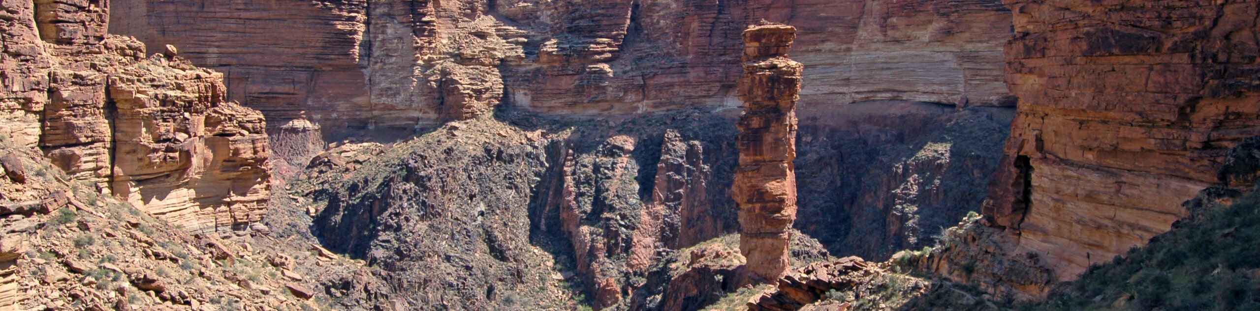
The South Rim, Grand Canyon
The South Rim is perhaps the most picturesque section of the Grand Canyon. Divided up into three sections: Grand Canyon Village, Desert View Road and Hermit Road––each offering a unique vantage point over the iconic landmark.
Hikers should visit each section to experience the highlights of each, which vary between smaller crowds, incredible viewpoints and epic sunset watching spots. The Grand Canyon is the second most visited park in the United States, so prepare for crowds!
The South Rim is particularly loved for its approximation to upscale hotels, lauded restaurants and fun cultural experiences, so visitors get to enjoy the best of both worlds––nature and the comforts of home.
Colorado River
The Colorado River is one of the main rivers winding from the Southwestern United States and northern Mexico. Stretching 1450.0mi the river runs straight through the Grand Canyon and is one of the main natural attractions in the area.
Rolling through dramatic rocky canyons, flowing whitewater rapids and many national parks, the Colorado River generates hydroelectric power for millions, as well as a main source of water.
Take a stroll along the Hopi Point along the South Rim’s Rim trail, where people congregate to watch the incredible sunsets over the Colorado River and Grand Canyon.
Frequently Asked Questions about the Grand Canyon’s South Rim
What is there to do at Grand Canyon South Rim?
There is plenty to do at Grand Canyon South Rim! The most popular activity is hiking and enjoying the beauty of the canyon, but you can also bike, river run or try out a mule ride down to the base. For kids, there is a ranger program to learn more about the formation and ecosystem of the Grand Canyon. Camping is also a popular option.
How much does it cost to visit Grand Canyon South Rim?
As of June 1, 2018 the park fees are $35 per vehicle or $30 for motorcycles. This will gain you access to the park for seven days. If you’re a local, you can purchase a $70 annual park pass.
Which rim of the Grand Canyon is best?
The Grand Canyon South Rim is usually prefered by first-time visitors for it’s breathtaking views and plenty of family-oriented activities to try your hand at. The South Rim is also open all year round, making it extremely accessible to enjoy the changing seasons.
How long does it take to walk the South Rim of the Grand Canyon?
Walking along the top of the South Rim can take anywhere between four and five hours. If you want to walk down to the bottom of the Canyon, it will be much longer.
What is the best month to visit the Grand Canyon?
Our favourite time to visit the Grand Canyon is during the spring months from March to May, as well as the fall season from September to November. This offers cooler temperatures and there are far less crowds. If you visit during the summer, you can enjoy incredible sunny weather, but prepare for very large crowds and long wait times at attractions.
How long does it take to walk to the bottom of the Grand Canyon?
To get to the bottom of the Grand Canyon, you can follow the 6.8mi South Kaibab Trail to Bright Angel Campground and the Bright Angel Trail is 9.3mi. It will take most hikers between 4 and 5 hours to get to the campground on either trail. Prepare for a longer return hike, which takes twice as long on average, around 7 to 8 hours. It’s recommended to stay at one of the campgrounds, rather than trying to hike the entire thing in one day.
Find even more great hikes in Grand Canyon National Park:
Insider Hints
Doing sections of this hike brings the difficulty grade down to a 1/5.
You can rent bikes in the village and bike along the Hermits Rest Road, another fantastic way to experience the trail.

Similar hikes to the South Rim Trail hike
Powell Plateau Trail
Powell Plateau Trail is a hiking trail in the northwestern arm of the Grand Canyon. This spot in the canyon…
1.5-Mile Resthouse via Bright Angel Trail
The hike to the 1.5-Mile Resthouse on Bright Angel Trail is a nice compromise for hikers who want a little…
Hermit Camp to Monument Creek Camp via Tonto Trail
This guide follows a portion of Tonto Trail from Hermit Camp to Monument Creek Camp. This is a 6.3mi
Barbara Clarkson 4 years ago
This was a great hike and well worth the views it has to offer!!! Must do!
Suzy TQ 4 years ago
Great way to see this American treasure. Even small bites of this spectacular landscape can nourish the soul.
Tiffany Swift 4 years ago
An amateur photographers paradise. Really worth the effort to spend your day!
TailBlazer 4 years ago
It’s easy to follow and there are lots of signs, so it’s a great beginner’s hike. you can enjoy the views without breaking a sweat.
Matty E. 4 years ago
It was great. Views are unique, trails are average.
TwoBoots 4 years ago
The trail is spectacular! There are no climbs or hard parts.
Anabelle Clyde 4 years ago
The views are stunning and it takes you to quite a few of the viewing points. Easy Grand Canyon access
Frank M. 4 years ago
A must see this amazing vastness of space. It was a very humbling experience. I was amazed the scenery and I enjoy walking the trail. Just take the time at your own pace, enjoy the views
Hannah D. 4 years ago
This hike is actually very rewarding. Works well with people who do not want to sweat that much.
Lou Sparks 4 years ago
Amazing hike, with tons of beautiful views! Start early to avoid the crowd.