
Dripping Springs hike
View Photos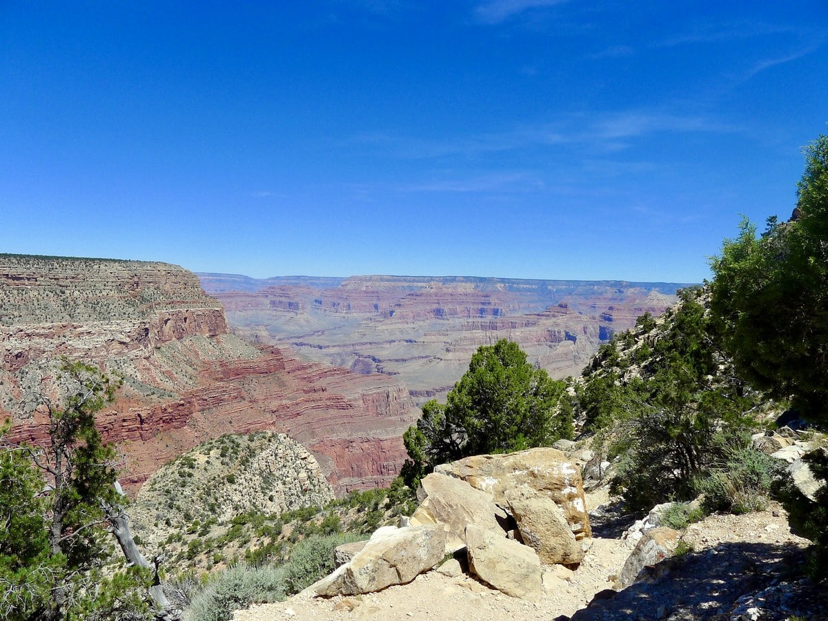
Dripping Springs hike
Difficulty Rating:
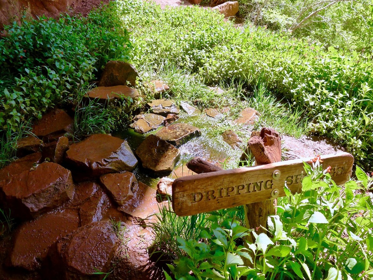
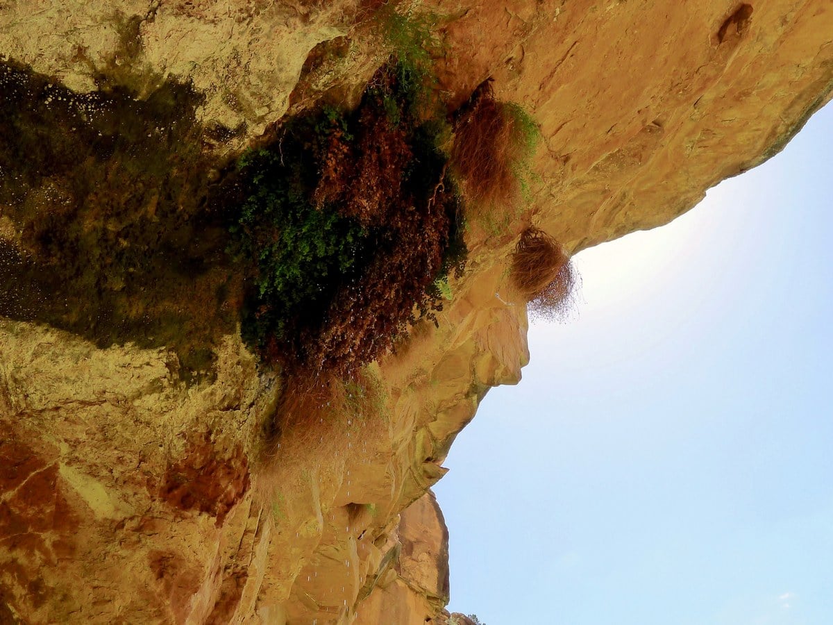
This less trodden trail leaves from Hermits Rest and bring you to a secluded and shaded spring that seeps down from a hole in the roof of a small overhang. This hike gets very little sun, and the solitude of the picturesque spring is well worth the physical effort!
Getting there
Park in Grand Canyon Village and then walk towards the Bright Angel Hotel. Continue past the hotel treading west along the rim. You will soon find the bus stop for the Hermits Rest Point loop, which comes every 15 minute or so. Take the bus to its final stop, Hermits Rest. The road is only open to public traffic during a brief period of time in the winter, so odds are you will be required to take the bus. At Hermits Rest there are pit toilets, water refill stations, and a small snack bar/gift shop.

About
| When to do | Spring and Fall, avoid summer heat |
| Backcountry Campsites | Yes, permits required |
| Toilets | At trailhead |
| Family friendly | No |
| Route Signage | Average |
| Crowd Levels | Low |
| Route Type | Out and back |
Dripping Springs
Elevation Graph
Weather
Route Description for Dripping Springs
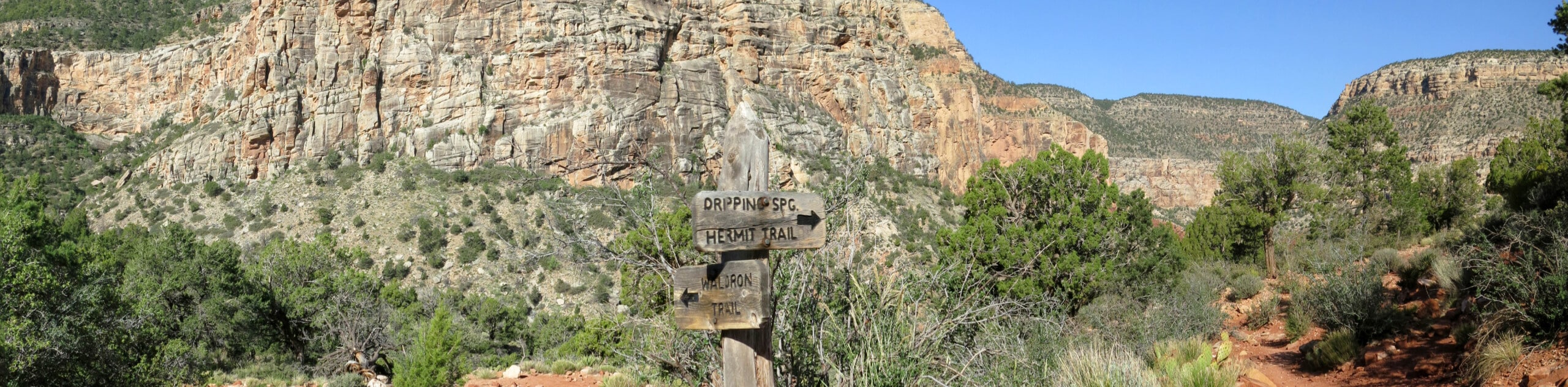
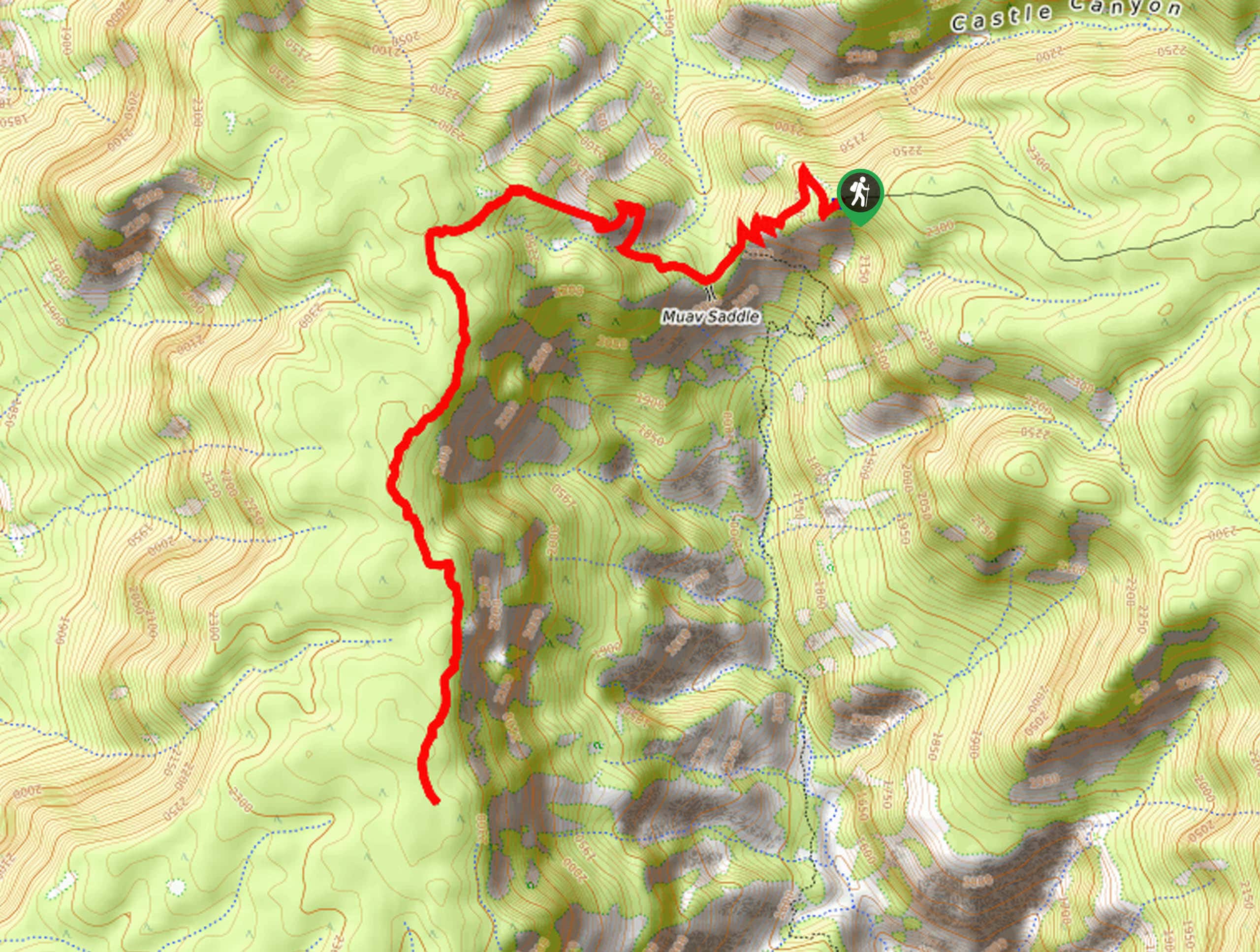
From where the bus drops you off, follow the main trail that leads along the edge of the point. This trail — on the opposite side from the toilets — will pass by the gift shop and snack bar, and continue along through the picnic area of the point. At the end, past where the winter parking lot is, you will find the Hermit Trailhead.
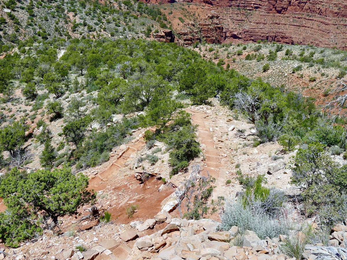
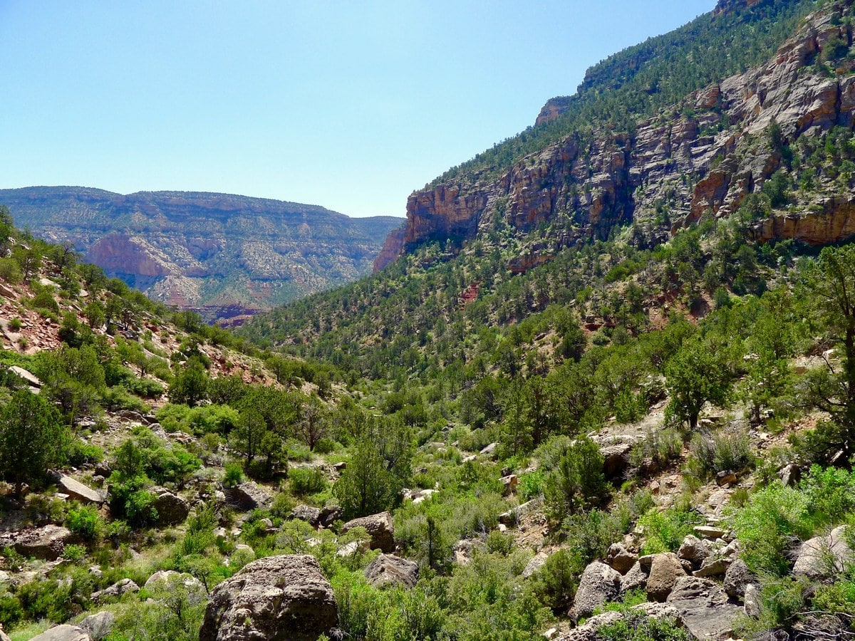
From here, start along the switch backing path that leads down the flank of the point towards a small plane. Though not as steep as the notorious Grandview Trail, this path still holds its own in the grade department. Take care when descending, and remember that you will have to ascend this same trail! It should also be noted that there are very few shaded spots along this trail, so leave early to save yourself on the ascent!
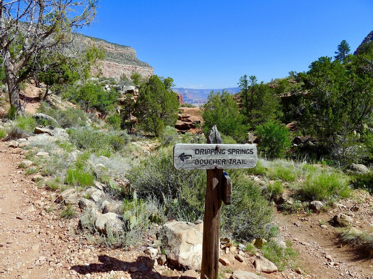
After 1.5mi you will reach the Waldron Trail junction. Turn right here to continue along the Hermit Trail. At this point you will have done the majority of the decent. Continue along the mostly flat valley for another quarter of a mile until you reach the Hermit Trail junction. Turn left here, signed as going towards Dripping Springs. At this point the trail quality goes down a few notches, principally due to the lack of attention from hikers that this route receives. This is the halfway point to the springs, in terms of distance.
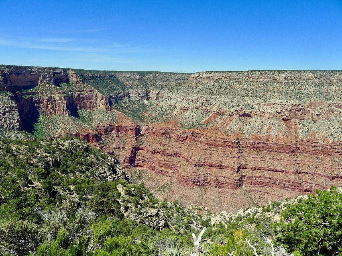
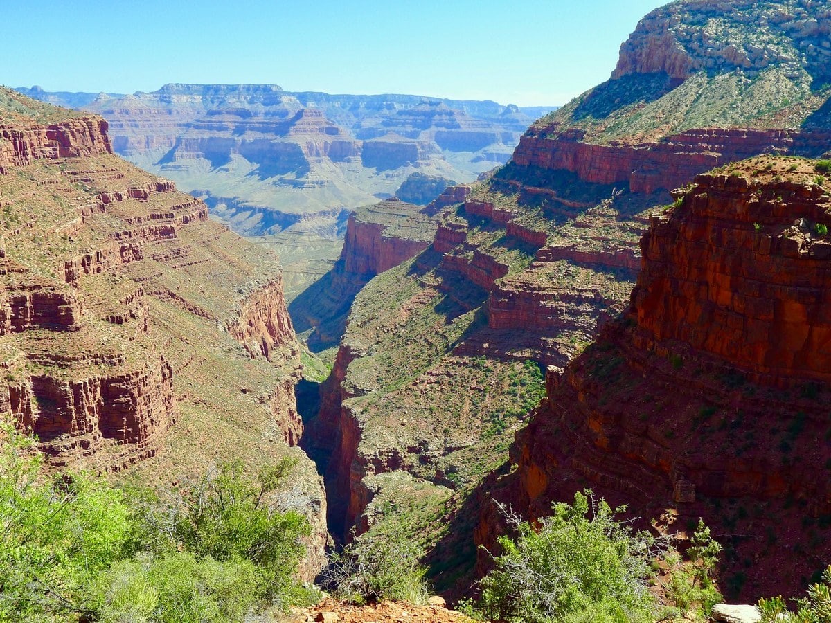
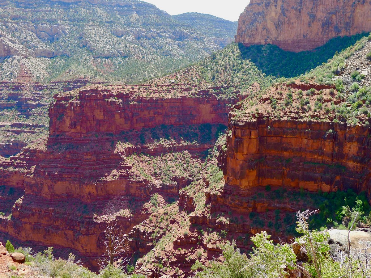
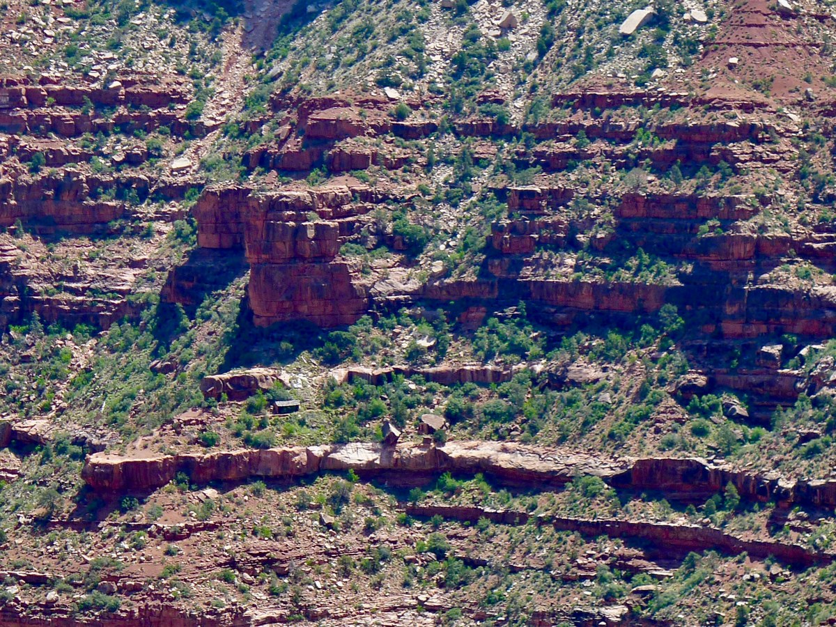
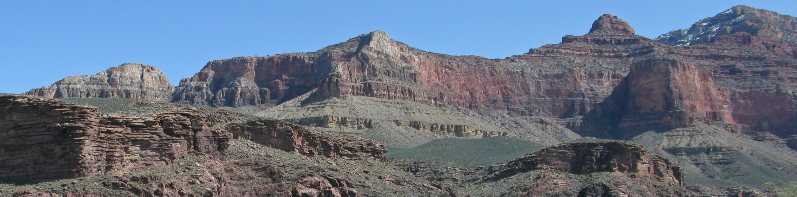
The hike will now start to gain elevation. You will continue along the somewhat exposed rim of a red rock cliff face. You will weave in and out with the rim, slowly gaining and losing elevation. You will get views down into the heart of the Grand Canyon, including the incredibly narrow and steep sided sub-canyon known as Cathedral Steps. If you look really hard you will even be able to see the rest house for Santa Maria Springs across the valley!
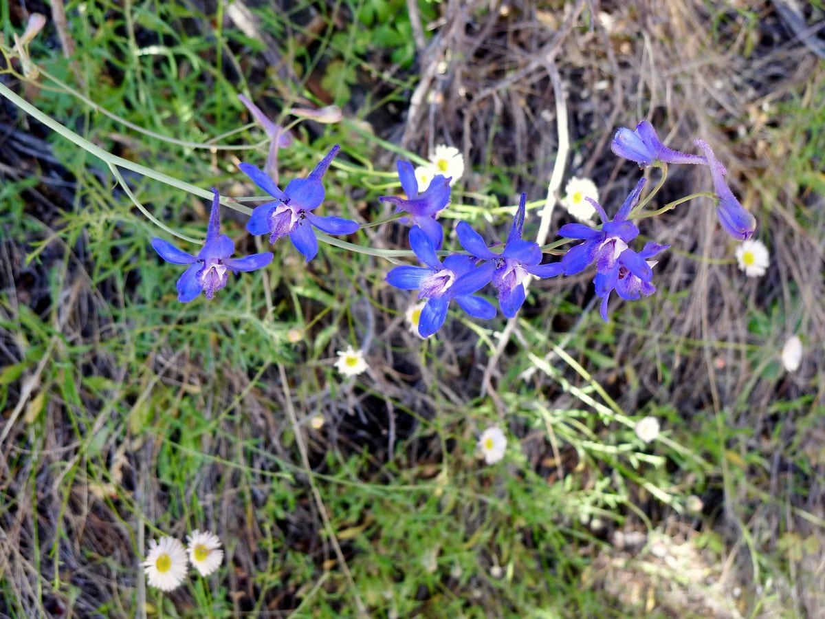
After traversing above the cliffs the trail veers left and heads up a lush valley. Along this section of the hike, cacti and other thorny plants have invaded the way, so watch your step and be ready to duck and weave! The other slight route finding difficulty along this section of the trail is when the path crosses a dry creek bed. However, just simply following the cairns and other distance trail markers to be on your way without confusion.
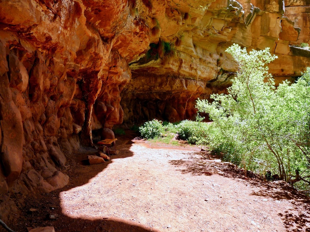
After a final short climb you will arrive at the springs, dripping from a mossy spot on the roof of the shaded alcove to a small pool on the bottom. This is a fantastic spot to wet your hair and clothes, cooling yourself off for the way back up.
Insider Hints
If you want to drink this water you must bring a method of purifying it, as it has not been treated.
For an especially long day hike, try combining the South Rim trail with Dripping Springs.

Similar hikes to the Dripping Springs hike
Waldron Trail
Waldron Trail is a hiking trail on the South Rim of the Grand Canyon that’s a bit of a hidden…
Powell Plateau Trail
Powell Plateau Trail is a hiking trail in the northwestern arm of the Grand Canyon. This spot in the canyon…
Indian Garden Campground via Bright Angel Trail
Of all places to camp, the Grand Canyon is a pretty hard one to beat, to say the absolute least.…
Barbara Clarkson 4 years ago
Beautiful views from the White Sands Base. Easy trail!
Suzy TQ 4 years ago
The path begins very rocky then opens into a lovely small meadow with gorgeous wild flowers before turning rocky again about half a mile from the shady house.
Tiffany Swift 4 years ago
Amazing views of Las Cruces and the cave was really neat! The hike is easy and nice. It's on a wide old road. We saw deer on the way. The mountains on all sides are dramatic.
TailBlazer 4 years ago
Loved walking the numerous trails. Beautiful views of the mountains.
TwoBoots 4 years ago
Very scenic with lots of wildlife. We were not disappointed!
Anabelle Clyde 4 years ago
Just gorgeous. Beautiful scenery.
Frank M. 4 years ago
Trail is well maintained and not too steep - although somewhat difficult due to the length. Amazing views all the way and I only saw a handful of other people.
MissGiggles 4 years ago
Nice and cool trail. There are plenty of shaded spot to stop. Pretty easy and quick hike.
Hannah D. 4 years ago
Nice hiking destination if you're looking for a less crowded hike in the Grand Canyon Park. Views are pretty cool.
Brian F. 5 years ago
Lovely hike. Lots of shaded areas. The peaceful trail was great.